Ticker for February 18, 2026
MESONET TICKER ... MESONET TICKER ... MESONET TICKER ... MESONET TICKER ...
February 18, 2026 February 18, 2026 February 18, 2026 February 18, 2026
Meltage
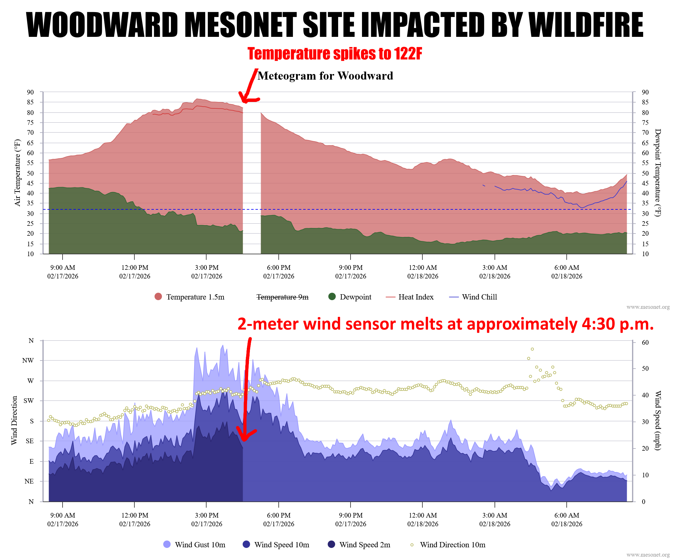
150,000+ acres burned, several mandatory evacuations, homes burned, firefighters
injured.
Well that about covers the wildfires, am I right? No, I'm not, because we get to
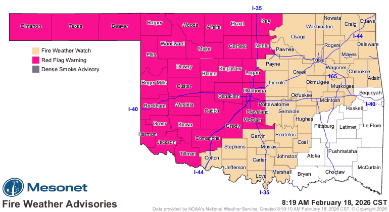
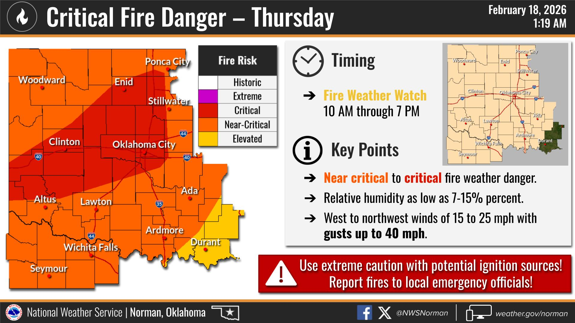
do the same thing today, and again tomorrow. Another Red Flag Fire Warning for
much of the western half of the state or so today through 8 p.m., then a Fire
Weather Watch for tomorrow covering most of the state, and likely upgraded to a
Red Flag Fire Warning. Here're (in times of fire danger, it's okay to make up
contractions) the deets from those in the know.
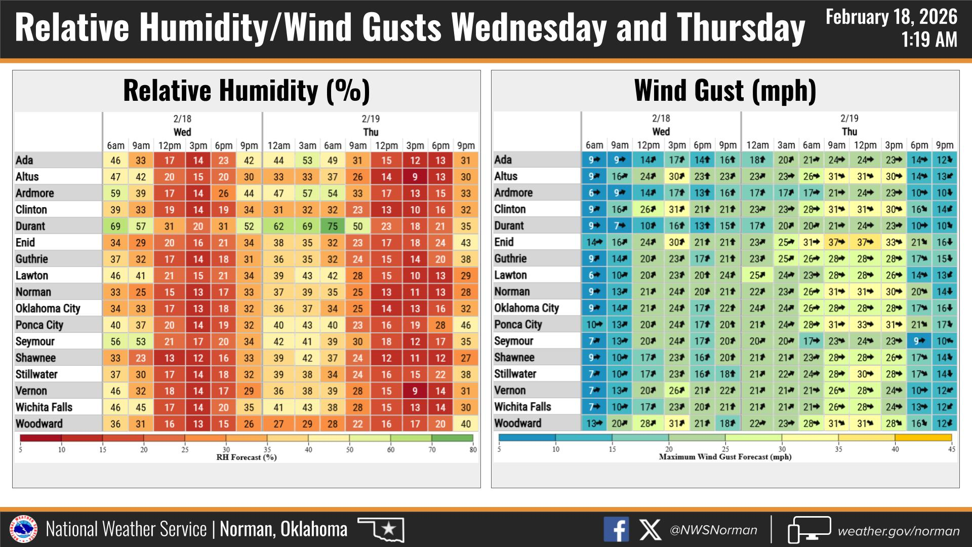
The good news is it won't be as windy today. The bad news is the humidity will
get even lower.
Already we're seeing the passage of the dryline last night priming the pump for
today's fire weather.
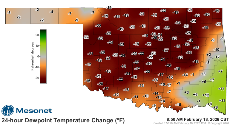
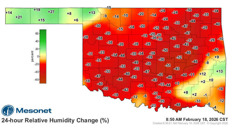
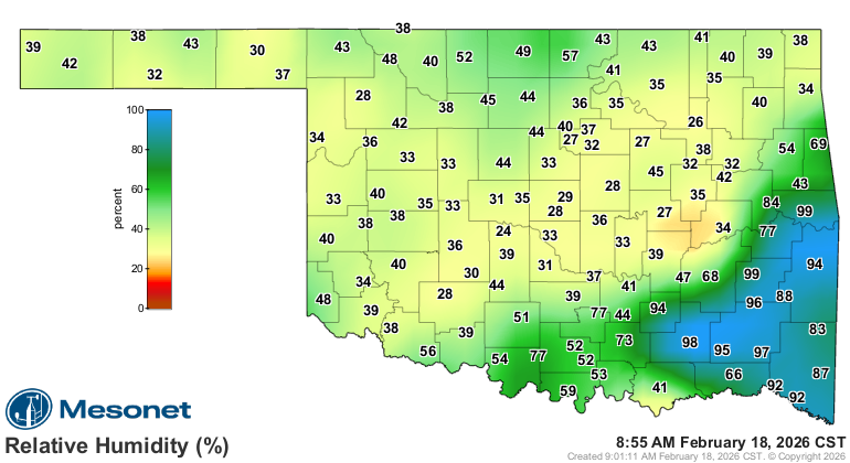
Already RHs are dangerously low for this time of the morning. When it starts
to heat up, the capacity for the air to hold water vapor will go way up, but
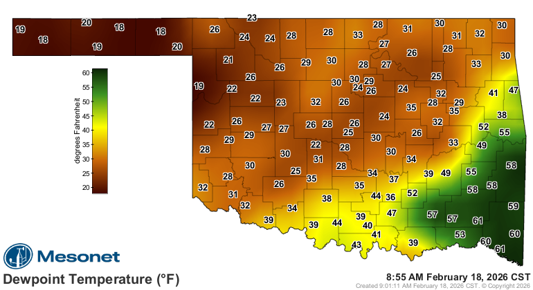
the dewpoint shows that there just ain't a lot of that moisture to keep those
relative humidity values from spiking.
That's the dumb guy version of how this works. It is ME, after all (I HEARD
THAT!!)
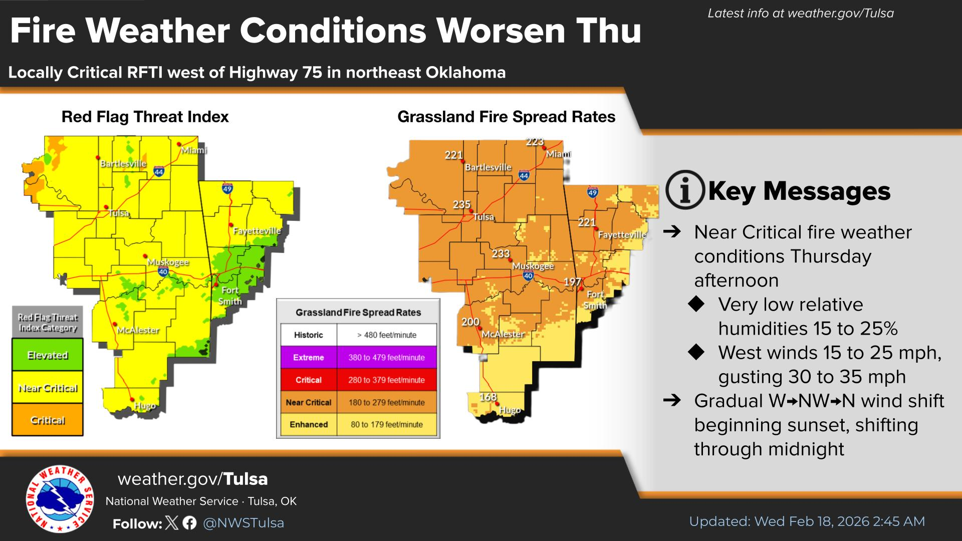
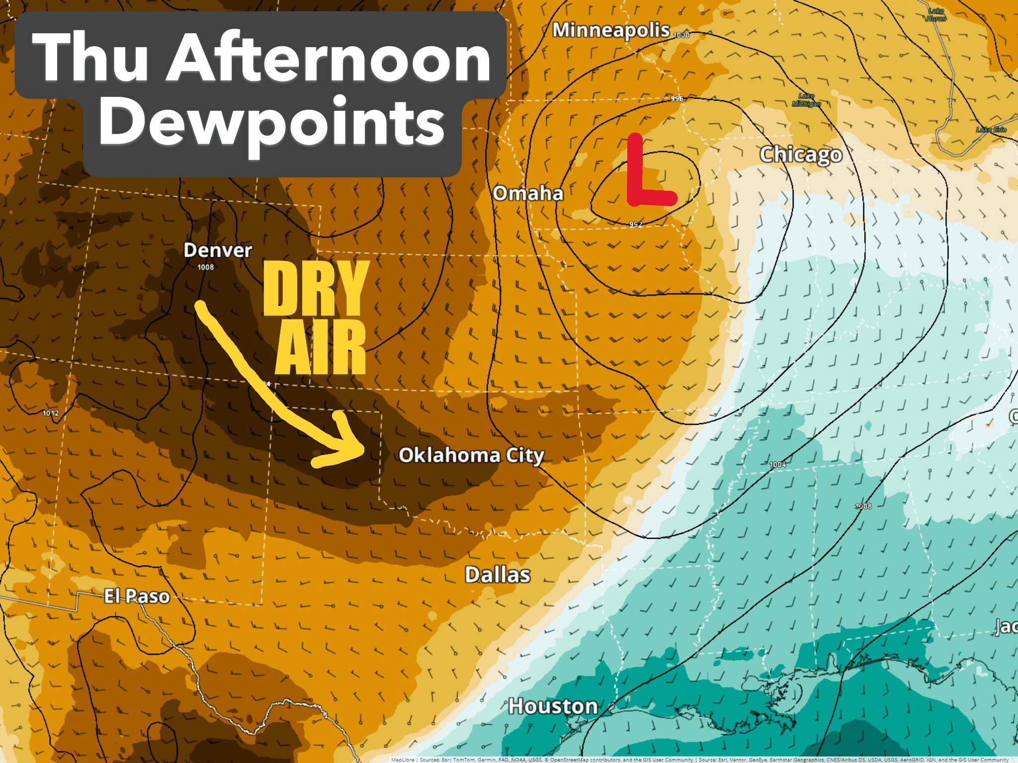
And as pointed out from our friends at the Norman NWS office, lower dewpoint
air is headed out way for tomorrow. These folks AREN'T dumb guys (or gals)!
Also not dumb, our OFS folks:
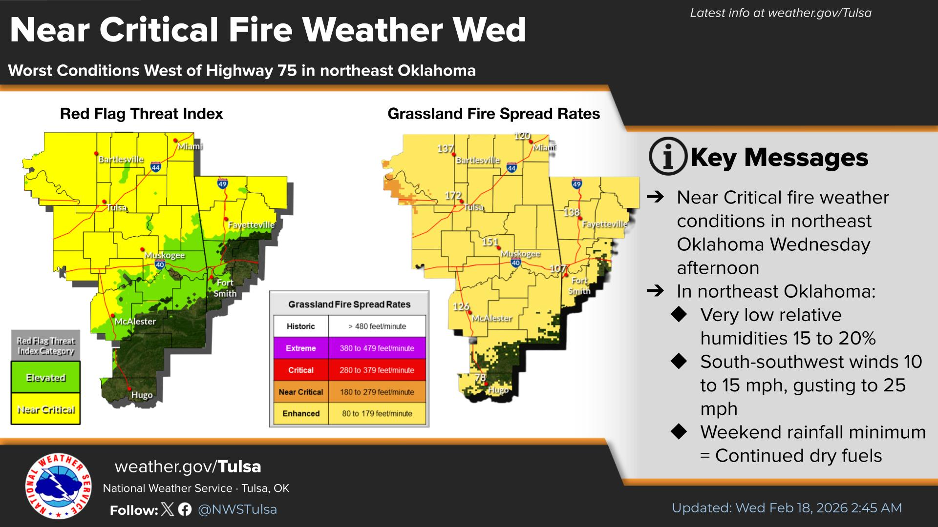
"Statewide Discussion: Fire behavior yesterday proved to meet
the fire behavior forecast and geographic area of concern with
extreme fire behavior observed on the significant, high-impact
wildfires in northwestern Oklahoma. Dry air will span a larger area
today with a Red Flag Warning extending into central Oklahoma
today. A Fire Weather Watch is in effect for Thursday extending
further east across north-eastern and south-central Oklahoma
with elevated fire weather over increasingly receptive fuels."
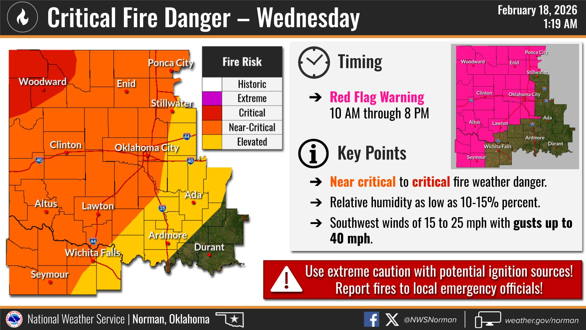
"Today: The highest fire danger indices today will again be focused
in the Oklahoma Panhandle and northwestern Oklahoma in
vicinity of significant fire occurrence yesterday. Poor overnight
moisture recovery in the northwest signals a near-continuous
burning period overnight into this morning while very dry air
overspread the state today. This afternoon relative humidity as
low as 14% in central Oklahoma / 18% far eastern Oklahoma.
Surface fuels will be extremely receptive this afternoon noting that
some areas where weekend rainfall occurred have wet ground
that will limit fire equipment access in some areas. Light and
somewhat variable winds this morning become southwesterly
this afternoon. While not as ominous as what was observed
yesterday, fully established wildfires will exhibit rapid rates of fire
spread in grass, brush and range fuels given current state of fuels."
Hopefully, the lower wind speeds give us a better chance today to get those
fires from yesterday, still now contained, under control, and limit the spread
of any new fires that might crop up.
Gary McManus
State Climatologist
Oklahoma Mesonet
Oklahoma Climate Survey
gmcmanus@ou.edu
February 18 in Mesonet History
| Record | Value | Station | Year |
|---|---|---|---|
| Maximum Temperature | 91°F | BUFF | 2016 |
| Minimum Temperature | -8°F | TIPT | 2021 |
| Maximum Rainfall | 0.78 inches | TIPT | 1998 |
Mesonet records begin in 1994.
Search by Date
If you're a bit off, don't worry, because just like horseshoes, “almost” counts on the Ticker website!