Ticker for February 17, 2026
MESONET TICKER ... MESONET TICKER ... MESONET TICKER ... MESONET TICKER ...
February 17, 2026 February 17, 2026 February 17, 2026 February 17, 2026
Sure smells smoky
OOOOOOOOOOOOOH-KLAHOMA, where the wind comes sweepin’ down the plain,
And the wavin’ grass can sure burn fast
When the wind gusts outrun the rain.
Oklahoma, ev’ry night the fire chiefs and I
Watch the sky turn brown as the dust spins ’round,
Makin’ dryline circles in the skyyyyyyyy!!!
I have very little time to Tick today...I have to go lay down those tracks on
vinyl before somebody steals me song. Obviously, today is gonna get hairy (jealous
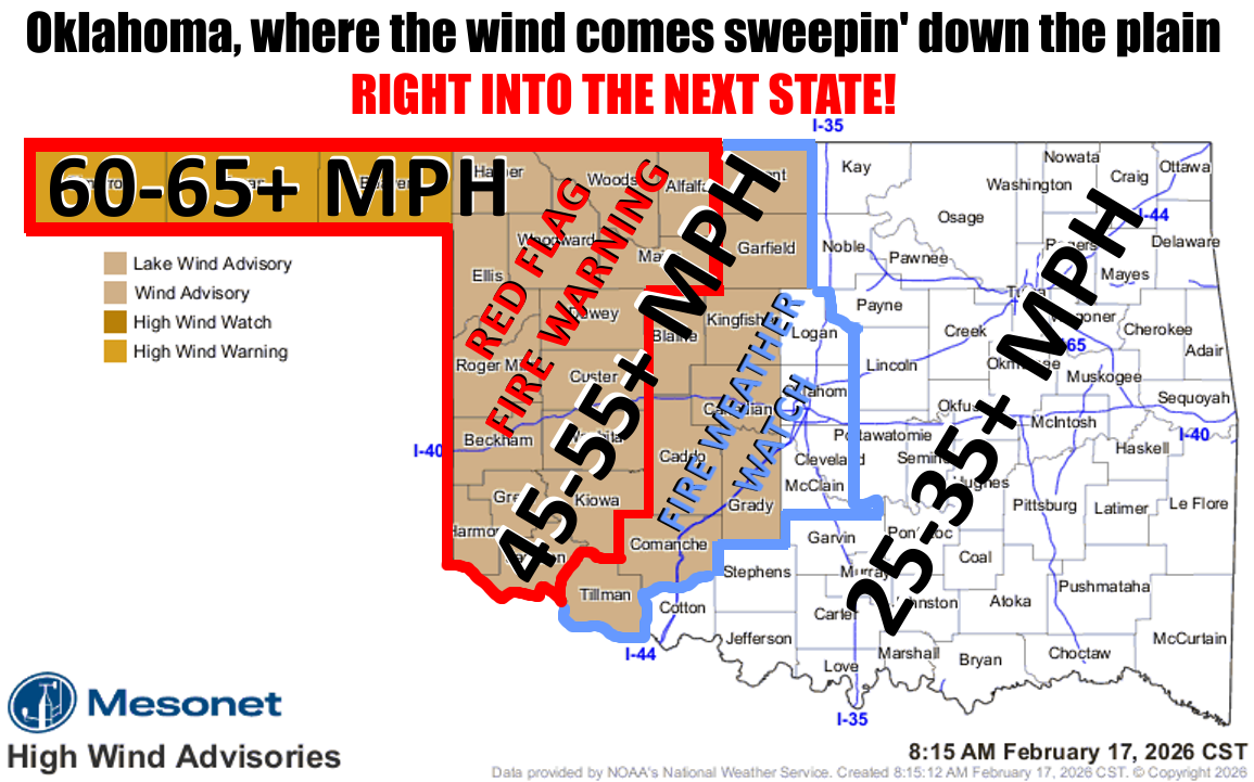
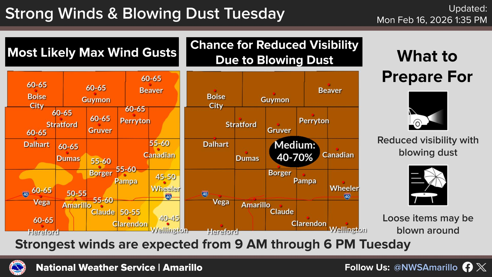
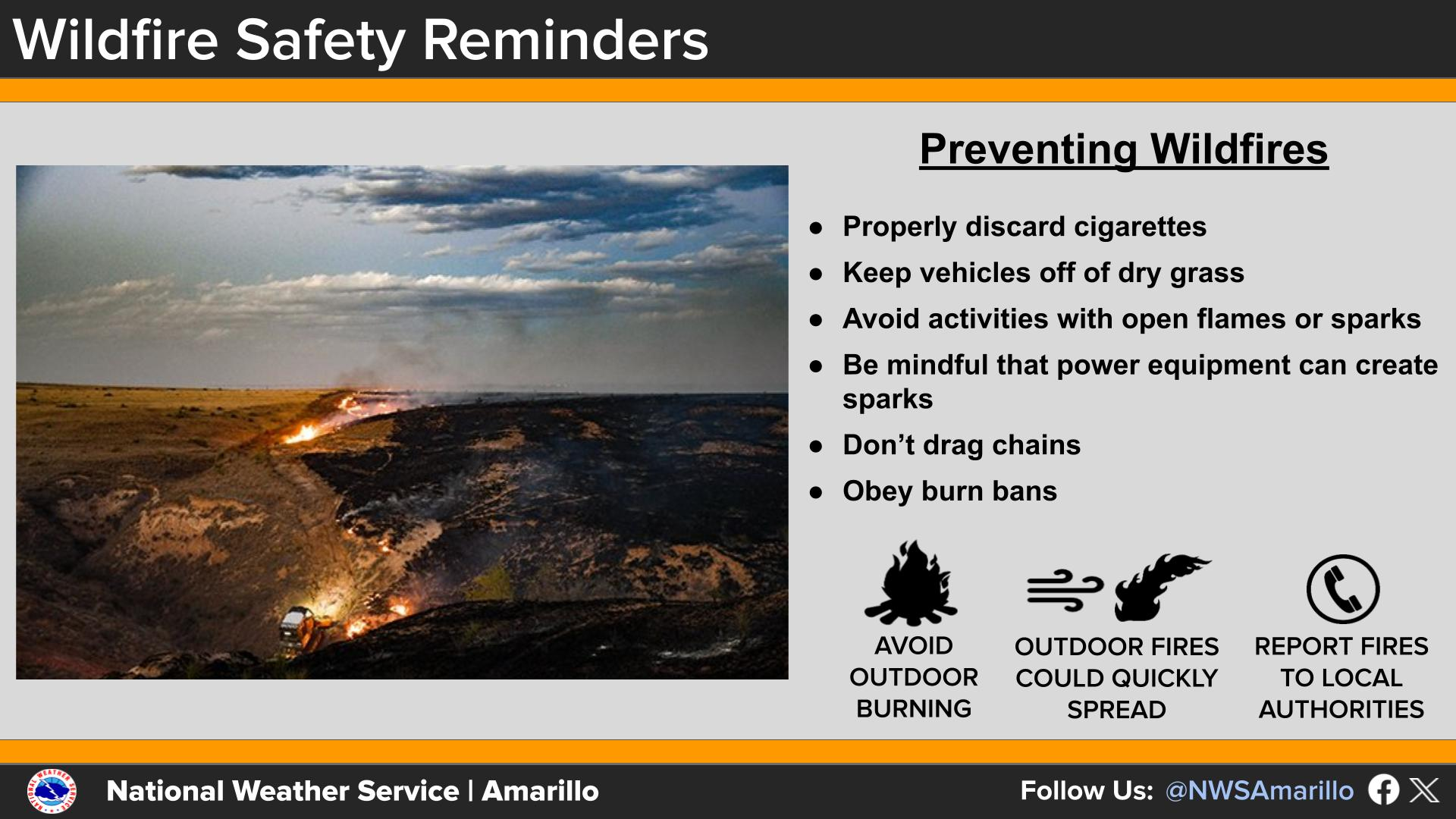
I am) if any fires ignite. We have the high wind warning and watch for winds
gusting up to 45-65 mph (maybe one or two a bit higher), and we have the Red
Flag Fire Warning and Fire Watch for critical fire danger.
The latest Fire Situation Report from OFS tells the story better than I can:
Qothe the report: Nevermore! Whoops, that was the Raven. Let's try again:
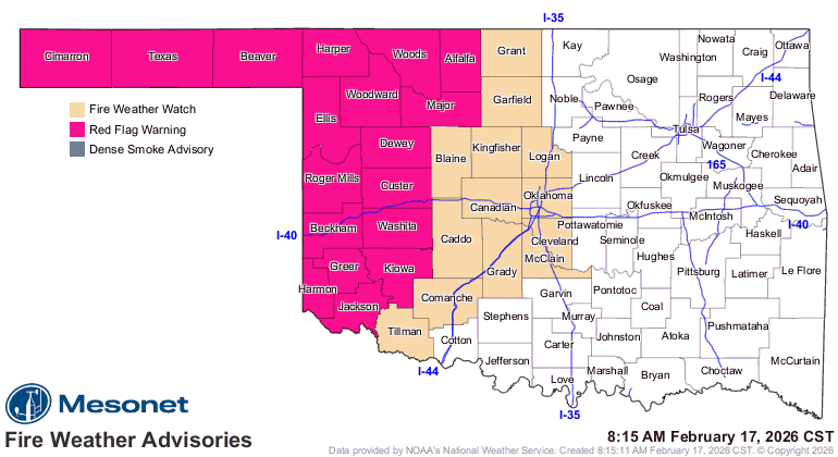
"Critical fire weather will develop today
across the Oklahoma Panhandle, Northwestern counties and
areas of Western Oklahoma today as unseasonably warm
temperatures, very dry air and strong gusty winds occurring over
receptive, dormant fuels presents potential for extreme fire
spread potential. Both large fire (>300 acres) and significant fire
occurrence (>5,000 acres) probabilities have increased with fire
danger escalating today through Thursday. A Fire Weather Watch
is in effect for Wednesday across the current Warned Area
extending into central Oklahoma tomorrow. Very dry air will
overspread Oklahoma both Wednesday and Thursday coupled
with warm temperatures and breezy conditions accelerating the
drying of wildland fuels and increasing fire danger concerns."
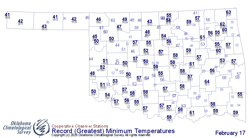
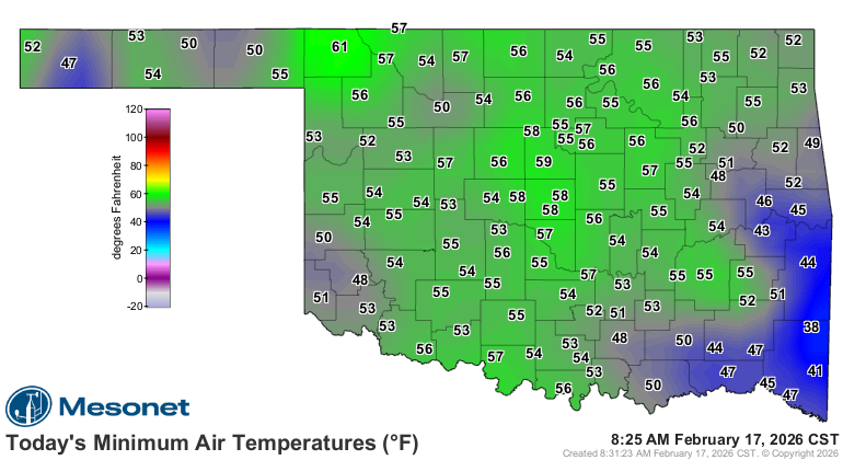
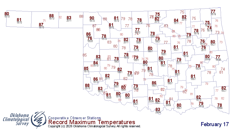
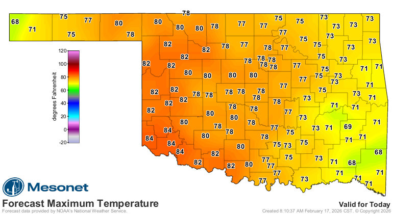
Once again we're dealing with record temps today, and NOT on the cold side.
We've already set quite a few record warm low temperatures, and we're aiming for
some of those high temps as well.
ZOUNDS! How many times have I posted the same thing about these record temps
over the last 3-4 months? Maybe we'll look at that tomorrow.
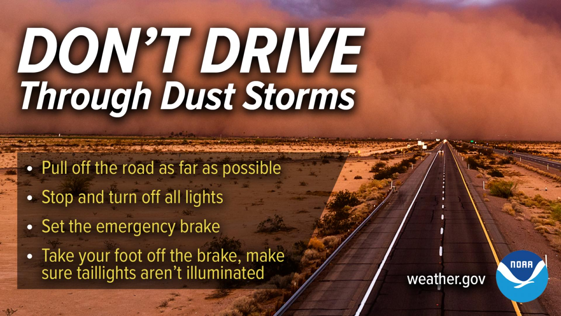
And as if fires weren't bad enough (and they are, I assure you), we're gonna
have blowing dust to deal with as well, especially out across far western OK and
the Panhandle. And do you know there are dust storm driving safety rules? Like
pull off to the side of the road and don't hit your brake lights or anything
because somebody coming up behind you might think you're still driving and
follow your brake lights right up your tailpipe, and you might do the same to
somebody else ahead of you!
And as always, remember those wildfire safety rules, and don't get complacent
because we get to do the same thing over again the next two days.
You know that hawk making lazy circles in the sky? It's up in Nebraska now.
Gary McManus
State Climatologist
Oklahoma Mesonet
Oklahoma Climate Survey
gmcmanus@ou.edu
February 17 in Mesonet History
| Record | Value | Station | Year |
|---|---|---|---|
| Maximum Temperature | 85°F | ALTU | 2011 |
| Minimum Temperature | -2°F | HOLL | 2021 |
| Maximum Rainfall | 1.56 inches | TULN | 2022 |
Mesonet records begin in 1994.
Search by Date
If you're a bit off, don't worry, because just like horseshoes, “almost” counts on the Ticker website!