Ticker for February 19, 2026
MESONET TICKER ... MESONET TICKER ... MESONET TICKER ... MESONET TICKER ...
February 19, 2026 February 19, 2026 February 19, 2026 February 19, 2026
She ran calling...
To quote the late, great DMX: "HERE WE GO AGAIN!"
I'll stop the quote right there, lest I be out of a job. But my job isn't to just
drop classic lyrics on you, my job is to PUMP. YOU. UP! Wait, that's Hans and
Franz.
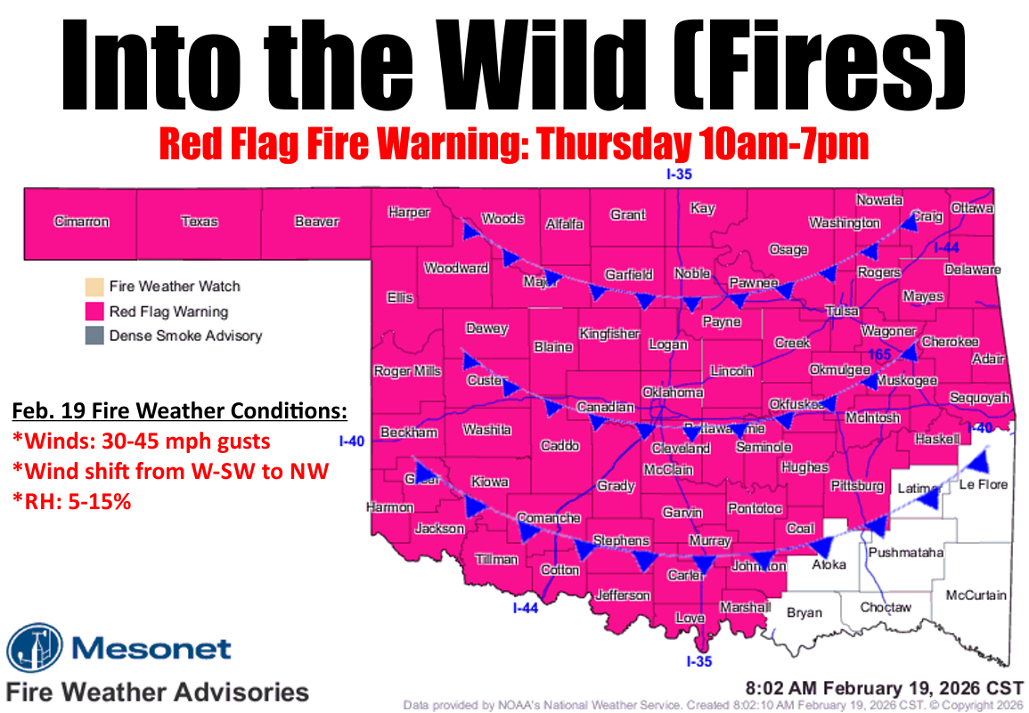
Oh right, my job is to give you the latest info on our weather, and the news
ain't good. We're starting out with a W/SW wind today, and that westerly component
means it's a downslope wind from off the higher elevations to the west. A
downslope wind is problematic when it comes to fire weather because it's a drying
wind.
Dumb-guy explanation, from the dumbest guy you'll ever know: as the wind flows
downslope, the pressure increases and the air compresses and warms, and the RH
drops considerably.
That's really simplified, but if I told you any more I'd have to kill you...with
boredom.
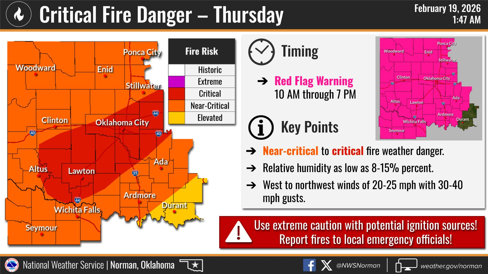
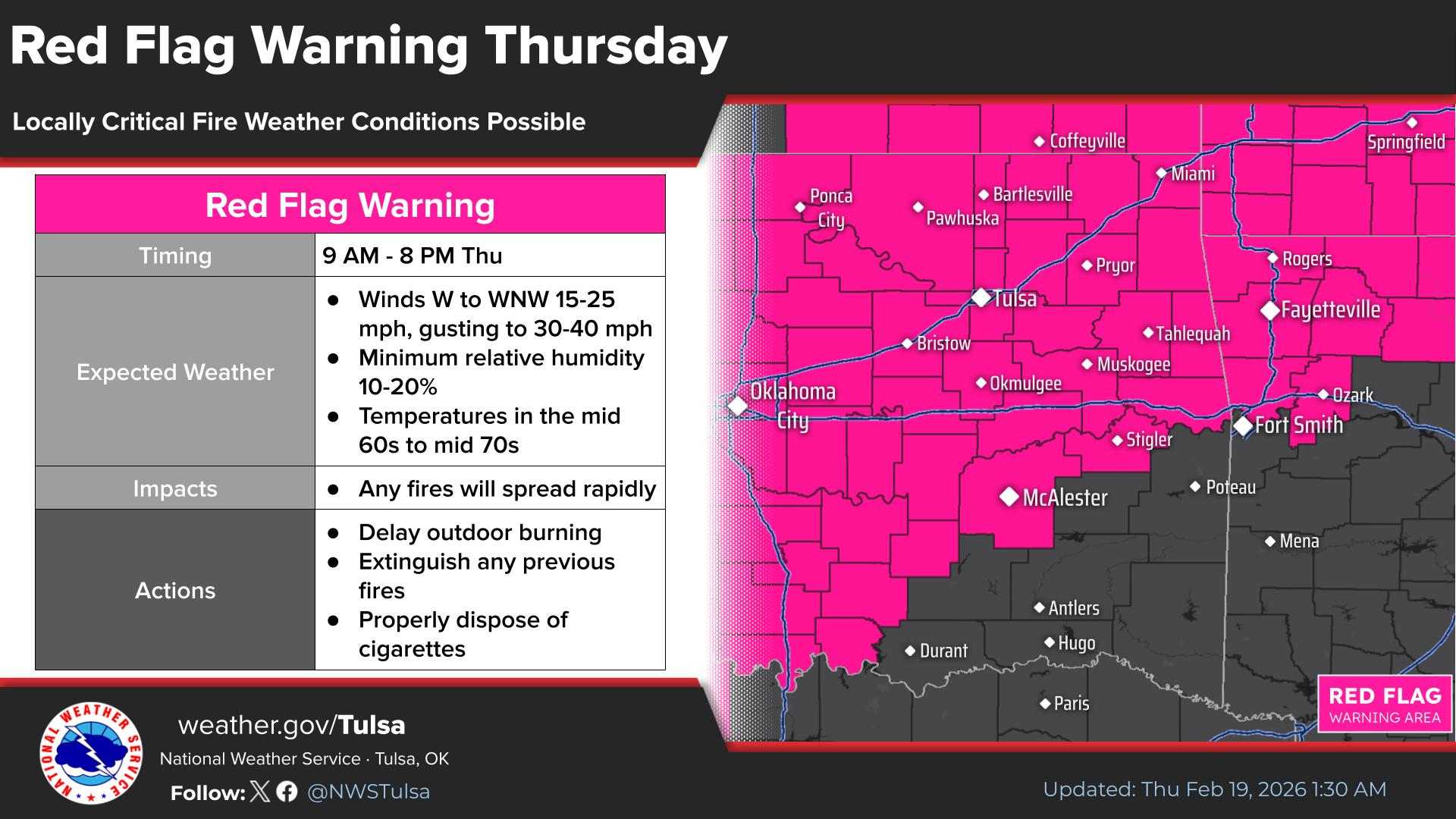
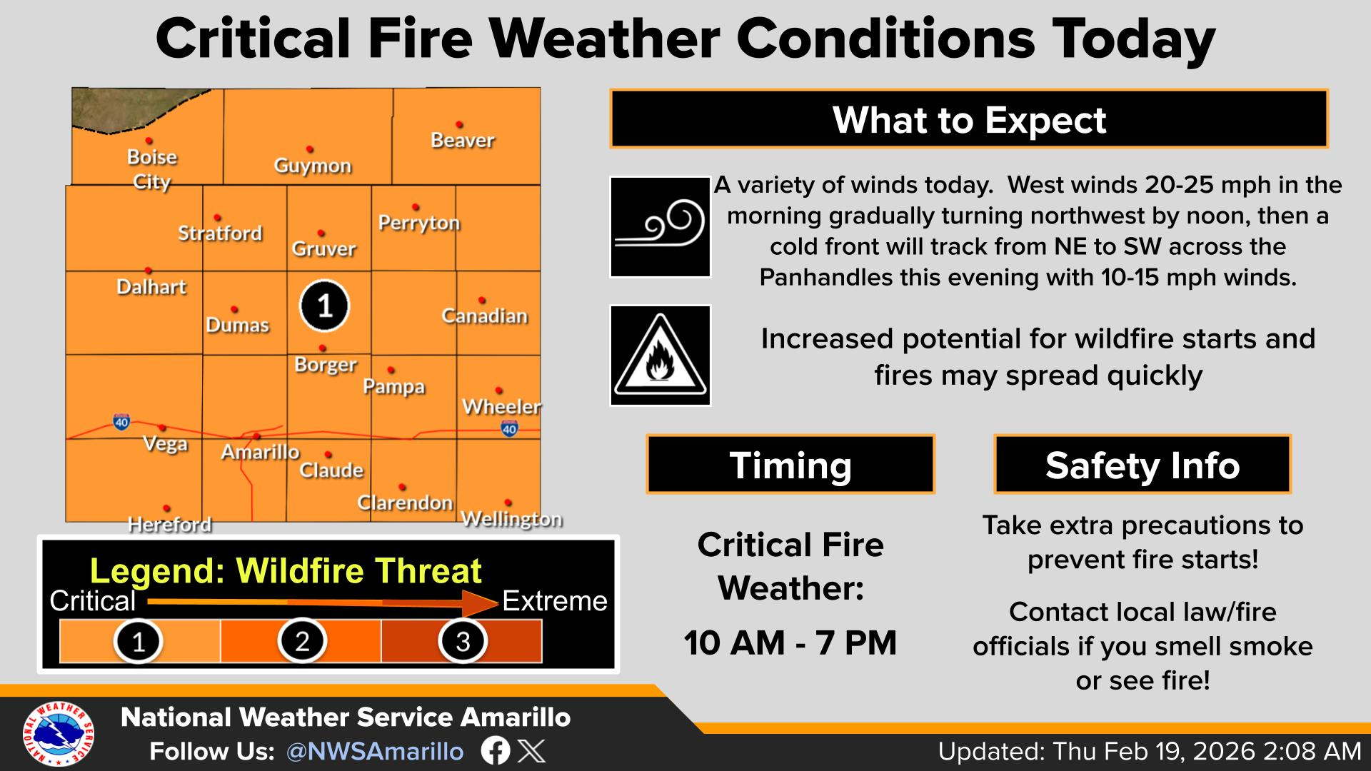
So today's setup will be the lowest RH of our 3-day descent into the inferno,
but the winds again won't be as bad as on Tuesday. However, that's complicated
by a cold front coming through later this afternoon/evening causing a wind
shift from these W/SW winds to NW, so any fires that might ignite will shift
directions. And while we won't see 60-70 mph winds like Tuesday, 40-45 mph gusts
will be extremely problematic. Here's some more info from our fine
(non-feathered) friends from our local NWS offices.
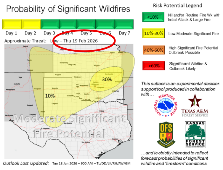
And even more info from our friends at Oklahoma Forestry.
"Winds will increase and veer northwest ahead of a cold
front today coupled with very dry air again across Oklahoma.
Relative humidity values in the teens are expected across most of
the state driving grass/leaf litter fuels to be very receptive.
Increased new wildfire occurrence with challenging firefighting
conditions will spur an increase in large fire potential (>300 acres)
while a moderate potential for significant, or high-impact, fire
occurrence concern has increased in central and northeastern
counties. Wildfires currently on the landscape will be challenged
with a different wind direction today presenting firefighters with
continued resource commitment and potential for flare-ups on
the southern flanks of active fires."
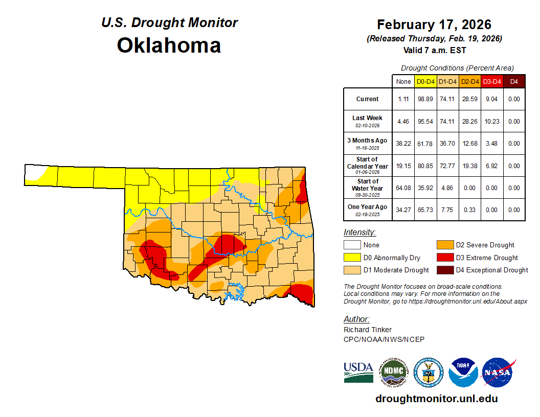
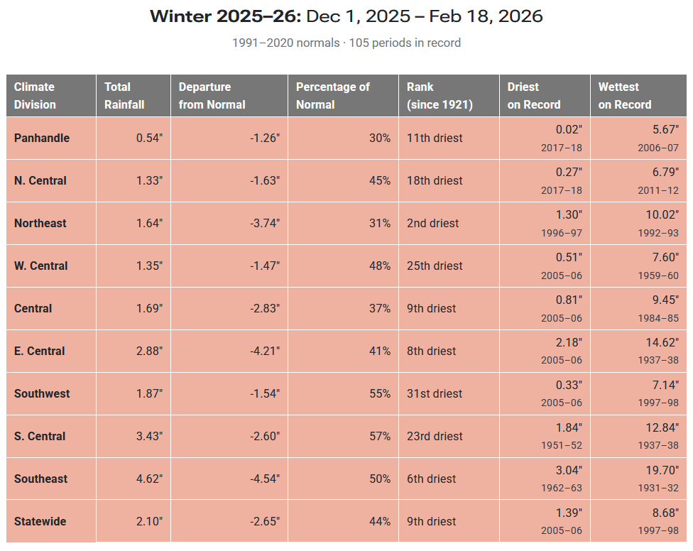
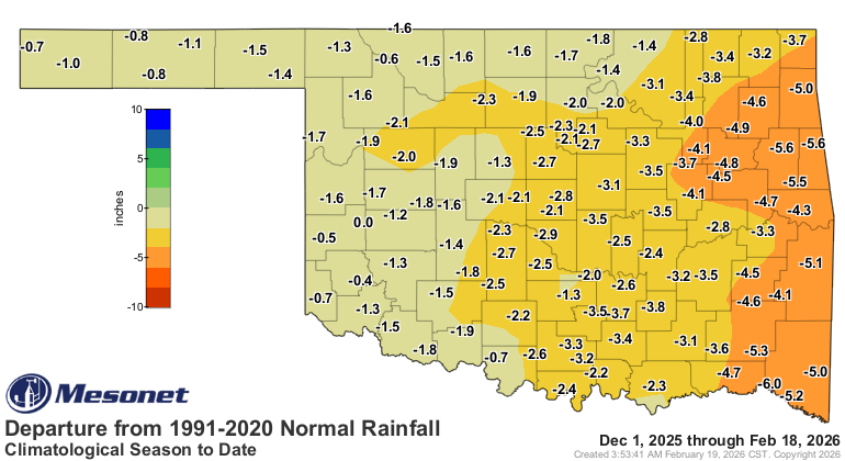
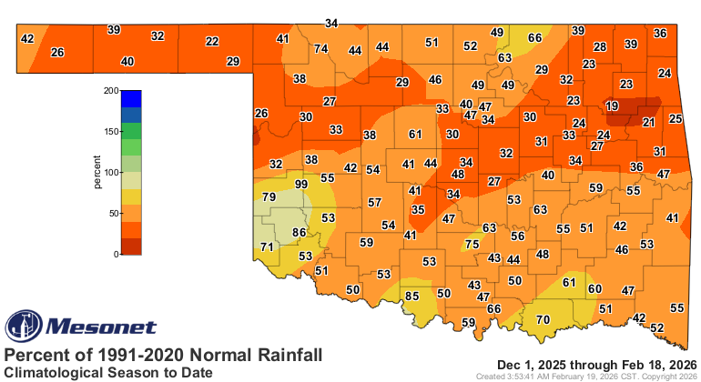
All of this is complicated because of drought, and while it's not the most
important factor during the cool season, it's not helping. A lot of that organic
material in the soil dries out during drought, and of course those red cedars
can turn into matchsticks thanks to the dry weather. And drought we have still,
with the lack of rainfall still plaguing us. Last week's rains helped, but not
enough. We're still in the midst of our 9th-driest winter thus far through at
least the last 100 years.
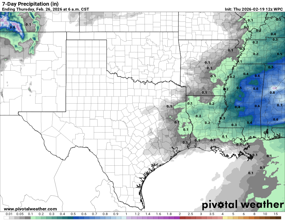
And not much help on the way.
Okay, that's enough for today. Here's hoping for a boring day.
Gary McManus
State Climatologist
Oklahoma Mesonet
Oklahoma Climate Survey
gmcmanus@ou.edu
February 19 in Mesonet History
| Record | Value | Station | Year |
|---|---|---|---|
| Maximum Temperature | 81°F | ALTU | 2004 |
| Minimum Temperature | -8°F | CHIC | 2021 |
| Maximum Rainfall | 2.94 inches | BURN | 1997 |
Mesonet records begin in 1994.
Search by Date
If you're a bit off, don't worry, because just like horseshoes, “almost” counts on the Ticker website!