Ticker for January 21, 2026
MESONET TICKER ... MESONET TICKER ... MESONET TICKER ... MESONET TICKER ...
January 21, 2026 January 21, 2026 January 21, 2026 January 21, 2026
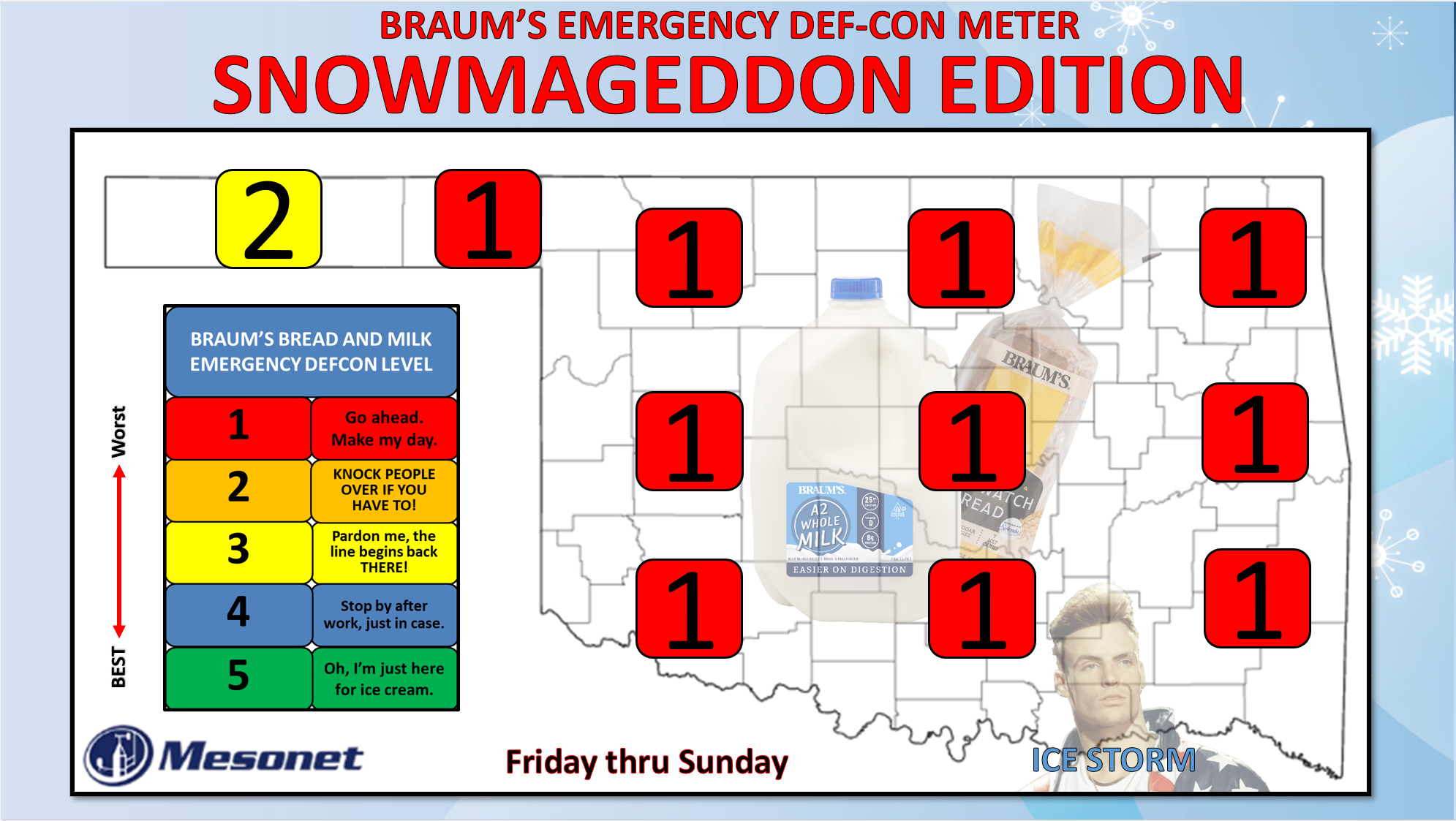
Get thee to a Braum's!
Human sacrifice, dogs and cats living together... MASS HYSTERIA!
OMG?? Okay, no gigantic Stay-Puft Marshmallow (English to Okie translation:
"Marshmellow") man, and you don't need to call the Ghostbusters. Just a snowstorm.
Unfortunately, much like the aforementioned giant marshmallow man, this event
continues to get bigger, now with a non-insignificant chance some folks will see
a foot of snow, and a darned good chance we'll see widespread 6+ inches.
Wait..."non-insignificant." So if I said non-significant, that'd mean...no, I was
right. Non-insignificant.
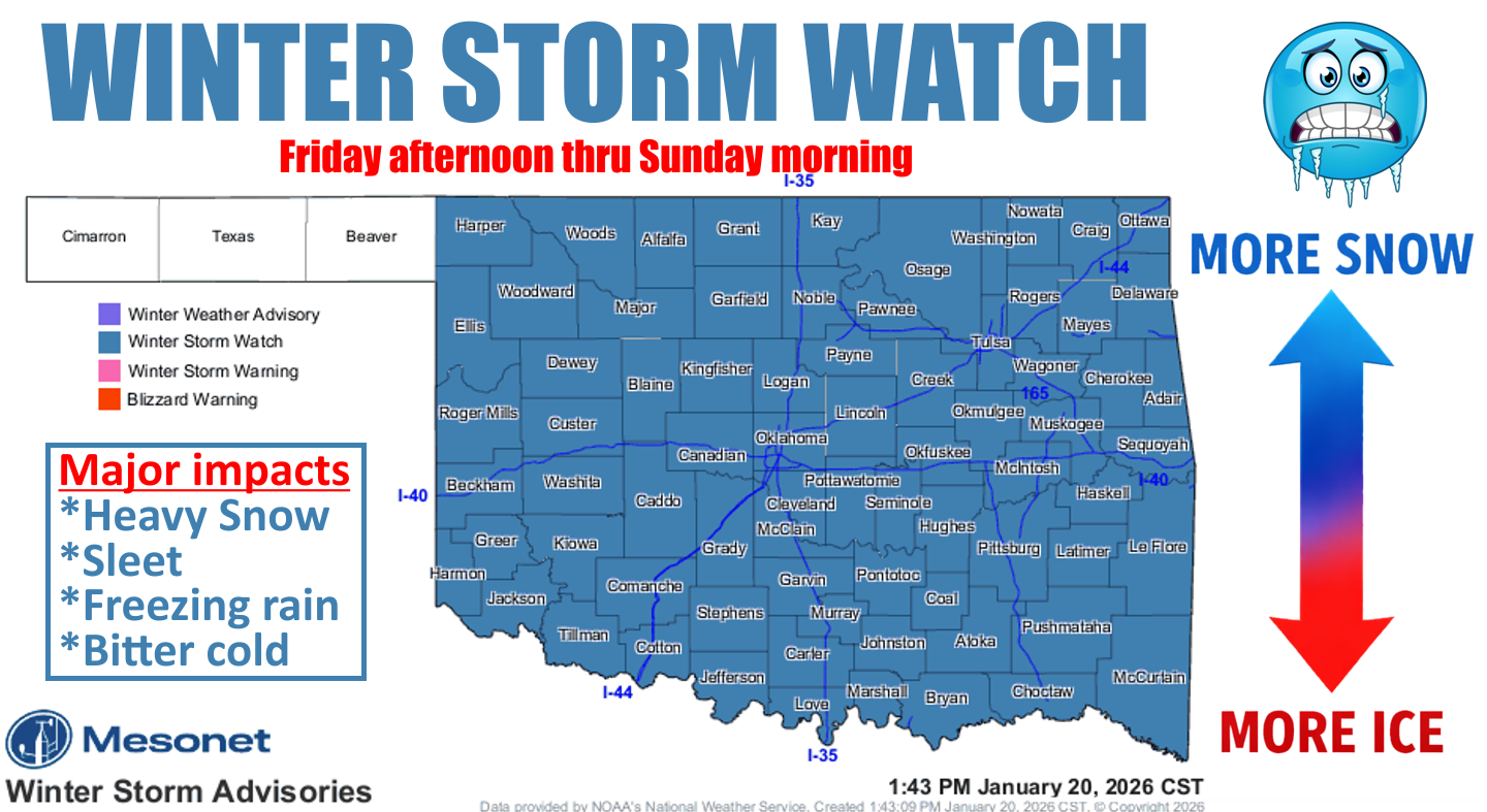
To the weather graphics!!
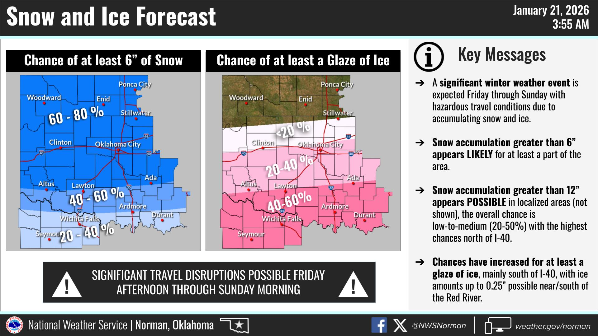
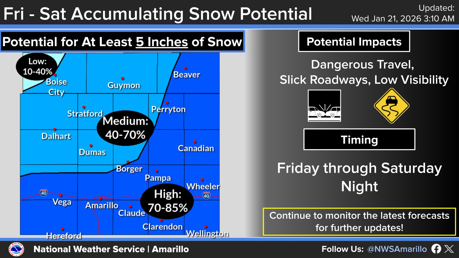
So the changes are a bit more ice in southeast Oklahoma. Okay, maybe a LOT more
ice in southeast Oklahoma. Some of that sleet and freezing rain inching its way
northward early in the event up to near I-40. And totals going up a bit as well,
as I said previously.
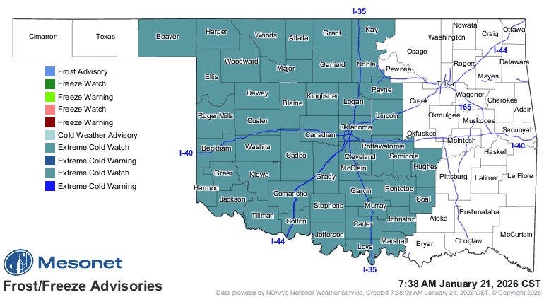
One thing not changing...my need for a hair brush. But another thing...the cold
weather. That's coming, and there's nothing in the world that can stop it. We
could see temperatures down into the -20F territory by Saturday morning, and
not much better through Sunday.
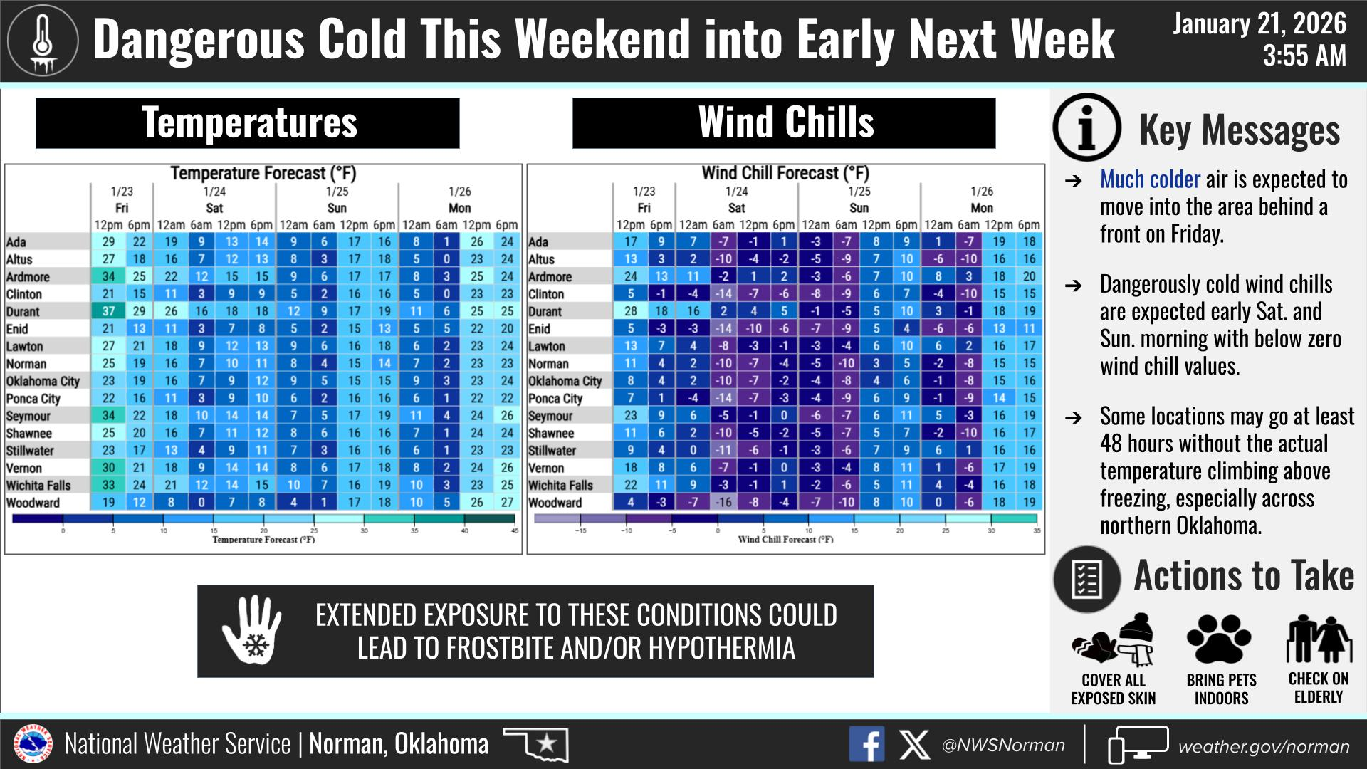
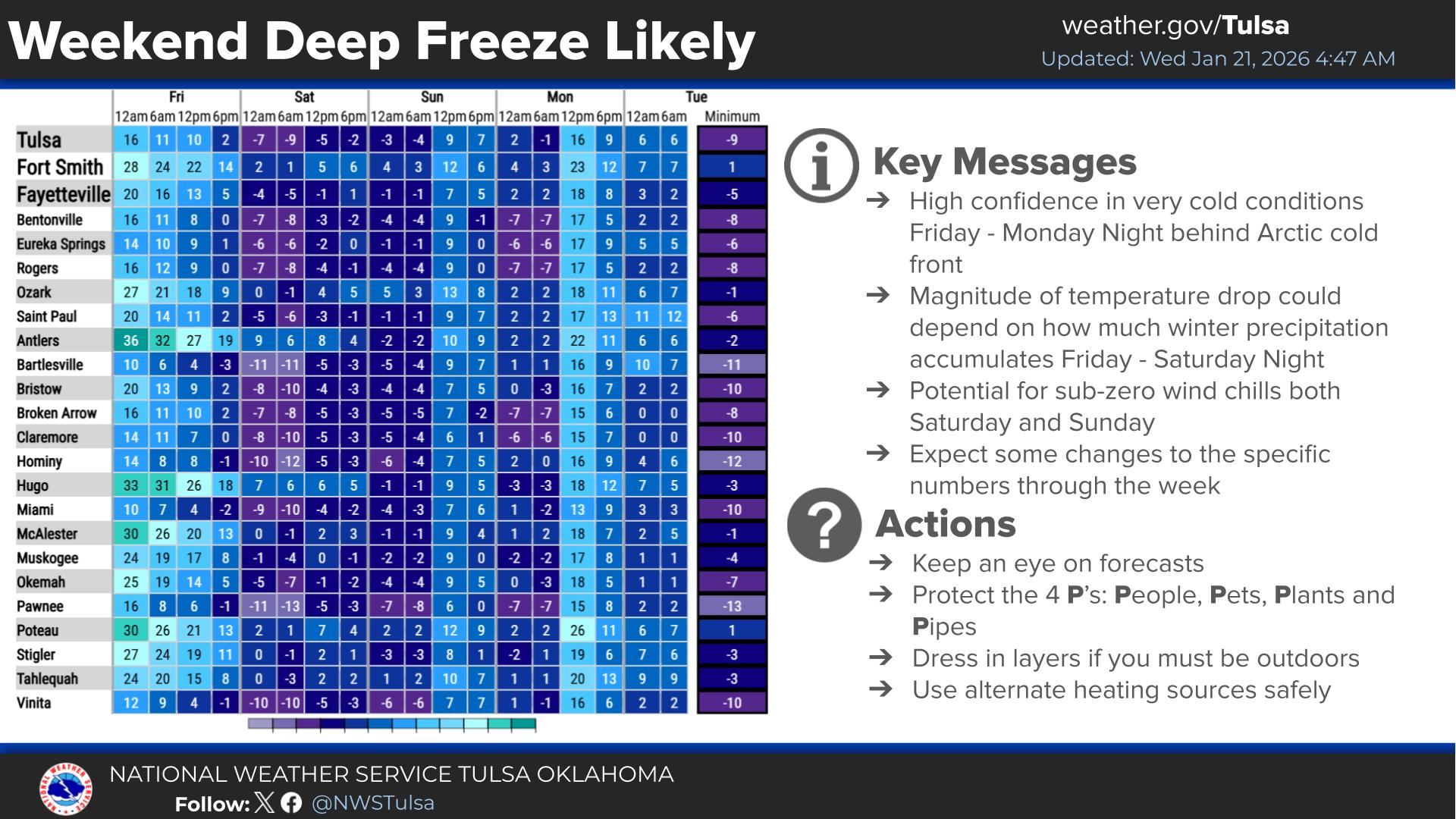
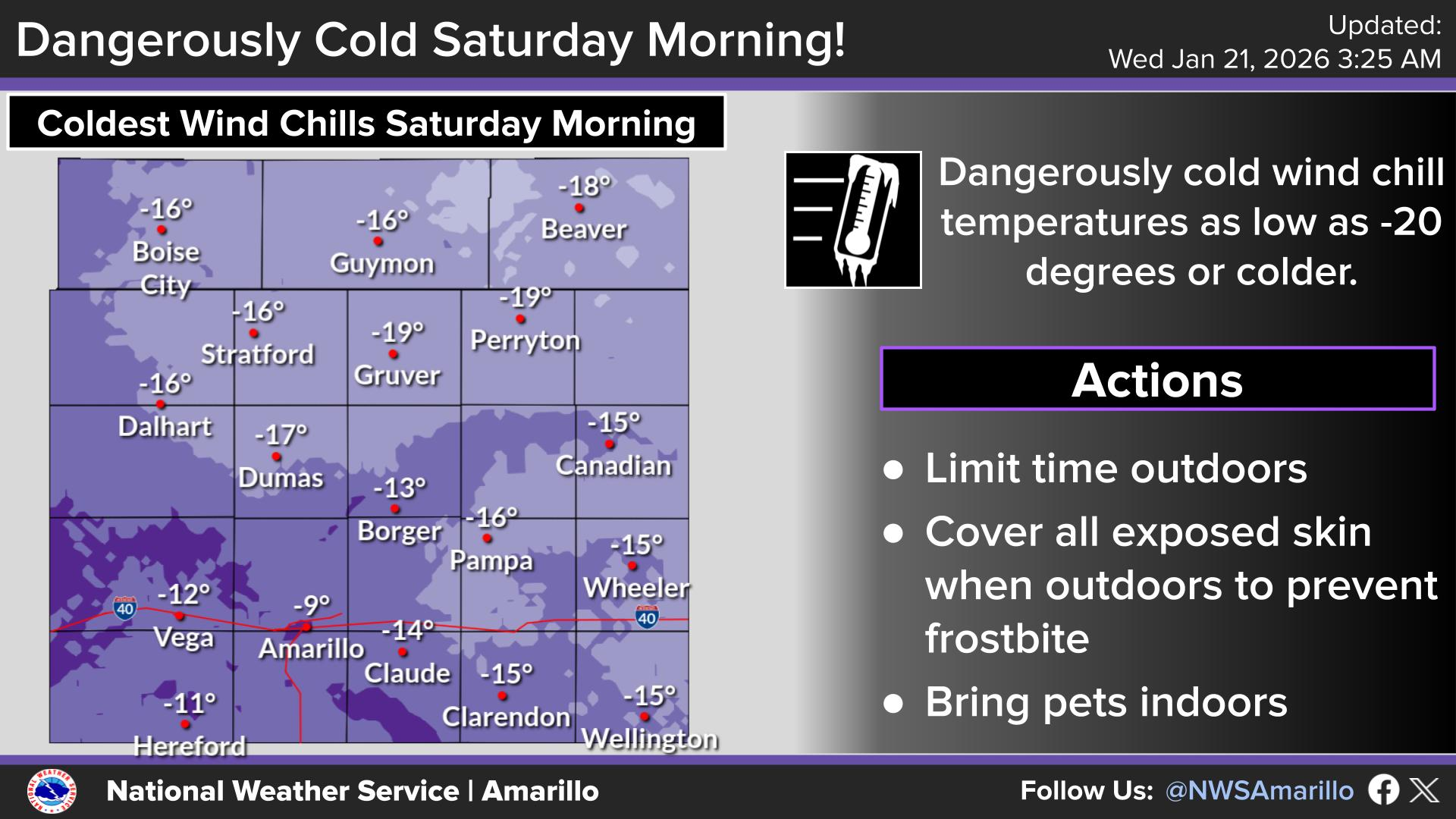
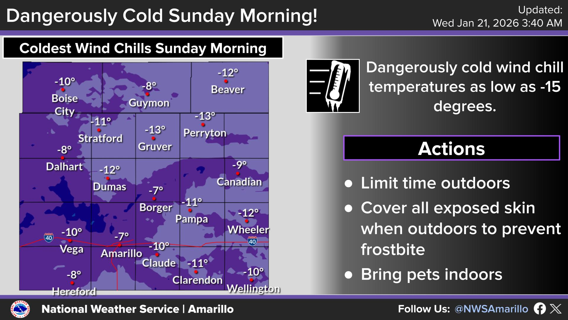
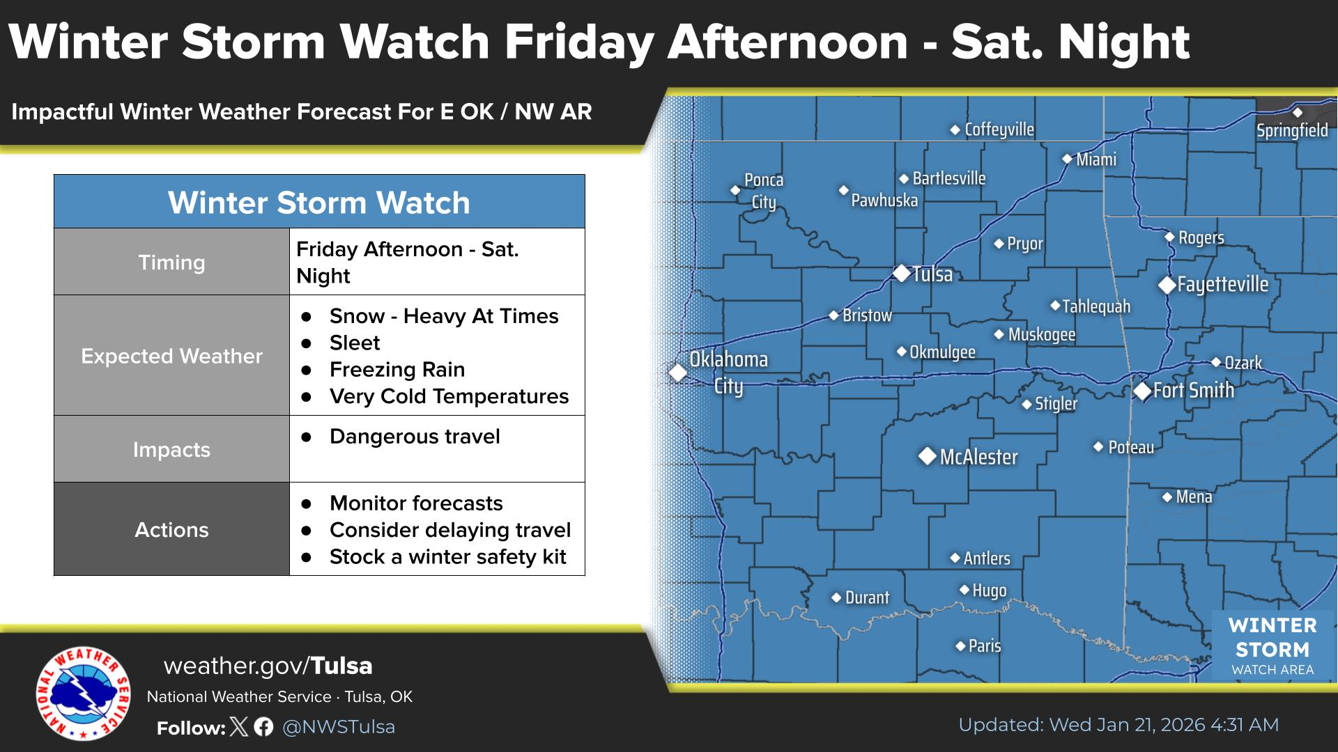
We've already seen the NWS issue an Extreme Cold Watch for late Friday through
Sunday morning for those wind chills across much of the state, to go along with
a winter storm watch.
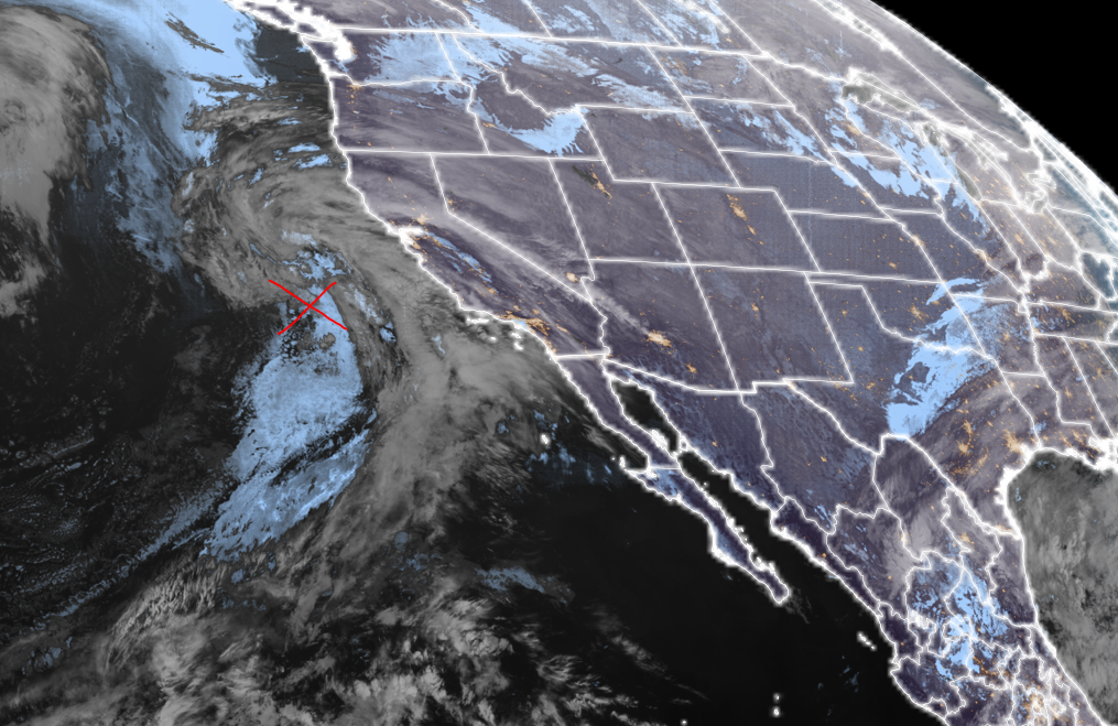
Obviously, being still out over the Pacific, this storm still has a bit of
wiggle left in it. X marks the spot.
Okay, so here's the deal. Plain-talk only. You should currently be preparing for
a significant winter storm to impact your state, your city, your neighborhood,
your house, with a good chance of 6-12 inches of snow or significant ice, at
times near white-out conditions, impassable roads, and life-threatening cold.
Some areas of the state could be below freezing for 5+ days. There's even some
model data claiming parts of the state don't get above freezing until February
as we get another shot of cold air later next week.
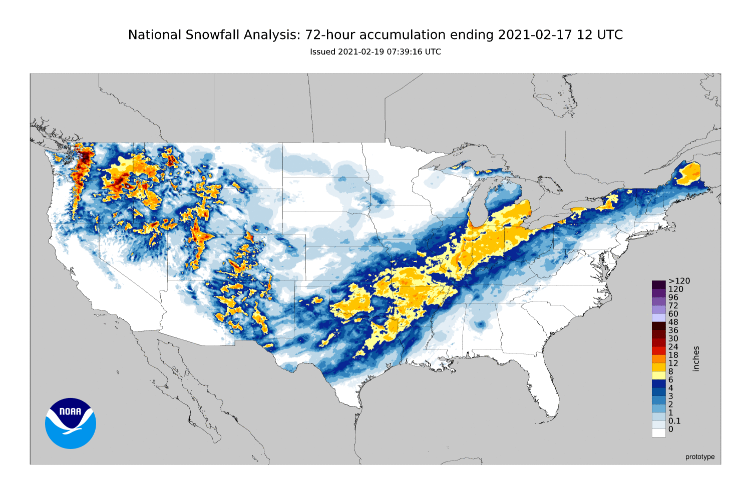
If you want an analog, this coming 5-day period resembles the storm we saw on
Feb. 1-3, 2011, with wind chills down around -20F, and a generous dollop of
6-12 inches of snow across a good portion of the state. Maybe more apt for the
snowfall would be--and I hesitate to say this because I know what memories it
will bring up--the Feb. 15-17 snowstorm during our near-historic cold snap
that month.
This storm is a 4-Family Pack of Pop-Tarts storm. Wait, what? Strawberry? Let's
not get crazy here. Cherry forever! Maybe, and I mean just MAYBE, Brown Sugar
and Cinnamon.
Never ever ever ever strawberry.
Now, get thee to a Braum's and be done with it.
Gary McManus
State Climatologist
Oklahoma Mesonet
Oklahoma Climatological Survey
gmcmanus@ou.edu
January 21 in Mesonet History
| Record | Value | Station | Year |
|---|---|---|---|
| Maximum Temperature | 78°F | WOOD | 2005 |
| Minimum Temperature | -17°F | BEAV | 2025 |
| Maximum Rainfall | 3.48 inches | CLOU | 2018 |
Mesonet records begin in 1994.
Search by Date
If you're a bit off, don't worry, because just like horseshoes, “almost” counts on the Ticker website!