Ticker for January 22, 2026
MESONET TICKER ... MESONET TICKER ... MESONET TICKER ... MESONET TICKER ...
January 22, 2026 January 22, 2026 January 22, 2026 January 22, 2026
Shouting over or no?
Okay, who has SNOWPOCALYPSAGEDDON 2026 fatigue yet? I mean, how many forecast
models and info-graphics can one guy look at?
Well add a bunch more to that because I can't, and I won't, and I don't stop!
Wasn't that a song? No idea, I'm high on Pop-Tarts. I've had 2...maybe 3 chocolate
milks and I'm looking for trouble. Also looking for trouble...this forecast.
There's this troubling intrusion of warm air showing up in the forecast models
in the mid-levels of the atmosphere threatening to melt a lot of that snow and
turn it into freezing rain and sleet.
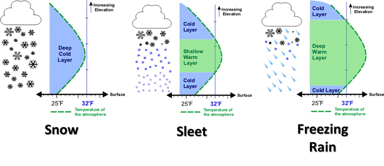
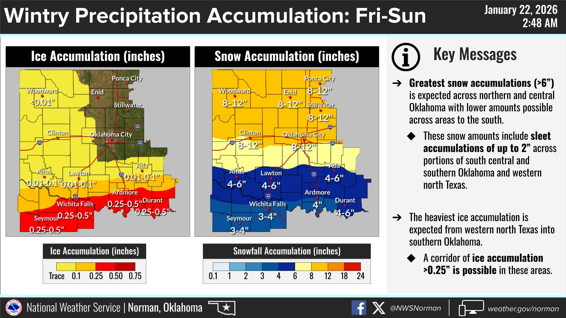
Remember our oft-used graphic, showing the delicate nature of that snow due to
those elevated temps, and how it impacts the frozen precipitation type. Just
memorize it...there'll be a quiz on this later.
We're obviously gonna have that layer of cold air...REALLY COLD...at the surface
as we go through Friday into Saturday. But how thick will that warm nose of
air be, and how far north will it push? That'll make all the difference in
whether you get 8" of snow, for example, or 3" of snow and a whole lot of
sleet. Or freezing rain.
Here's the current thinking, from folks much smarterer than I am. And this will
probably change as soon as I type this. THAT is the reality of winter
forecasting in the Southern Plains.
Timing? Well, that's the period in which something starts to occur, but that's
not important right now. Oh, you wanted to know the timing of the precip? Well
why didn't you ask?
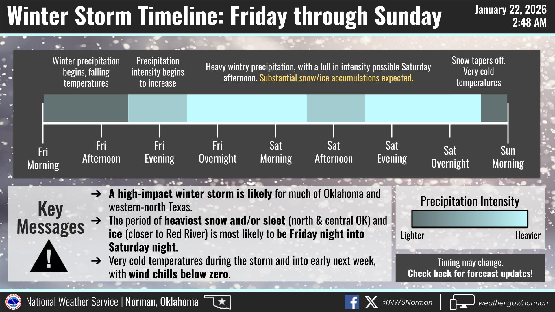
All that adds up to a winter storm warning for most of the state from 6am
Friday through noon Sunday.
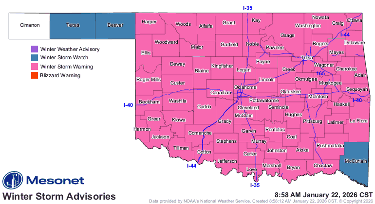
And remember, if the snow and ice get help ya park in the ditch and you have to
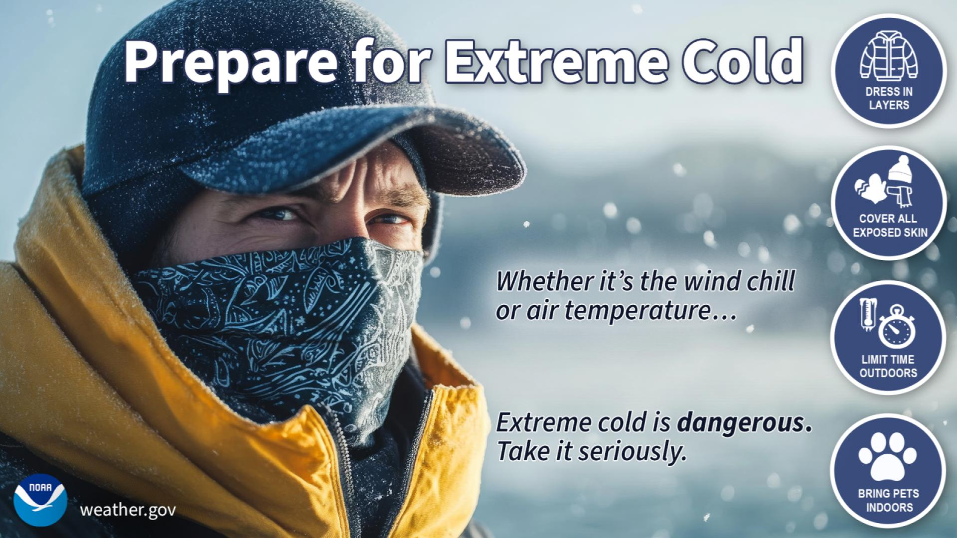
get out, then the frigid air will get ya, hence the extreme cold watch for
Friday through Monday morning for wind chills as low as -20F or more. Or less.
However that works.

So there won't be a lot of thawing going on, at least until the sun comes out.
These types of winter storms help create their own environment for days after
it's over. It's just like packing things in an ice chest with all that snow and
ice, plus it increases the reflectivity of the surface (i.e., the albedo) so
even when the sun does come out, it will reflect more of the sun's rays upward.
Wait, there's more! Once this does all melt, how much will it mean? Well,
forecast liquid-equivalent amounts show the best moisture over most of the
state since November. For crying out loud.

Okay, here's the deal. I know you want intricacies built into the forecast.
When does it start exactly, and how bad will it be Friday morning? Can I get
to work? Can I get HOME from work? How much ice will I get? Will I lose power?
I'm afraid the acute answers to those questions just aren't available yet, and
it could get augly (get it?) while you're waiting. The storm isnt' even over
land yet, for crying out loud, and these southwest-diving storms are notorious
for doing what they want to when the make their way across the Rockies. Yes,
the two-pairs of gloves Rockies (I might be Dumb, but I'm actually Dumber).
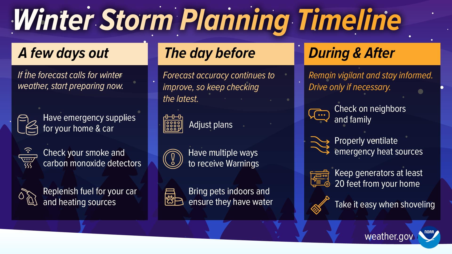
So you gotta be weather aware over the next 72 hours. You should have all
your preparations for an impactful winter storm completed by tonight.
So tune into your trusted media source and local NWS office and stay weather
aware, because the forecast can AND PROBABLY WILL change over the next 24
hours.
One thing that won't...it's gonna get really, really cold this weekend, and
there's gonna be a lot of snow and ice around.
One final "remember": the forecast could improve, but it could also get worse.
Gary McManus
State Climatologist
Oklahoma Mesonet
Oklahoma Climate Survey
gmcmanus@ou.edu
January 22 in Mesonet History
| Record | Value | Station | Year |
|---|---|---|---|
| Maximum Temperature | 84°F | WAUR | 2009 |
| Minimum Temperature | 1°F | HOOK | 2007 |
| Maximum Rainfall | 2.28 inches | BROK | 2024 |
Mesonet records begin in 1994.
Search by Date
If you're a bit off, don't worry, because just like horseshoes, “almost” counts on the Ticker website!