Ticker for January 20, 2026
MESONET TICKER ... MESONET TICKER ... MESONET TICKER ... MESONET TICKER ...
January 20, 2026 January 20, 2026 January 20, 2026 January 20, 2026
Receipts
Unless you're living in a cave (and if you are, good on you and your 54 degrees
year-round), you have probably heard about the bigtime arctic snap coming this
weekend. Hey, "Bigtime Arctic Snap" was my band's name in 9th grade!
Anyway, you know it had to happen eventually after such a warm December and most
of January. Not that it's been this weekend, obviously. Heck, it's arctic-ish right
now, for crying out loud!
But that's like baby-winter compared to what's coming this weekend where we'll
see the coldest air since last Feb. 20th or so. Remember?
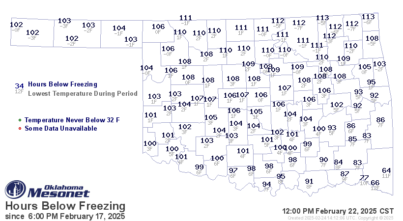
We were at or below freezing in the state as many as 113 hours, and
the statewide average temperature on Feb. 19 was 9.6F, which is
33rd-coldest day on record in Oklahoma, dating back to at least 1920. Of course,
that pales in comparison to Feb. 16 and 15, 2021, which came in at -0.6F and -0.2F,
respectively, to take the top-2 spots. Now keep in mind that January 14 and 15,
2024, were both colder than last Wednesday at 7.4F and 8.8F, respectively again
(more like DISrespectively being that cold). So maybe we shoot for the coldest
air since last January, if we're unlucky.
I'm not gonna bore ya with lots of scenarios, so I'll just bore ya with some
cautionary tales. Remember, this storm system we're looking at for this weekend
is still out over the Pacific Ocean where it is not well-sampled by instruments,
at least as well as it would be over land, so that data is getting fed into
computer forecast models and projected forward. Being not-well-sampled, any
errors or lack of a complete picture, for lack of a better term...uncertainty
maybe(??) will be projected forward as well. Chaos, like this.
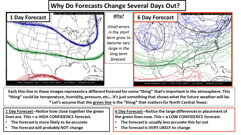
And with chaos comes mayhem. No, I'M chaos, HE'S mayhem.
And also remember it's not just the temperature at the surface those computer
models have to get correct, they have to try and project the temperature through
the depth of the atmosphere as well, and that temperature well above the
surface is just as important in determining your possible frozen precip type.
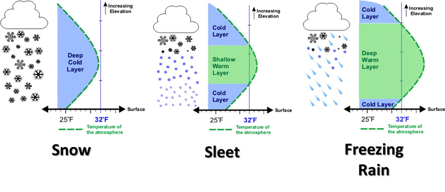
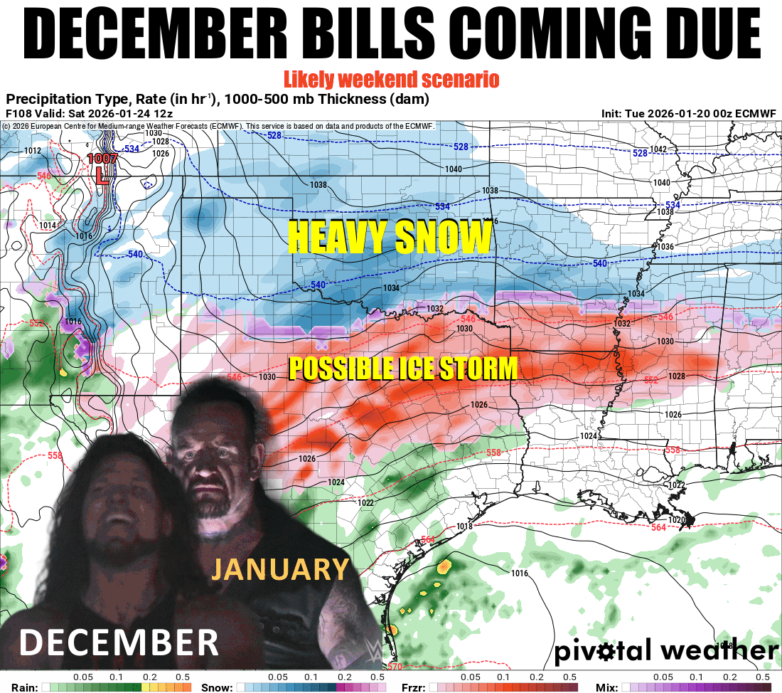
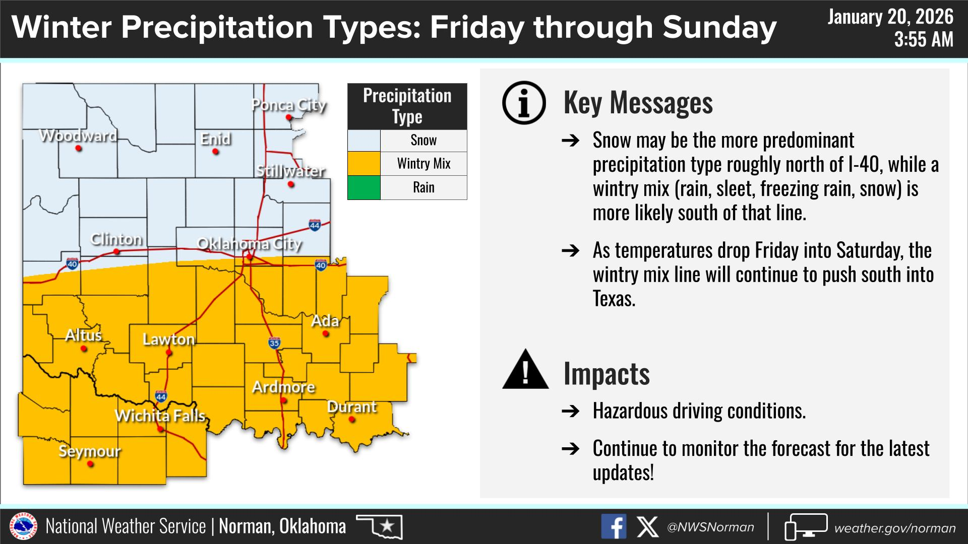
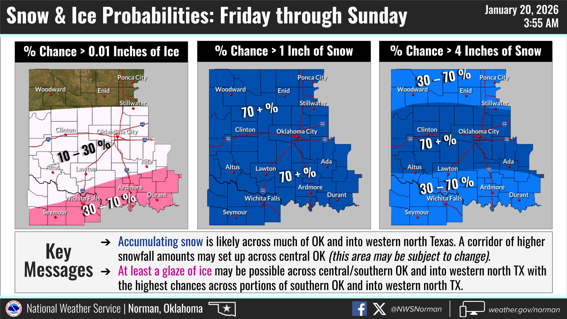
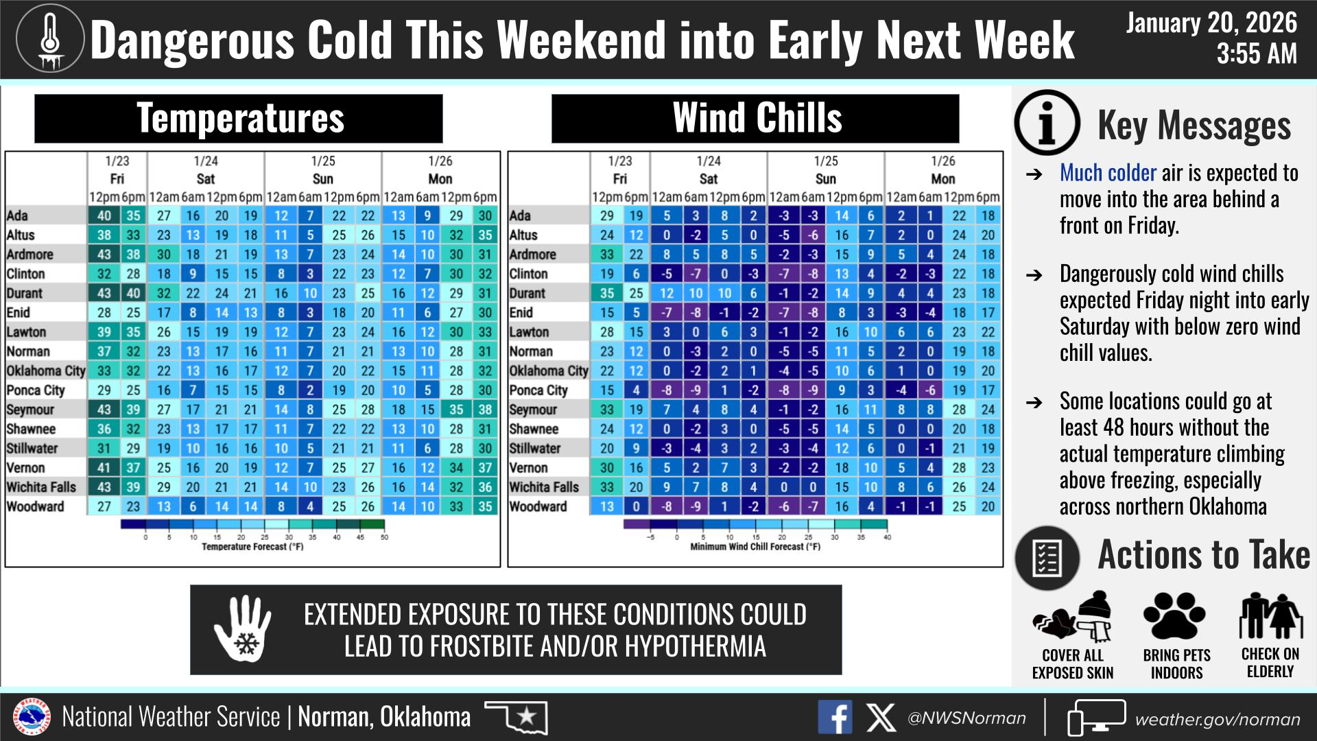
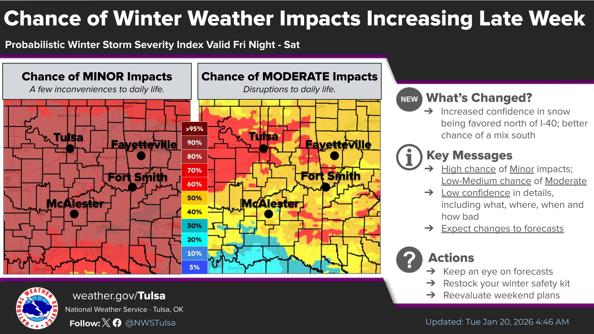
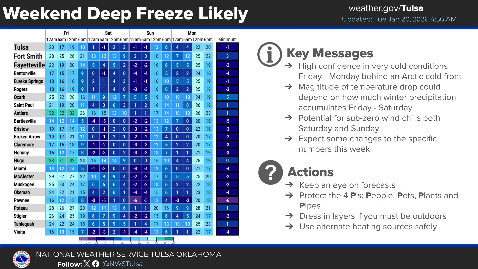
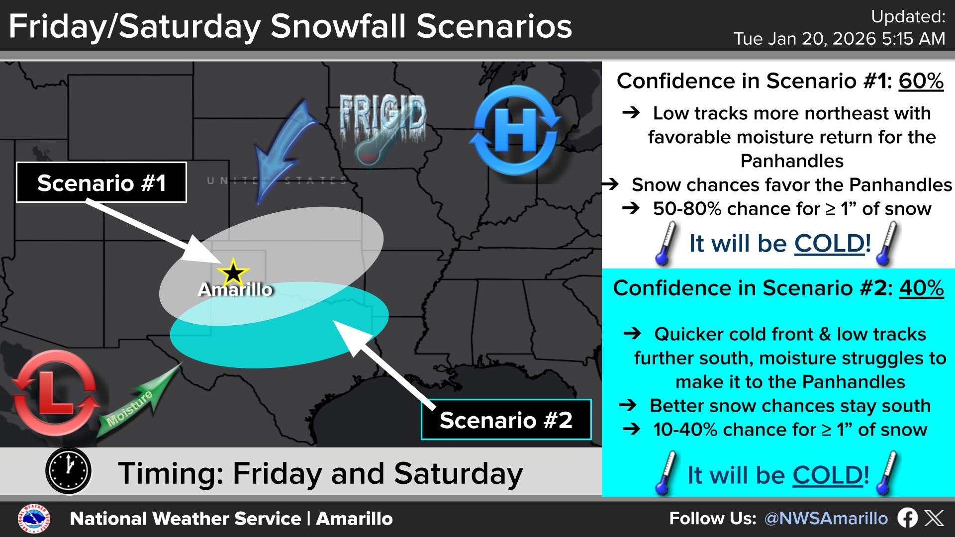
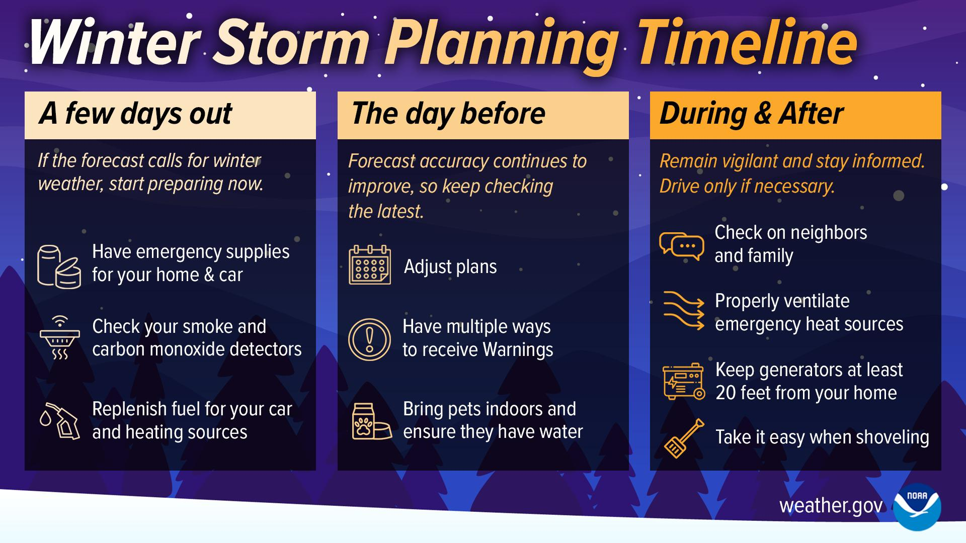
Anyway, here are some non-boring graphics from our good friends at your local
NWS office with more info.
You know the funny thing, and "funny" as in tragic? All this will probably
change as we get closer, as I showed you why earlier. And if that was bad
grammar, you ain't seen nothing yet!
Now, some caveats (and we all know just how painful caveats can be):
** The snow--amounts, track, impacts--are still iffy as we type and read this
Tuesday morning.
** The bitter cold arctic air isn't, and this could be life-threatening cold.
As of this morning, though, you have a good 72 hours or so before the possibility
of an impactful winter storm with life-threatening cold air arrives. Prepare
now, not later!
Now, for anybody that lives closer to the Red River, or in Dallas, or has to go
to Dallas this weekend (makes dread face).
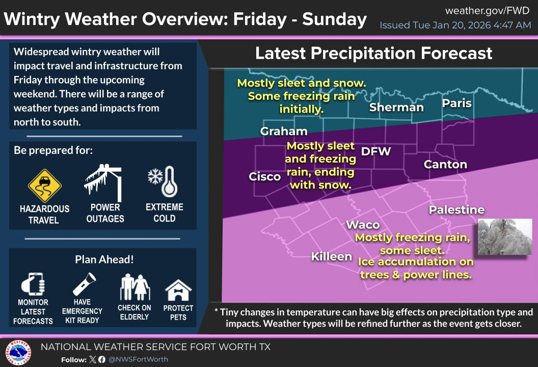
Yeah, I'll take the snow.
Gary McManus
State Climatologist
Oklahoma Mesonet
Oklahoma Climate Survey
gmcmanus@ou.edu
January 20 in Mesonet History
| Record | Value | Station | Year |
|---|---|---|---|
| Maximum Temperature | 80°F | ALTU | 1999 |
| Minimum Temperature | -15°F | KENT | 2025 |
| Maximum Rainfall | 2.05 inches | CLOU | 2010 |
Mesonet records begin in 1994.
Search by Date
If you're a bit off, don't worry, because just like horseshoes, “almost” counts on the Ticker website!