Ticker for January 16, 2026
MESONET TICKER ... MESONET TICKER ... MESONET TICKER ... MESONET TICKER ...
January 16, 2026 January 16, 2026 January 16, 2026 January 16, 2026
Fireday the 16th
Much like my time in the Beatles, I'm gonna make this short but sweet...bigtime
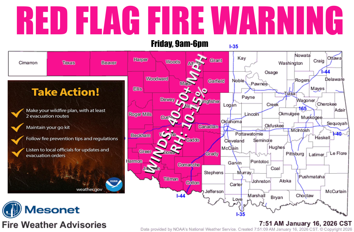
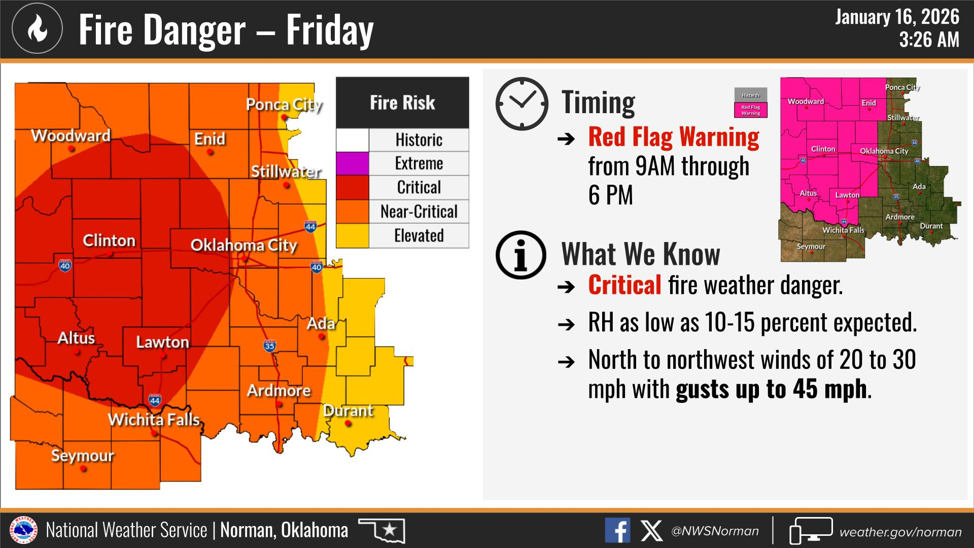
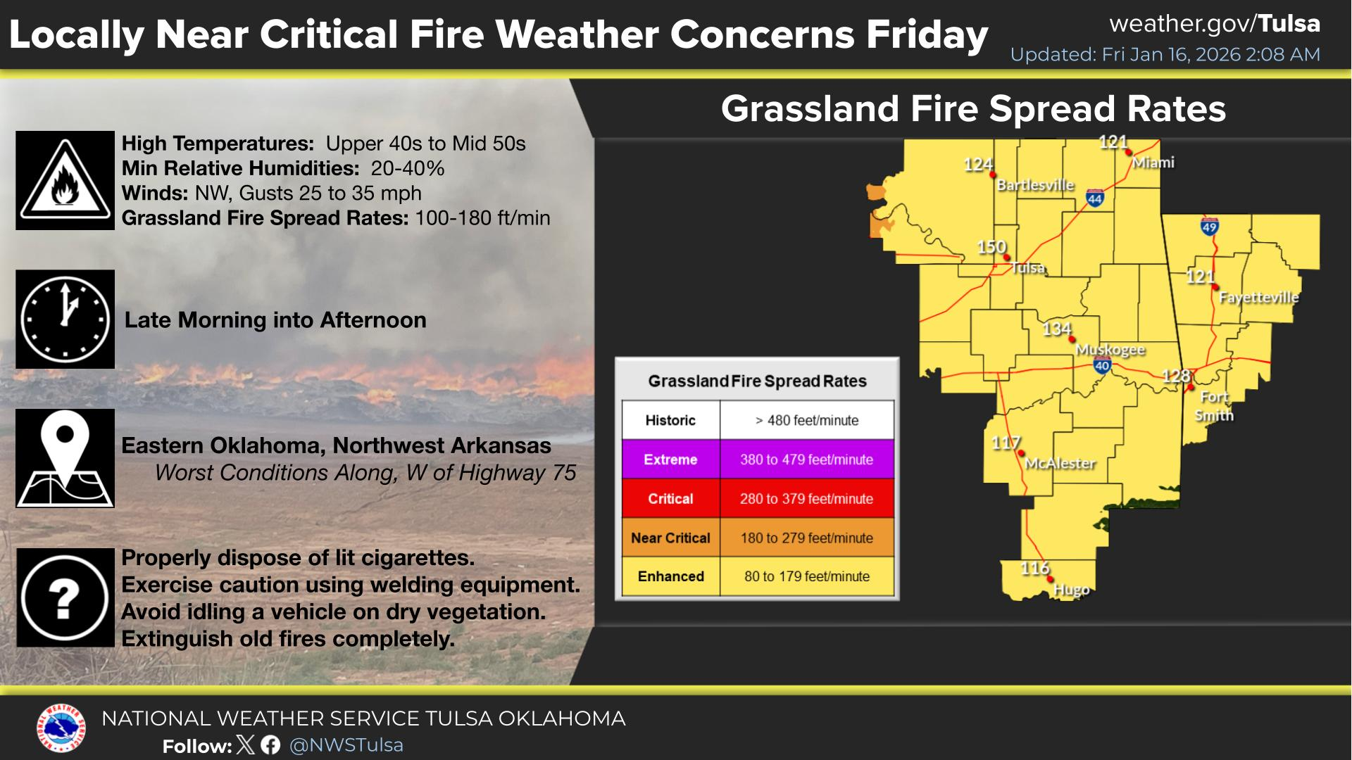
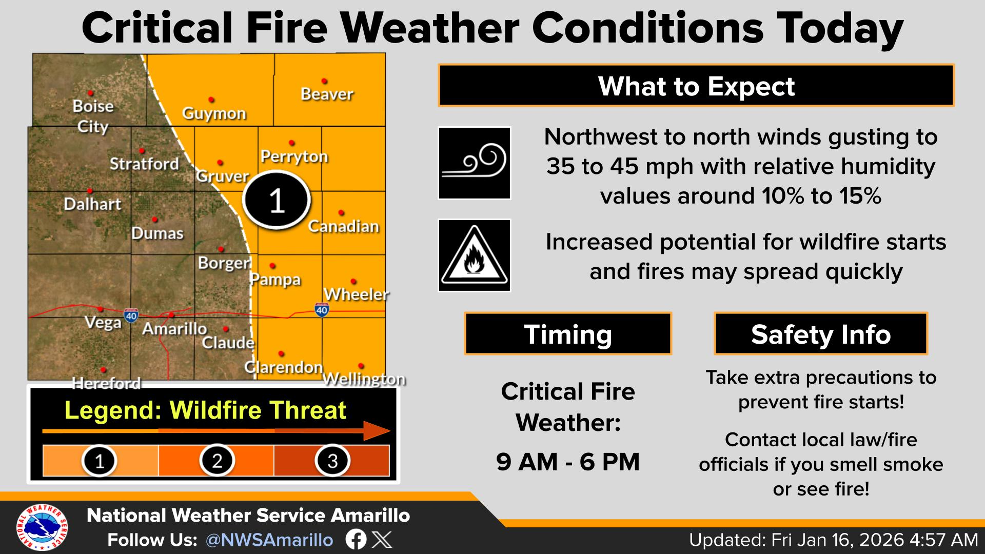
fire danger today across the state, but especially across western Oklahoma where
a Red Flag Fire warning has been issued. We'll worry about capitalization
mistakes later! Winds gusting to 40-50+ and RHs down in the teens will make for
critical fire danger levels later this morning into the evening.
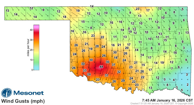
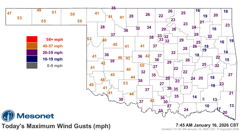
Winds have already gusted to over 50 this morning, and aren't gonna let up until
later tonight.
Here's a bit more from our fine friends from the NWS.
And here's the latest word from the Fire Situation Report from the OK Dept. of
Ag, Food, and Forestry:
"Today: Very dry air and strong northerly winds in the post-frontal fire
environment will escalate fire spread potential today and support potential
for problematic fire behavior including single/group tree torching and
short-range spotting. The highest fire danger indices will develop midday
and persist through the evening hours in western and southwestern
Oklahoma. Range and grass-dominated fuels across the state have potential
to exhibit rapid rates of fire spread. Fire behavior in timber fuel types
will be less concerning although the current drying period has elevated
resistance to control given declining composite fuel moisture. Initial
attack activity will prove challenging with moderate large fire potential."
https://ag.ok.gov/wp-content/uploads/2023/04/Most-Recent-Fire-Situation-Report.pdf
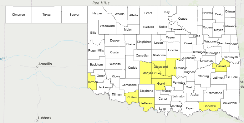
Reminder, there are still counties with burn bans in place. Do NO burn in those
counties. Should you start a fire that burns out of control, you'll be in a
world of hurt. You will not pass Go, and you will not collect $200.
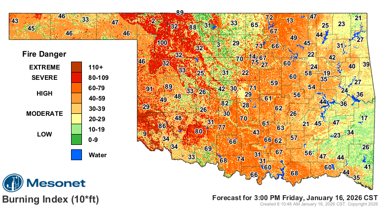
3pm would appear to be the witching hour, the peak of the fire danger (but it'll
be high all day).
As if that's not enough, we'll get a blast of "oh yeah, it's winter" this
weekend.
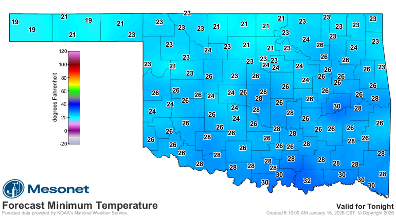
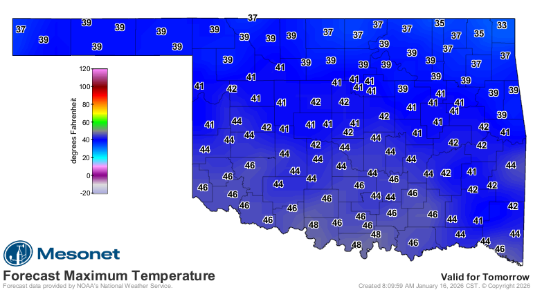
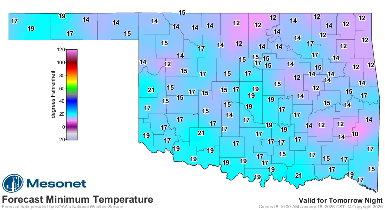
Take 10-20 degrees off those maps for wind chills. Those'll be in the teens and
single-digits.
That's it. Carry on, and carry me out.
Gary McManus
State Climatologist
Oklahoma Mesonet
Oklahoma Climate Survey
gmcmanus@ou.edu
January 16 in Mesonet History
| Record | Value | Station | Year |
|---|---|---|---|
| Maximum Temperature | 79°F | MANG | 2012 |
| Minimum Temperature | -15°F | VINI | 2024 |
| Maximum Rainfall | 2.43 inches | ALTU | 2004 |
Mesonet records begin in 1994.
Search by Date
If you're a bit off, don't worry, because just like horseshoes, “almost” counts on the Ticker website!