Ticker for September 8, 2025
MESONET TICKER ... MESONET TICKER ... MESONET TICKER ... MESONET TICKER ...
September 8, 2025 September 8, 2025 September 8, 2025 September 8, 2025
Faker Maker
Oh the sweaters! The pumpkin spice lattes! The leaves changing color, uhhhhhhh,
in another two months!
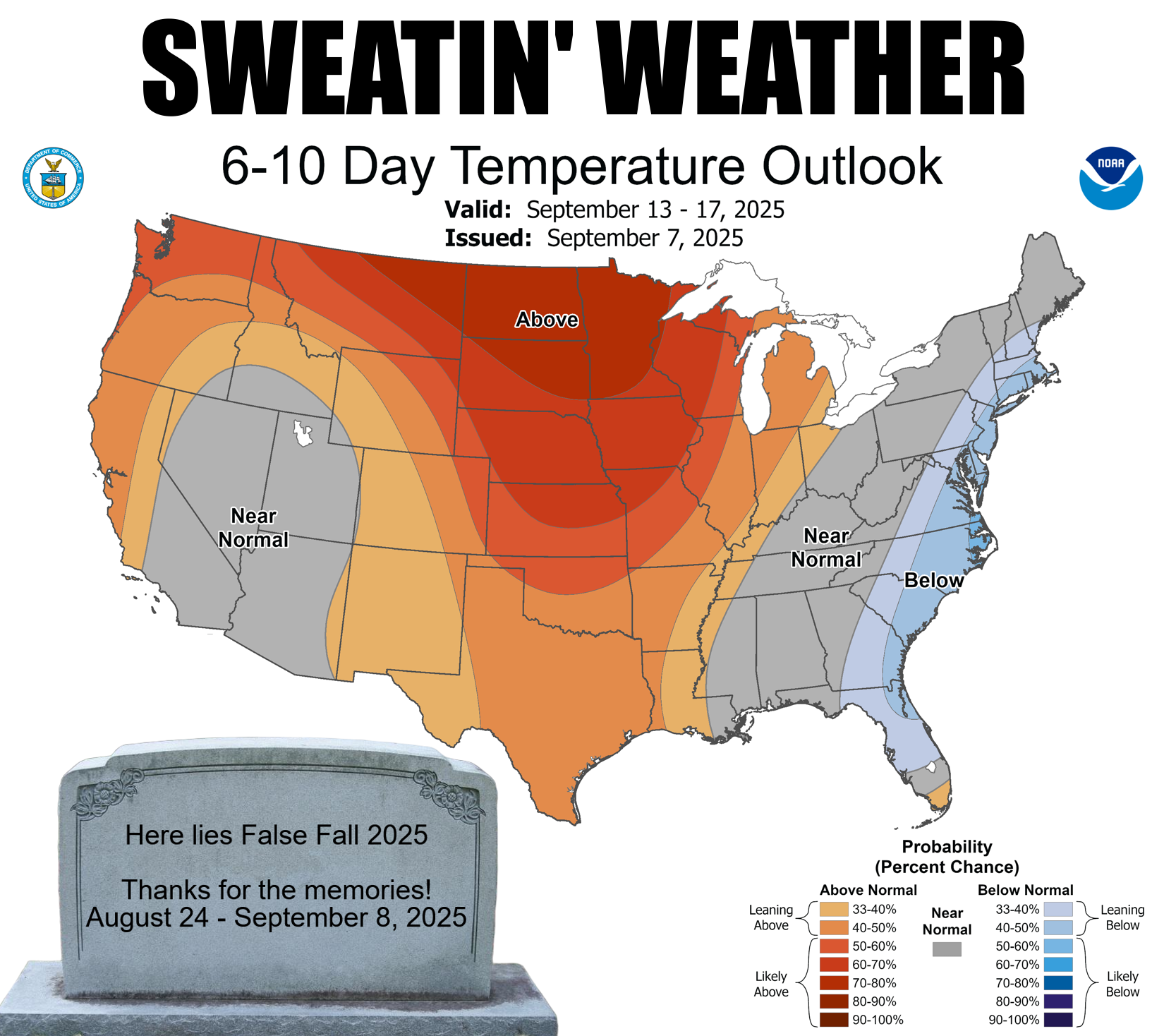
Look at all we're gonna miss out on when we go back to *GASP* normal temps for
the next couple of days, then *GASP* (maybe I should get all this gasping checked
out?) back to above normal temperatures for a week or two. And after a good solid
two weeks of lovely fall'ish weather. For most of us.
Remember that thing on the side of your house that made all that noise and ran
all night long, and ate up all your money?
No, not Gary Busey! Your air conditioner. Prepare yourselves, because it's coming
back.
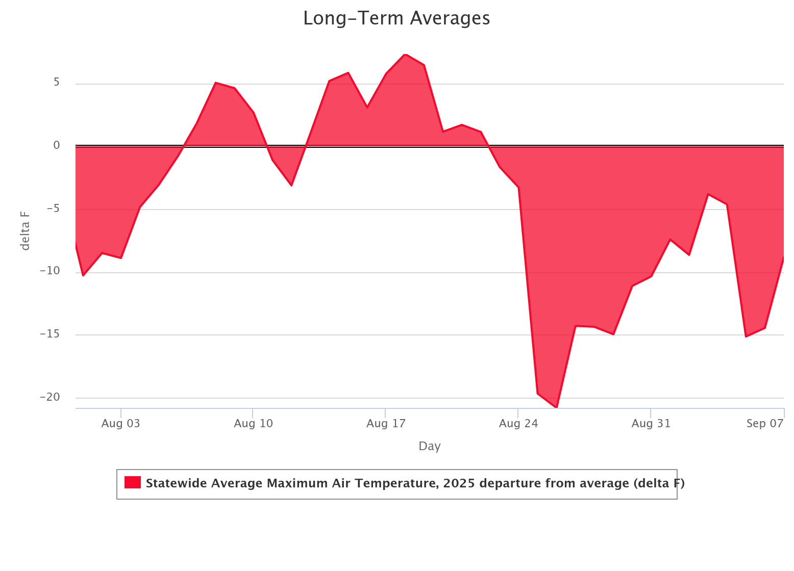
This is okay though! We can survive this, because we cruised through some of
the worst weather Oklahoma has to offer in late summer, from the last week of
August through the first week of September, with the governors on full blast.
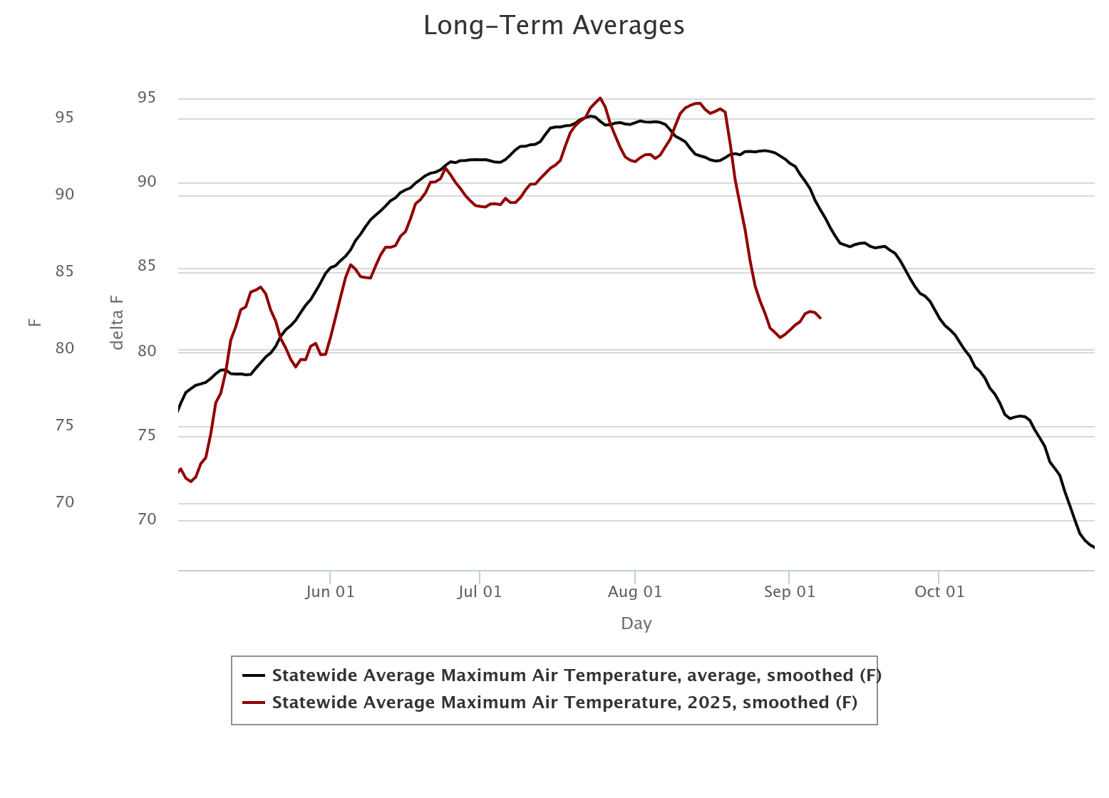
See all that area under the curve during that period? That's a lot of heat
that we escaped over that time, spent huddled under blankets at Friday night
football games, thought about turning on the car heater on the way to work,
and dusted off those chili recipes.
And don't worry too much, not like we're headed back to hundreds, just
threatening that 90 mark more often than not. The rain has gone away too,
unfortunately.
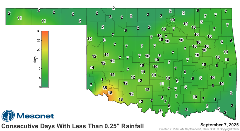
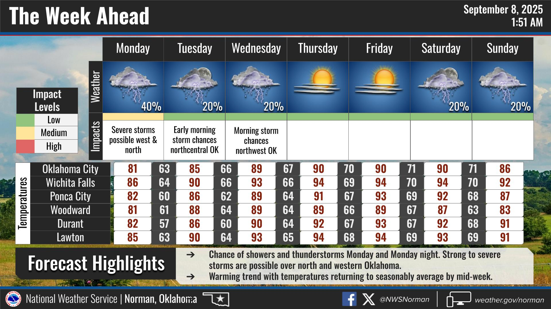
And not much in the way showing up in the next week, save for NW OK where some
severe storms are possible later on today.
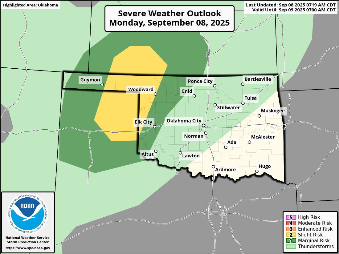
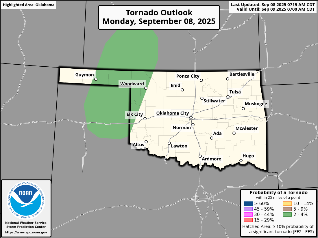
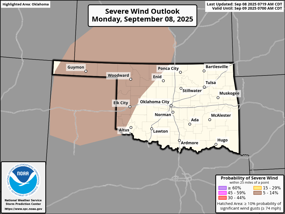
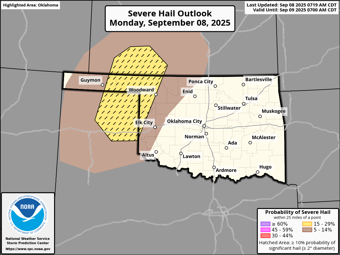
Despite the return to summer, we are transitioning from a summertime storm
pattern to more of a fall severe weather type as that jet stream dips farther
to the south and we get more wind shear and whatnot, so the tornado threat
will start to be more non-zero, as well as the threat for large hail as you
can see above. So stay weather aware!
And put away that latte!
Gary McManus
State Climatologist
Oklahoma Mesonet
Oklahoma Climate Survey
gmcmanus@ou.edu
September 8 in Mesonet History
| Record | Value | Station | Year |
|---|---|---|---|
| Maximum Temperature | 111°F | GRA2 | 2023 |
| Minimum Temperature | 34°F | KENT | 2020 |
| Maximum Rainfall | 5.37 inches | WILB | 2001 |
Mesonet records begin in 1994.
Search by Date
If you're a bit off, don't worry, because just like horseshoes, “almost” counts on the Ticker website!