Ticker for September 4, 2025
MESONET TICKER ... MESONET TICKER ... MESONET TICKER ... MESONET TICKER ...
September 4, 2025 September 4, 2025 September 4, 2025 September 4, 2025
Ruuuuuuudy
Having lived through the 80s and 90s, I really thought I'd get more slow-claps in
my everyday life, like in "Hoosiers," "Rudy," and "Lucas."
No, I didn't walk on to one of the Blue Bloods of college football, or win a
state championship for a tiny school against a Goliath (I was pretty close to
being an undersized nerd that mistakenly went out for my high school football
team, though).
But you know, just for some of the heroic things I actually do, like mow the lawn,
take out the trash, do the dishes. Standard Herculean tasks I'm faced with
every day.
That's fine, I'm pretty humble about being a hero like that, but how about a
slow-clap for this weather? Almost gone is the ability for the atmosphere to
throw out those punishing temperatures we've seen in the past for the first half
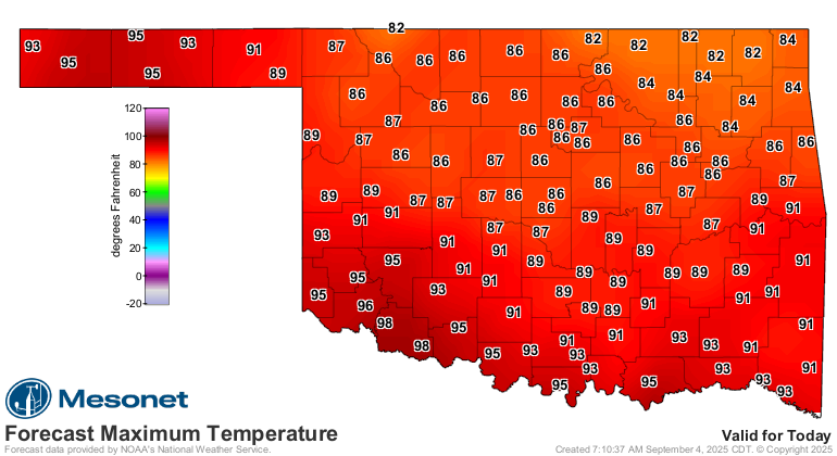
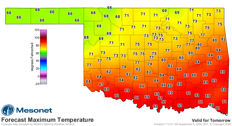
of September, with much of that space eaten up by highs in the 70s and 80s (and
a few 90s and triple-digits down across SW OK). And now, we'll have yet another
strong cold front coming tonight through tomorrow. So another day with seasonable
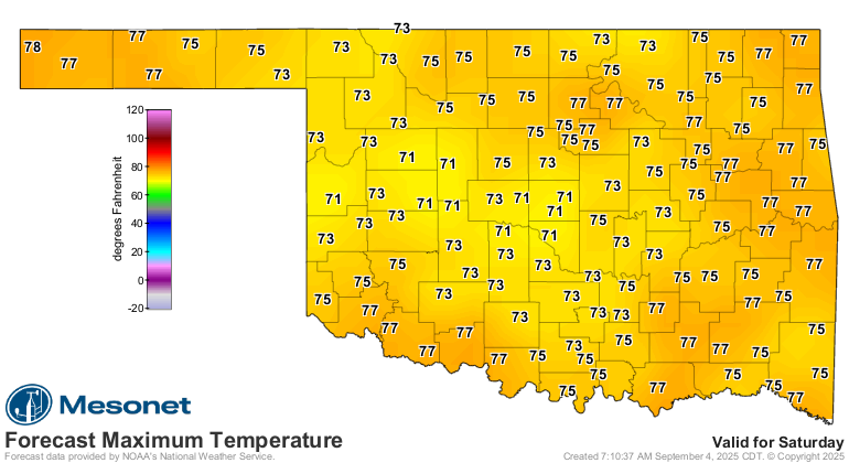
temperatures (if not a bit below normal) for the state, and then another lovely
fall weekend with lots of gray skies, some showers around, and temps in the
60s and 70s (and a few 80s).
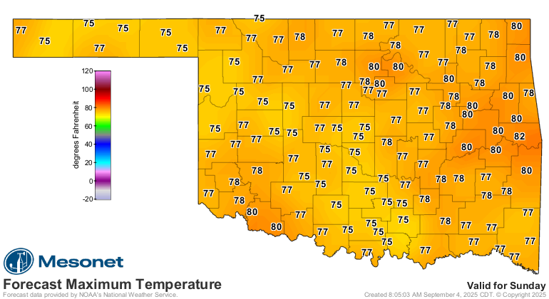
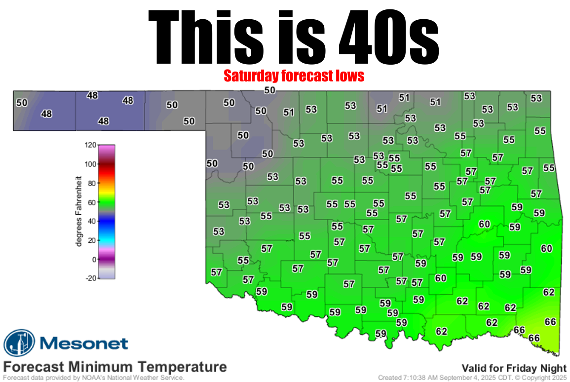
That graphic at the top of the page sees lows in the 40s Saturday morning, which
would be the first 40s we've seen in the state since Eva dropped to 43F way
back on June 4. And when 40s show up, you know 30s are not that far behind.
Well...usually. It IS Oklahoma, after all. We might not see 30s until December!
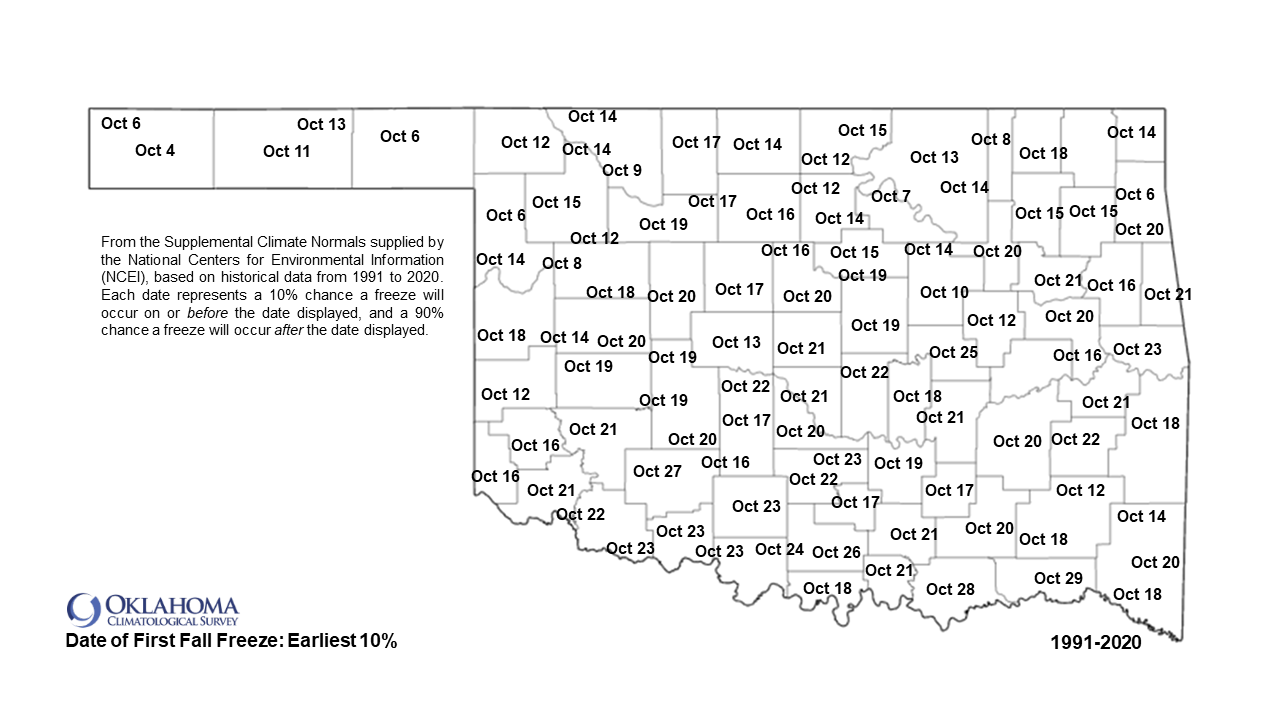
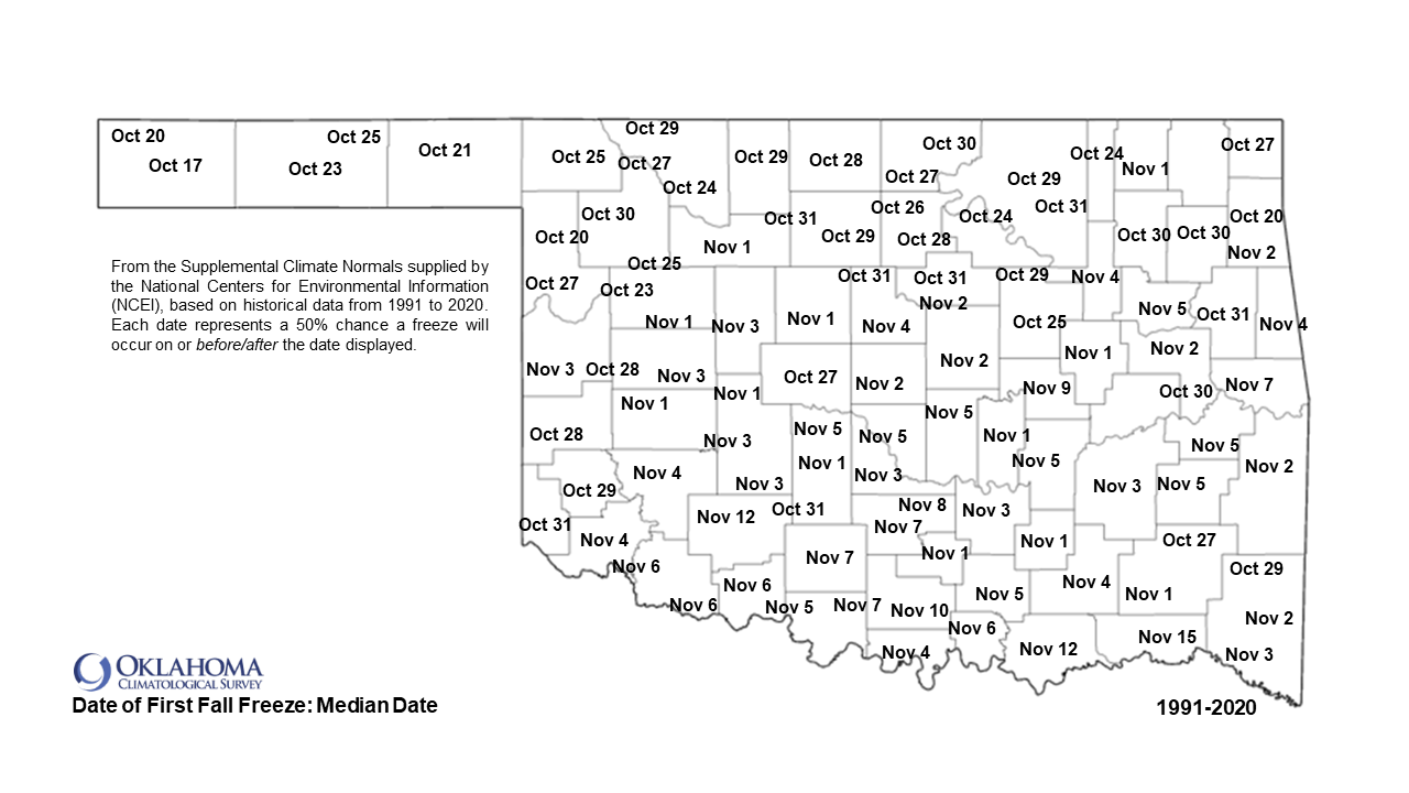
But just as a reminder, we're still about a month away from the earliest fall
freeze probabilities (based on the 1991-2020 normals). And a good month.5 from
our average first fall freeze date. Or we could wait until November, which is
the option highly favored by certain State Climatologists!

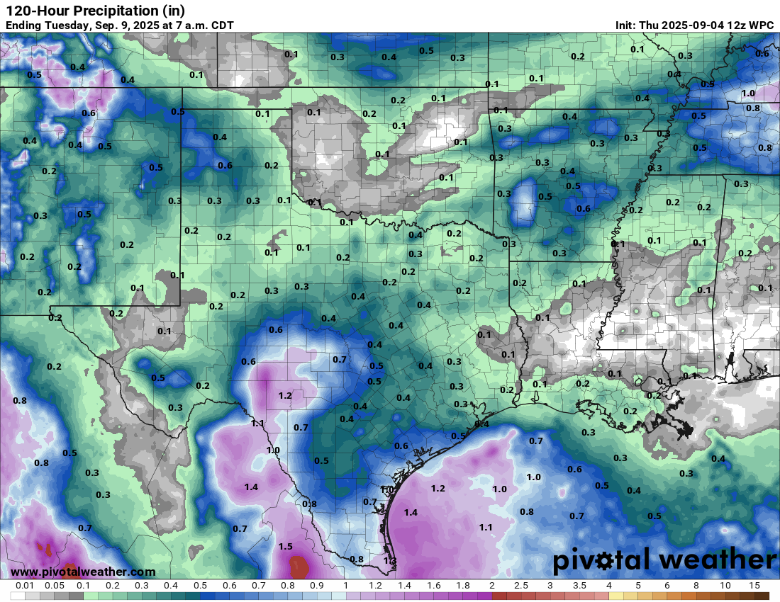
One of the biggest differences with this big front with the ones that ended August's
summer punch will be the lack of moisture...not a lot of rain showing up with this
one.
We will have to be on the lookout for a few marginally-severe storms around tonight
through tomorrow with that frontal passage, but a bigtime severe weather event is
not likely.
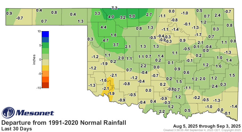
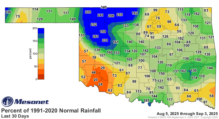
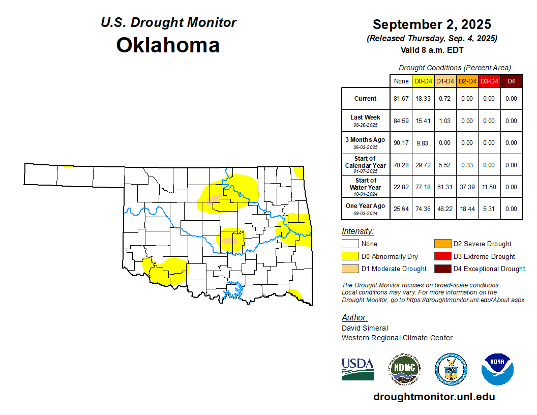
We are on the lookout for drought concerns across SW OK, which has missed out on the
big rains other parts of the state saw. We did introduce more D0 across that region,
which isn't drought on the U.S. Drought Monitor, but shows as a precursor to some
danger areas if they don't get rain.
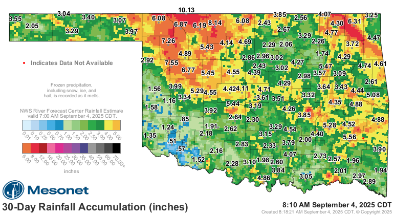
If it rains down that way, I say we give it a...yep, slow-clap!
Gary McManus
State Climatologist
Oklahoma Mesonet
Oklahoma Climate Survey
gmcmanus@ou.edu
September 4 in Mesonet History
| Record | Value | Station | Year |
|---|---|---|---|
| Maximum Temperature | 112°F | WALT | 2000 |
| Minimum Temperature | 43°F | BOIS | 2008 |
| Maximum Rainfall | 4.22 inches | MANG | 1996 |
Mesonet records begin in 1994.
Search by Date
If you're a bit off, don't worry, because just like horseshoes, “almost” counts on the Ticker website!