Ticker for September 2, 2025
MESONET TICKER ... MESONET TICKER ... MESONET TICKER ... MESONET TICKER ...
September 2, 2025 September 2, 2025 September 2, 2025 September 2, 2025
August Augone
Wow, I spent so much time making that graph that I don't have much words to
say more stuff (ain't I a wordsmith??).
Let me put it this way: For those of us that love summer, having the coldest
final week of August on record is like getting those WalMart-brand Pop-Tarts.
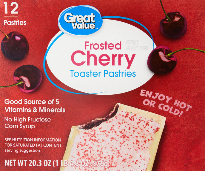
Yes, I just shuddered.
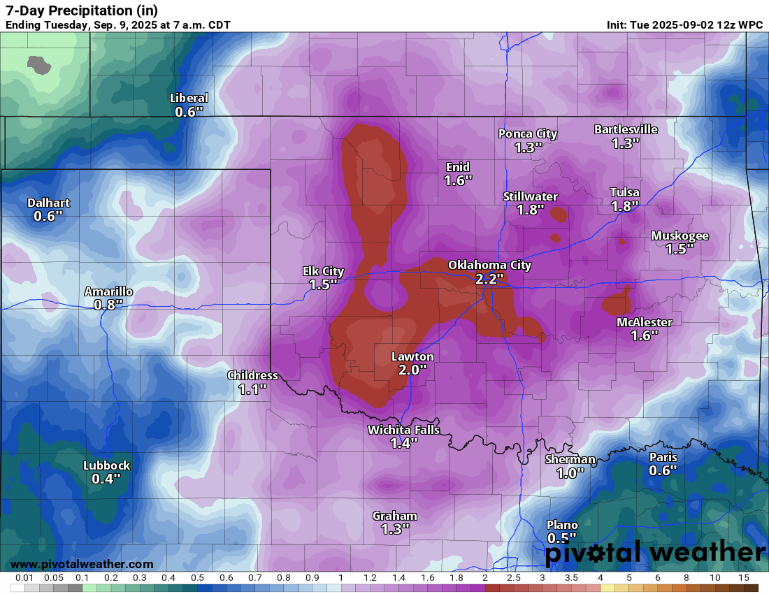
I won't bore ya (I HEARD THAT!), so to make a long story short, after making
a short story long, here are some graphics that will help you with the rest
of the short-week left. More of the same, for the most part. A slow warm up
through the week, then another bigtime cold front for the weekend.
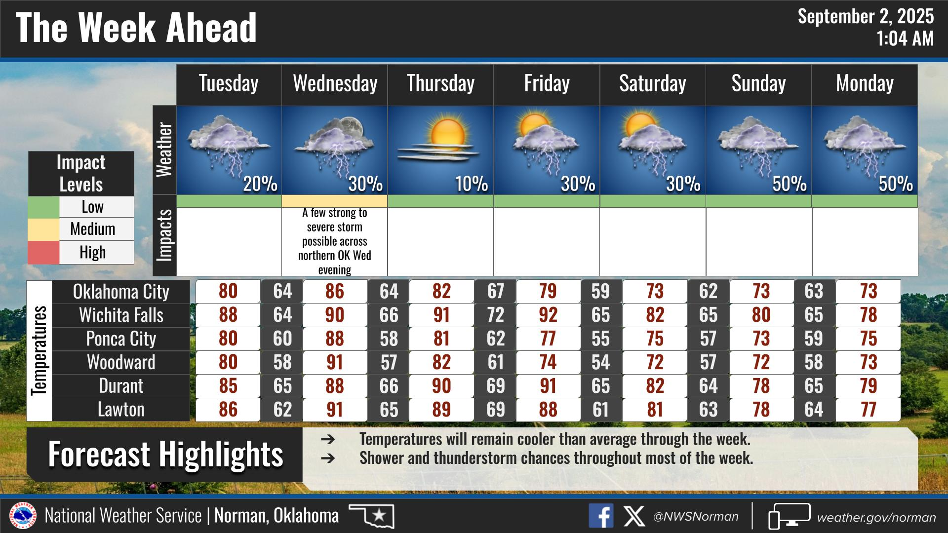
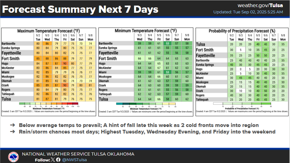
And more rain!
Ugh. This is like Great Value Summer. Or even worse: STRAWBERRY Great Value
Summer!

URP!
-------------------------------------------------------------------------------
August brings early summer exit
Sept. 2, 2025
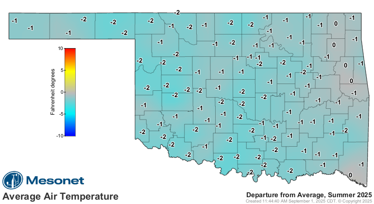
August 2025 pulled a fast one on Oklahoma. Instead of the typical late-summer
swelter, the month ended with a taste of fall as two powerful cold fronts
shoved aside the heat. The final week brought gray skies, steady rain and highs
stuck in the 60s and 70s — more like October than August. The chill was strong
enough to break multiple records, including several record-low maximums and
even a few outright record lows.
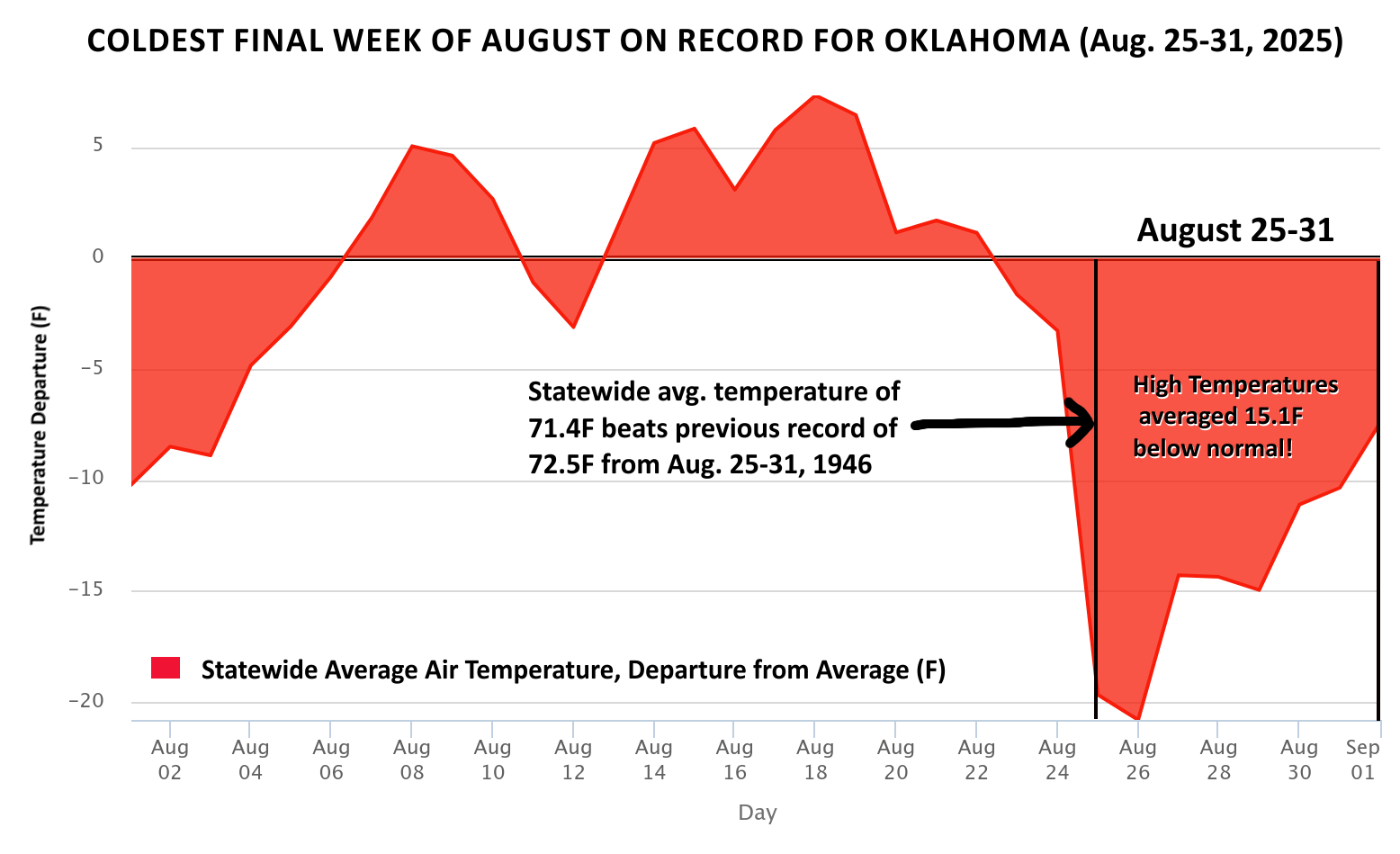
August’s fall plunge breaks records
The final seven days of August 2025 were the coolest such stretch on record in
Oklahoma, with a statewide average of 71.4 degrees. That mark bested the
previous record of 72.5 degrees set in 1946. Multiple days during the period
produced widespread record-low maximum temperatures, and several long-term
sites established their lowest August maximum on record. Those included
Bartlesville, which reached only 70 degrees on Aug. 27 (records back to 1920),
Norman at 68 degrees on Aug. 27 (records back to 1894), and Waynoka at 64
degrees on Aug. 26 (records back to 1938). Summer briefly returned in southwest
Oklahoma on Aug. 28 with highs back into the upper 90s and low 100s in southwest
Oklahoma, but another strong cold front quickly reinforced the autumn-like air.
Highs in the 60s were recorded on four of the final seven days, with Cheyenne,
Eva and Hooker all bottoming out at 63 degrees on Aug. 26.
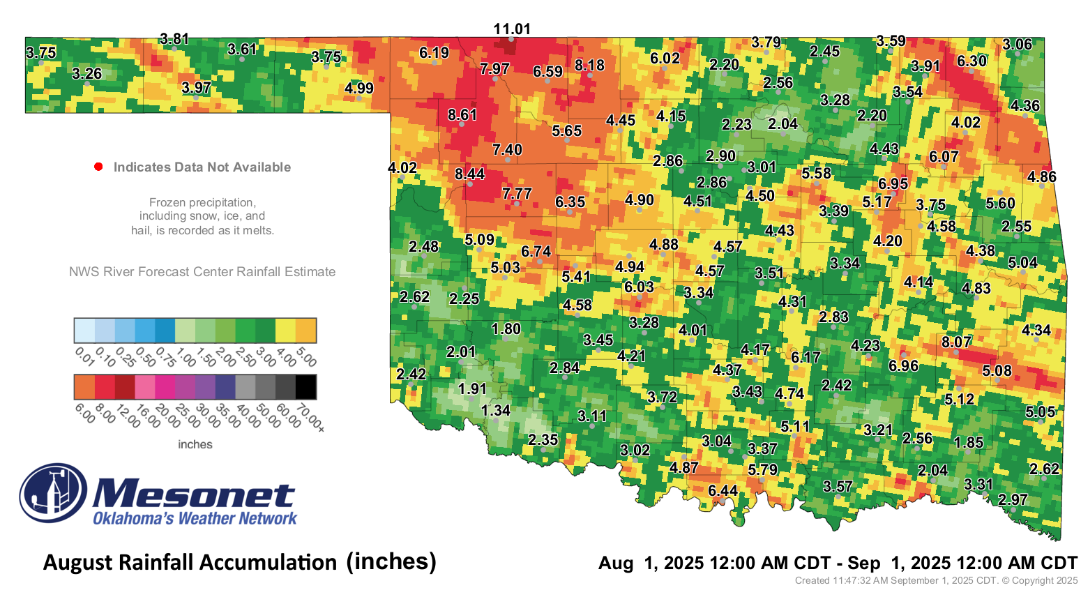
August rains impress
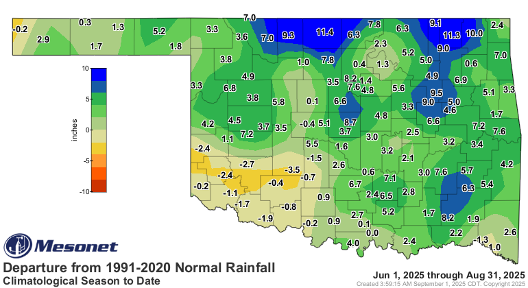
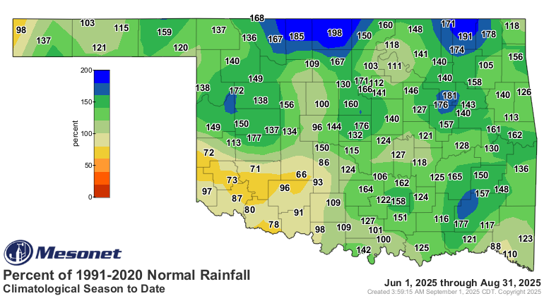
The moisture that accompanied Oklahoma’s fall-like turn was nearly as remarkable
as the chill. From Aug. 25–31, the statewide average rainfall totaled 2.58
inches — the second-wettest such period on record, 1.9 inches above normal and
just shy of the 2003 record of 2.76 inches. For the month overall, August ranked
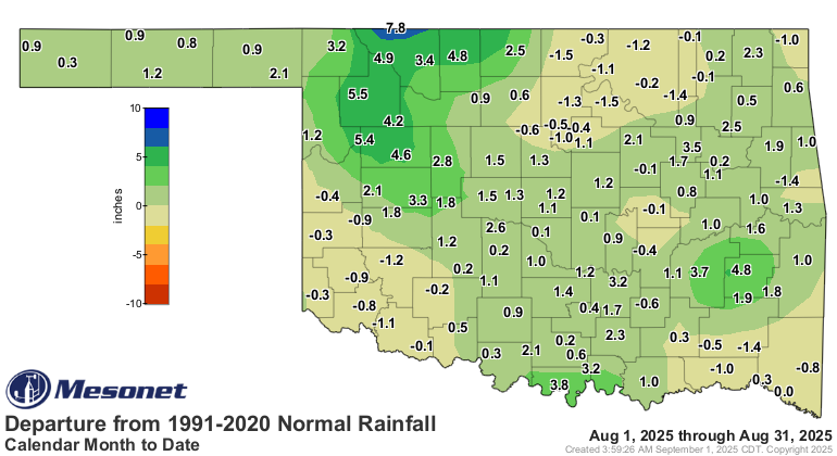
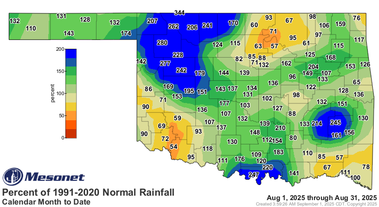
as the 21st-wettest on record with a statewide average of 4.32 inches, 1.09
inches above normal. The heaviest rains fell across northwest Oklahoma, where
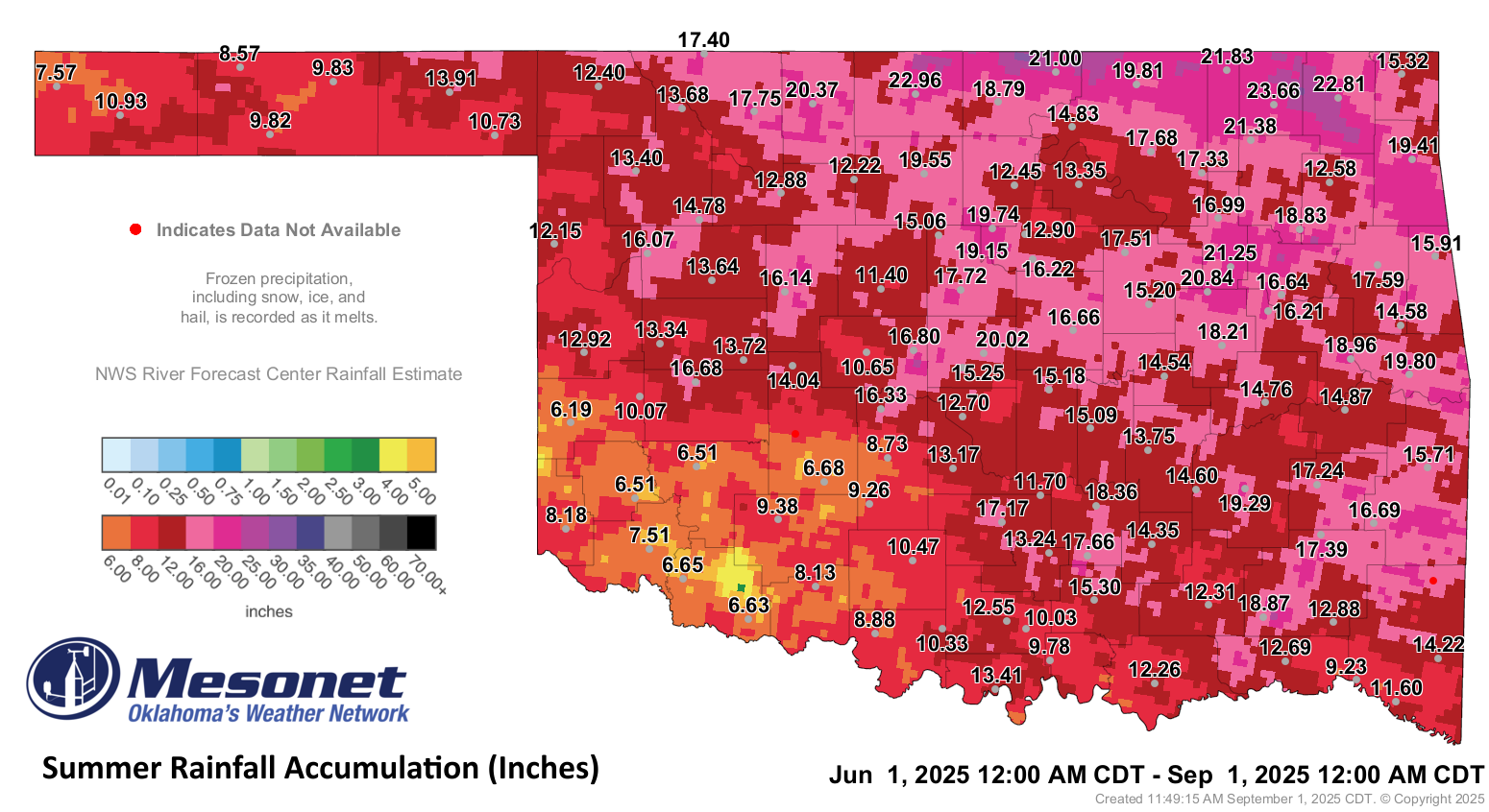
surpluses of 4–6 inches were common. The May Ranch Mesonet site led the state
with 11.01 inches.
Drought returns to Oklahoma
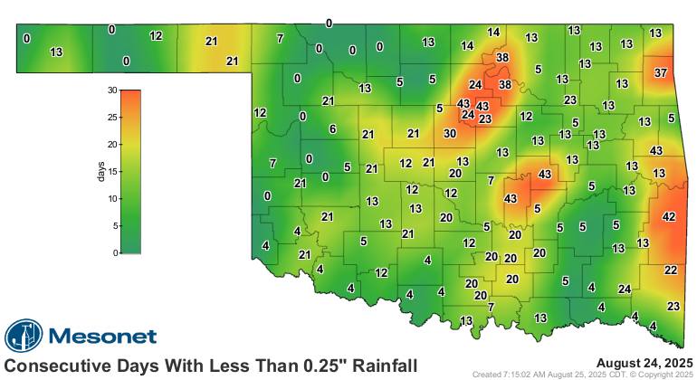
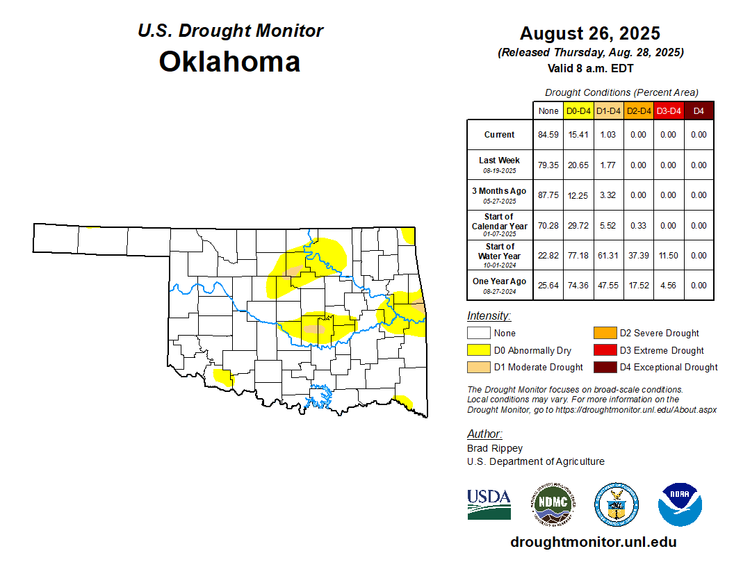
After 11 weeks without drought, dryness returned to Oklahoma on the Aug. 19
U.S. Drought Monitor. Moderate drought rose to 2% of the state, with another
19% listed as abnormally dry. Some areas had gone as many as 44 days without a
quarter-inch of rain, leaving 30-day deficits of 2–4 inches. By Aug. 26, drought
coverage had eased to 1% moderate and 14% abnormally dry, with further
improvement likely thanks to late-month rains.
August by the Numbers
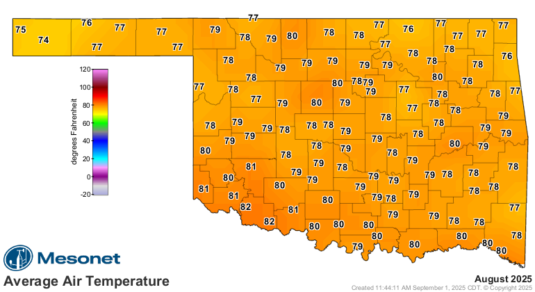
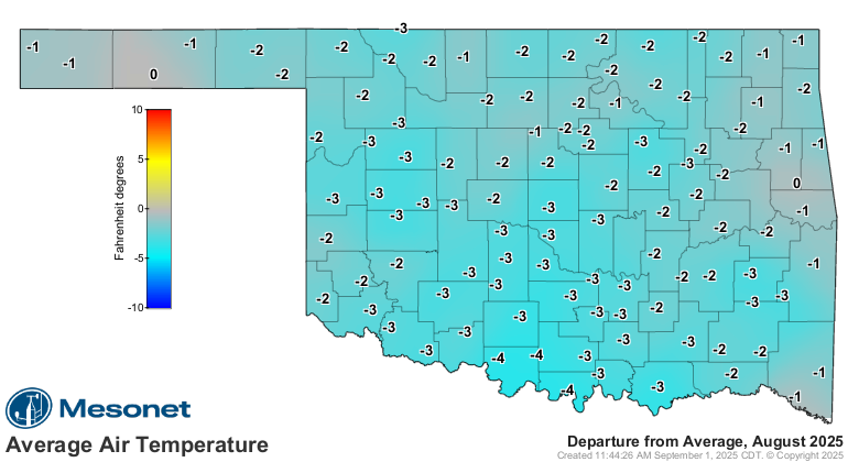
• Statewide average temperature: 79.3°F, 1.5°F below normal — the 33rd-coolest
August since records began in 1895
• Temperature extremes: High of 111°F at Hooker on Aug. 8; low of 52°F at
Nowata on Aug. 26–27 and Vinita on Aug. 27; highest heat index, 119°F at
Bristow on Aug. 19
• Warmest and coolest locations: Highest monthly average, 82.8°F at Grandfield
and Tipton; lowest, 75.3°F at Boise City
• Statewide average precipitation: 4.32 inches, 1.09 inches above normal — the
21st-wettest August on record
• Rainfall extremes: High of 11.01 inches at May Ranch; low of 1.34 inches at
Tipton
• Rainfall totals over 5 inches: 33 instances recorded at the 120 Oklahoma
Mesonet sites
• Highest wind gusts: Camargo, Aug. 24: 99 mph; Buffalo, Aug. 17: 81 mph;
Beaver, Aug. 8: 71 mph
Climatological Summer (June–August) by the Numbers
• Statewide average temperature: 79.7°F, 0.3°F below normal — the 62nd-coolest
summer since 1895
• Temperature extremes: High of 111°F at Hooker on Aug. 8; low of 43°F at Eva
on June 4
• Statewide average precipitation: 13.91 inches, 3.22 inches above normal —
the 15th-wettest summer on record
• Rainfall extremes: High of 23.66 inches at Nowata; low of 6.19 inches at
Erick

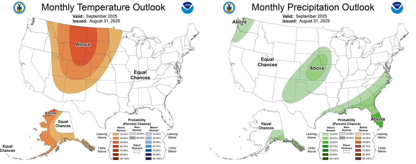
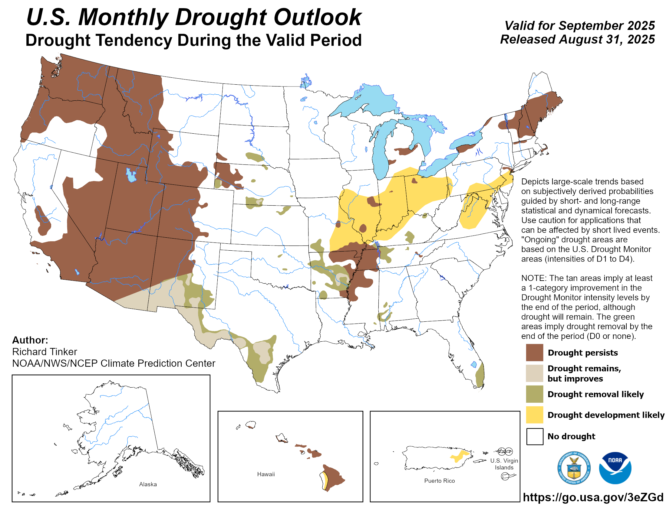
Drought improvement likely during September
The Climate Prediction Center’s (CPC) September outlook indicates increased
odds of above-normal temperatures for the Panhandle, but equal chances of
above-, below-, or near-normal conditions across the main body of the state, as
well as increased odds of above-normal precipitation through the northwestern
two-thirds of Oklahoma. The CPC’s September drought outlook calls drought
removal “likely” from those small areas where it still existed at the beginning
of the month.
###
Gary McManus
State Climatologist
Oklahoma Mesonet
Oklahoma Climate Survey
gmcmanus@ou.edu
September 2 in Mesonet History
| Record | Value | Station | Year |
|---|---|---|---|
| Maximum Temperature | 111°F | TALI | 2000 |
| Minimum Temperature | 49°F | BOIS | 2006 |
| Maximum Rainfall | 2.86 inches | CHAN | 2014 |
Mesonet records begin in 1994.
Search by Date
If you're a bit off, don't worry, because just like horseshoes, “almost” counts on the Ticker website!