Ticker for August 26, 2025
MESONET TICKER ... MESONET TICKER ... MESONET TICKER ... MESONET TICKER ...
August 26, 2025 August 26, 2025 August 26, 2025 August 26, 2025
Well...bye
I realized as I sat on my couch last night shivering in a hoodie that the only
thing hot at that point was the cherry filling in my Pop-Tart.
Like molten lava, I tell you, fresh out of the toaster!
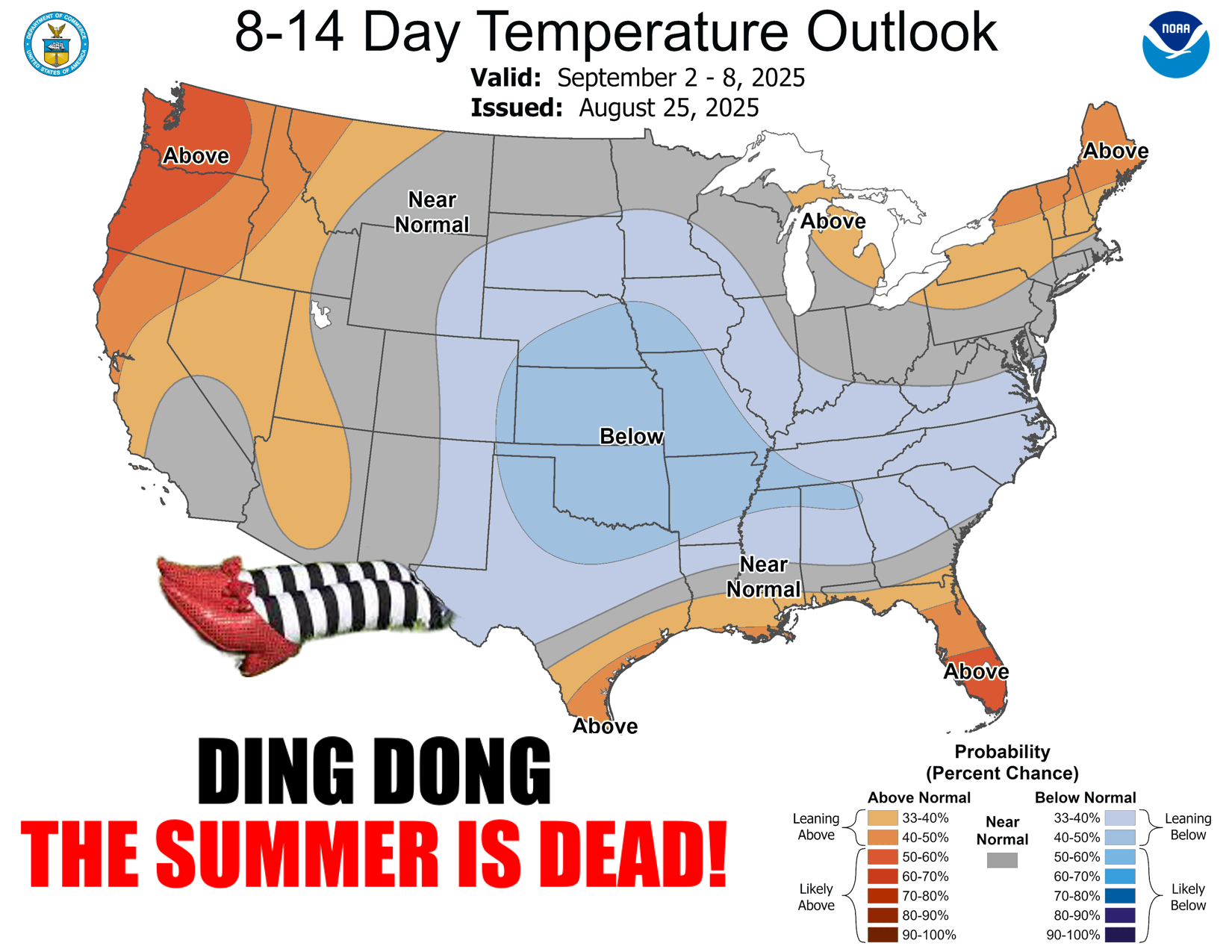
Friends (and enemies), I'm here to tell you that the worst that summer has to
offer...is over. Eliminating the heat we normally get in the last week of August
and well into and even a bit past the first week of September--at least what we
can see in the forecasts to this point--gets us past the hump of summer's worst,
straight into the State Fair transition point into early Fall.
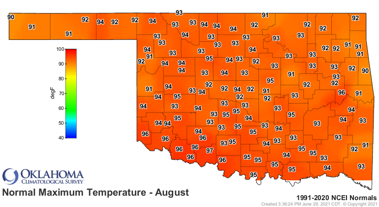
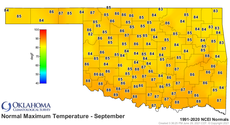
Just look at the transition between the normal highs of August and those of
September.
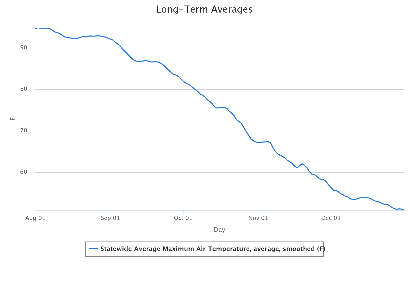
And look at that sharp downward slide as we exit August and early September
into the mid and latter parts of the month according to long-term OK Mesonet
data.
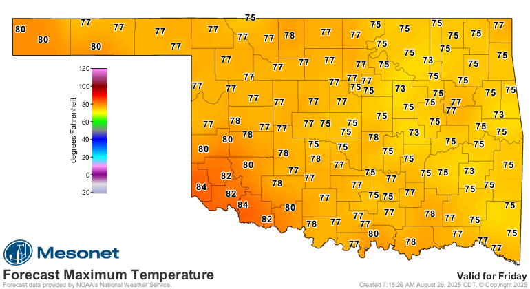
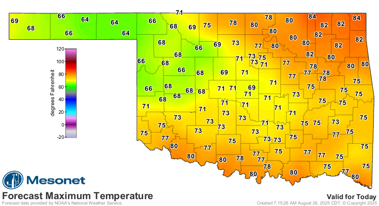
Will it get hot again? OF COURSE! I mean, just look at Thursday.
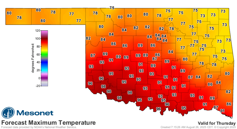
But that's not widespread, impenetrable heat, confided largely to SW OK, and it
goes away again after another cold front that day and lasts through the
weekend.
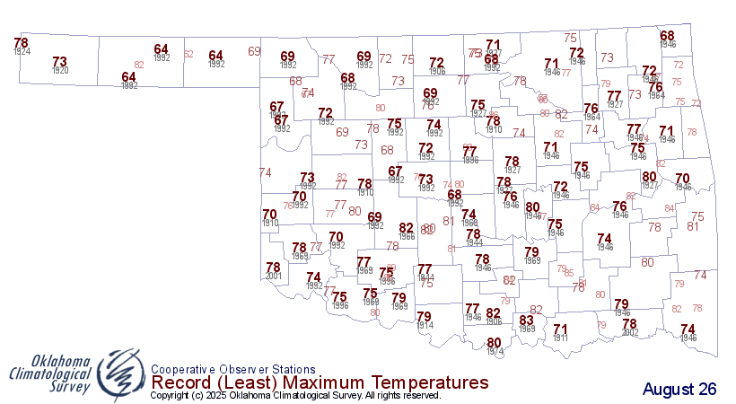
Just look at what's happened the last couple of days. We had record-breaking
(and lots of near-record breaking) low maximum temps yesterday.
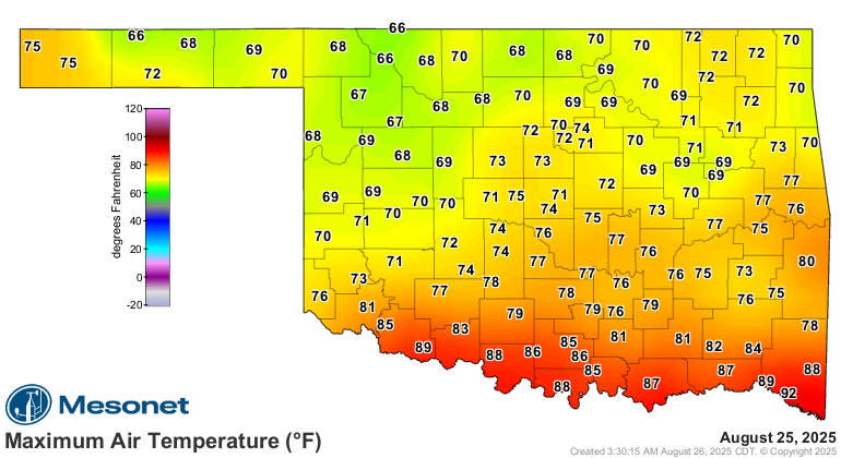
And the reality there is many of those highs were in the wee hours of the morning
after midnight, so the spirit is we had a lot more records fall.
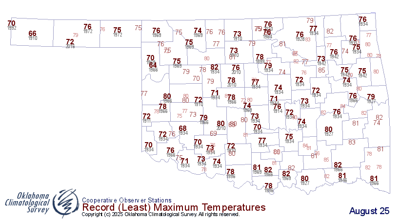
Those 66s at Eva, Freedom, and May Ranch tie for the SECOND-COLDEST high
temperatures ever recorded for an Aug. 25. Only Arnett's 64 back in 1966 tops
those marks.
And even this morning we got close to record lows up in NE OK.
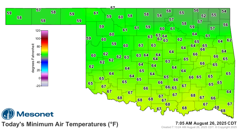

And we'll probably get closer to more record low highs (as opposed to high lows,
or far middles and middle fars) today as well.
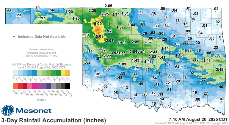
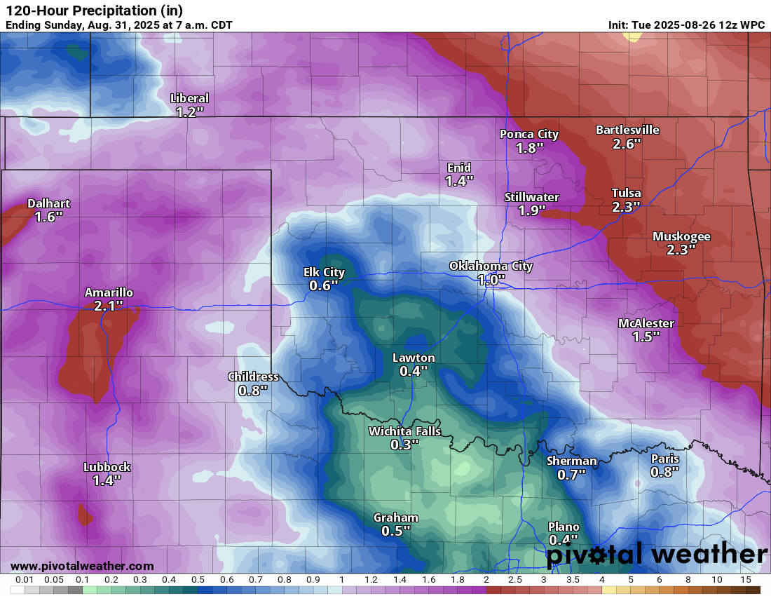
Oh, and the rain. Too much in some places, not enough in others...but there's
more on the way for EVERYBODY, hopefully.
It will get hot again. Of course, it's Oklahoma! But it ain't gonna be
AUGUST hot again.
State Fair, coming up.
Gary McManus
State Climatologist
Oklahoma Mesonet
Oklahoma Climate Survey
gmcmanus@ou.edu
August 26 in Mesonet History
| Record | Value | Station | Year |
|---|---|---|---|
| Maximum Temperature | 110°F | WAUR | 2023 |
| Minimum Temperature | 46°F | SEIL | 2010 |
| Maximum Rainfall | 5.24 inches | BROK | 2020 |
Mesonet records begin in 1994.
Search by Date
If you're a bit off, don't worry, because just like horseshoes, “almost” counts on the Ticker website!