Ticker for August 25, 2025
MESONET TICKER ... MESONET TICKER ... MESONET TICKER ... MESONET TICKER ...
August 25, 2025 August 25, 2025 August 25, 2025 August 25, 2025
Sweat(ah) Weathah
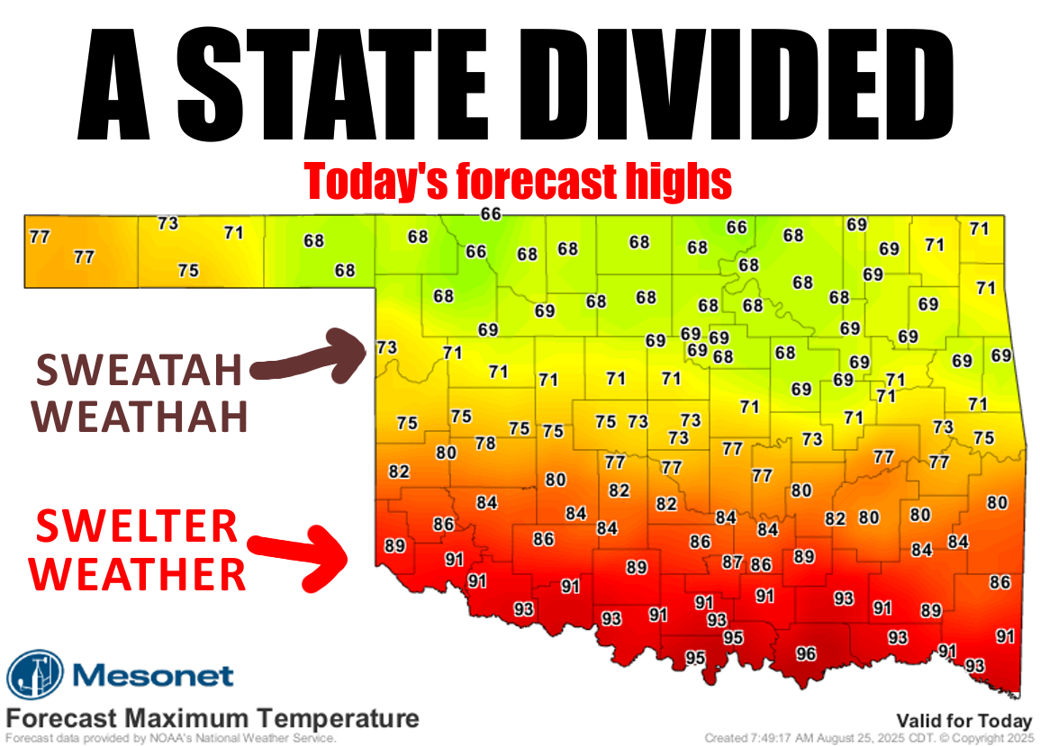
That's a pretty incredible forecast map, but just like my scalp said: "There's
something missing here!"
Context.
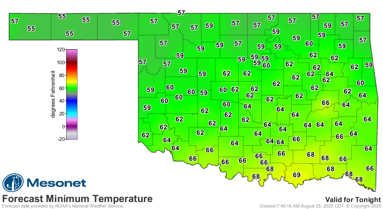
Check out the current temperatures in that rain-cooled air.
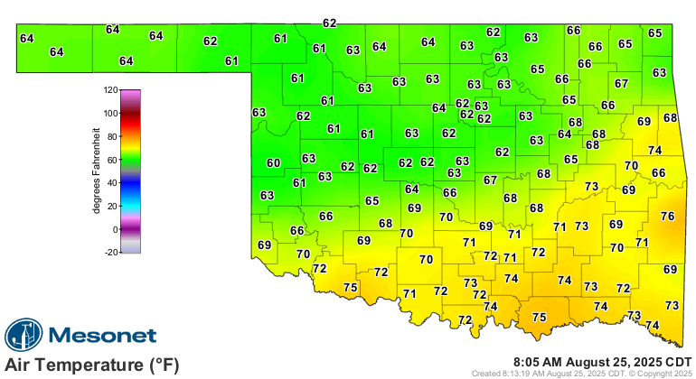
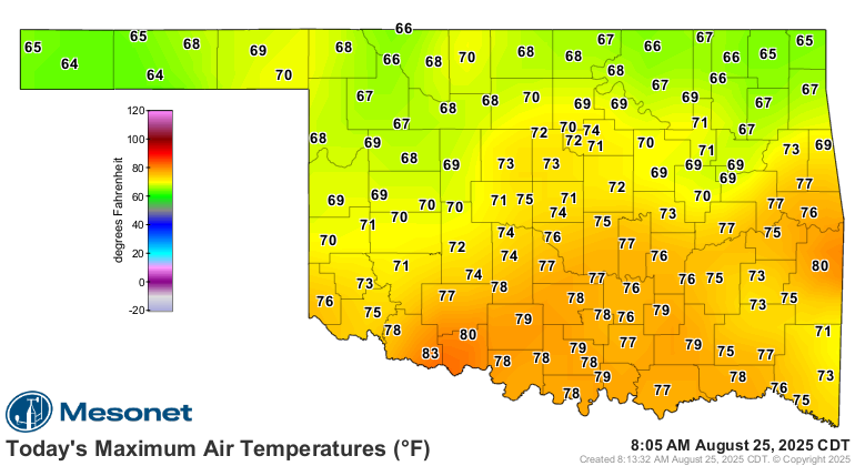
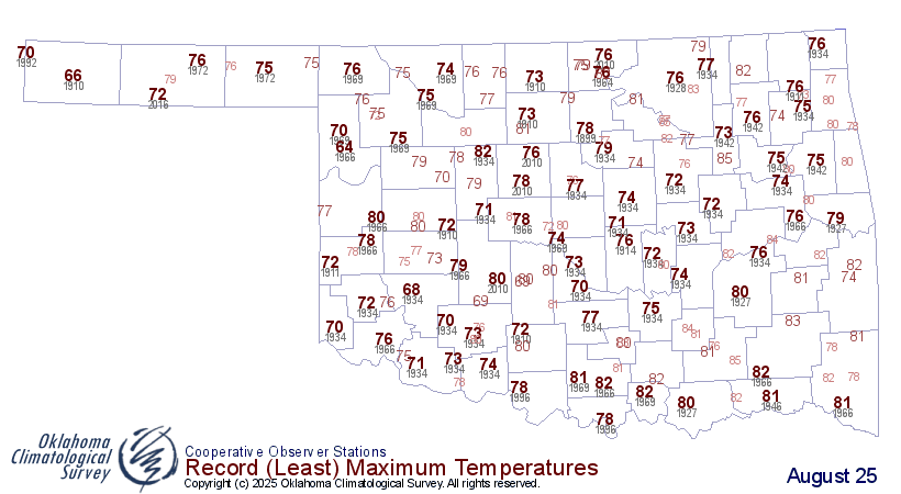
Uh huh, see? So here's the deal...some of those high temperatures in the 70s
being forecast have already occurred early this morning before the rain and cool
air from our strong cold front filtered in. You can see that on today's actual
high temperature map.
So our current temperature map (2 maps above) is actually our low temperature
map BECAUSE temperatures are dropping.
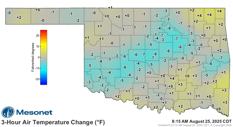
So that will prevent some areas from breaking their record-low maximum temps
for the day on that technicality, but in reality and the spirit of the thing,
many folks will FEEL record-low max temps in the waking hours. Despite that,
many others will see those actual records broken in reality and whatnot.
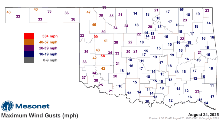
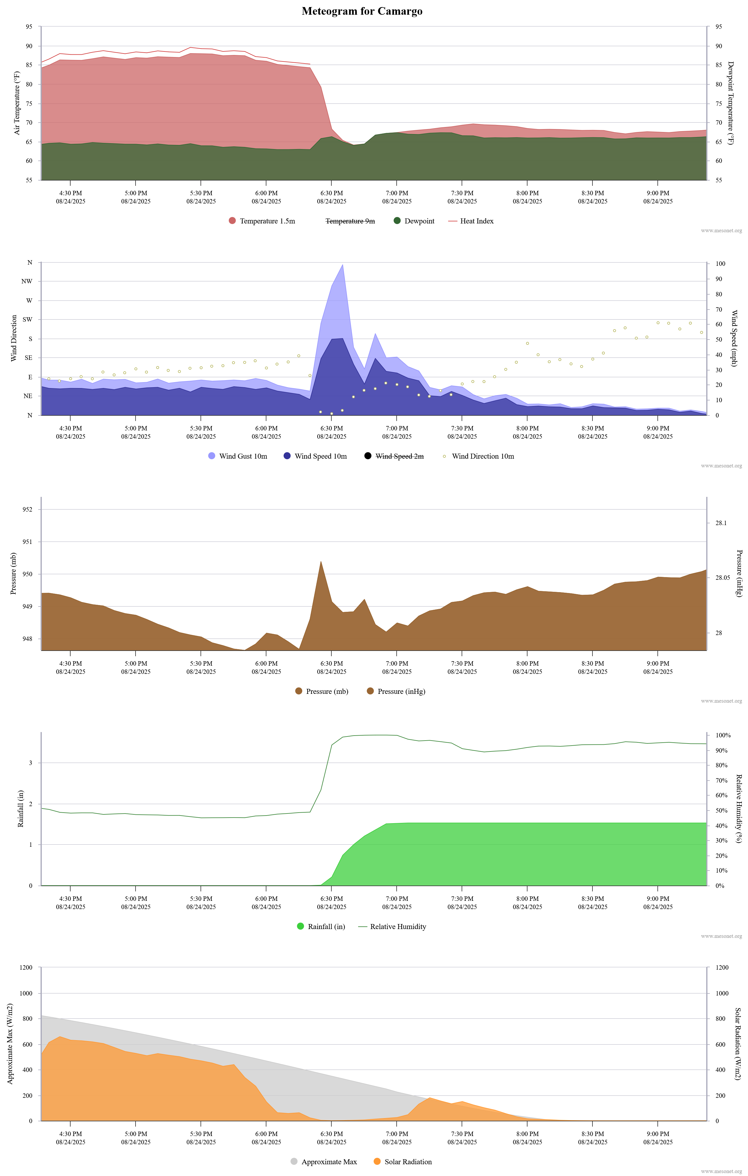
Crazy stuff for August, amirite? Crazier than the 99 and 85 mph wind gusts that
our Camargo site measured yesterday evening with a gobsmacker of a storm that
moved through?
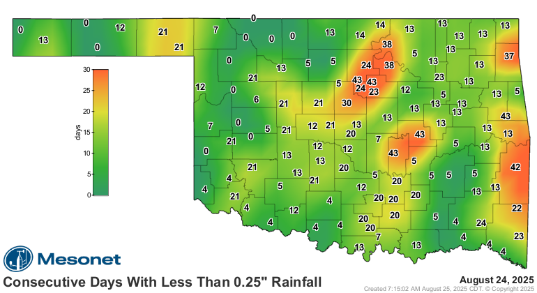
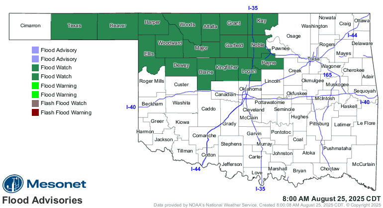
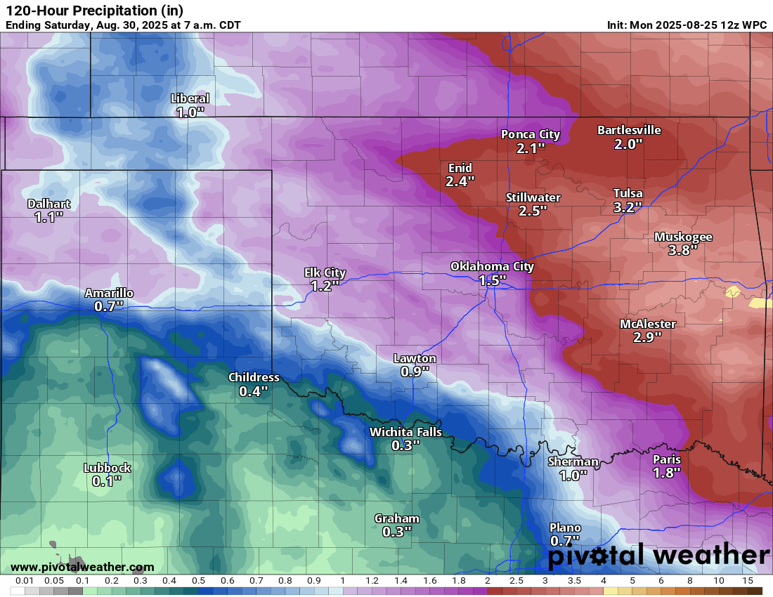
Crazier than all the rain that has fallen thus far, after so long of an
absence of said rain, creating flooding concerns?
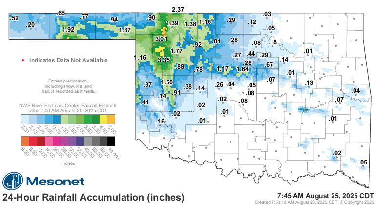
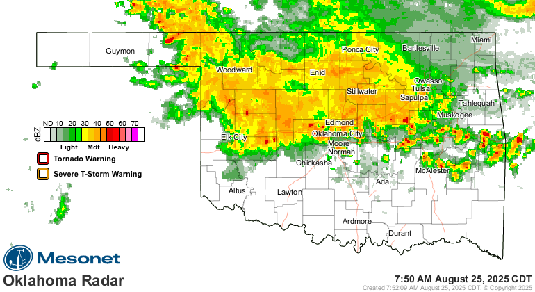
Crazier than heck, it's raining right now for crying out loud!??
CRAZIER THAN THOSE LOWS TOMORROW MORNING??
Yeah, that's sweatah weathah, or at least a heavy jacket. Very October'ish. And
check out our roller coaster ride for the rest of the week (but at a much
smaller height than normal).
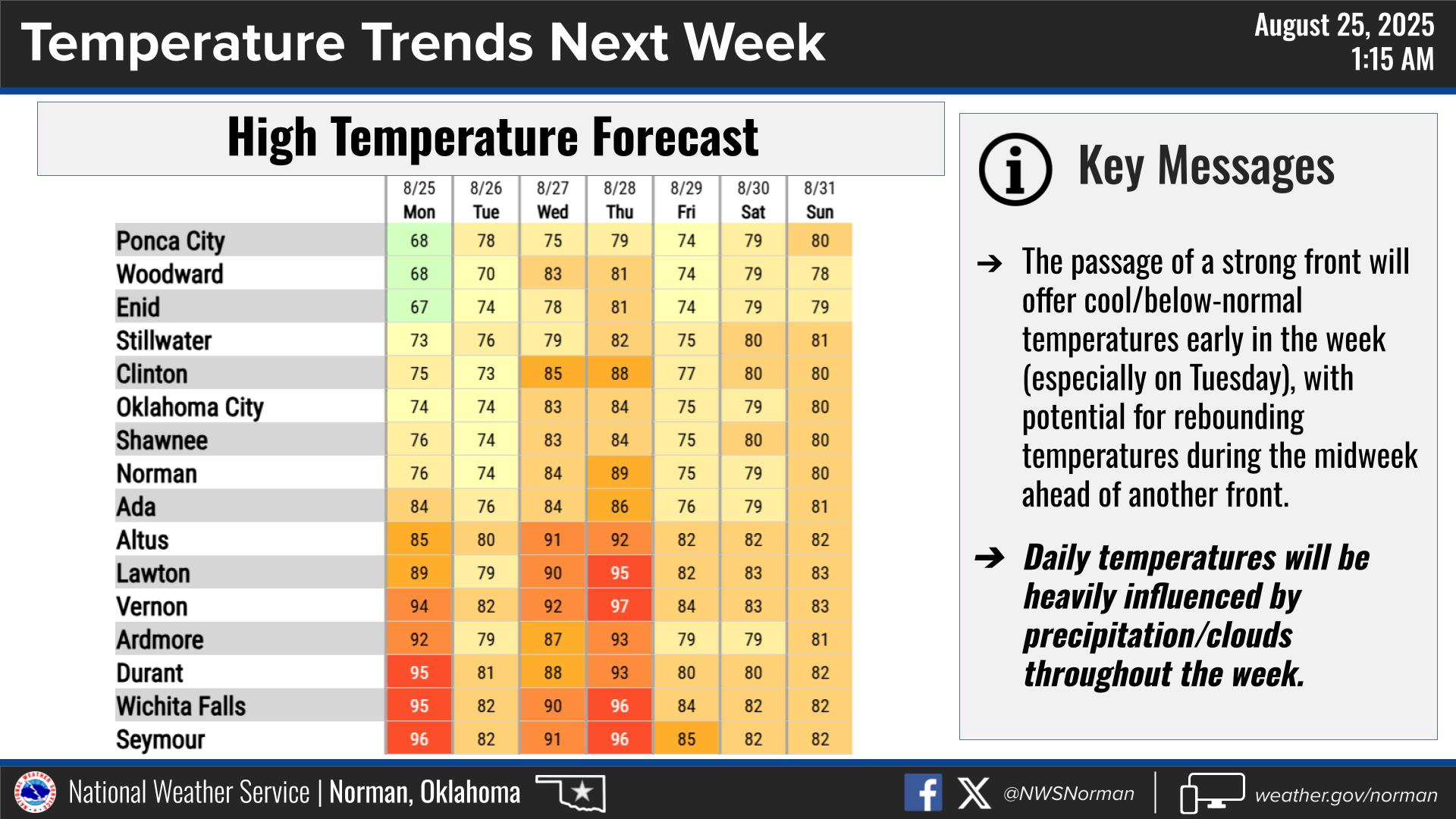
If it hasn't rained where you are yet, it will eventually. Some will get more,
some will get less.
Crazy!
Know what's not crazy? Being prepared for wildfires. And our OK-FIRE program
here at the Mesonet is ready for its fall Fall 2025 workshops. You can register
at:
https://www.mesonet.org/news/ok-fire-fall-2025-workshops
Or point your phone camera at this picture of me right after I get up in the
morning:

Dates and locations:
*Lawton: Monday, October 20, 9:00 AM – 4:30 PM
*Bartlesville: Tuesday, November 4, 9:00 AM – 4:30 PM
*Virtual: Monday, December 15 – Tuesday, December 16, 1:00 PM – 4:00 PM
The FREE workshops will be led by Dr. Monica Mattox and guest speakers. Content
will include a combination of presentations, case studies, and interactive lab
exercises. Topics will cover the OK-FIRE website, components of fire danger,
forecast and monitoring products, real-life emergency management scenarios,
and prescribed burning. The intended audience includes landowners, wildland
managers, firefighters, prescribed burn associations, and public safety
officials.
Gary McManus
State Climatologist
Oklahoma Mesonet
Oklahoma Climate Survey
gmcmanus@ou.edu
August 25 in Mesonet History
| Record | Value | Station | Year |
|---|---|---|---|
| Maximum Temperature | 109°F | FREE | 2024 |
| Minimum Temperature | 46°F | BEAV | 2010 |
| Maximum Rainfall | 4.69 inches | MEDI | 2017 |
Mesonet records begin in 1994.
Search by Date
If you're a bit off, don't worry, because just like horseshoes, “almost” counts on the Ticker website!