Ticker for July 24, 2025
MESONET TICKER ... MESONET TICKER ... MESONET TICKER ... MESONET TICKER ...
July 24, 2025 July 24, 2025 July 24, 2025 July 24, 2025
Sunny and Cher
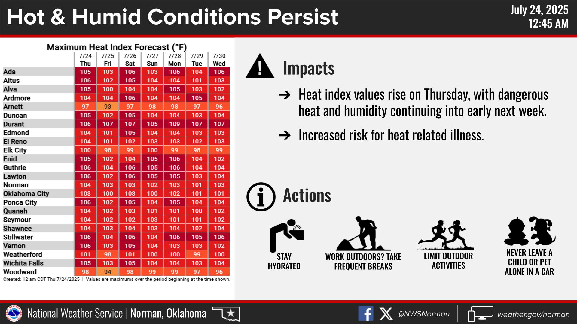
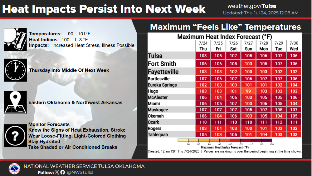
So much for our "break" yesterday, when we thought it wouldn't be hot hot (let's
not go through that again), but it was indeed hot hot.
Well, might as well settle in with the "making your own gravy" type of weather
because it looks like it's gonna be here awhile.
Now every time we talk about this type of heat in the summer, some Wisenheimers
and Clodhoppers like to remind us "Duh, it's summer, what did you expect?"
BALDERDASH, I say (ix-nay on the ald-bay, mmm-kay?)!
Should we not warn folks when there is dangerous heat in place? Heat that can
cause injury, and even death?
Sooooo, should we not alert folks in the spring (or anytime of the year) if a
tornado watch is issued? Or a high risk for severe weather from SPC? How about
dangerous flood conditions?
How about we don't, then the day after tell them "Well, it's May...what did you
expect?"
Nonsensical and foolish (and I know nonsensical and foolish...you're reading it
right now!!).
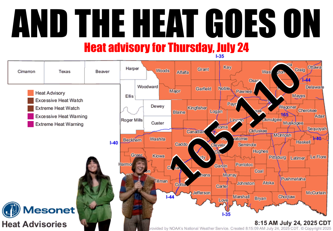
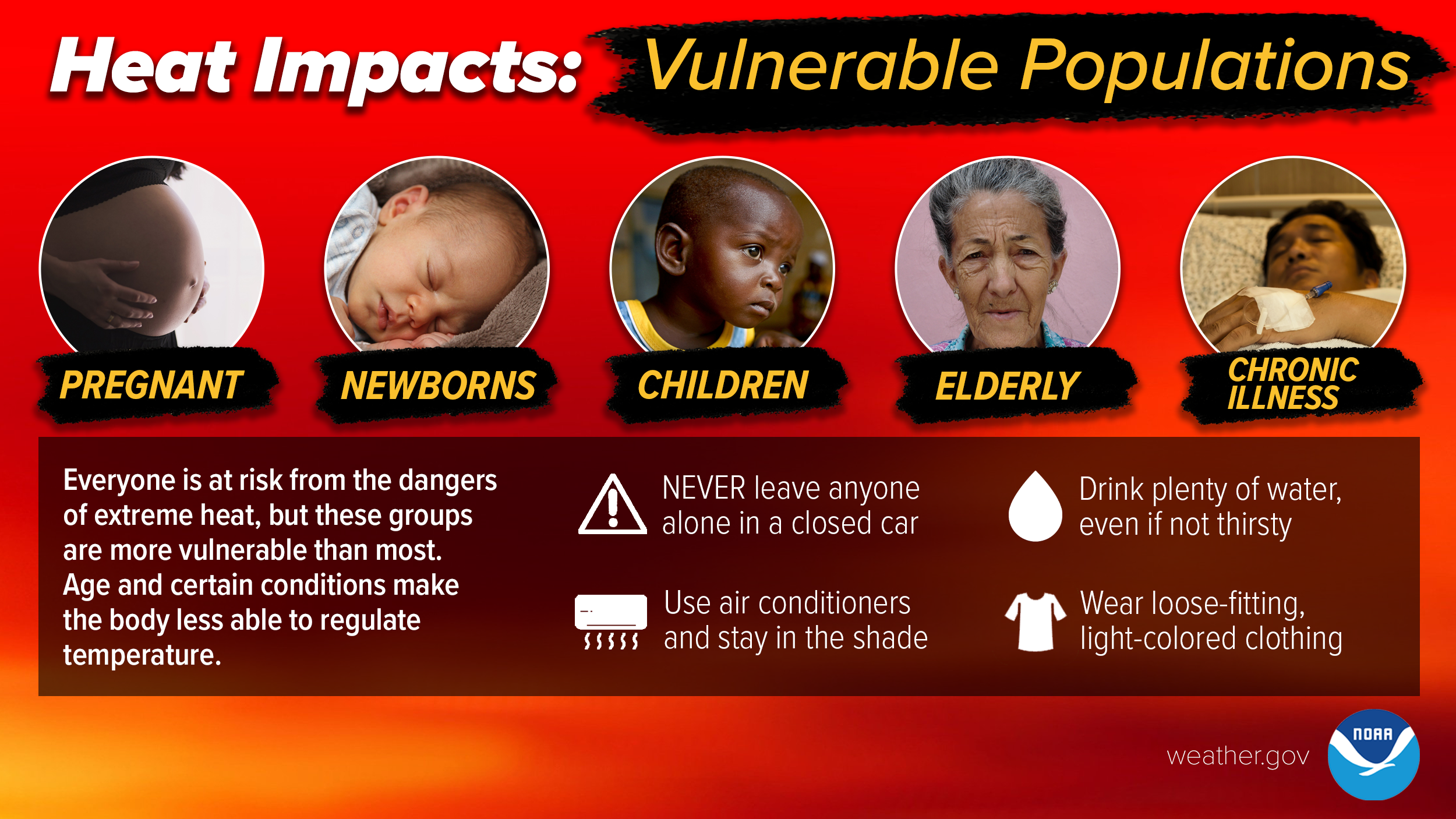
So yes, it's summer and it's hot, and dangerous heat is in place, and you should
check on those most vulnerable populations AND also stay hydrated and seek
shade and/or cooling during the heat of the day.
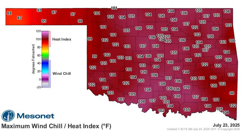
It's also advised to cool down and rest during the overnight hours during
heat like this, because heat's impacts are cumulative. And we know there are
vulnerable populations that don't get adequate cooling at night, so they're at
even bigger risk during the day.
Oh, speaking of severe weather, we should alert you that there is a chance
of severe storms this afternoon and evening across the NW half of the state, and
the main impact is likely to be high winds, in pure summer-storm fashion.
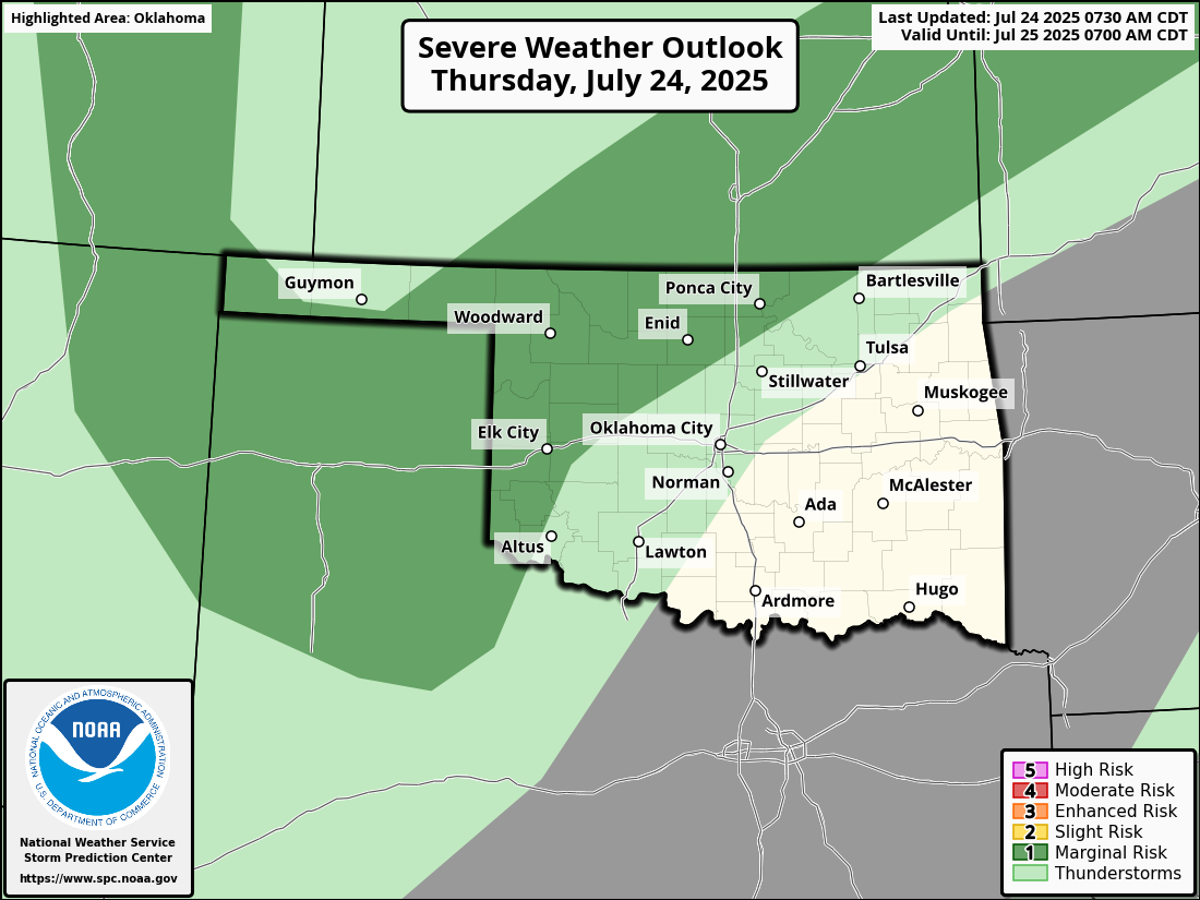
Heavy rain is also possible, again in pure summer-storm fashion!
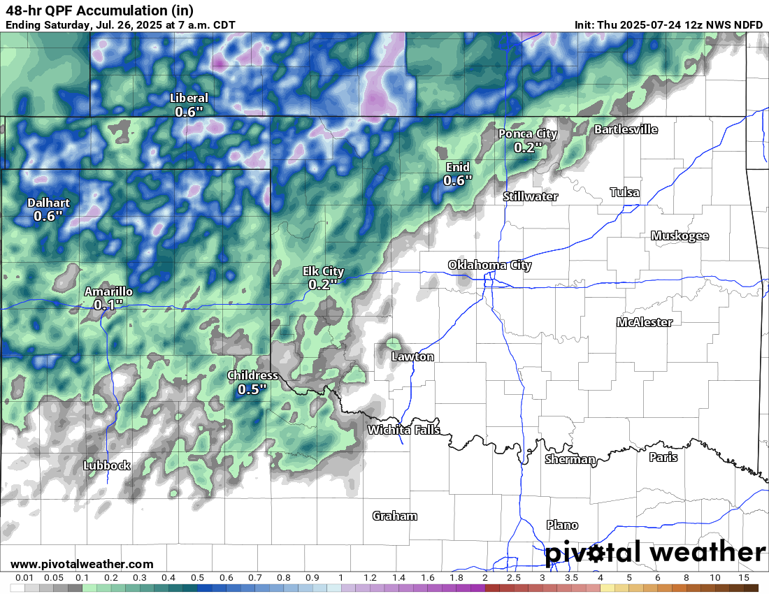
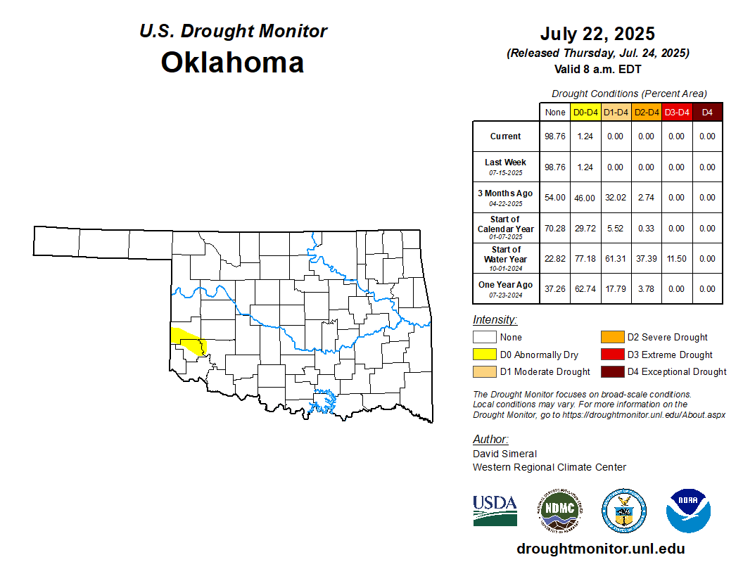
We do need the rain in SW OK, especially, because that's the area where those
abnormally dry conditions, as shown on the new U.S. Drought Monitor map, remain
and are curing. Without rain soon, we'll see that D1 moderate drought pop back
onto the map, and then spread and intensify.
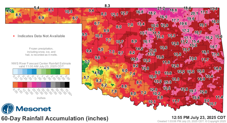
You look out to the last 60-days and that dry-spell becomes more obvious in
that part of the state.
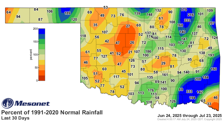
And narrow into 30 days, and the dryness spreads over a much larger portion of
the state.
Yeah, I know...it's dry during the summmer, what did I expect? Well I didn't
expect that extra m in summmer, nor is it expected to be just flat-out "dry"
during the summer, it's just that the heat and vegetation overwhelm supply with
demand.
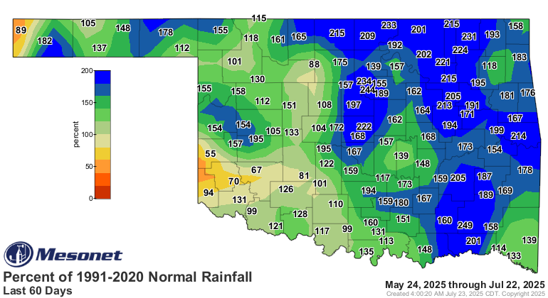
See the normal rainfall since June 1? Does that look like it's supposed to
be "dry?"
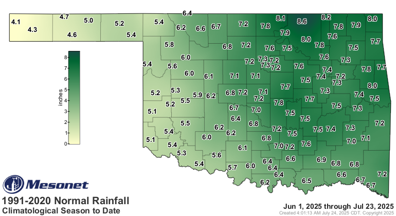
BALDERDASH!!
So when we go through a dry spell during this time of increased demand, things
can get ugly. And I know ugly because...never mind, I've used that joke before.
Gary McManus
State Climatologist
Oklahoma Mesonet
Oklahoma Climatological Survey
gmcmanus@ou.edu
July 24 in Mesonet History
| Record | Value | Station | Year |
|---|---|---|---|
| Maximum Temperature | 110°F | MARE | 2011 |
| Minimum Temperature | 48°F | CAMA | 2019 |
| Maximum Rainfall | 4.43 inches | COOK | 2004 |
Mesonet records begin in 1994.
Search by Date
If you're a bit off, don't worry, because just like horseshoes, “almost” counts on the Ticker website!