Ticker for June 17, 2025
MESONET TICKER ... MESONET TICKER ... MESONET TICKER ... MESONET TICKER ...
June 17, 2025 June 17, 2025 June 17, 2025 June 17, 2025
Again?
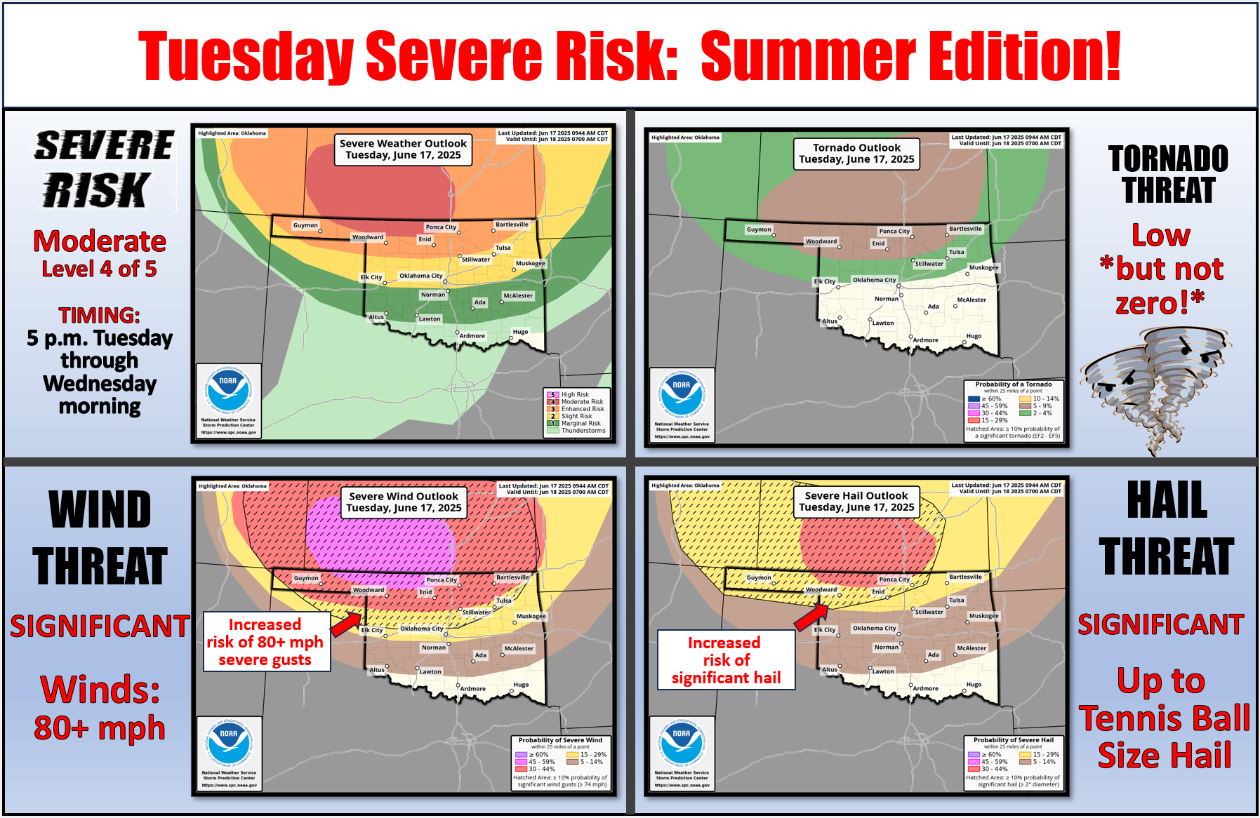
Ever heard of 80+ mph winds, tennis ball size hail, tornadoes?
Morons...whoops, that was Plato, Aristotle, Socrates.
How about "wimps" instead.
Now why would I call 80+ mph winds, yada yada yada, wimps?
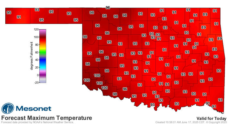
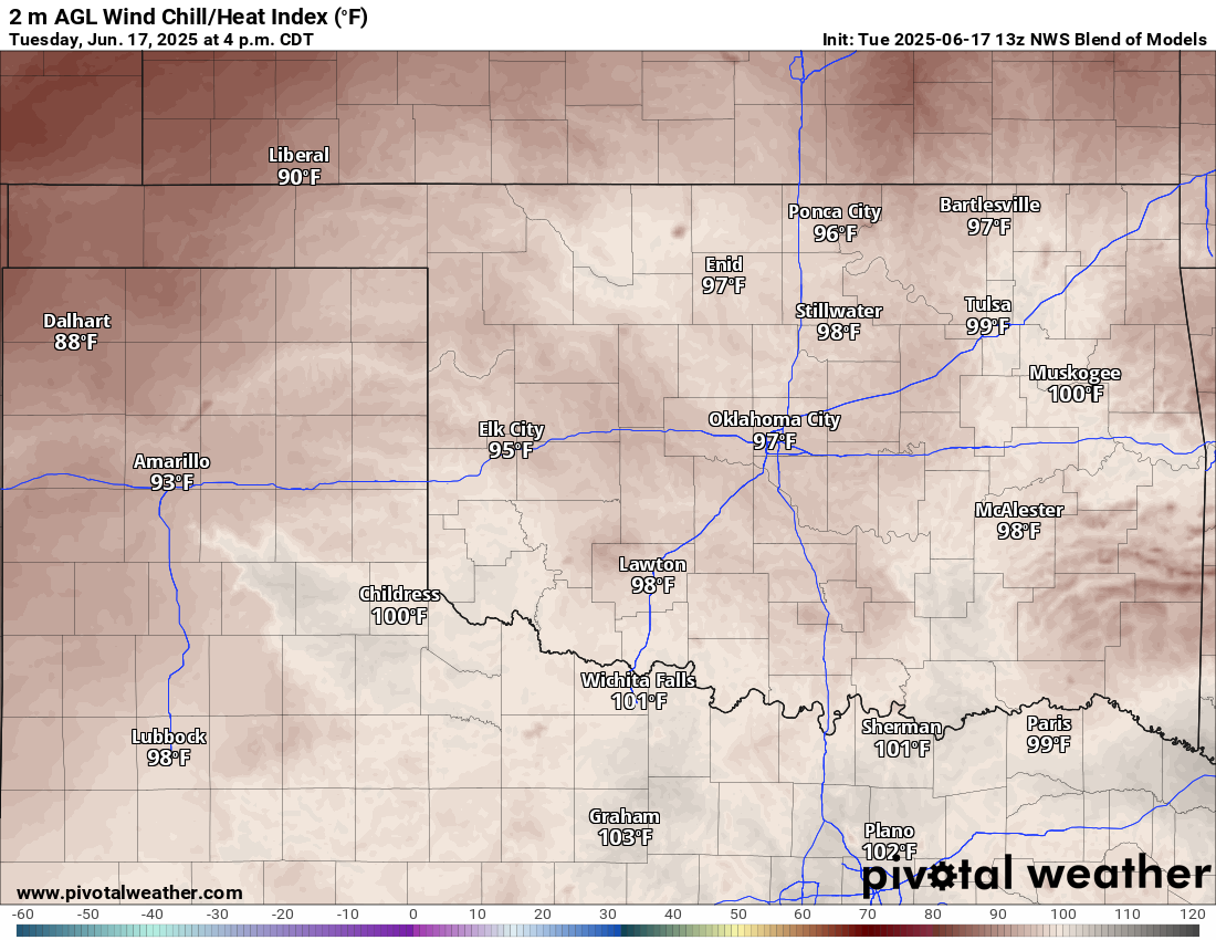
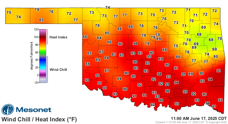
Because the heat might be what'll get ya! Check out today's highs, and the
forecast heat index.
Heck, it's steamy right now, for crying out loud! And storming.
So who promised God they'd put up with stifling heat and severe weather if the
Thunder would just win last night? You're supposed to promise to become a
priest or a nun, you know. Or at least lead a better life.
Is a heat index approaching a hundred living a better life, Claude?
I thought so.
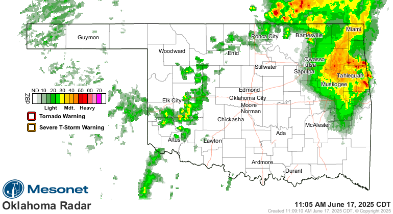
At any rate, be aware of what's going on today with the weather, especially late
afternoon into the evening as storms are expected to develop across northern
Oklahoma and plunge south.
And stay hydrated, seek shade, and AC if you have it available.
Now what did I promise for a win last night?
Nunya.
Gary McManus
State Climatologist
Oklahoma Mesonet
Oklahoma Climate Survey
gmcmanus@ou.edu
June 17 in Mesonet History
| Record | Value | Station | Year |
|---|---|---|---|
| Maximum Temperature | 114°F | GRA2 | 2011 |
| Minimum Temperature | 45°F | BEAV | 1999 |
| Maximum Rainfall | 10.49 inches | NEWP | 2015 |
Mesonet records begin in 1994.
Search by Date
If you're a bit off, don't worry, because just like horseshoes, “almost” counts on the Ticker website!