Ticker for June 11, 2025
MESONET TICKER ... MESONET TICKER ... MESONET TICKER ... MESONET TICKER ...
June 11, 2025 June 11, 2025 June 11, 2025 June 11, 2025
DUN-DUN...DUN-DUN...DUNDUNDUNDUNDUNDUN
I know how much the scene in the bottom left of that image scares some of you, but
I'll give you the same advice one of my best friends from Buffalo used to say
when given any animal attack scenario: punch it in the throat.
So, it would go like this: "What if we locked you in the cab of a pickup with a
mountain lion...who would win?"
Friend: "Me. I'd just punch it in the throat."
Wolf? Throat. Lion? Throat.
Chihuahuahawawa (you know what I'm talking about)?
Yep, throat.
But we're not here to talk about hair(ouch)-brained schemes to avoid animal (or
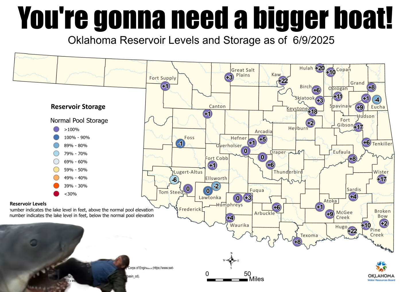
fish) attacks, we're here to talk about our lake levels. Now compare those levels
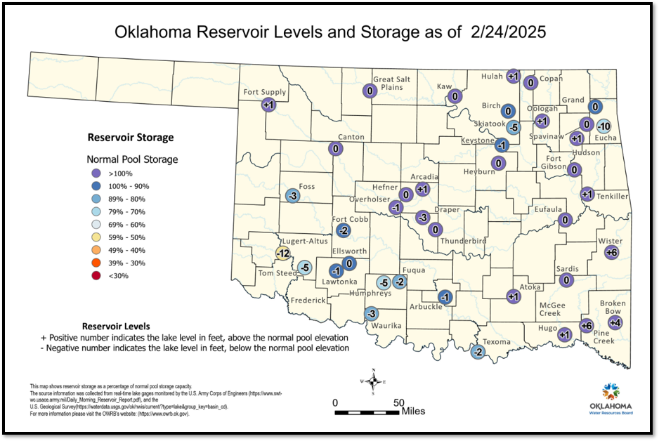
above, with some areas having lakes up to 22 feet above normal, to what we
saw just a few months ago.
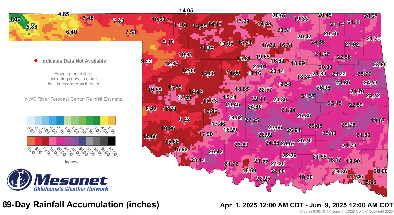
Nothing that 20-30 inches of rainfall can't cure.
That's definitely a throat-punch.
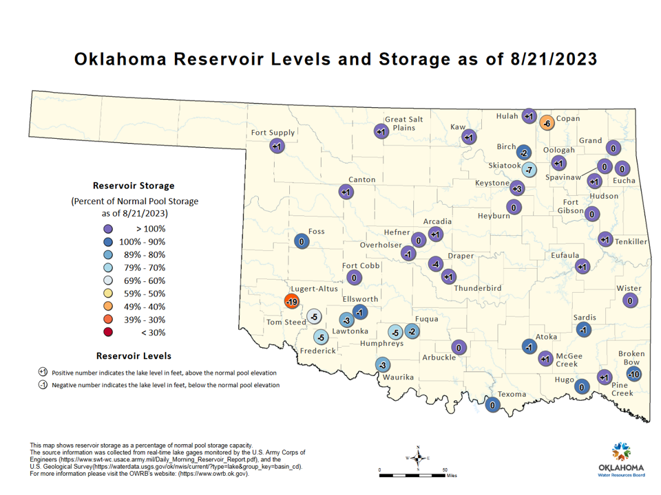
And look where we were just a couple of years ago.
And remember when it was REALLY ugly (save the jokes!), back in the 2010-15
drought?
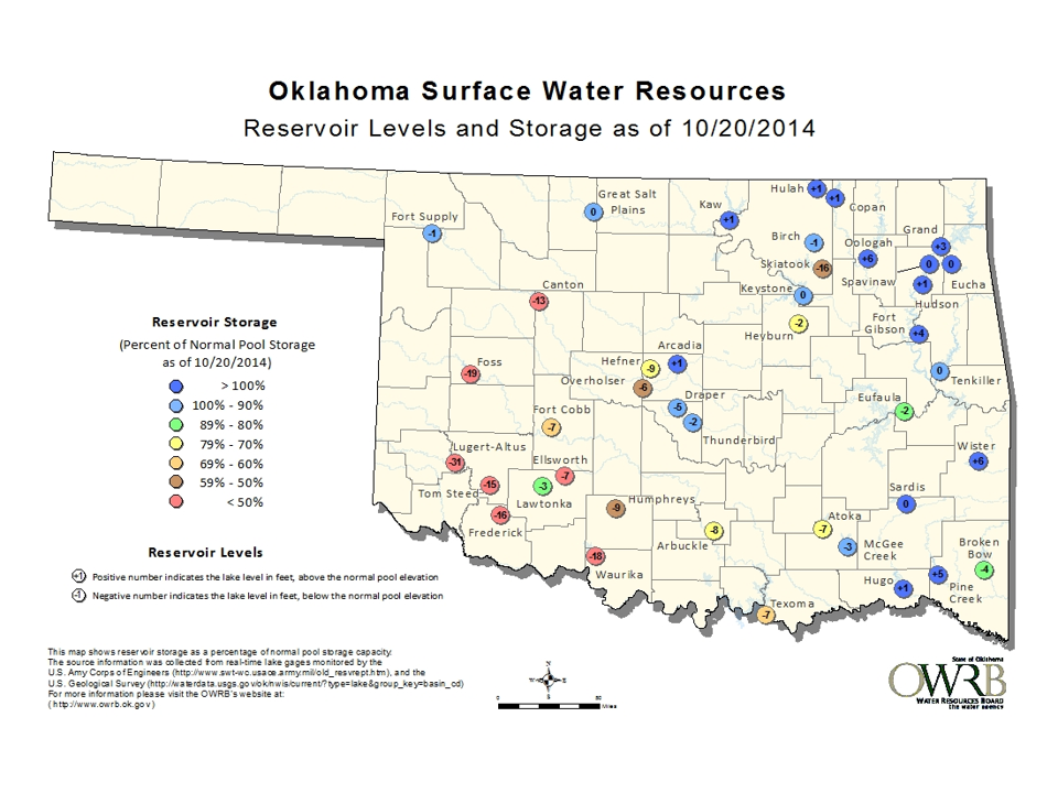
And those lakes, at least in some parts of the state, have a chance to go even
higher after the next few days, starting tonight.
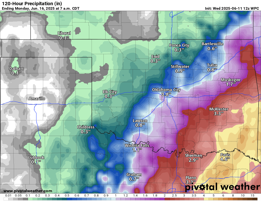
Those rain chances have done the "Southeast Shuffle" Okies get so tired of, at
least the NW half of the state's Okies.
Gary McManus
State Climatologist
Oklahoma Mesonet
Oklahoma Climate Survey
gmcmanus@ou.edu
June 11 in Mesonet History
| Record | Value | Station | Year |
|---|---|---|---|
| Maximum Temperature | 108°F | ALTU | 2022 |
| Minimum Temperature | 44°F | KENT | 2004 |
| Maximum Rainfall | 6.05 inches | COPA | 2007 |
Mesonet records begin in 1994.
Search by Date
If you're a bit off, don't worry, because just like horseshoes, “almost” counts on the Ticker website!