Ticker for June 2, 2025
MESONET TICKER ... MESONET TICKER ... MESONET TICKER ... MESONET TICKER ...
June 2, 2025 June 2, 2025 June 2, 2025 June 2, 2025
I'm actually off today (AGAIN??? What am I, a bank lawyer's doctor??), but I had
to send out my May press release (below, as usual) but also tell you about more
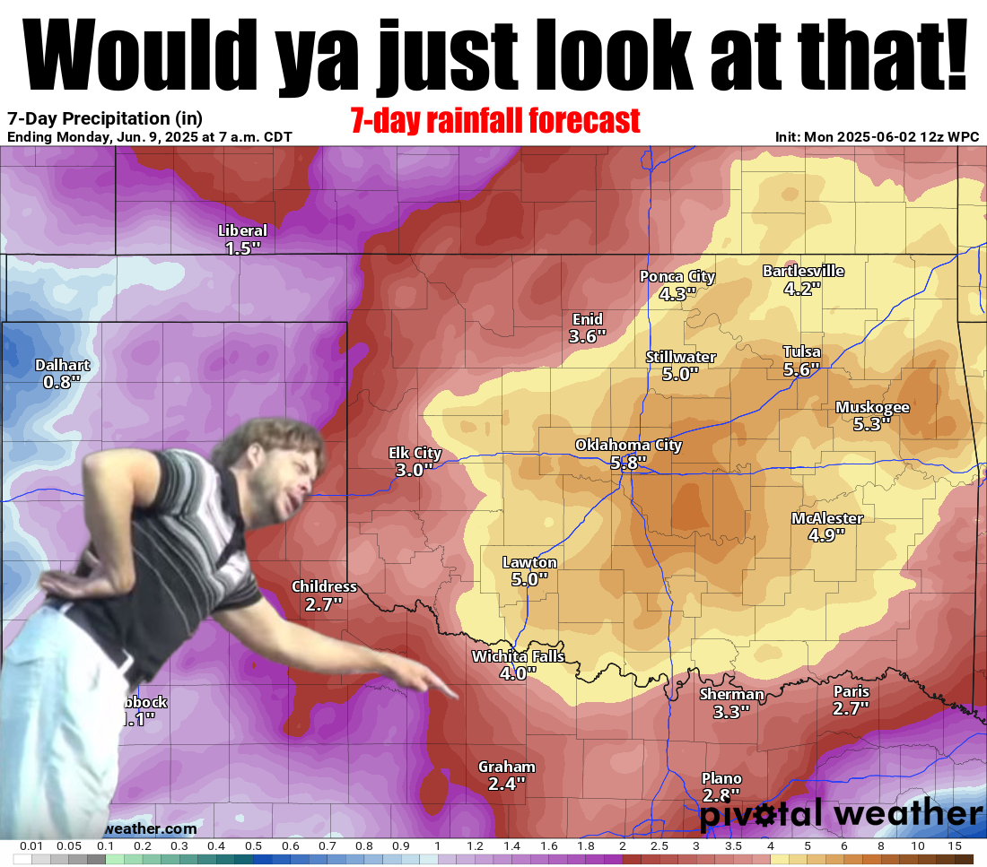
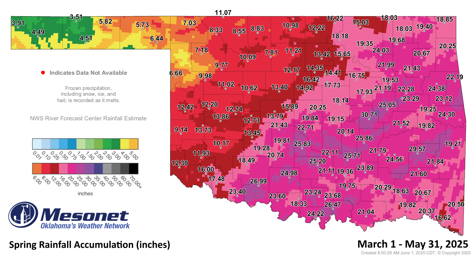
flooding rainfall looking likely across Oklahoma this week. As you can tell
from the graphic above, we're seeing forecasts of 4-6 inches of rainfall across
parts of the state that have already seen 15-20+ inches over the last couple of
months. So yes, it's best to be prepared in whatever way will keep you and yours
safe, the most important of which is telling them (and yourself) to NOT DRIVE
INTO WATER!
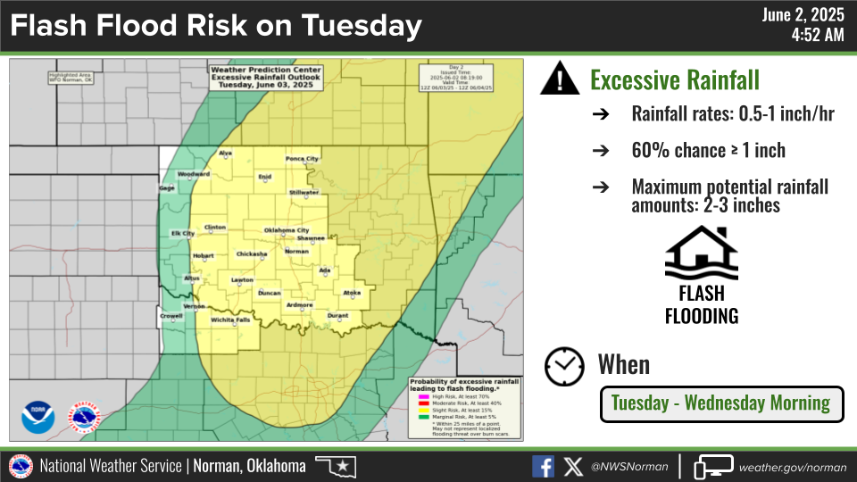
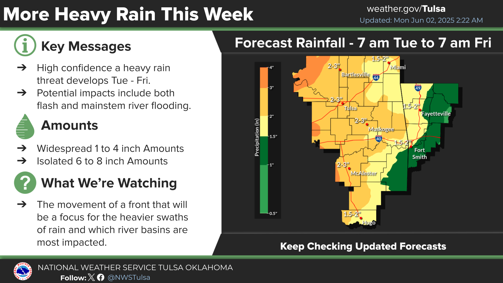
Here's a bit more from our local NWS offices.
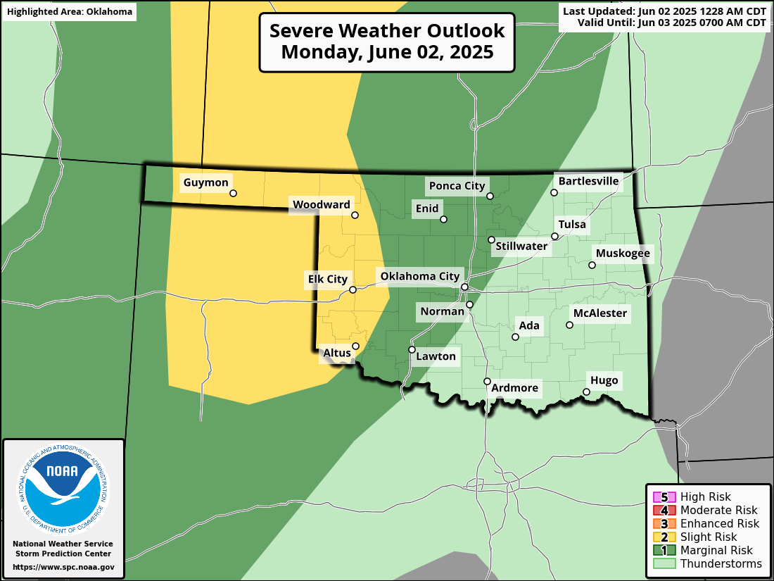
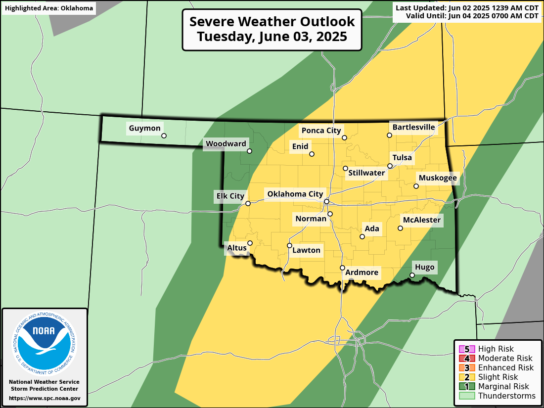
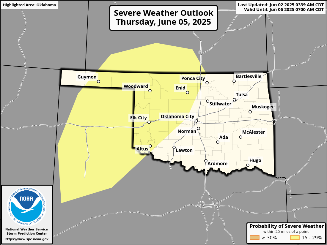
Severe weather, omnipresent during Oklahoma springs, will also be present. At
least the risks. That starts today as well, ramps up tomorrow, and again on
Thursday.
Fun times. Fun fun times. Not.
Stick around below for a look back at May.
And enjoy your day.
And quite rhyming.
It's messing up my timing.
Well there you go.
----------------------------------------------------------------------------------
Hail and Twisters Dominate May
May 2, 2025
After April’s stormy chaos, the first half of May brought a rare lull in
Oklahoma’s spring severe weather season. Aside from an active kickoff on May 1
— featuring large hail, damaging winds, tornadoes, and flash flooding — the
state experienced a quiet 16-day stretch, interrupted only by a single report
of half-dollar-size hail in far southeastern Oklahoma on May 16. But the break
didn’t last: severe storms returned on May 17 and dominated the remainder of
the month.
2025 Tornadoes Reach Annual Average
At least 20 tornadoes were confirmed across Oklahoma in May, though that number
may increase as National Weather Service (NWS) personnel continue their damage
surveys. The preliminary total for January through May now stands at 58, nearly
matching the state’s long-term annual average of 58.8 from 1951 to 2024. The
January–May average is 41.8. Sixteen of the 20 tornadoes in May were rated EF1
or stronger.
Two of those tornadoes were the strongest of the year so far, both rated EF3.
The first formed in the High Plains of Ellis County near Arnett on May 18, one
of four tornadoes produced by the same parent supercell. The funnel was widely
photographed as it moved over mostly open country, staying on the ground for
5.5 miles before lifting near Arnett’s outskirts. Peak winds were estimated at
145 mph, strong enough to strip bark from trees and toss a large shipping
container 175 feet.
The second EF3 tornado struck southern Pittsburg County, carving a 16-mile path
with peak winds estimated between 135 and 145 mph. At times up to 1.7 miles
wide, the tornado damaged several homes and injured at least one person near
the town of Pittsburg. Unlike the Ellis County storm, this tornado passed
through more developed areas, contributing to its greater impact.
Hailstorms Cause Widespread Damage
Severe hailstorms pounded Oklahoma throughout May, producing widespread damage
across multiple regions. One of the most extreme reports came from Ellis County
on May 18, where 5-inch diameter hail — roughly the size of a DVD — fell from
the same supercell that produced the Arnett EF3 tornado. Another bout of
exceptionally large hail occurred near Hammon in Roger Mills County on May 26,
with grapefruit-size stones reported.
Perhaps the most destructive hailstorm of the month struck on May 17, when a
swath of 2- to 4-inch hail tore through central Oklahoma from near Chickasha to
Oklahoma City. The hail shattered windshields, damaged roofs and siding,
battered businesses, and shredded trees along its path. In total, Oklahoma’s
NWS offices received at least 228 reports of severe hail (1 inch or larger)
during the month, with 79 reports involving hail the size of golf balls or
larger. Hail 2 inches or greater — often considered the threshold for
significant damage — was reported more than 40 times.
May saw at least 16 separate days with one or more severe hail reports across
the state. The most active day was May 17, with over 60 hail reports logged
statewide. Hailstones of 3 inches or larger were reported on five different
days during the month, underscoring the unusually intense and frequent nature
of this year’s spring hail activity.
May by the Numbers
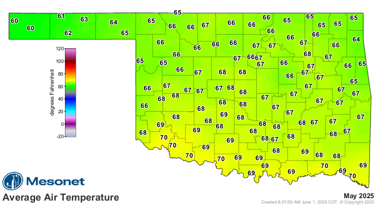
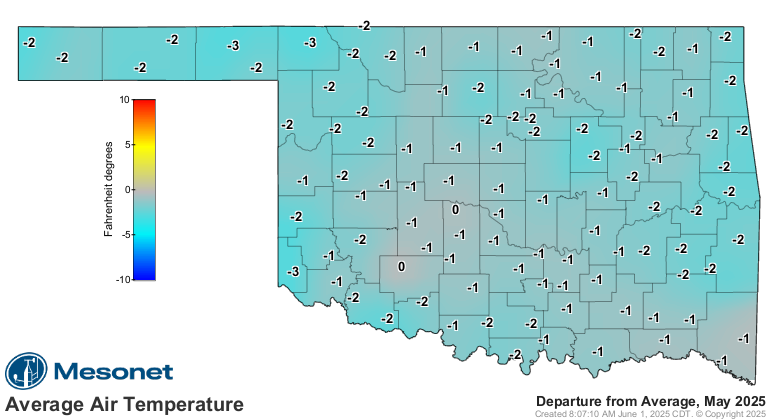
* Statewide average temperature: 66.7°F (1.7°F below normal), 35th-coolest May
since records began in 1895
* Temperature extremes: High of 101°F at Altus on May 13; low of 38°F at Eva on
May 2
* Warmest/Coolest locations: Highest monthly average temperature, 70.5°F at
Altus; lowest, 59.7°F at Kenton
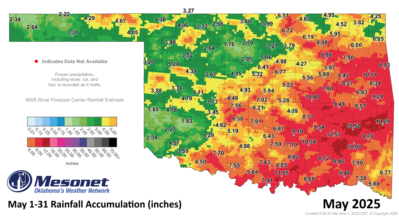
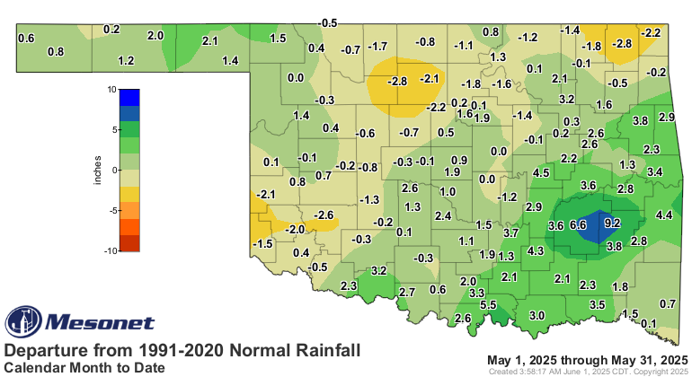
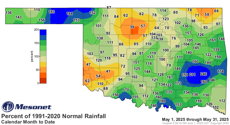
* Statewide average precipitation: 5.82 inches (0.89 inches above normal),
35th-wettest May on record
* Rainfall extremes: High of 15.52 inches at Wilburton; low of 1.75 inches at
Lahoma
* Rainfall totals greater than 5 inches: 67 instances recorded at the 119
Oklahoma Mesonet sites, including eight above 10 inches
Climatological Spring (March–May) by the Numbers
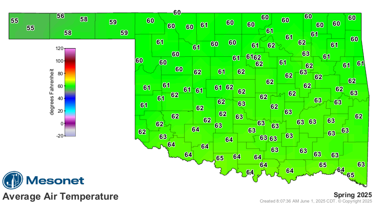
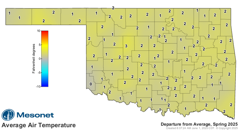
* Statewide average temperature: 61.5°F (1.8°F above normal), 14th-warmest
spring since 1895
* Temperature extremes: High of 101°F at Alva on April 17 and at Altus on May
13; low of 18°F at Eva on March 5 and 16
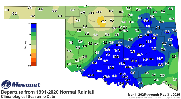
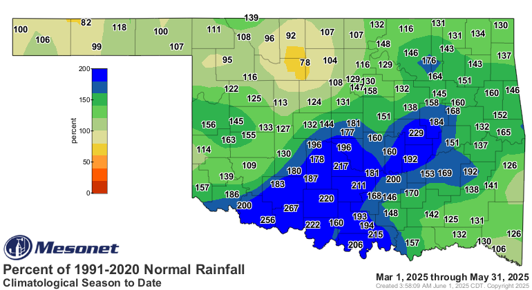
* Statewide average precipitation: 15.6 inches (4.3 inches above normal), ninth-
wettest spring on record
* Rainfall extremes: High of 29.57 inches at Wilburton; low of 3.51 inches at
Eva
Drought Conditions Improve, July Outlook Promising
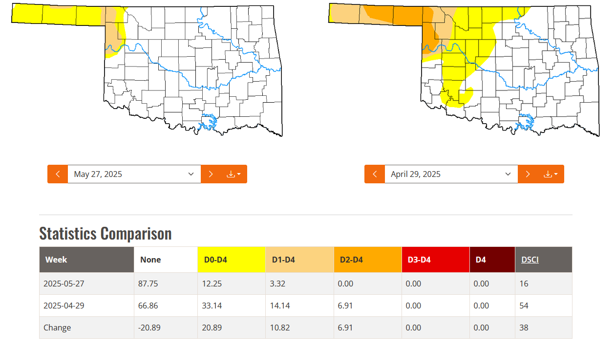
Drought coverage in Oklahoma dropped from 14 percent to just over 3 percent
during May, according to the U.S. Drought Monitor. Severe drought, which had
covered 7 percent of the state at the beginning of the month, was completely
eliminated. This marked the lowest statewide drought extent in nearly four
years, dating back to the onset of the broader drought episode in August 2021.
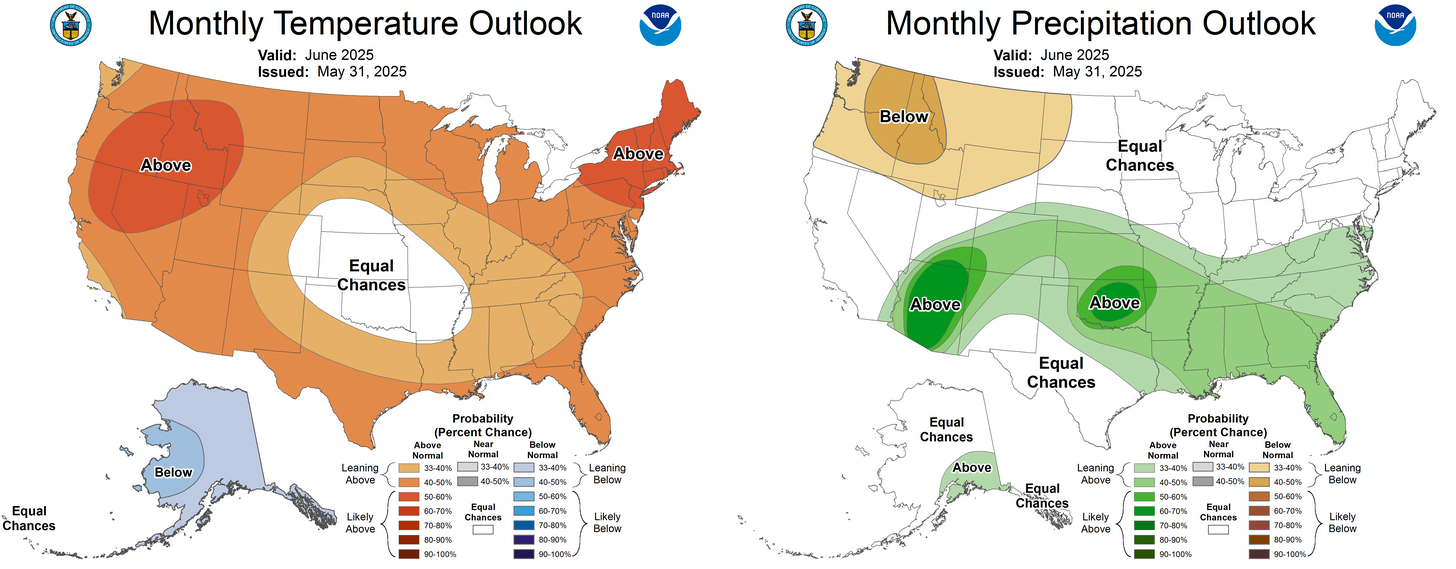
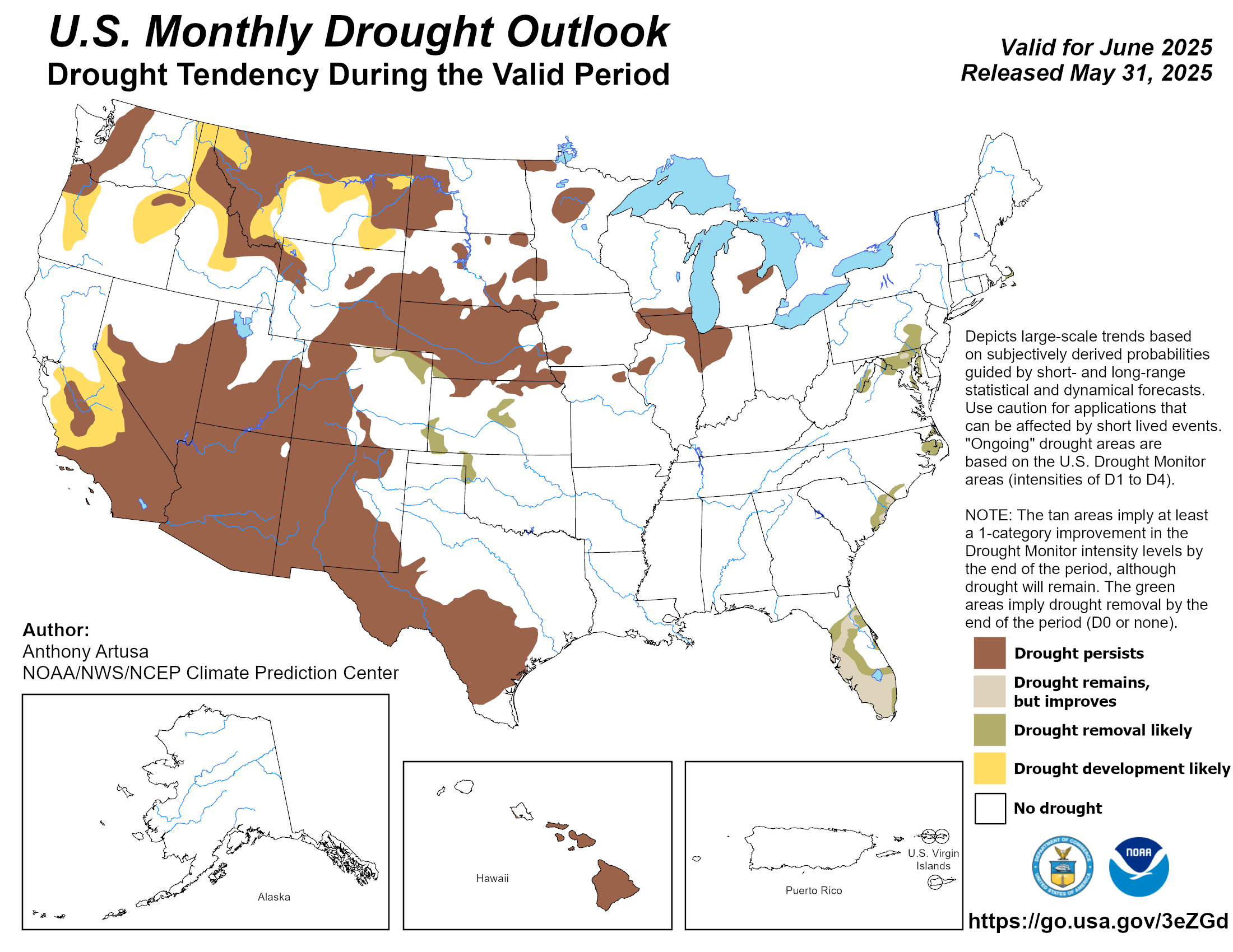
The Climate Prediction Center’s outlook for July shows significantly increased
odds of above-normal precipitation across all of Oklahoma, with equal chances
of above-, near-, or below-normal temperatures. The CPC’s drought outlook also
projects that drought will likely be fully eradicated from the state by the end
of the month.
###
Gary McManus
State Climatologist
Oklahoma Mesonet
Oklahoma Climate Survey
gmcmanus@ou.edu
June 2 in Mesonet History
| Record | Value | Station | Year |
|---|---|---|---|
| Maximum Temperature | 111°F | MANG | 1998 |
| Minimum Temperature | 42°F | HOOK | 2013 |
| Maximum Rainfall | 5.14 inches | WYNO | 2014 |
Mesonet records begin in 1994.
Search by Date
If you're a bit off, don't worry, because just like horseshoes, “almost” counts on the Ticker website!