Ticker for June 3, 2025
MESONET TICKER ... MESONET TICKER ... MESONET TICKER ... MESONET TICKER ...
June 3, 2025 June 3, 2025 June 3, 2025 June 3, 2025
Pull the plug!
Much like Taco Bell, Bit-O-Honey candy (look it up, kids), or Nickelback,
sometimes the fun is in overdoing it, am I right Ladies and Gentlemen? I mean,
sure, those 3 bean burritos LOOK great, and they TASTED great (come on, work with
me here), but soon after, you're paying for it. Now I don't want to even think
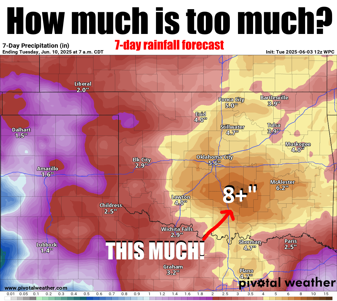
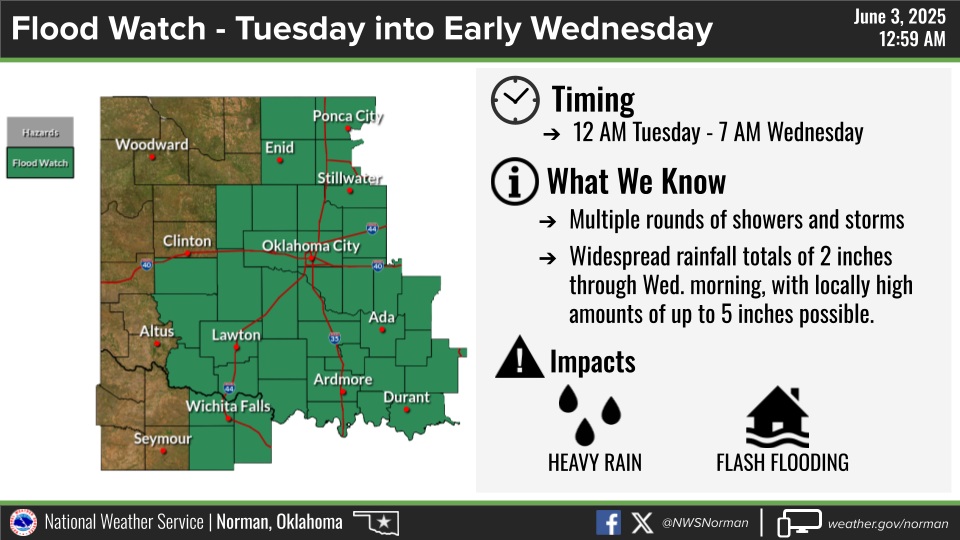
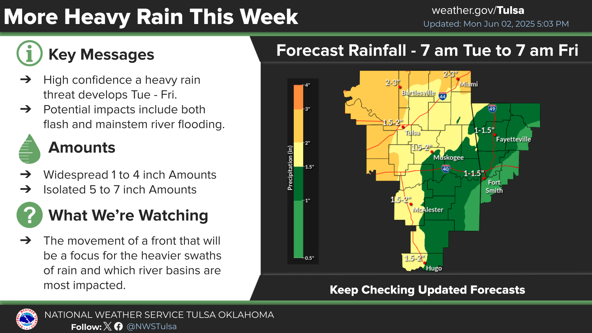
about what's gonna happen in that area across Oklahoma where 4-7 inches (and
higher in local amounts) is forecast to fall, because it's already had way too
much rain over the previous two months, But I'm gonna go ahead and predict it
ain't gonna be pretty.
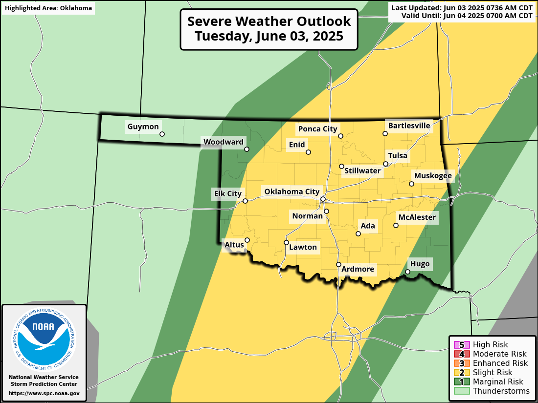
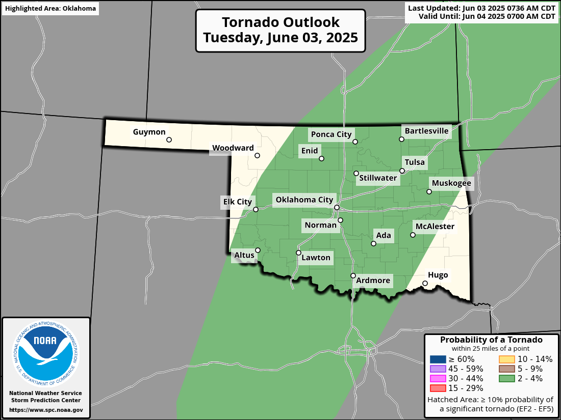
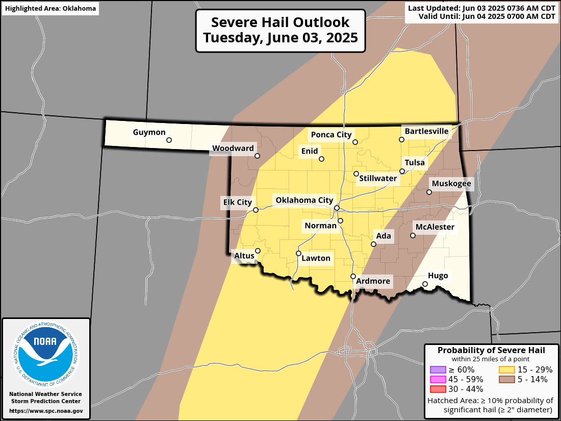
Speaking of not pretty (yes, I've looked in a mirror, thank you), the rain today
could come with some of the nasty stuff, including a NON-ZERO chance of tornadoes.
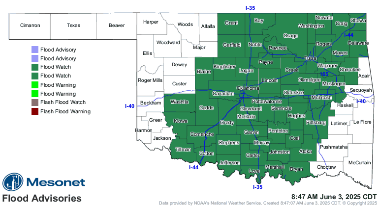
Wait wait wait, as bad as that looks, the threat of flash flooding is just as
great, and we already have a flash flood watch out for much of the state in
anticipation. And no, this isn't a ketchup commercial. Yeah, I'm that old and
you are too if you remember that commercial.
Dang it, now I can't get that commercial out of my head. And trust me, there's a
LOT of room in there for it to bounce around. Where was I? Oh yeah, ketchup.
No, I mean, flooding. So those areas where storms are going to train over and
over, as well as OVER saturated soils, there's gonna be life-threatening
flash flooding. After the loss of life just this spring from driving into
flooded roadways, it's imperative that we TURN AROUND, DON'T DROWN.
The best advice is to simply STAY HOME and not get out in the mess, but if you
can't avoid it, then just take the longer way home. Don't drive into that
water. Just within a few miles of me here in Norman, we have two roadways that
washed away underneath rushing water. You drive into that, the rug (and road)
will be pulled out from under you and off you go into the flood waters. Don't
worry, nobody is in that much of a hurry to see you that you have to risk the
straight route through that water. Okay, maybe I'm projecting, but better to
stay safe.
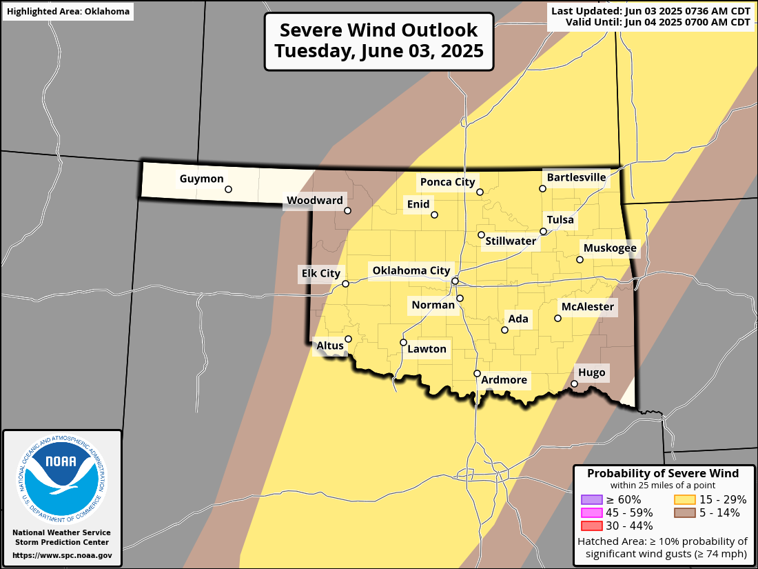
So we have several threats today into the overnight hours...big storms, big
hail, big wind (mmmmmmm, bean burritos!), tornadoes, and flash flooding. After
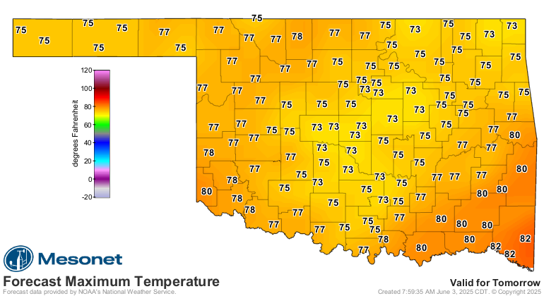
the cold front pushes through, we'll cool down from our foray into summer
yesterday and today. Wait, you didn't go outside yesterday? It was punishing,
and nobody was acclimated to it yet because it's been so mild. Check out that
heat index!
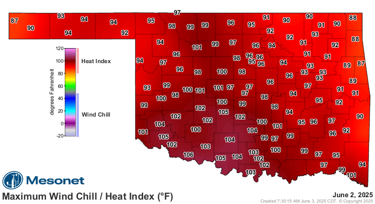
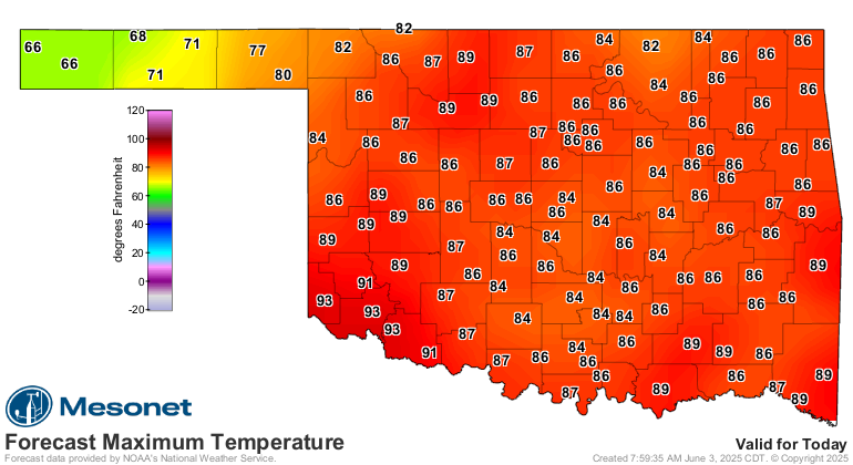
Another steamy day today, and then it's gonna be downright March-ish tomorrow.
So you've been given your MARCHing orders (get it?)...stay weather aware today,
have a plan should severe weather approach you, have at least two ways to get
warnings, AND don't drive into that water.
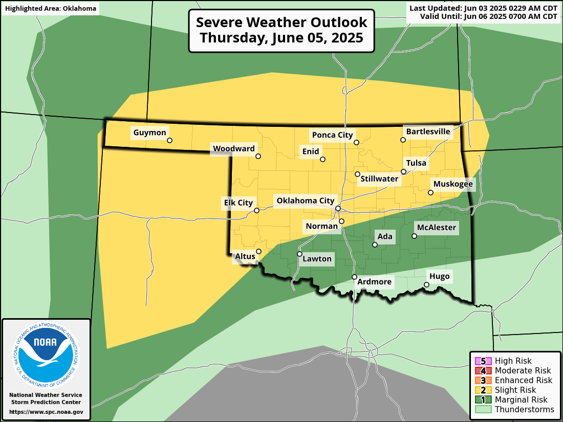
And then we do it all again on Thursday.
Gary McManus
State Climatologist
Oklahoma Mesonet
Oklahoma Climate Survey
gmcmanus@ou.edu
June 3 in Mesonet History
| Record | Value | Station | Year |
|---|---|---|---|
| Maximum Temperature | 108°F | ALTU | 2008 |
| Minimum Temperature | 45°F | EVAX | 2018 |
| Maximum Rainfall | 5.20 inches | FTCB | 1995 |
Mesonet records begin in 1994.
Search by Date
If you're a bit off, don't worry, because just like horseshoes, “almost” counts on the Ticker website!