Ticker for May 22, 2025
MESONET TICKER ... MESONET TICKER ... MESONET TICKER ... MESONET TICKER ...
May 22, 2025 May 22, 2025 May 22, 2025 May 22, 2025
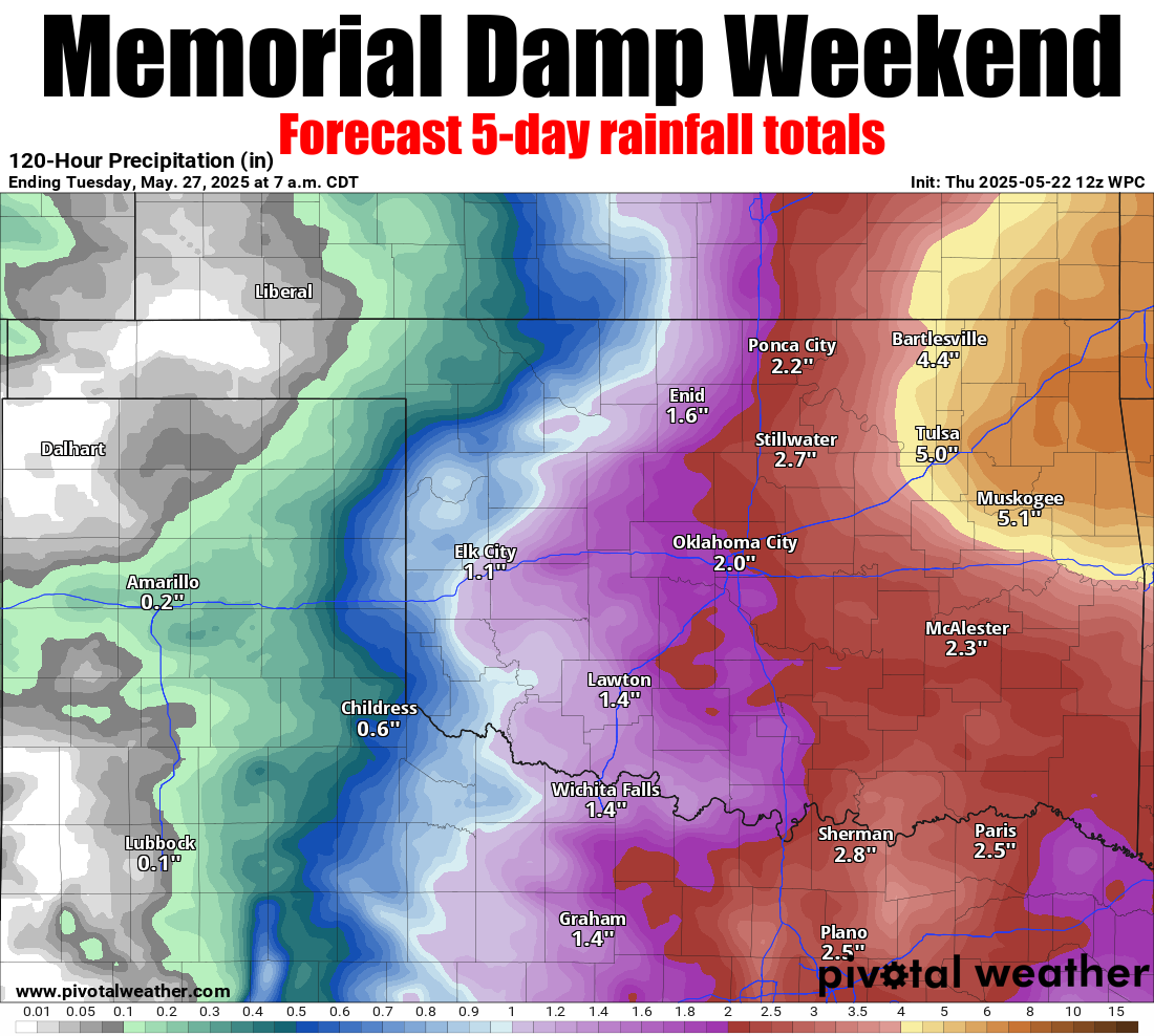
Memorial Dampener
It's been 3 days since I Ticked at you...wait, I'm getting the urge for a song.
Barenaked Ladies, anyone?
"It’s been three days since I sent a Ticker,
Tornadoes dropped and the hail got thicker,
Wind rolled in with a sky so mean,
Oklahoma spring doing chaos unseen."
Dang, that song (the original) is like 27 years old already...and I'm old enough
to be it's Dad! Sorry, I have enough kids, and we had enough severe weather over
the weekend and Monday to last us for awhile. But unfortunately, as the forecast
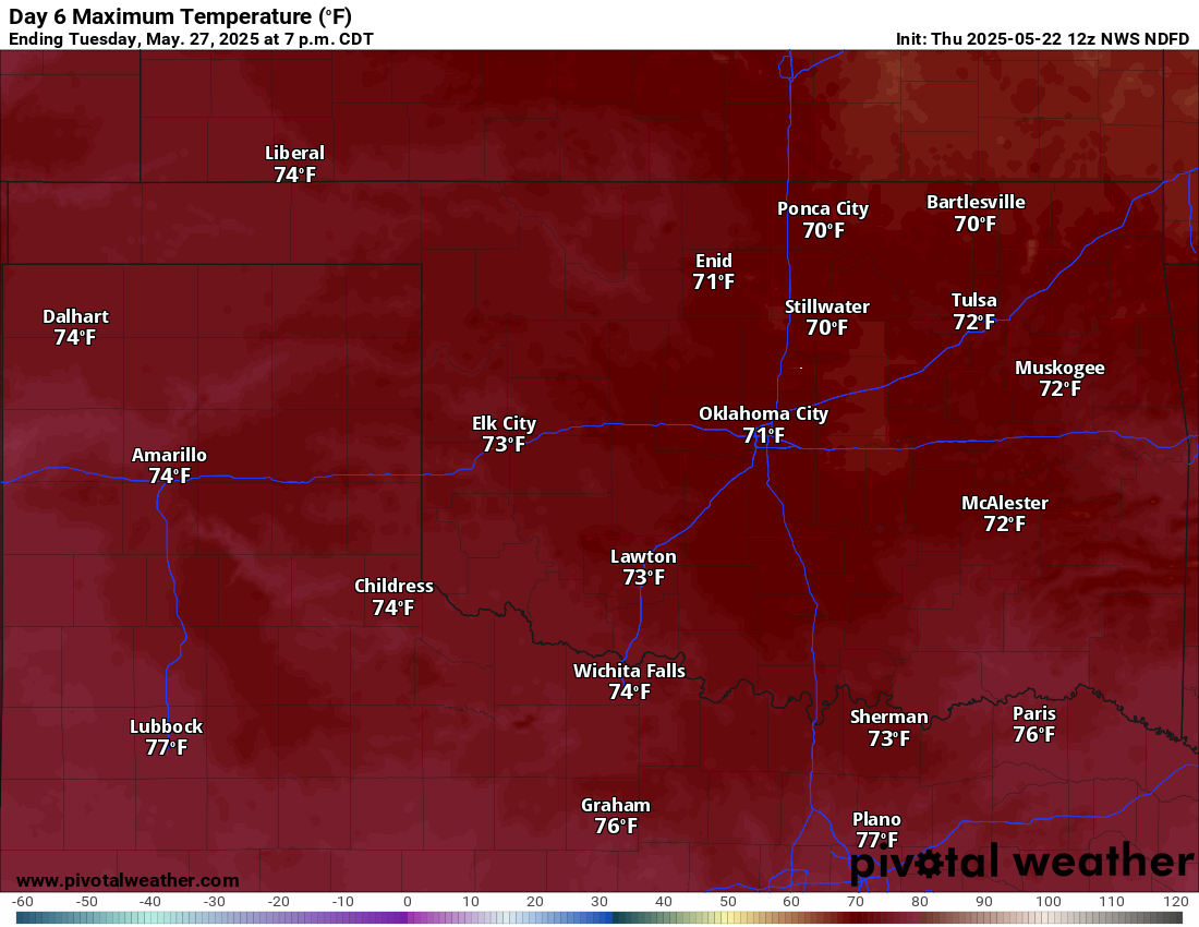
rainfall map above shows us, the weather will remain unsettled over the next
few days with more chances of severe weather. Not quite as high end as this last
batch, hopefully, but it is May and these things can escalate in a hurry.
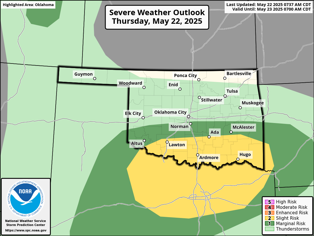
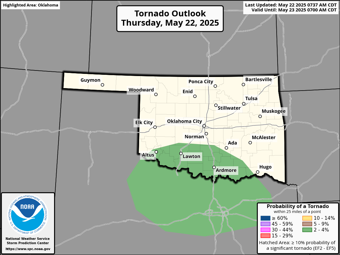
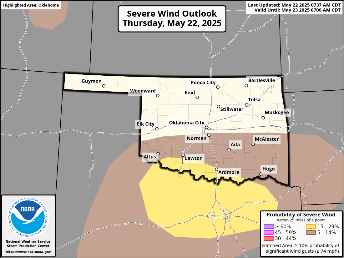
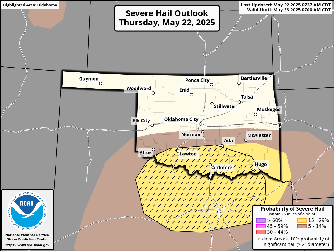
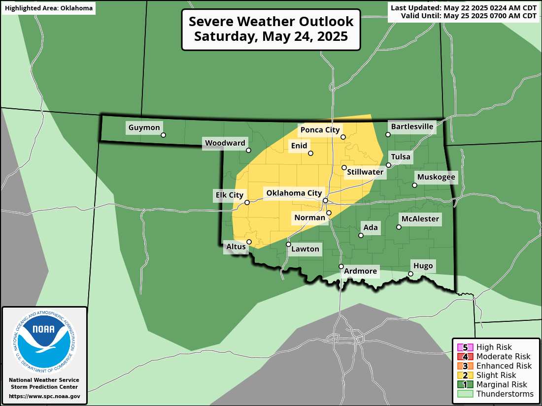
South-central Oklahoma is the threat zone today, and that will shift around a bit
over the weekend.
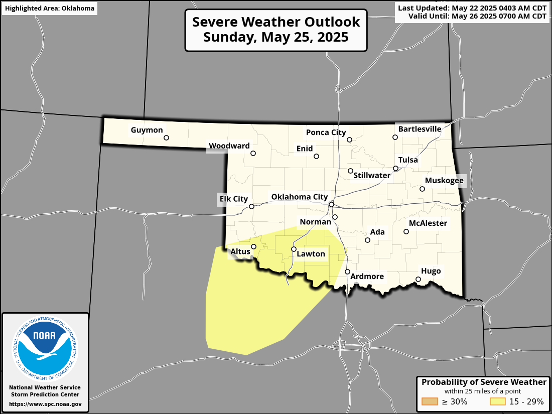
That Sunday is a bit concerning, of course, but almost (not really, just for
effect) as concerning to me is that we're gonna take a trip back to March with
a strong cold front dropping us into the 40s and 50s for lows and 60s and 70s
for highs early next week, including on Memorial Day!
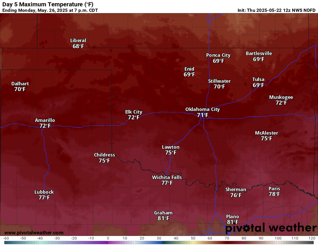
Are you kidding me, Memorial Day? More like Brrr-morial Day. Some of those
temperature dips will be due to incessant rain, and some from the cold front.
At any rate, Mother Nature is about to March our late-May for awhile.
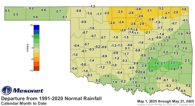
The good news is it's gonna rain again, which we've started to see slack off
after our crazy wet April, and now we're working on a 2-week+ dry spell.
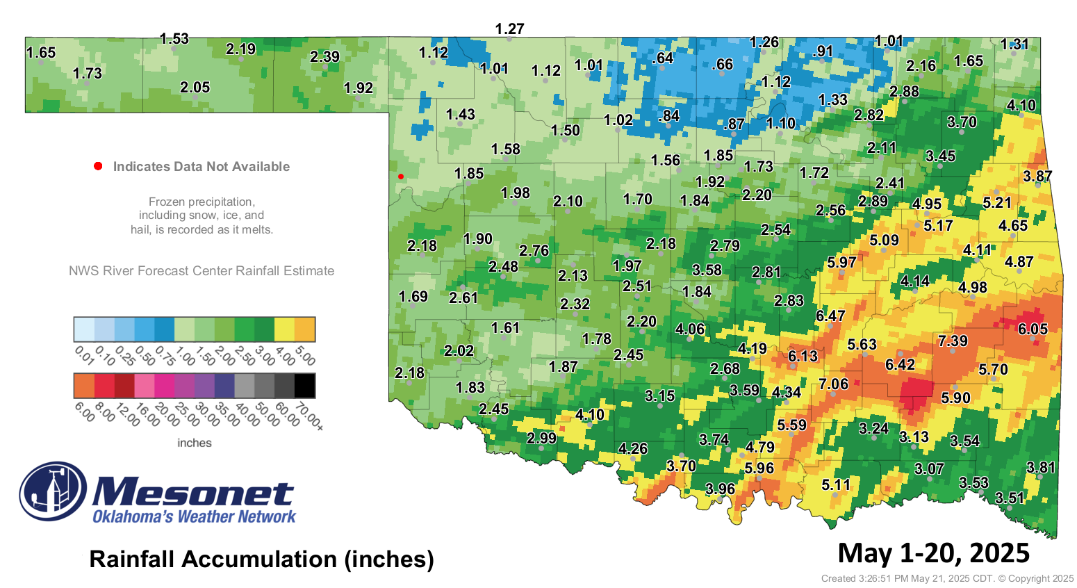
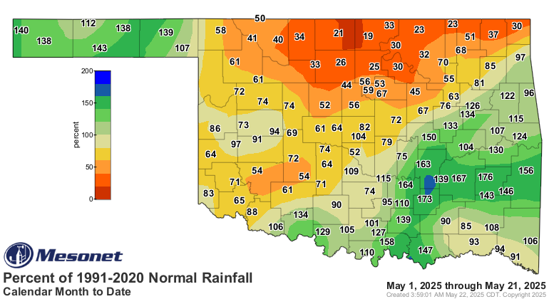
The bad news is most of it is gonna avoid western Oklahoma where we need it the
most to boost our ailing May rainfall totals.
As always, stay weather aware for the next 5 days or so and remember, NOBODY
should be going barenaked, especially while singing.
Gary McManus
State Climatologist
Oklahoma Mesonet
Oklahoma Climate Survey
gmcmanus@ou.edu
May 22 in Mesonet History
| Record | Value | Station | Year |
|---|---|---|---|
| Maximum Temperature | 104°F | ALTU | 2000 |
| Minimum Temperature | 32°F | EVAX | 2019 |
| Maximum Rainfall | 3.92 inches | HOLL | 2016 |
Mesonet records begin in 1994.
Search by Date
If you're a bit off, don't worry, because just like horseshoes, “almost” counts on the Ticker website!