Ticker for April 18, 2025
MESONET TICKER ... MESONET TICKER ... MESONET TICKER ... MESONET TICKER ...
April 18, 2025 April 18, 2025 April 18, 2025 April 18, 2025
Ruh Roh
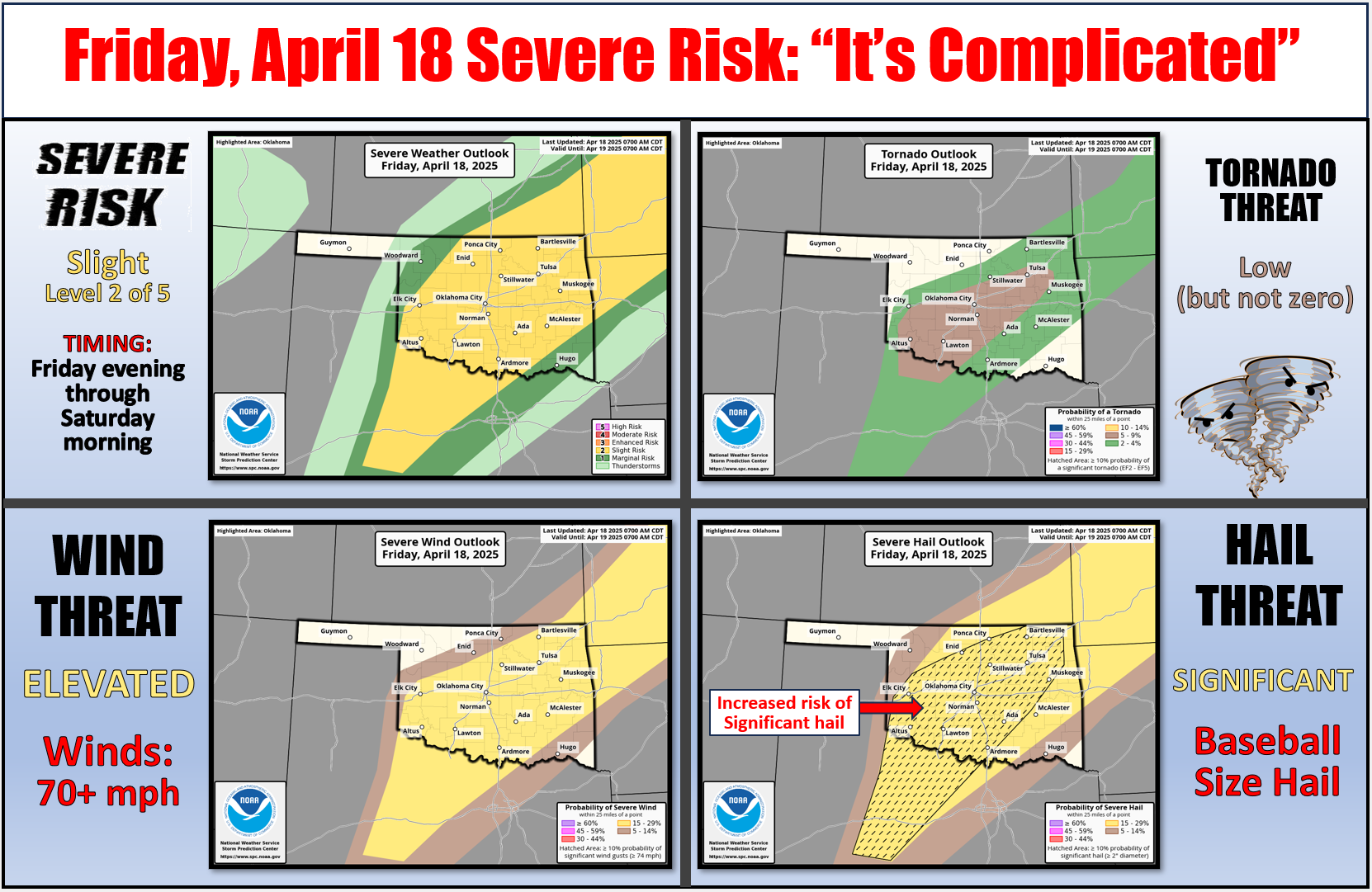
Yeah, a Friday Ticker is never good. Well, NO Ticker is ever good...I mean, look
who's writing it (I HEARD THAT!). But today just has that feel to it. You know,
one of those days when you wake up in the morning and it smells tornadoey. Here's
the deal though...tornadoes aren't the biggest threat today, but the threat is
there nonetheless. Moretheless either.
As the SPC folks said: "Even with a higher concentration of thunderstorms expected
across the southern Plains, the messy convective mode this evening and tendency
for convection to be undercut by the cold front currently limit confidence in
delineating a corridor of greater severe hail/wind potential."
That's the "it's complicated part." I'm not gonna bore ya much longer (been doing
that since 2009), but the hail is what'll get ya. And after that? Well, as we get
into next week, watch for animals bunching together in 2X2s. And if they're
difference species...REALLY watch out, because it's gonna rain if you believe
the Weather Prediction Center's 7-day rainfall forecast.
A lot.
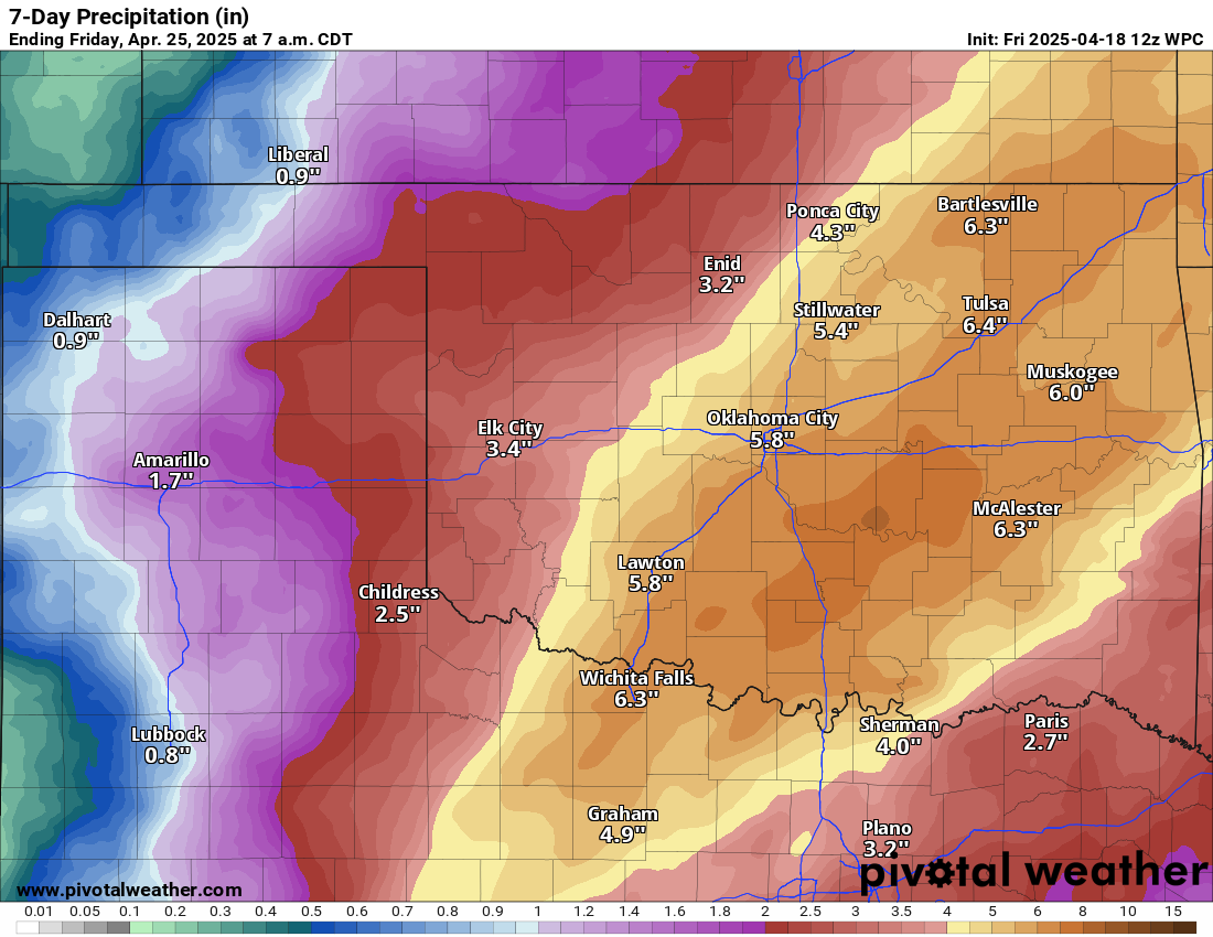
Jeez, that's like 7-8 inches of rain in spots. And you know there'll be a bit
more, a bit less in localized areas. Kind of like my hair, except mostly a lot
less.
I said I wouldn't bore ya too long. Are you not not entertained?
Gary McManus
State Climatologist
Oklahoma Mesonet
Oklahoma Climate Survey
gmcmanus@ou.edu
April 18 in Mesonet History
| Record | Value | Station | Year |
|---|---|---|---|
| Maximum Temperature | 101°F | ALTU | 2011 |
| Minimum Temperature | 22°F | BOIS | 2013 |
| Maximum Rainfall | 3.17 inches | TAHL | 2009 |
Mesonet records begin in 1994.
Search by Date
If you're a bit off, don't worry, because just like horseshoes, “almost” counts on the Ticker website!