Ticker for April 17, 2025
MESONET TICKER ... MESONET TICKER ... MESONET TICKER ... MESONET TICKER ...
April 17, 2025 April 17, 2025 April 17, 2025 April 17, 2025
All is wet
What do you do when life gives you lemons?
Dammit Jim, I'm a climatologist, not a grocer! How would I know? Some say make
lemonade, but I don't know you you turn the lemons into those little crystals that
you scoop out of the can and put in water to make it.
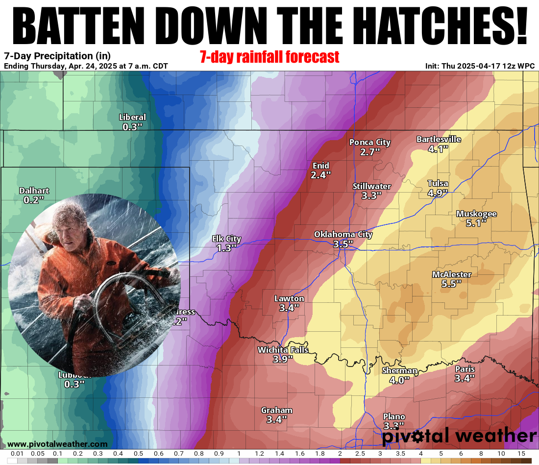
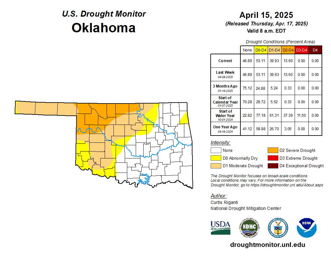
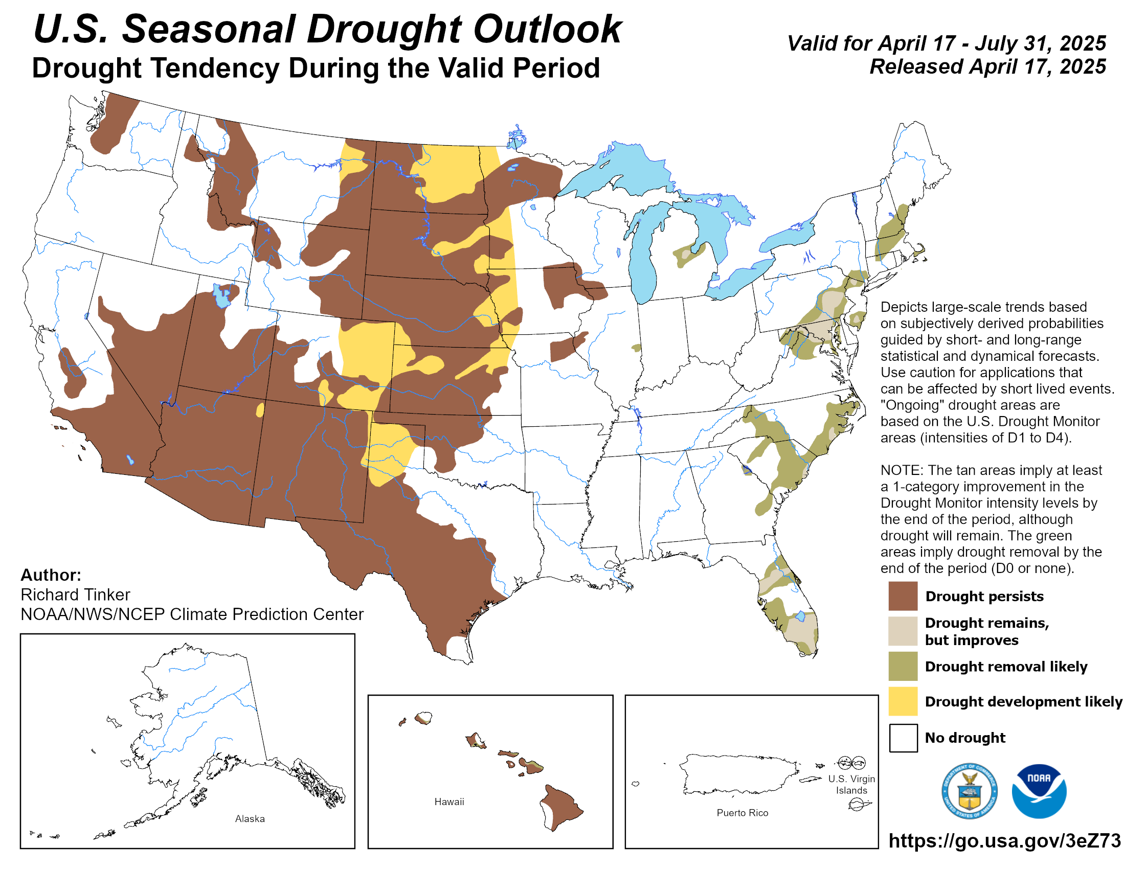
We CAN make something of the current forecast, though, including knocking some of
this drought out.
Obviously, the disconnect there is in the NW third of the state where the rainfall
forecast isn't as much, but we can work with the moisture we get. It's not like
we have a choice, but coming from where we were a month ago with 130+ consecutive
days without significant moisture, this will still be a big improvement. And you
never know, these storms could over-produce.
Yikes! What a thing to say for a late-April storm system in Oklahoma, right?
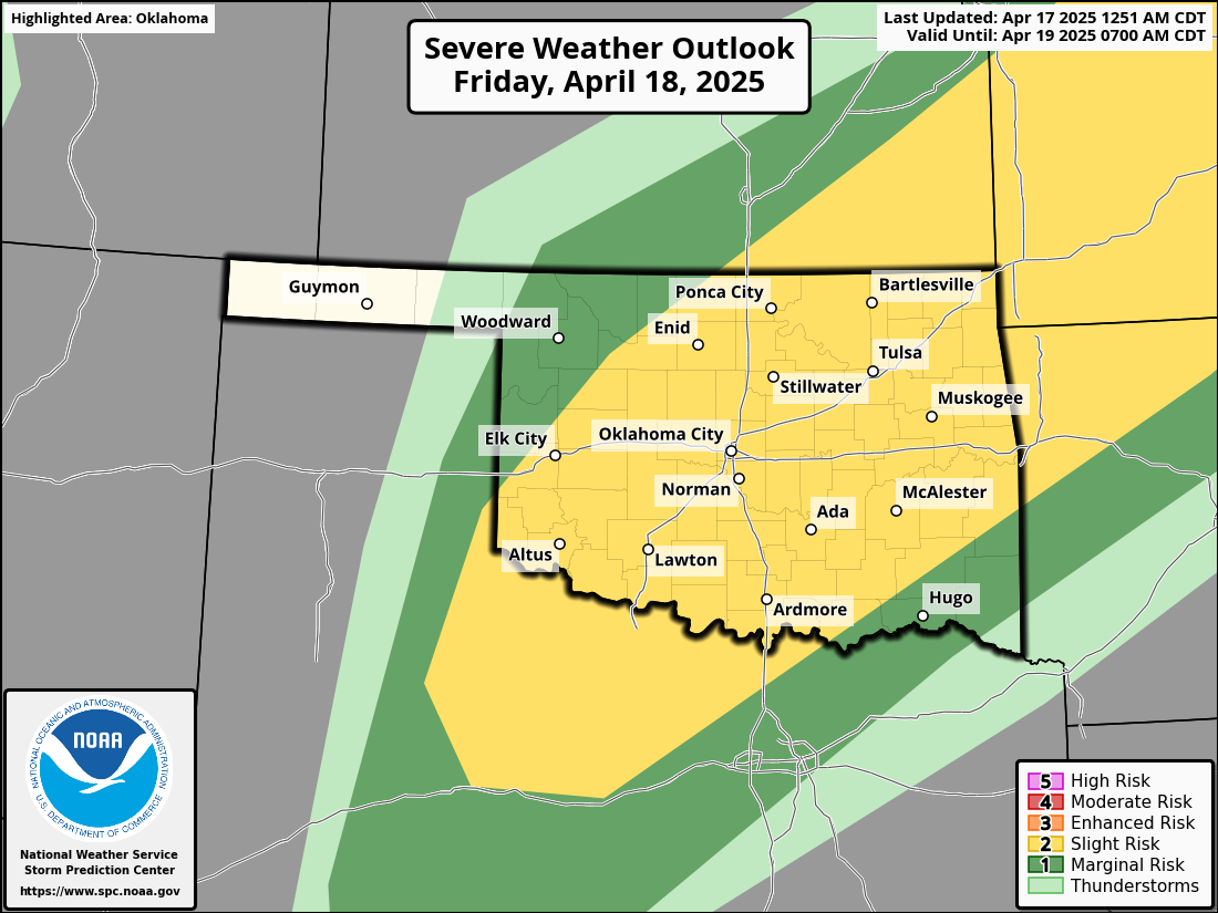
Well, I mean overproduce on the RAINFALL side, not the severe side. Speaking
of severe, there will be a chance for severe weather tomorrow and Saturday,
so you know the drill. No, not the power drill (DEWALT, of course), the severe
weather safety drill...it might be needed starting tomorrow.
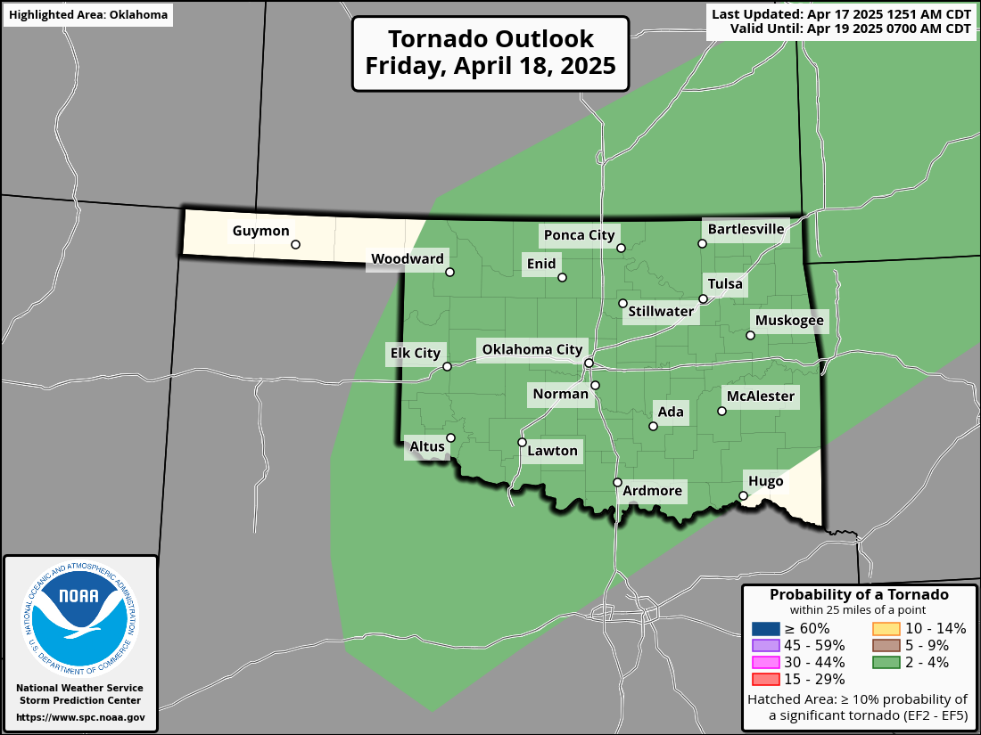
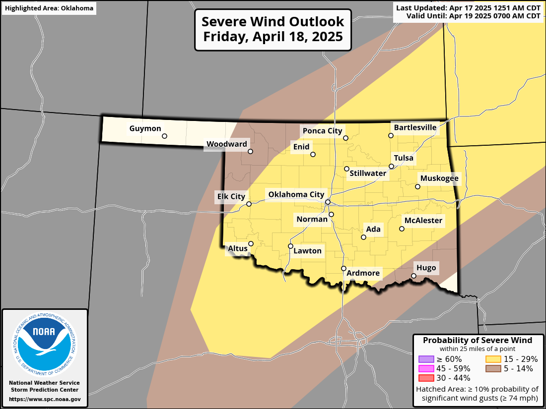
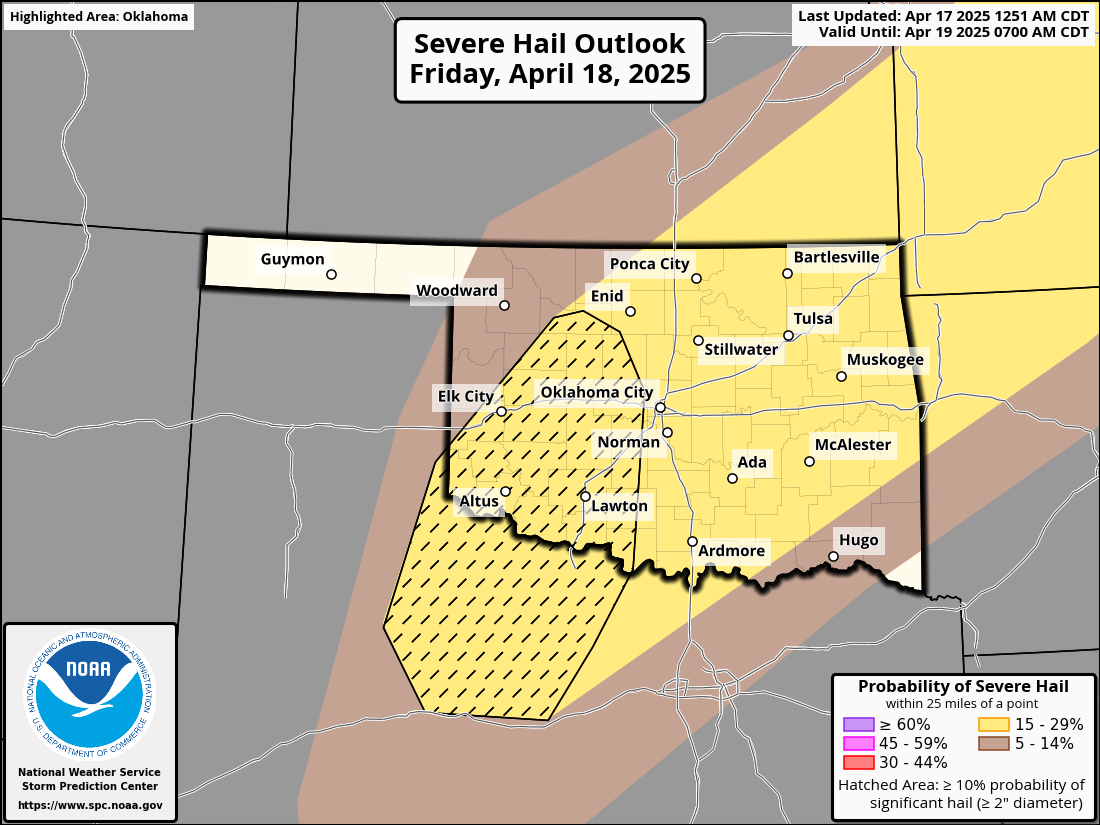
Tornado threat is low, but not zero. What's the worst that could happen? Well,
you know already, so stay weather aware. Then we see another round Saturday.
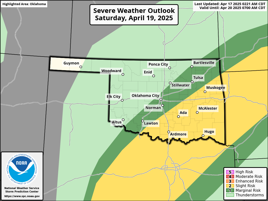
And then maybe another round or two next week. For today though, we still have
to worry about fire danger. We also have to worry about no spaces after periods,
but that's for another day.We'll be okay. See!
Back to fire danger, a Red Flag Fire Warning has been issued for the NW corner
of the state, and it is obviously not a good day to burn anything anywhere in
the state with this wind.
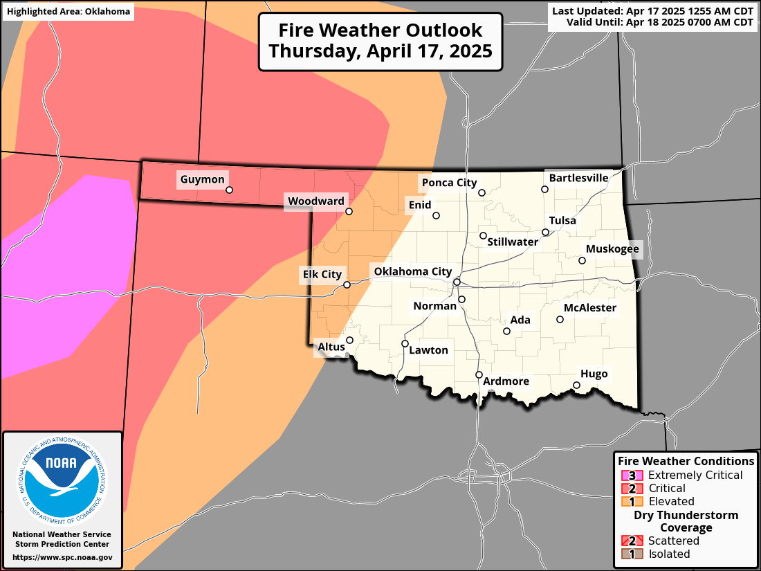
The Panhandle could see gusts up to 65 mph today, and as we go from west
to east, probably in the 35-45 mph range. Maybe a rogue 50 here or there.
Let's look into the future, though. I see...I see no hair, still! RATS! But I
also see more chances for rain as we go through the rest of April.
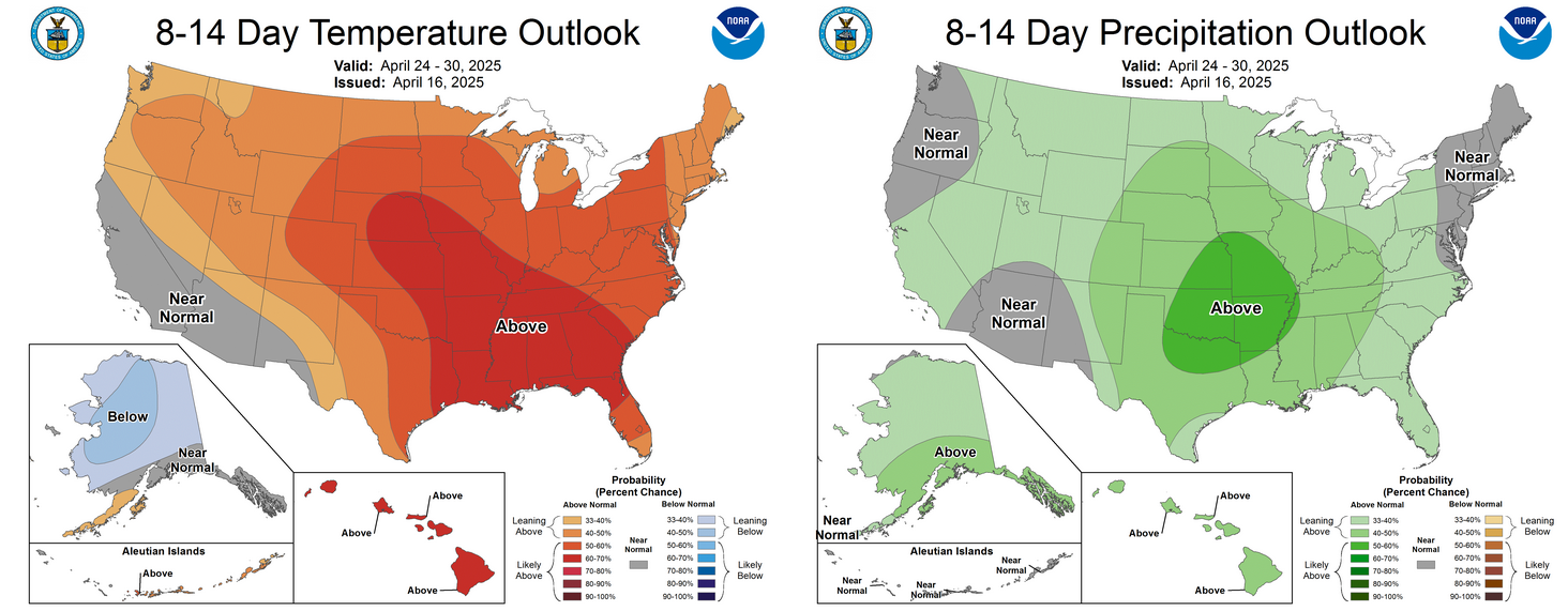
What's significant there is the increased odds of above normal precip that last
week of April, since that's also getting into the climatological wettest part
of the year, so above normal rainfall for that period...noice!
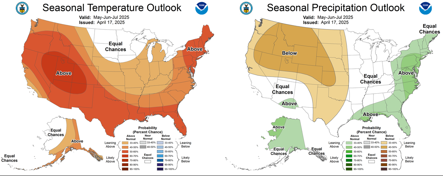
The May-July outlooks, not so great, but we'll worry about those when we come
to those periods.
Gary McManus
State Climatologist
Oklahoma Mesonet
Oklahoma Climate Survey
gmcmanus@ou.edu
April 17 in Mesonet History
| Record | Value | Station | Year |
|---|---|---|---|
| Maximum Temperature | 102°F | GRA2 | 2006 |
| Minimum Temperature | 22°F | BOIS | 2020 |
| Maximum Rainfall | 6.57 inches | MEDI | 2013 |
Mesonet records begin in 1994.
Search by Date
If you're a bit off, don't worry, because just like horseshoes, “almost” counts on the Ticker website!