Ticker for March 31, 2025
MESONET TICKER ... MESONET TICKER ... MESONET TICKER ... MESONET TICKER ...
March 31, 2025 March 31, 2025 March 31, 2025 March 31, 2025
April foolish
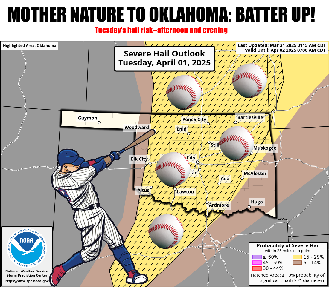
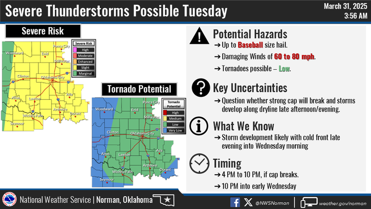
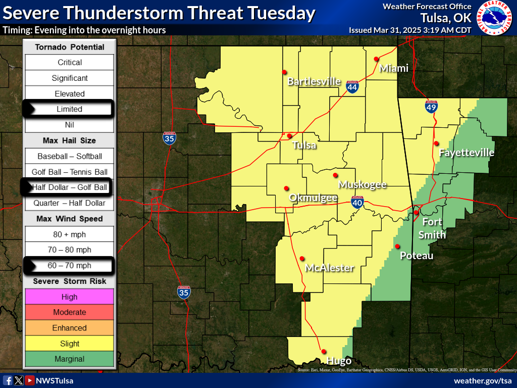
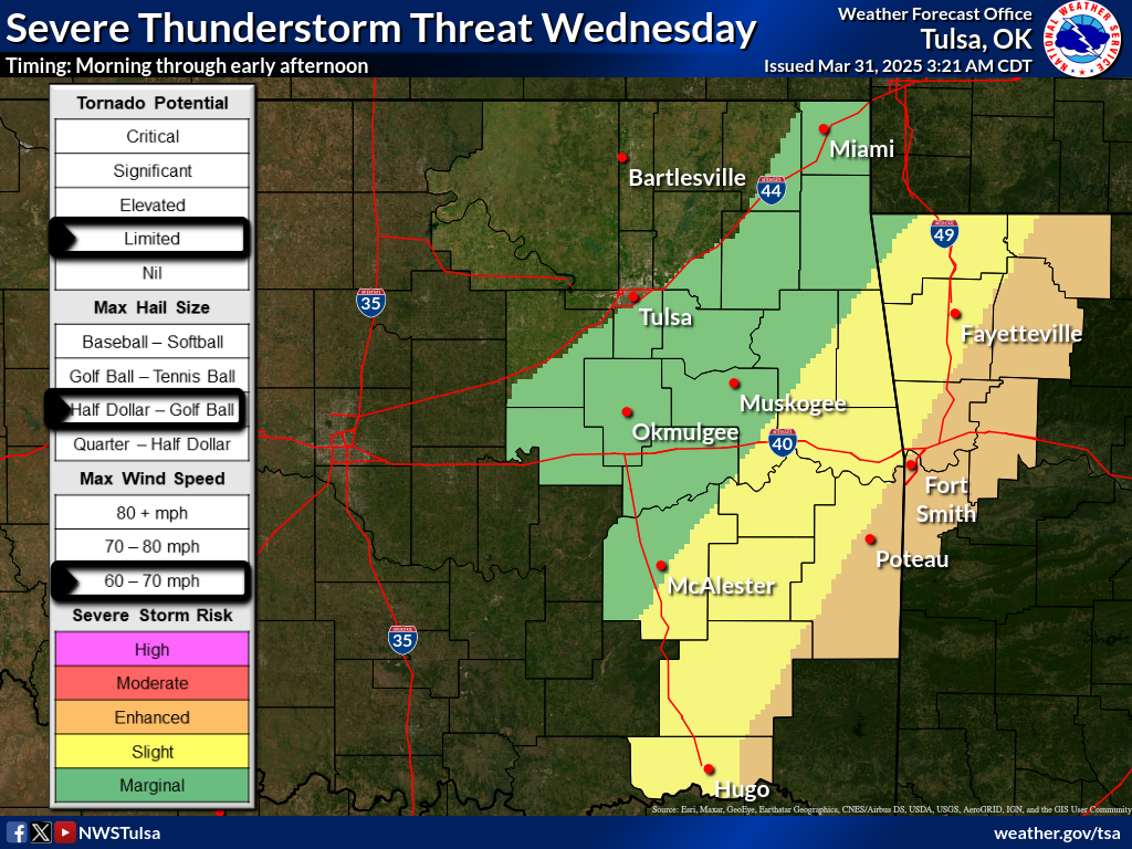
What the hail is going on around here? Fresh off our hailers from Saturday night/
Sunday morning, we have another POTENTIAL round of significant severe weather on
the line for Tuesday.
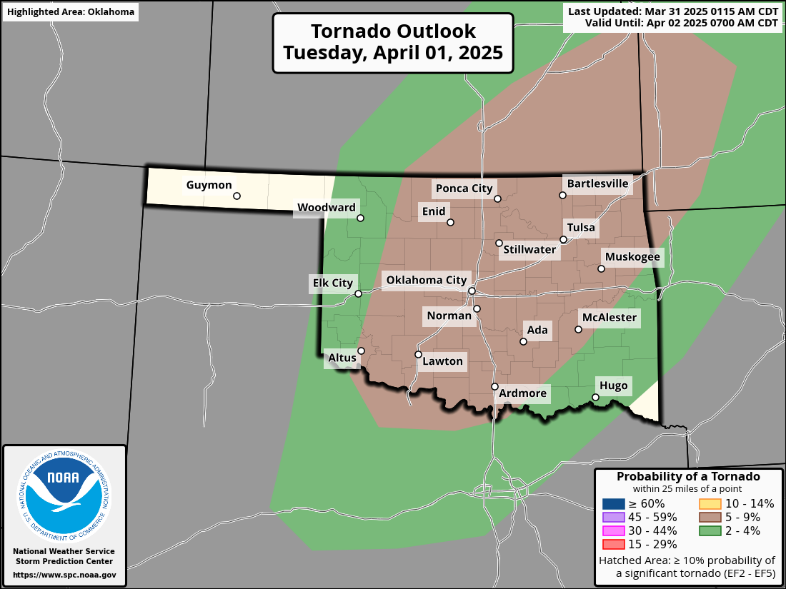
Tornadoes? Sure, but the hail'll could be what gets ya, putting knots on your
noggin faster'n you can rub 'em. Now obviously storms actually have to form in
the first place, and there is an indication a somewhat strong cap, or lid on
the atmosphere, will be in place. This layer of warm air thousands of feet above
the surface would act as a dead-stop for that air rising explosively upwards
(think the Taco Bell effect, but vertically) and forming thunderstorms. If we get
enough heating along and ahead of that dryline that will be in place, however...
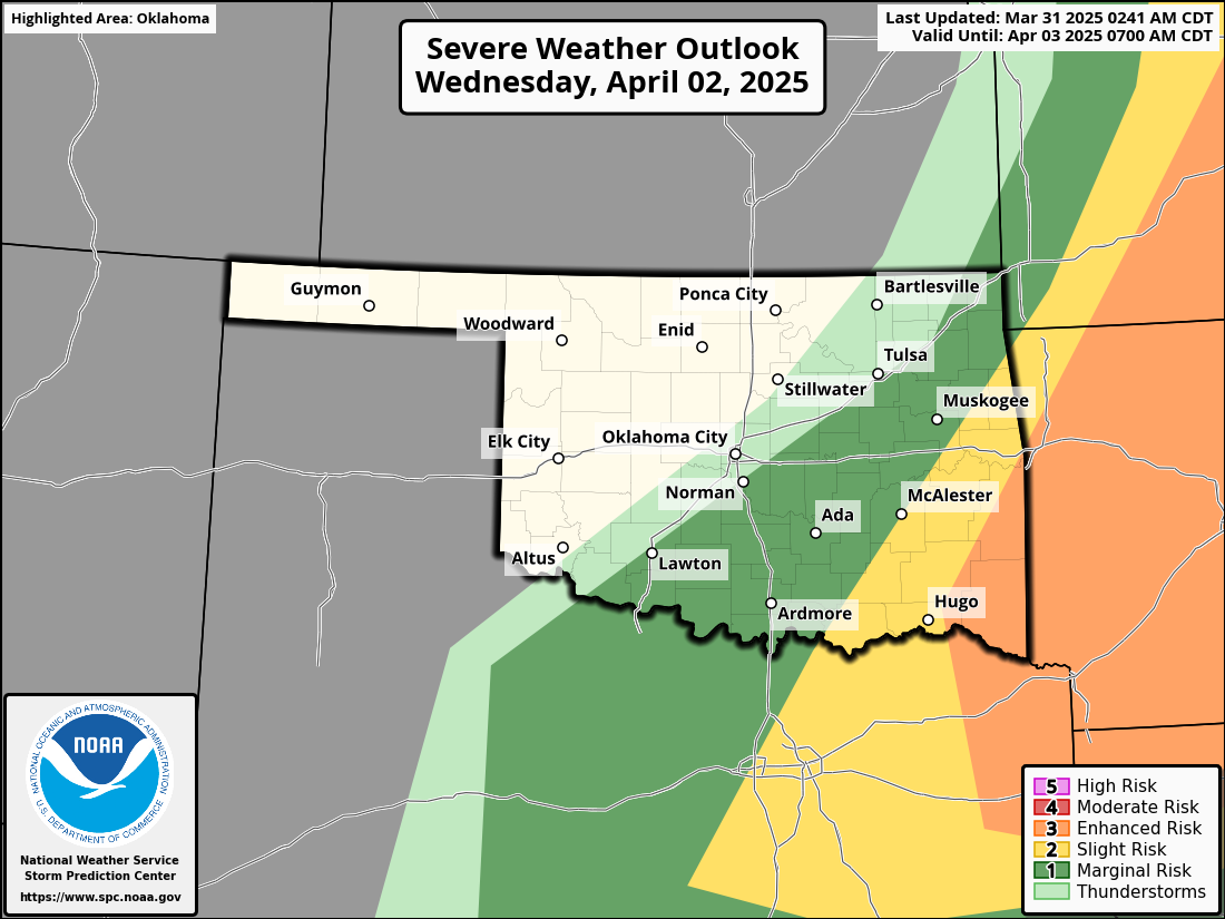
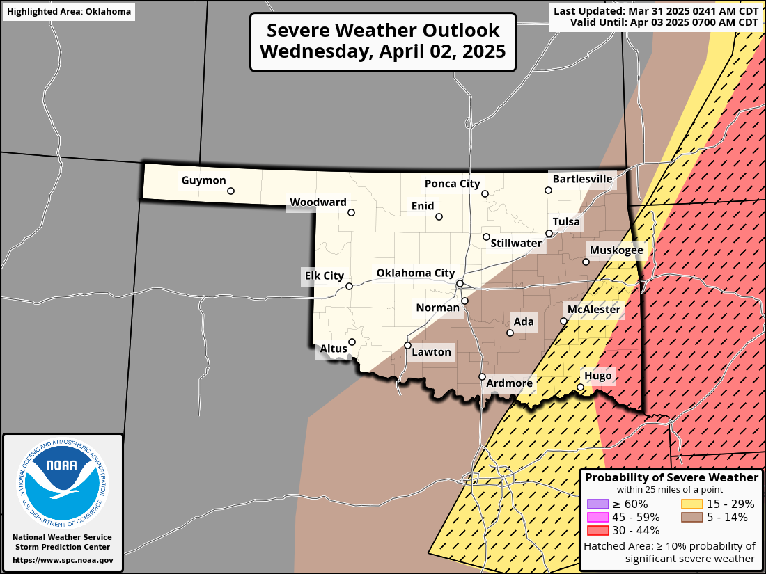
watch out. Here are the gruesome details as of now, from our fine friends at the
Storm Prediction Center.
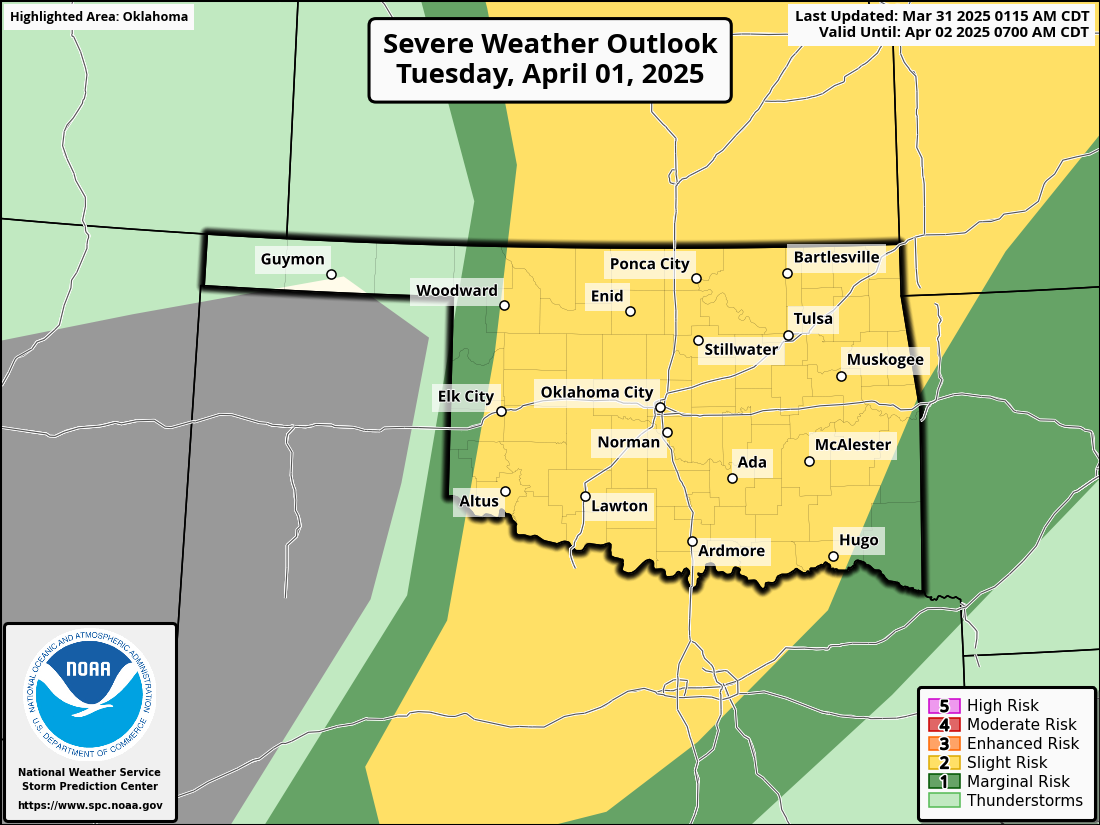
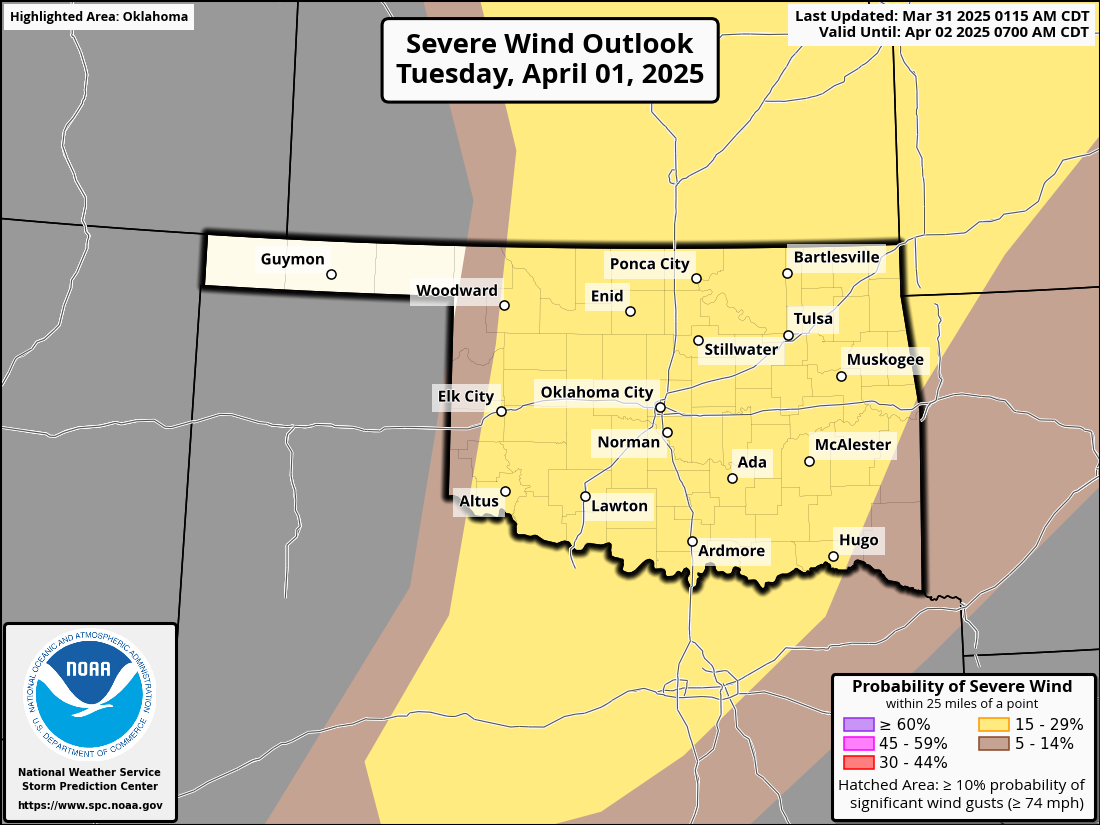
Annnnddddd, this forecast will continue to evolve and shift around a bit, and
maybe get a bit better (i.e., less violent). Always remember, though, that it
could get worse. Like in far SE OK the following day.
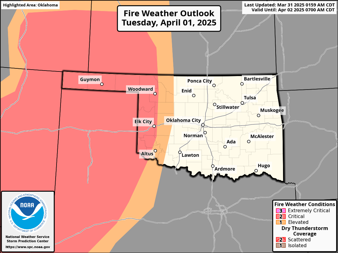
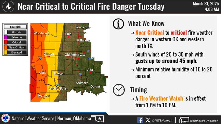
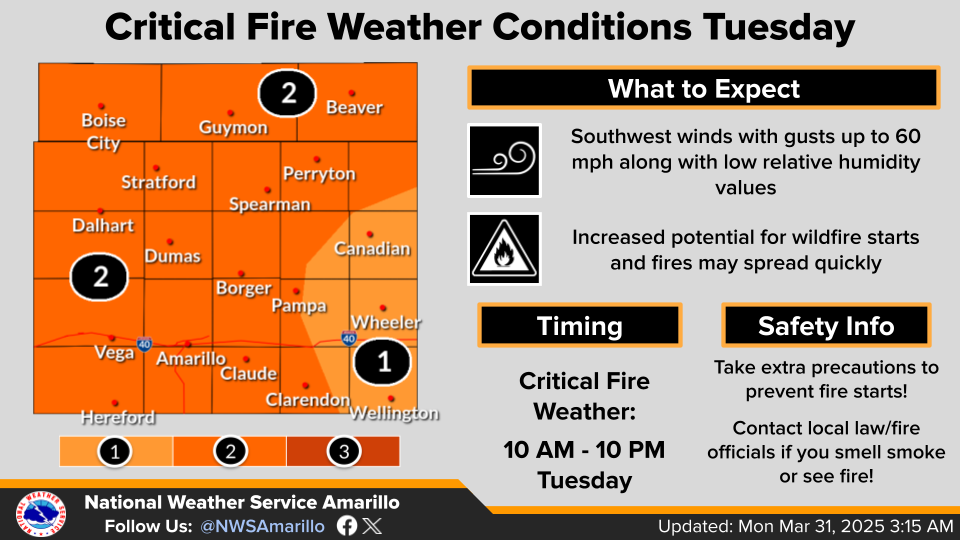
Now let's fine-tune it with some words (or pictures) from our fine friends
at the local NWS offices.
And if there's gonna be a dryline, with all that dead/dormant vegetation out
there waiting on some rain to green up, that means there's gonna be some fire
danger. LOTS of fire danger, possibly.
I guess the good news with all this is we can at least get some rain. Well, that
and I'll be getting anxious/excited about the weather, which will lead to
multiple bouts of Cherry Pop-Tart consumption! But that rain, along with the
storms Tuesday and Wednesday, we should see several consecutive days with good
chances of moisture.
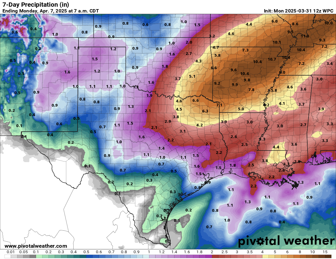
Holy flooding threat, Batman! Those are some major amounts down in southeast
OK. Unfortunately, NW OK sees a forecast of Corporal Amounts. I would have
said "Private Amounts" but that's, uhhhhhhh, private.
Gary McManus
State Climatologist
Oklahoma Mesonet
Oklahoma Climate Survey
gmcmanus@ou.edu
March 31 in Mesonet History
| Record | Value | Station | Year |
|---|---|---|---|
| Maximum Temperature | 97°F | BUTL | 2010 |
| Minimum Temperature | 16°F | EVAX | 2019 |
| Maximum Rainfall | 5.36 inches | BOWL | 2015 |
Mesonet records begin in 1994.
Search by Date
If you're a bit off, don't worry, because just like horseshoes, “almost” counts on the Ticker website!