Ticker for March 27, 2025
MESONET TICKER ... MESONET TICKER ... MESONET TICKER ... MESONET TICKER ...
March 27, 2025 March 27, 2025 March 27, 2025 March 27, 2025
Wait!
This might be the latest Ticker I've ever sent out (and with the Ticker, sometimes
better never than late), but I've been waiting on the U.S. Drought Monitor maps
to be produced on the USDM site. There was some sort of snafu, which is better
than a debacle, but worse than a fiasco.
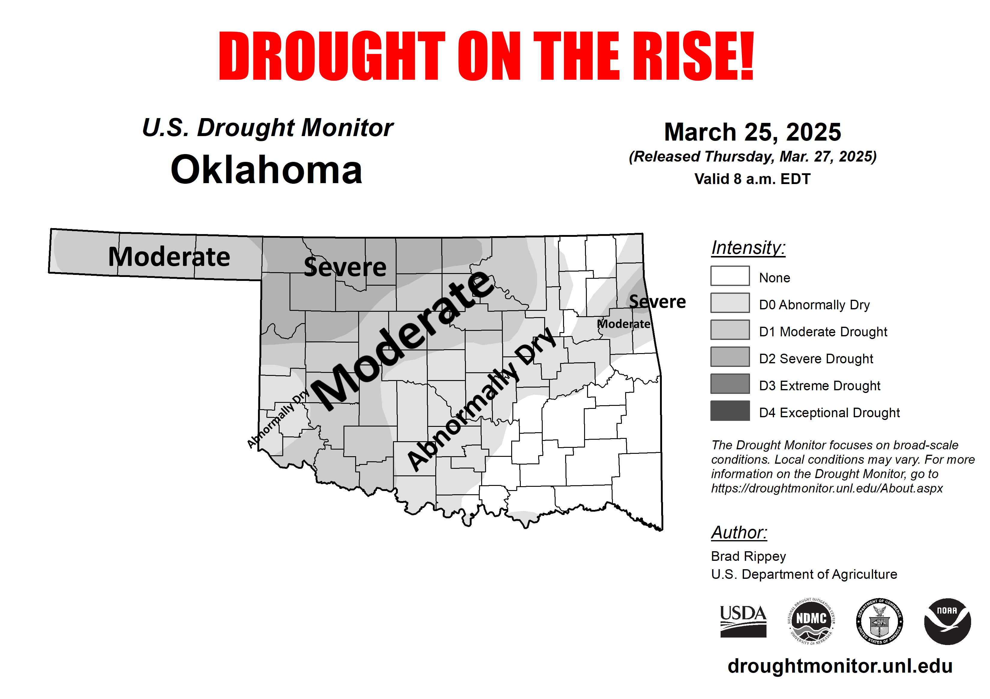
The best I could find even this late in the day was this black and white map, so
don't adjust your sets. And speaking of fiascos, we see yet another month with
advancing drought across the state, and if you look at the last month as a whole,
a broad resurgence of this drought that began all the way back in August 2021.
This map is in color, for some reason.
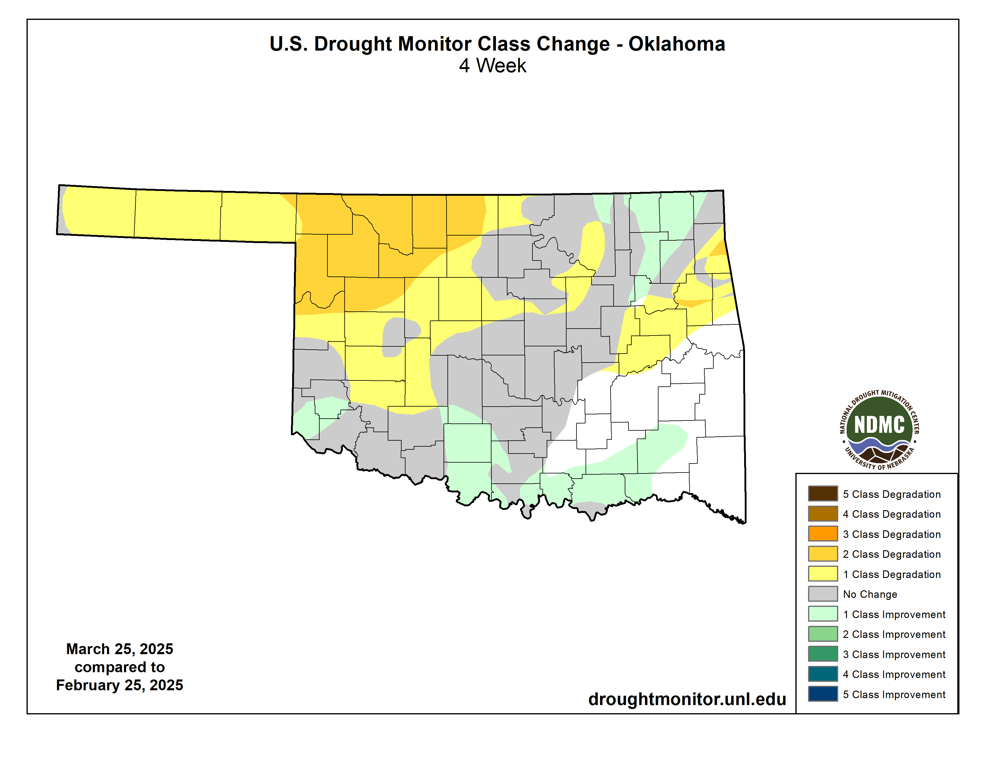
Must be nice to have the 64-count box of Crayons for the change maps! All I ever
had was the 12-pack of candle-like Crayoffs, the knockoff you used to be able to
buy at Gibson's (google it, kids).
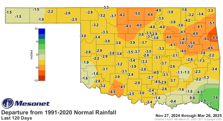
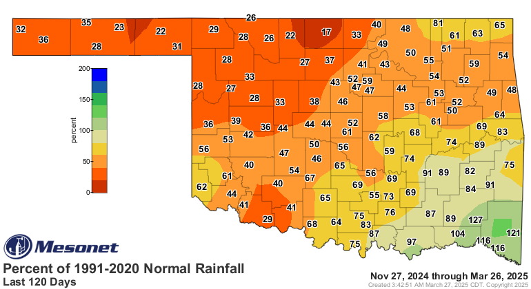
The reason for the drought's resurgence is obvious, but I'll show you again.
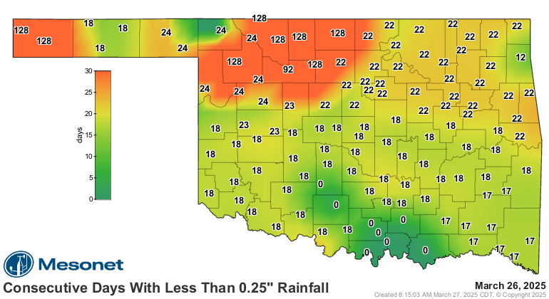
We've simply been mired in yet another long-term dry spell across much of the
northern and western parts of the state, and not doing exactly great in other
areas on the 14-21 day time frame.
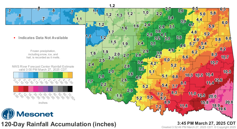
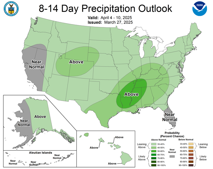
And for much of that area, still looks a bit bleak. Okay, a LOT bleak.
After that...maybe (and you can fill in the "not" or "so").
Okay, that's it. Go home. Tell your boss I said so.
Gary McManus
State Climatologist
Oklahoma Mesonet
Oklahoma Climate Survey
gmcmanus@ou.edu
March 27 in Mesonet History
| Record | Value | Station | Year |
|---|---|---|---|
| Maximum Temperature | 91°F | WAUR | 2008 |
| Minimum Temperature | 11°F | KENT | 2005 |
| Maximum Rainfall | 3.74 inches | STIG | 2018 |
Mesonet records begin in 1994.
Search by Date
If you're a bit off, don't worry, because just like horseshoes, “almost” counts on the Ticker website!