Ticker for March 4, 2025
MESONET TICKER ... MESONET TICKER ... MESONET TICKER ... MESONET TICKER ...
March 4, 2025 March 4, 2025 March 4, 2025 March 4, 2025
Fittstown 'nader?
I hereby declare with the power vested in me by the State of Oklahoma, whoever
produces Pop-Tarts, as well as the lead singer of 90s rock band Blind Melon, that
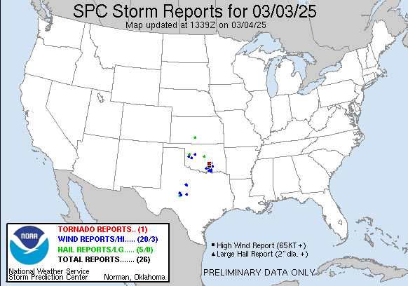
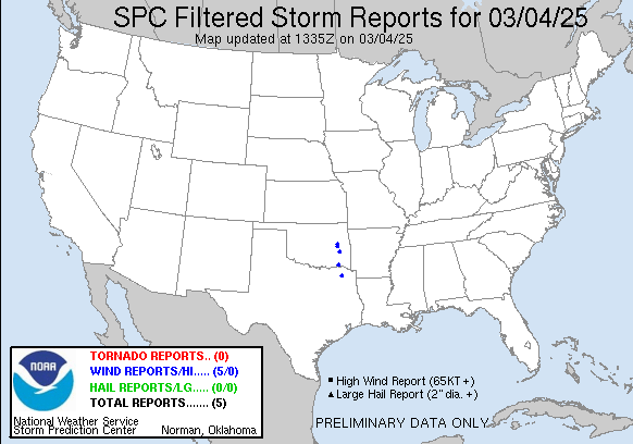
severe weather season can go kick rocks. We had a slew of tornado warnings last
night, and now a slew of damage reports from this morning in places like Ada,
Durant, Lake Texoma, Johnston County, and more wind/hail reports to go along
with the line that moved through overnight and into this morning.
Heck, it's storming right now for crying out loud!
Those possible tornado encounters will have to be investigated by our awesome
friends and the impacted NWS offices, but there were obviously a few tornadoes
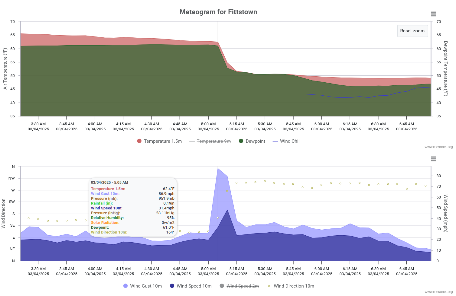
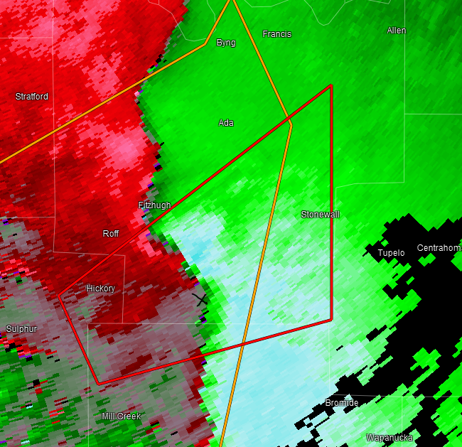
at least. Was our Fittstown Mesonet site visited by a tornado, or tornado
adjacent? It has the signs on the meteogram, with the sudden drop in pressure
and a wind gust of 87 mph. Could have been tornado-adjacent, rear flank
downdraft, or something similar. But Pontotoc County was hit hard nonetheless.
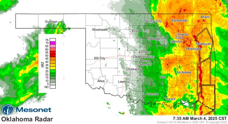
You can see the radar velocity image here where there was a tornado warning,
including our Fittstown site (marked by the "x").
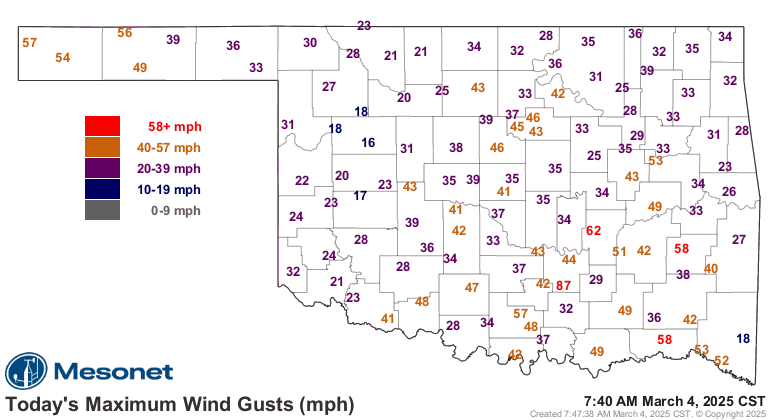
More slews: lots of severe gusts with the line of storms.
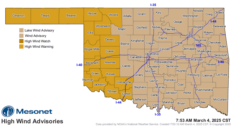
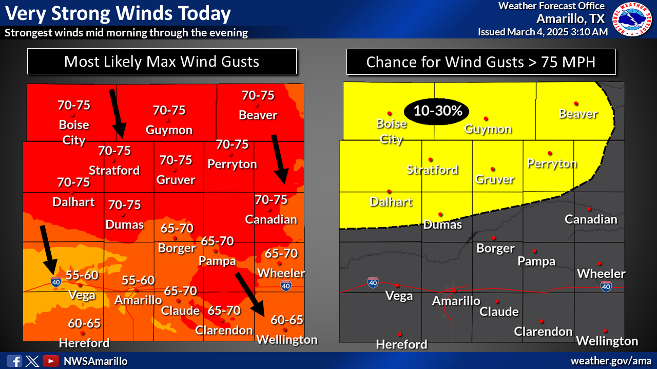
The winds are just now picking up in the Panhandle, and those winds are now the
biggest concern as the line of storm exits the state. It won't make clean up
or damage survey attempts any easier as winds are expected to gust up to 75 mph
in the Panhandle to 45 mph in eastern OK.
75 mph non-thunderstorm wind gusts!!
Saving the best for last. Funyuns! I mean, rain! We had a drought-halting rain
over quite a bit of the state, just as it looked as if we were gonna have a
massive leap for the second week in a row on the Drought Monitor map. We still
need more...lots more in places, but this helps as we look at how this storm
system over-performed in some areas.

That about covers today (and last night). Time to batten hatches as we endure
the winds for the next 24 hours or so.
Gary McManus
State Climatologist
Oklahoma Mesonet
Oklahoma Climate Survey
gmcmanus@ou.edu
March 4 in Mesonet History
| Record | Value | Station | Year |
|---|---|---|---|
| Maximum Temperature | 91°F | HOLL | 2009 |
| Minimum Temperature | -5°F | VINI | 2002 |
| Maximum Rainfall | 5.31 inches | KING | 2004 |
Mesonet records begin in 1994.
Search by Date
If you're a bit off, don't worry, because just like horseshoes, “almost” counts on the Ticker website!