Ticker for March 3, 2025
MESONET TICKER ... MESONET TICKER ... MESONET TICKER ... MESONET TICKER ...
March 3, 2025 March 3, 2025 March 3, 2025 March 3, 2025
Twisty spinny things.
Okay, who is officially (or even unofficially) NOT ready for tornadoes and other
spinny-twisty things already? I mean, unless we're talking a Pop-Tart tornado.

Now we're talking! Well, writing and reading, I guess. Have you finished your
paper, by the way?!?
We had our first tornado warning of the season yesterday, no actual tornadoes
that I know of. I started to say "no actual tornado touchdowns" but a tornado
by definition "touches down," otherwise it'd be a funnel.
Learn this and other facts in my new book: "The Pedantically Fussy Climatologist."
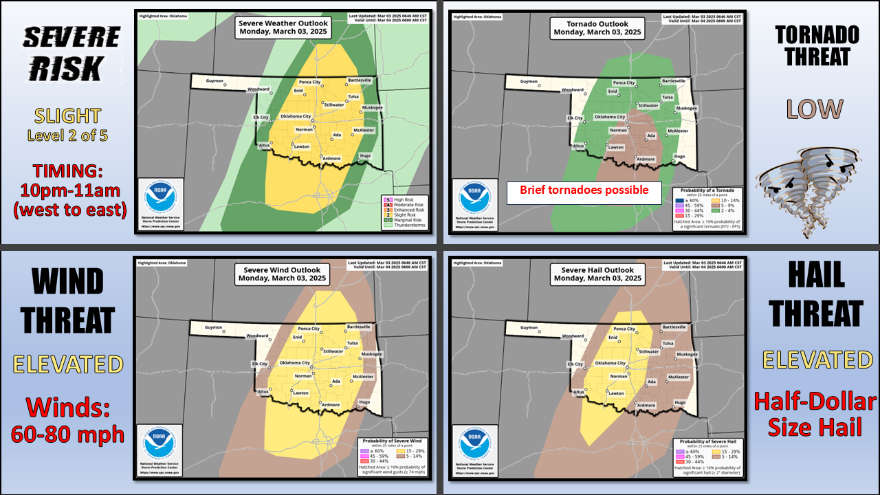
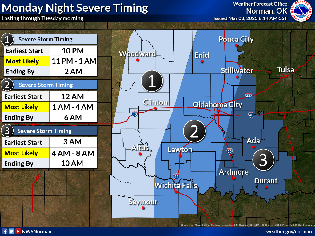
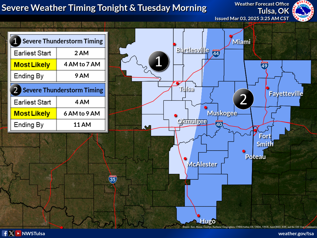
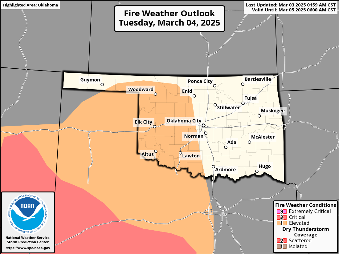
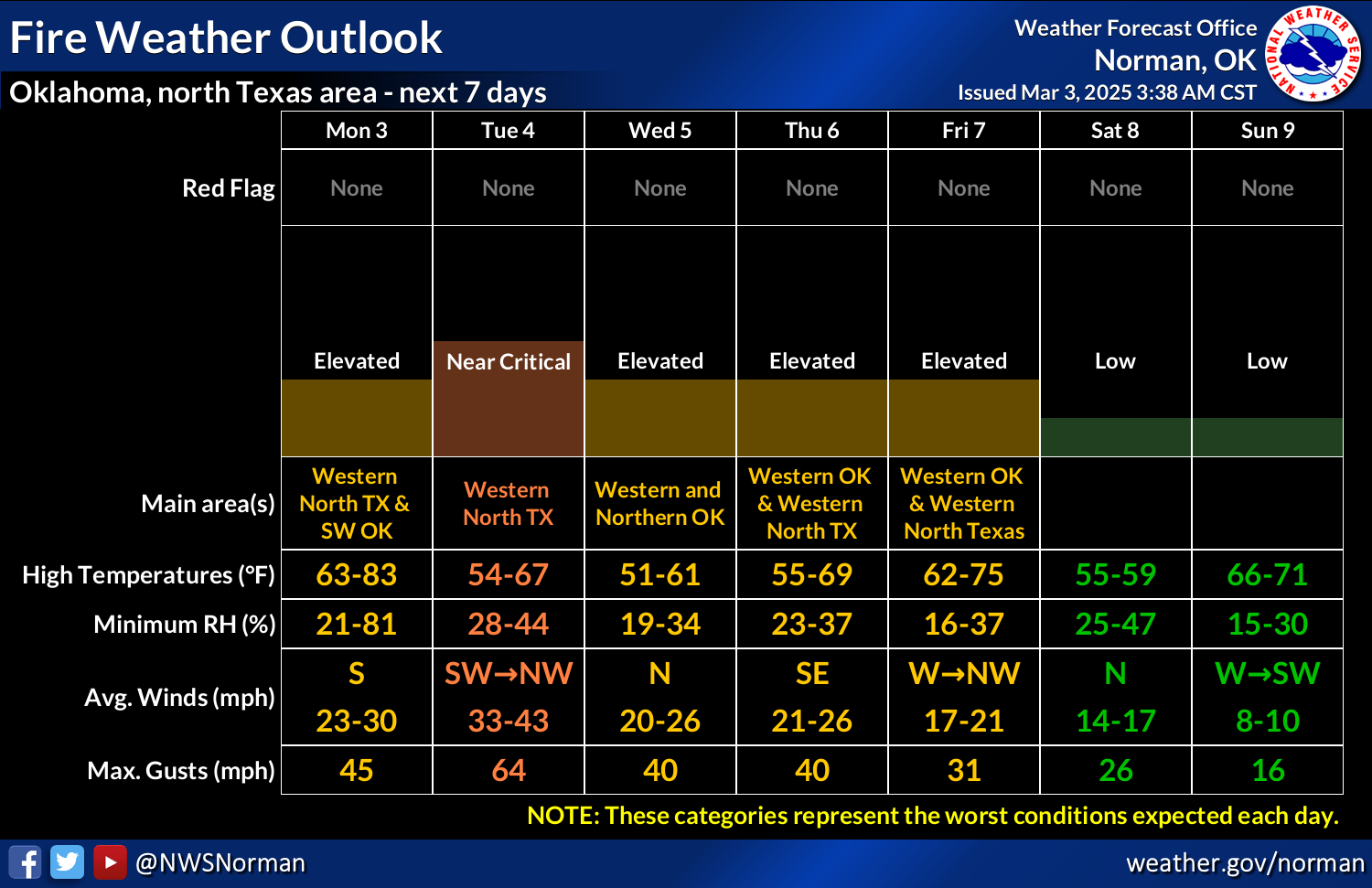
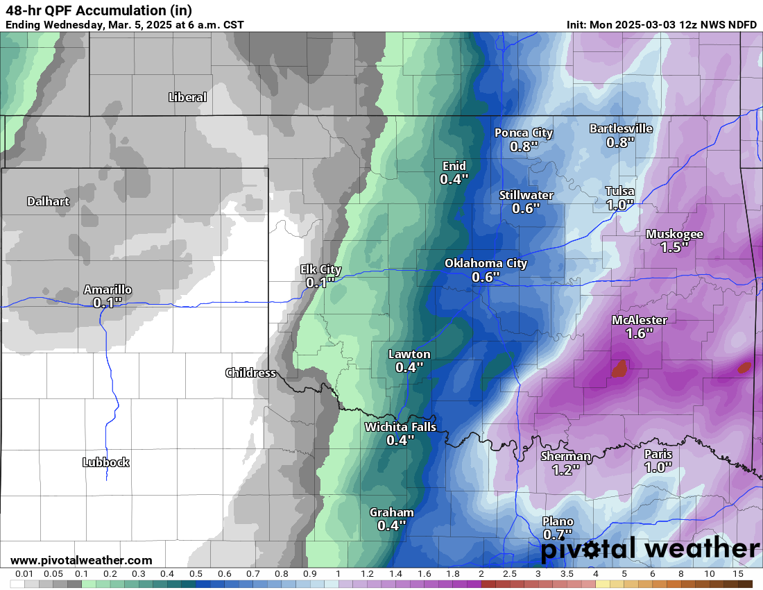
Storms should fire later tonight as a cold front catches up to a dryline across
NW OK and rapidly form into a line. We're lucky on the timing since it'll be
overnight so not a lot of heat to work with (i.e., lacking instability), and
also a bit low on the Gulf moisture. However, still enough to give us some
large hail, severe winds, and brief twisty-spinny things.
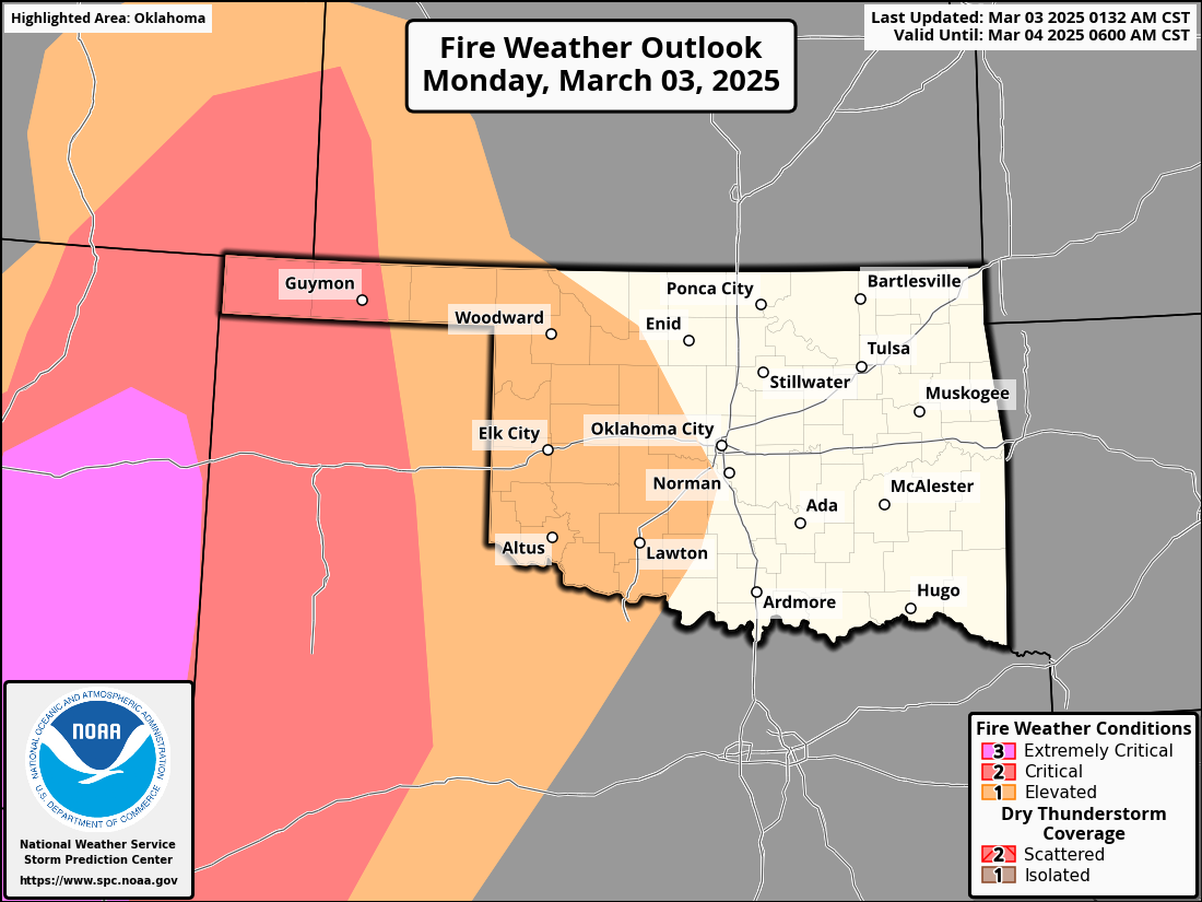
Now of course, given the time of year, any storm system will probably come with
some fire danger. You know how it works, you kick up those SW winds behind the
dryline, sometimes gusting to over 60 mph, combined with low humidity and a burst
of heat...fire danger. We will definitely see that with those winds of, uhhhhhh,
over 60 mph, and low RH.

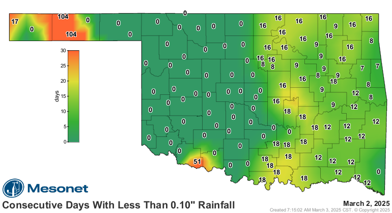
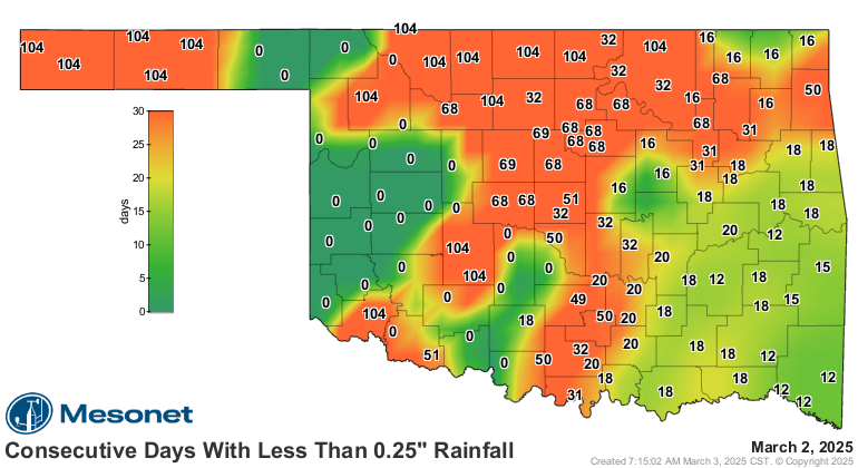
The good news is we got some good rainfall, and we should get some more good
rainfall. We reset some of those nasty-looking "days without" maps as well.
Okay, that's it! I've been up since 5am climatizing, and I'm spent (all 3 cents
worth). We're have a very active couple of days here so be sure to pay attention
to your favorite NATIONAL WEATHER SERVICE office, and tune into your favorite
media source to stay weather aware!
Now stick around below to be climate aware as we take a look back at our icy,
cold February and winter.
----------------------------------------------------------------------------------
February's Roller Coaster: Record Heat to Deep Freeze
March 03, 2025
February started off with a warm and pleasant stretch, reaching a summery 89
degrees in several locations on Feb. 3, breaking the all-time high temperature
record for that date—87 degrees, set in Erick back in 1934. However, it was all
downhill from there, as winter quickly reclaimed its grip on the calendar with
a series of storms, each colder than the last.
The first cold front arrived soon after the record warmth, bringing freezing
drizzle to northwestern Oklahoma on Feb. 5, prompting a traveler’s advisory
from the National Weather Service. The following week, a wintry mix of freezing
rain, sleet, and snow blanketed the northwest on Feb. 11 and 12, causing school
and business closures and hazardous travel conditions. The coldest temperature
of the month, -8 degrees, was recorded at Eva on Feb. 13, accompanied by a wind
chill of -23 degrees, which tied for the lowest wind chill of the month. During
this stretch, widespread sub-zero wind chills were observed across the state.
The coldest weather of the month, and possibly the season, hit the following
week, with widespread snow, ice, and record-breaking cold. Temperatures
remained below freezing in some areas for over 100 hours straight from Feb. 17
to 21. An 'Extreme Cold Warning' was issued for most of the state as wind
chills dipped between -15 and -25 degrees below zero. This was accompanied by
winter storm warnings for sleet, freezing rain, and 3-5 inches of snow.
Numerous highways were closed, and schools and businesses were shut down for
several days. Oklahoma City and Tulsa each tied or broke numerous record low
minimum and maximum temperatures from Feb. 19 to 21, as did many other sites
across the state.
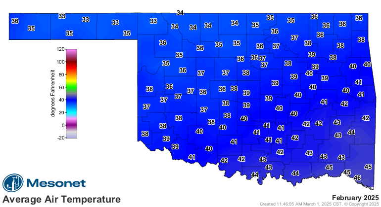
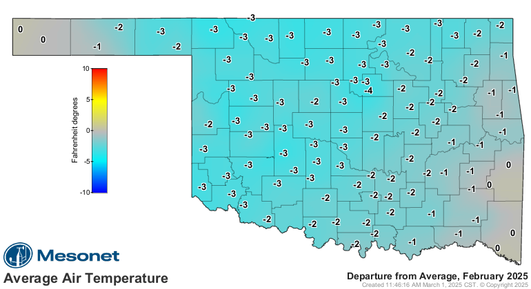
February by the Numbers:
• Statewide average temperature: 38.7°F (3.7°F below normal), marking the
39th-coolest February since records began in 1895.
• Temperature extremes: High of 89°F on Feb. 3; low of -8°F at Eva on Feb. 13.
• Low temperatures below 10°F: 487 instances recorded on the Oklahoma Mesonet,
including 52 readings below zero.
• Wind chills below zero: 520 instances across the Mesonet network.
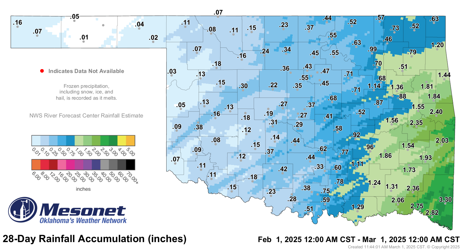
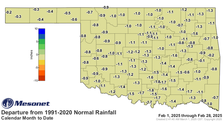
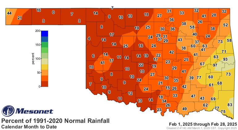
• Statewide average precipitation: 0.64 inches (1.05 inches below normal),
ranking as the 23rd-driest February on record.
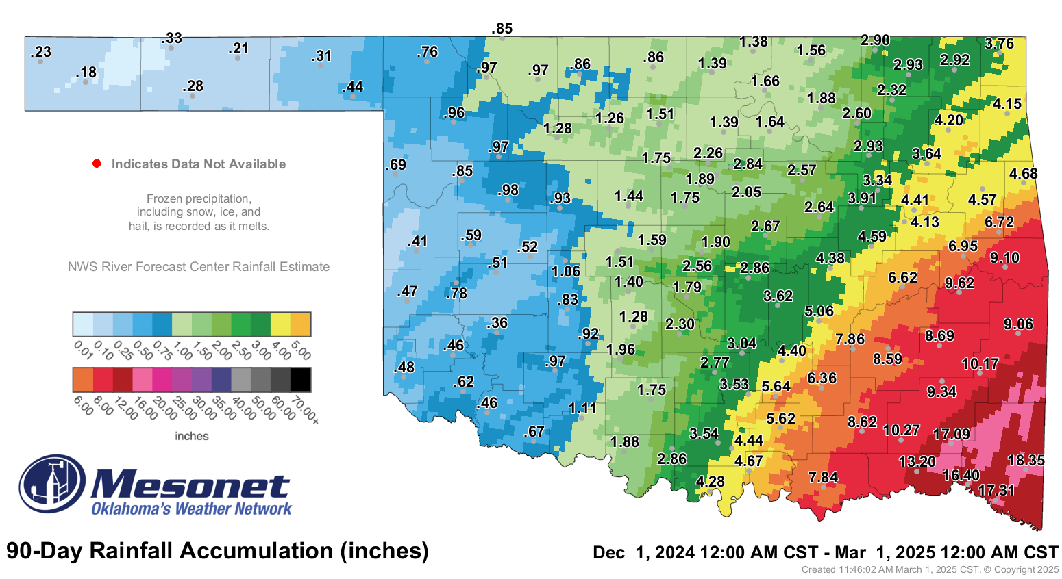
• Rainfall extremes: High of 3.3 inches at Broken Bow; low of 0.01 inches at
Goodwell.
Winter by the Numbers:
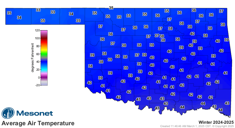
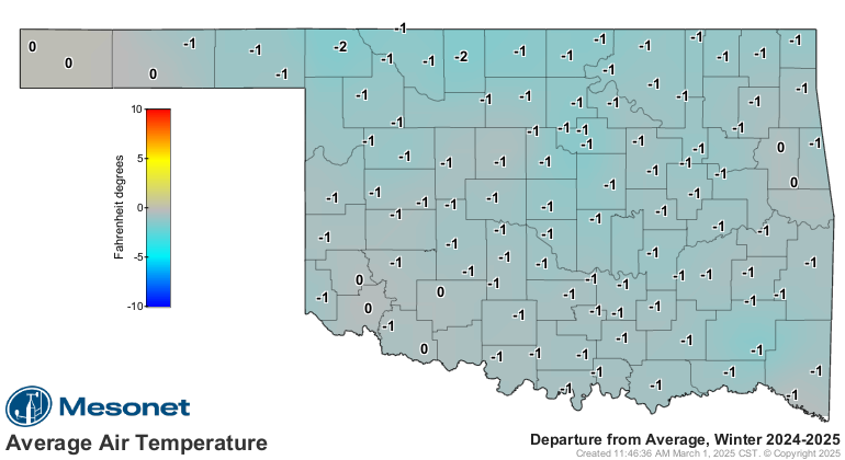
• Statewide average temperature (Dec-Feb): 36.2°F, ranking as the 27th-coolest
winter on record.
• Temperature extremes: -15°F at Kenton on Jan. 20; 89°F on Feb. 3.
• Statewide average precipitation (Dec-Feb): 3.33 inches (2.04 inches below
normal), ranking as the 29th-driest winter on record.
• Driest winter totals: 0.18 inches at Boise City.
• Wettest winter totals: 18.35 inches at Broken Bow.
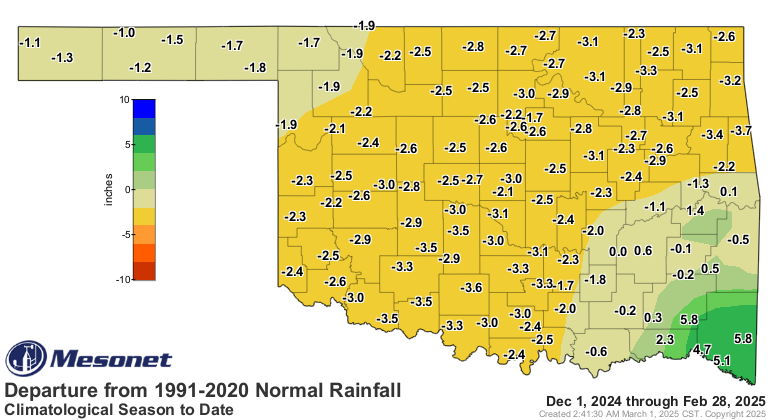
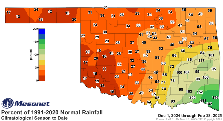
Western Oklahoma faced considerable dryness, with the Panhandle, west-central,
and southwest regions recording their 5th, 6th, and 4th driest winters on
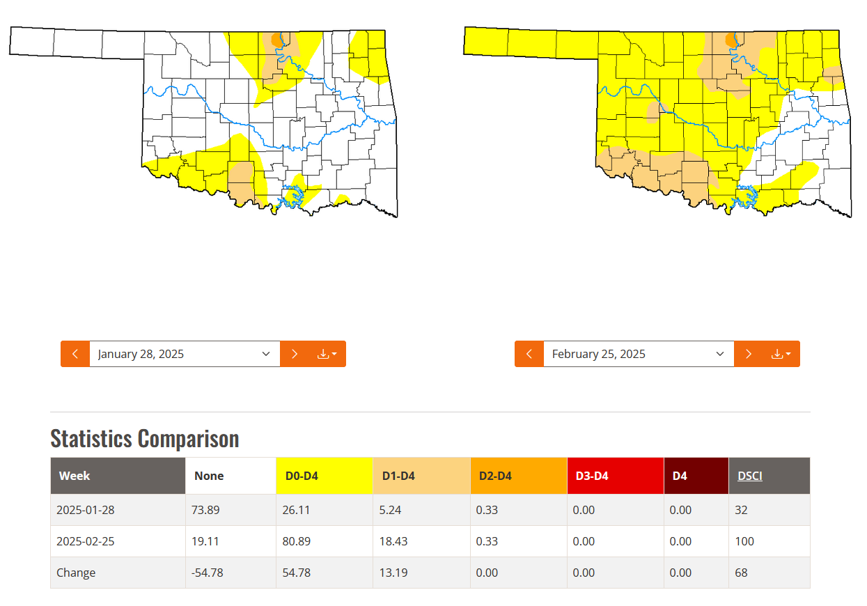
record, respectively. As a result, the percentage of Oklahoma in at least
moderate drought more than tripled from 5% at the end of January to over 18% at
the end of February, according to the U.S. Drought Monitor. Additionally, 62%
of the state was in 'abnormally dry' conditions by the end of February, up from
21% at the start of the month.
Looking Ahead:
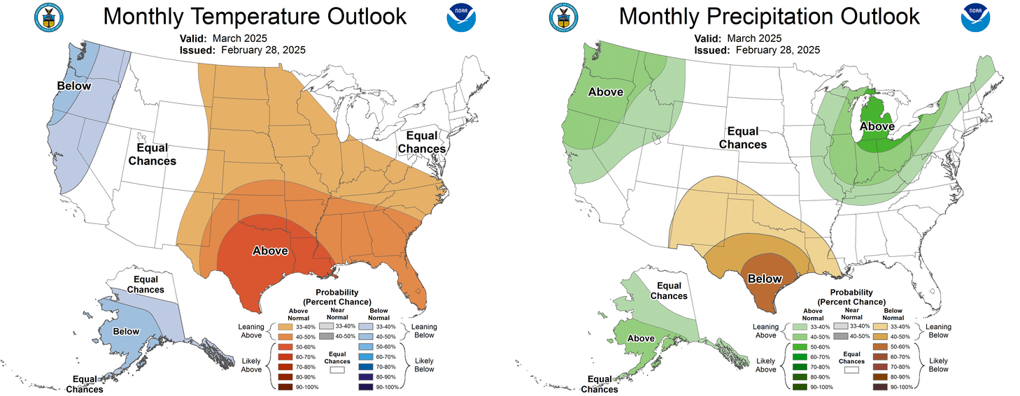
The Climate Prediction Center’s outlook for March indicates increased odds of
above-normal temperatures across Oklahoma, with the highest likelihood in the
southern part of the state. There is also a slightly greater chance of below-
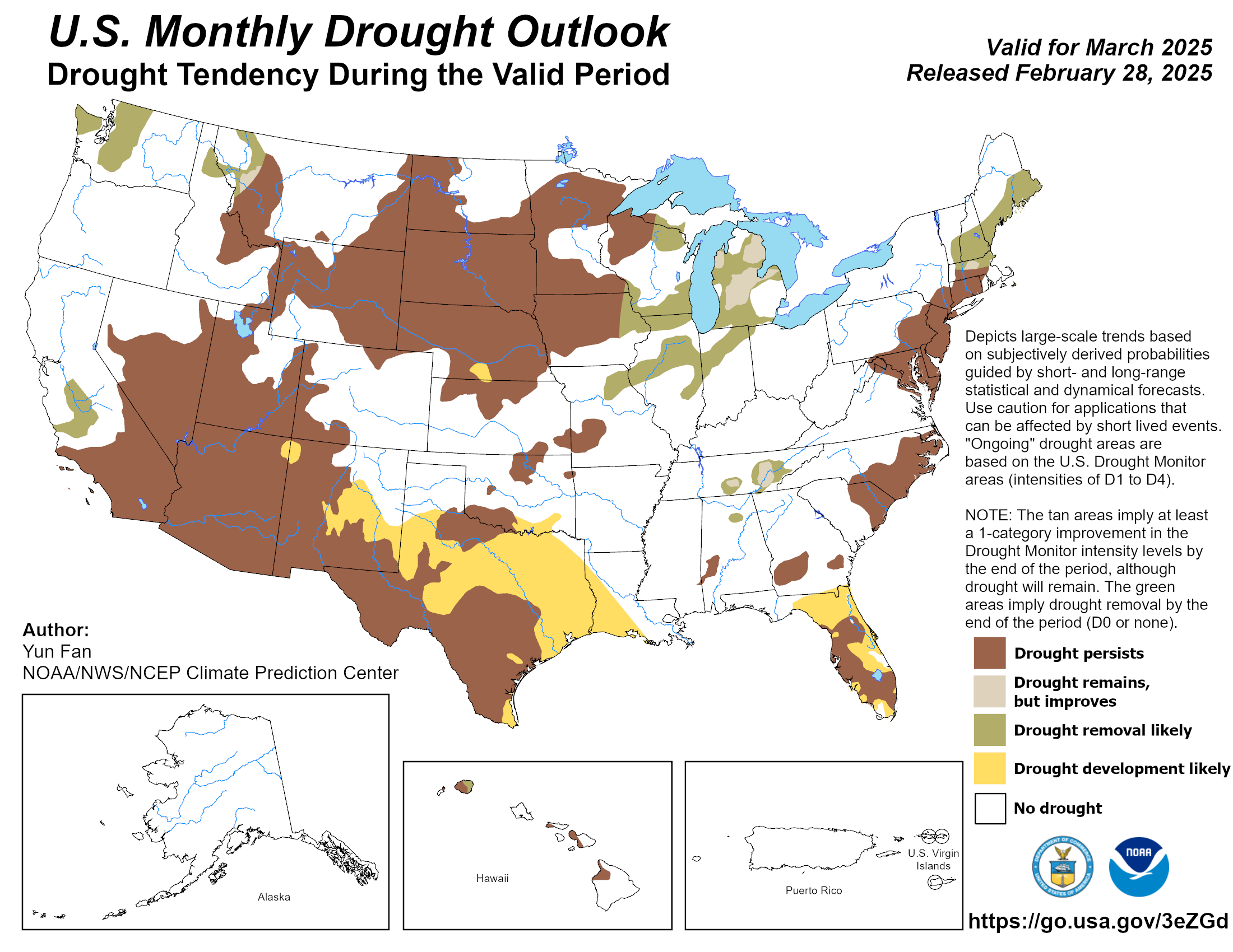
normal precipitation in the southwestern half. As for drought, the March
outlook suggests it may persist in areas where it currently exists and spread
further east across south-central Oklahoma.
Gary McManus
State Climatologist
Oklahoma Mesonet
Oklahoma Climate Survey
gmcmanus@ou.edu
March 3 in Mesonet History
| Record | Value | Station | Year |
|---|---|---|---|
| Maximum Temperature | 86°F | WAUR | 2024 |
| Minimum Temperature | -7°F | BUFF | 2014 |
| Maximum Rainfall | 3.93 inches | PORT | 2004 |
Mesonet records begin in 1994.
Search by Date
If you're a bit off, don't worry, because just like horseshoes, “almost” counts on the Ticker website!