Ticker for February 28, 2025
MESONET TICKER ... MESONET TICKER ... MESONET TICKER ... MESONET TICKER ...
February 28, 2025 February 28, 2025 February 28, 2025 February 28, 2025
Shocker no no
Just a quick Tick today, to Tock about some dry stuff, since nobody is reading
my Ticker today.
Oh yeah? WELL I'M NOT READING YOUR STUFF TODAY EITHER!!
How does that make you feel, huh?
Hello?
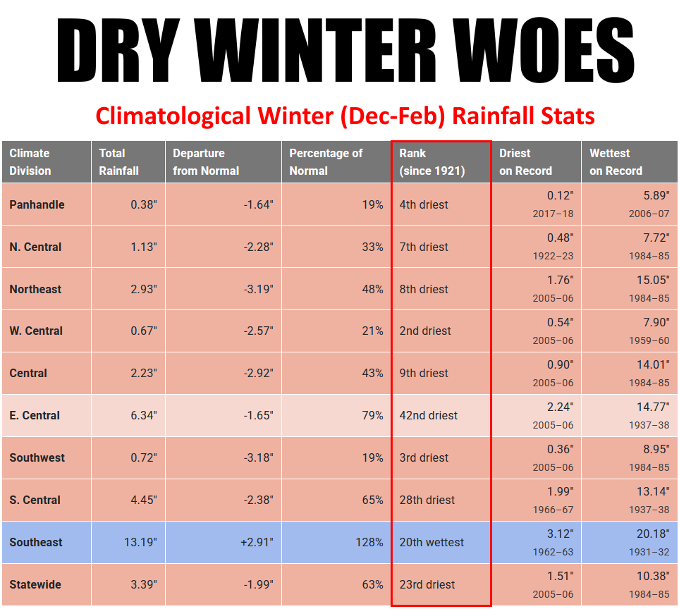
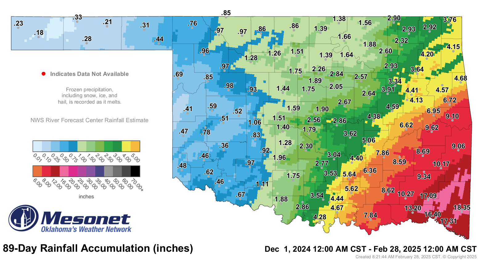
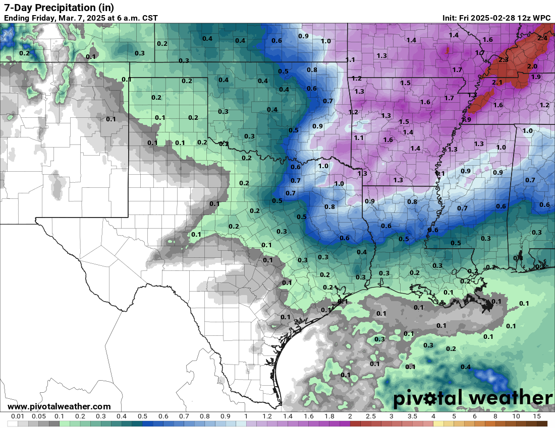
Well okay then. It should come as a shock to no one that our climatological
winter ended up as one of the driest on record for parts of the state, and the
23rd-driest across the state as a whole. That final stat is biased, obviously,
but the wet weather across east central and southeastern OK.
Also not shockingly, and shockingly so, everybody else was in their top-10 driest
such periods dating back to at least 1921, save for south central's 28th ranking.
Not shockingly part #3, here's why.
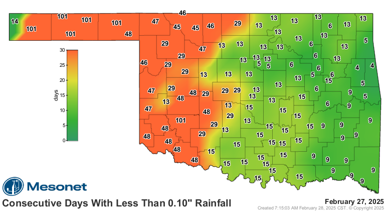
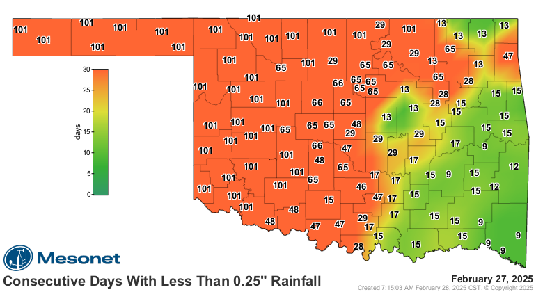
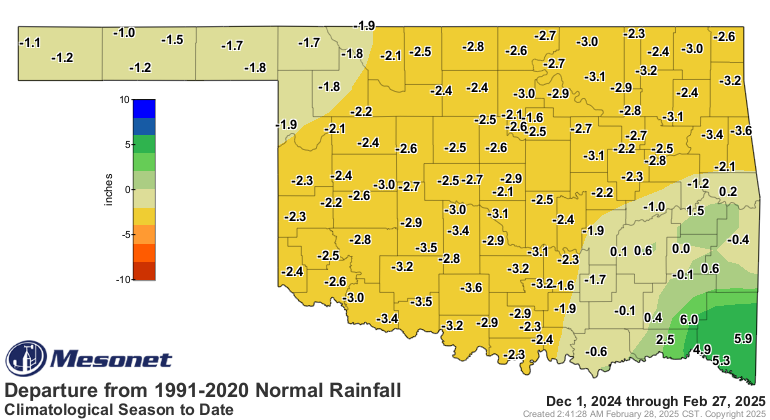
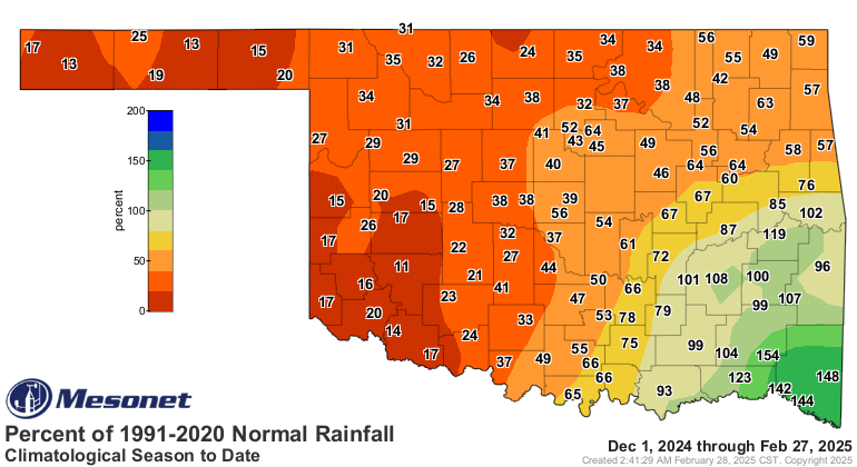
Another way to wrap this up is "one of the driest driest-times-of-the-year on
record," which sounds as bad as it is. And that's the reason why we saw our
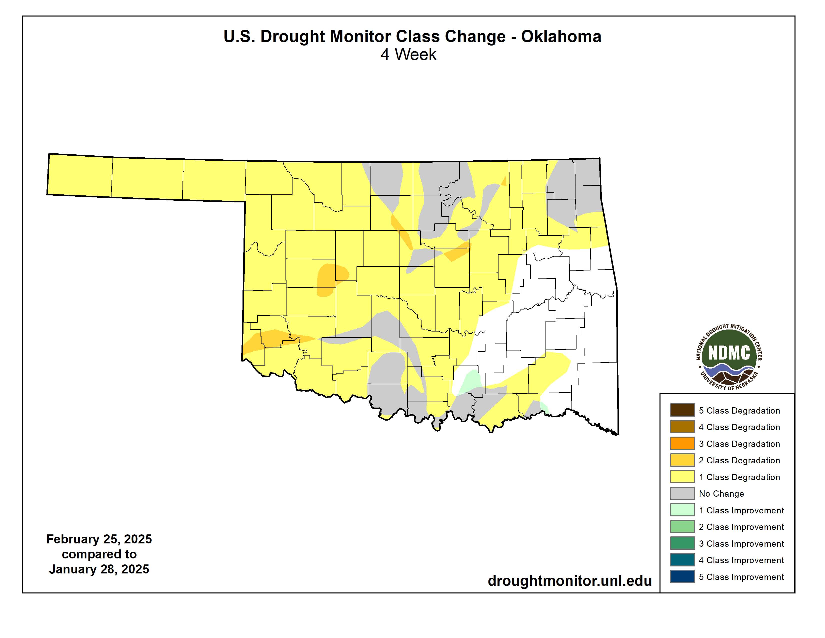
drought coverage across the state nearly triple in one week, and a grand
expansion on dry weather in the last month.
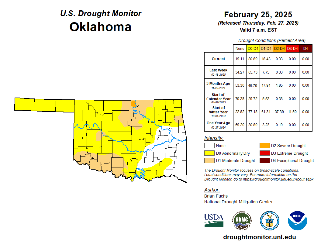
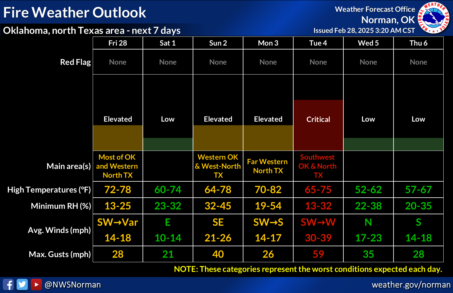
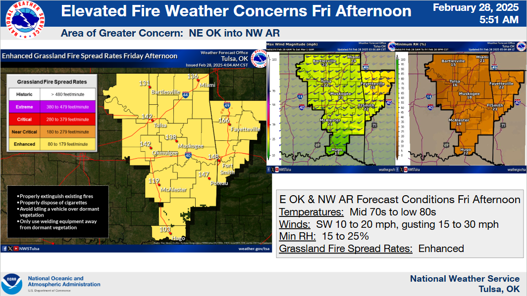
Rain chances go up next week, starting Sunday, but so do fire danger concerns.
But so do fire concerns as we enter peak wildfire season here in Oklahoma. The
extended dry spell doesn't help matters at all.
Now, back to your scheduled Friday.
Gary McManus
State Climatologist
Oklahoma Mesonet
Oklahoma Climate Survey
gmcmanus@ou.edu
February 28 in Mesonet History
| Record | Value | Station | Year |
|---|---|---|---|
| Maximum Temperature | 90°F | HOLL | 2006 |
| Minimum Temperature | 7°F | BEAV | 2019 |
| Maximum Rainfall | 3.70 inches | BROK | 2018 |
Mesonet records begin in 1994.
Search by Date
If you're a bit off, don't worry, because just like horseshoes, “almost” counts on the Ticker website!