Ticker for February 3, 2025
MESONET TICKER ... MESONET TICKER ... MESONET TICKER ... MESONET TICKER ...
February 3, 2025 February 3, 2025 February 3, 2025 February 3, 2025
Wait!
LET'S TAKE A RIDE ON THE BISON ROLLER-COASTER!
(clap clap CLAP-CLAP-CLAP)
I SAID LET'S TAKE A RIDE ON THE BISON ROLLER-COASTER!
Well, that cheer only works if you grew up in Buffalo (Oklahoma...New York? HOW
DARE YOU!). OBU too, I guess, but nobody grows up in OBU. There's also Bison,
OK, but they don't have cheerleaders. Oddly enough, I don't think either have
actual bison. Isn't that odd? Wait, there's also Buffalo Valley, but they're the
Buffaloes.
HA! There aren't even any buffaloes in the U.S., they're all bison!
What does this have to do with anything whatsover? Well, nothing. Other than a
nonsensical and roundabout way to say we're gonna be on the weather roller
coaster for this week, before the bottom falls out next week.
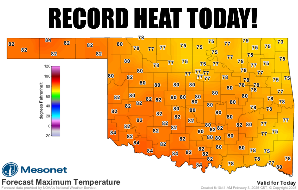
We should see some record high temps fall today, especially across southern OK.

The highest temperature ever recorded in Oklahoma on a Feb. 3, dating back to
the 1880s, is 87 degrees from Erick back in 1934. Be watching western OK for
somebody to threaten that (you wouldn't hit a record with glasses, would ya?).
And remember, Mother Nature doesn't respond well to threats.
We deal with some cold fronts off and on over the next week, until sometime
early next week when the Arctic opens back up and gives us the business.
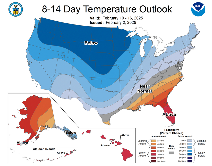
Maybe some snow in the forecast? But any precip for the next week?
For most of us? No.
But let's not look ahead, let's live in the past! Here's a look back at a very
chilly and snowy January.
---------------------------------------------------------------------------------
Winter Strikes Back in January
Feb. 3, 2025
Like the villain in a ‘90s action movie, winter struck back with a vengeance in
January following the unusual warmth that closed out 2024. Several strong cold
fronts delivered blustery winds, snow, ice, and some of the coldest air the
state had seen since the generational freeze of February 2021.
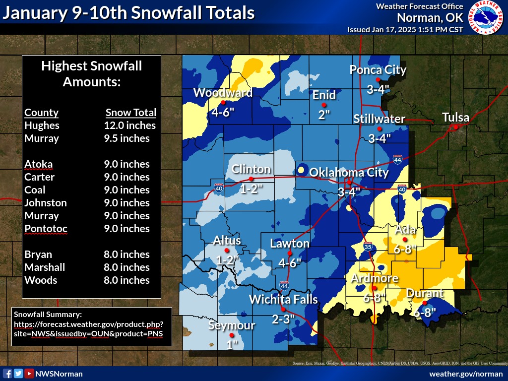
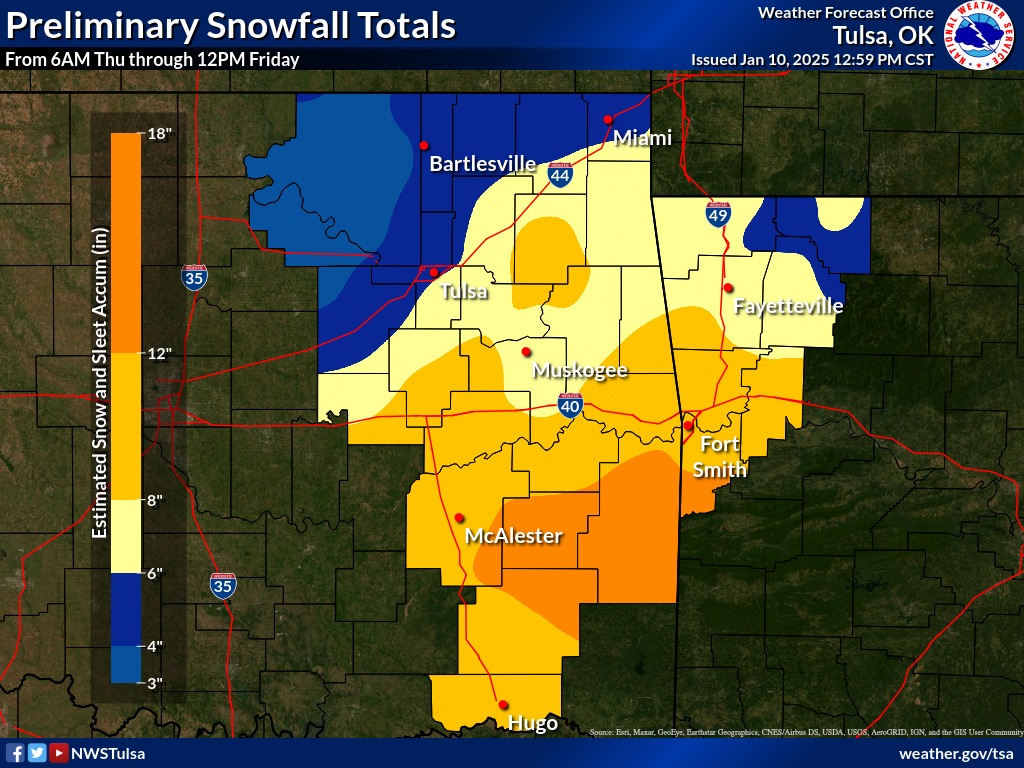
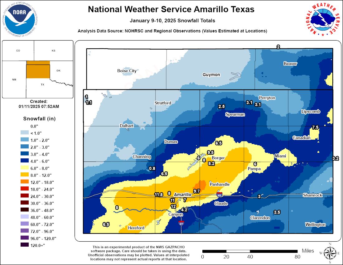
The first major bout of winter weather hit on January 9-10, prompting Winter
Storm Warnings for much of southeastern Oklahoma before expanding north and
west. Snow covered nearly the entire state except for the far western Panhandle,
with widespread totals of 2-6 inches. Heavier bands of 9-13 inches fell in
parts of northwestern and southeastern Oklahoma, while Lehigh in Coal County
claimed the highest official snowfall total with 14 inches.
The next impactful storm delivered far less snow but packed a much colder punch.
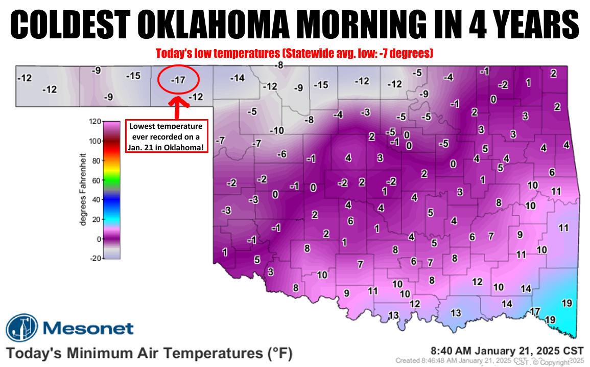
A powerful arctic front plowed through on January 17, dropping temperatures
below freezing for more than 100 consecutive hours in some areas. January 21
stood out as the coldest day of the outbreak, bringing:
• Lowest temperature ever recorded on a January 21 in Oklahoma – -17°F in
Beaver, dating back to the 1880s, a degree lower than Alva’s -16°F in 1984.
• Coldest temperature in the state since February 16, 2021 – also -17°F in
Beaver, the coldest since Nowata’s -22°F on that date.
• Lowest wind chill since December 22, 2022 – -33°F in Beaver and Hooker,
previously reached by Eva and Hooker on that date.
• Lowest statewide average low temperature since February 16, 2021 – -6.7°F,
compared to -12.4°F that year.
The deep freeze finally broke on January 22, when Medford became the last
Mesonet site to rise above freezing after 106 hours below the mark, just after
noon. While snowfall was more sporadic in the latter half of the month,
persistent cold kept winter firmly in place, making January 2025 one of the
colder winter months of the last several years.
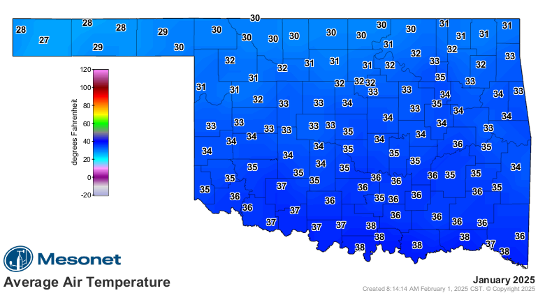
January by the Numbers
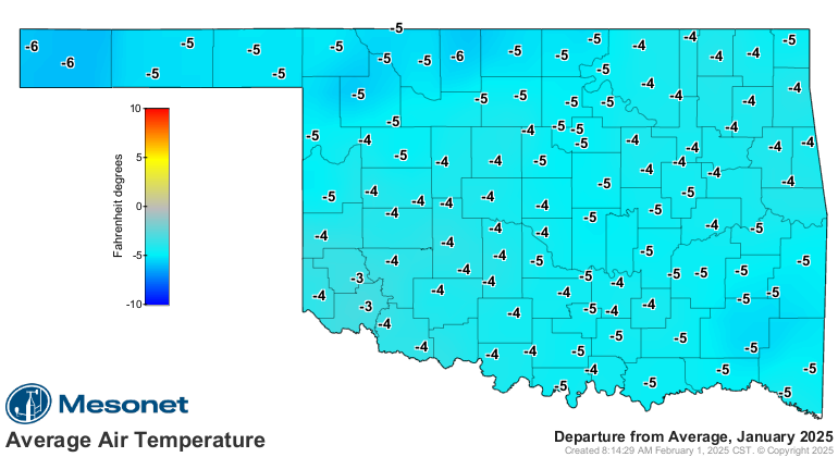
• Statewide average temperature: 34.0°F, ranking 27th-coolest since
records began in 1895, and 4.3°F below normal.
• Temperature extremes: 75°F in Tipton (Jan. 17) to -17°F in Beaver (Jan. 21).
• Sub-10°F temperatures: The 119 Mesonet sites recorded 315 instances at 10°F
or lower, including 67 below-zero readings.
• Wind chills: The Mesonet recorded 400 instances of below-zero wind chills,
with 64 below -10°F.
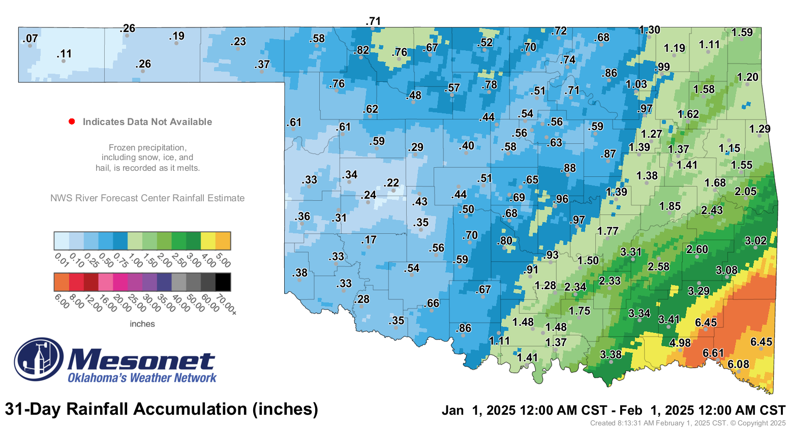
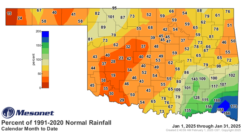
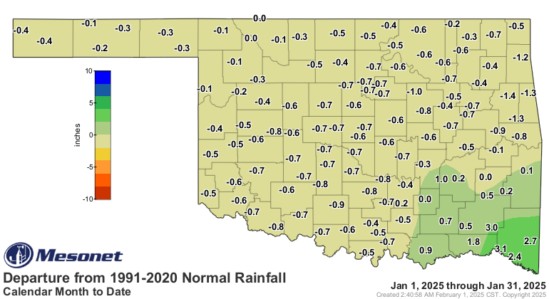
• Statewide precipitation: 1.23 inches, 0.34 inches below normal, ranking as
the 61st driest January since 1895.
• Wettest location: 6.61 inches in Valliant (southeast Oklahoma).
• Driest location: 0.07 inches in Kenton (far northwest Panhandle).
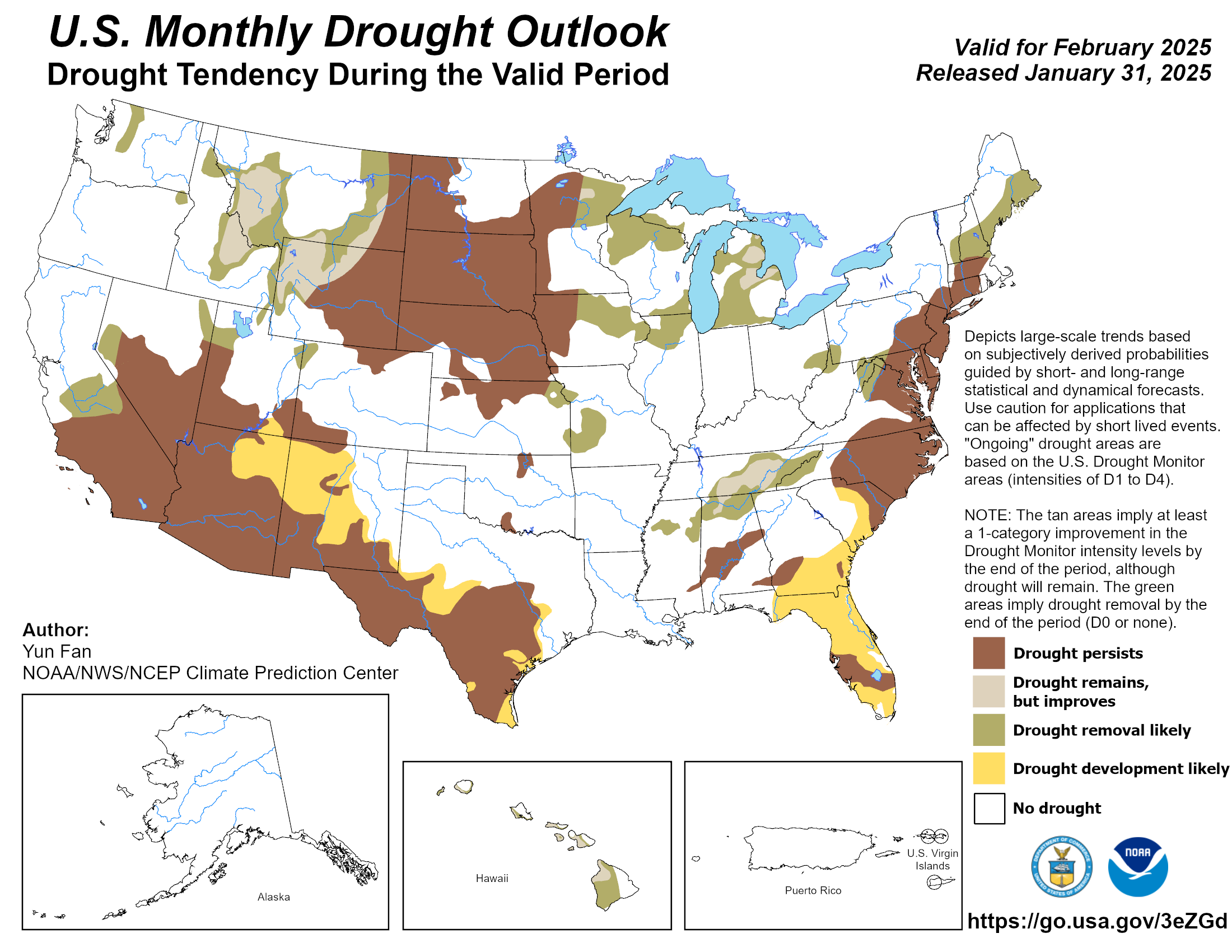
• Drought status: Despite the dry conditions, statewide drought coverage
remained steady at ~5%, with small pockets in south-central and north-central
Oklahoma.
Looking Ahead
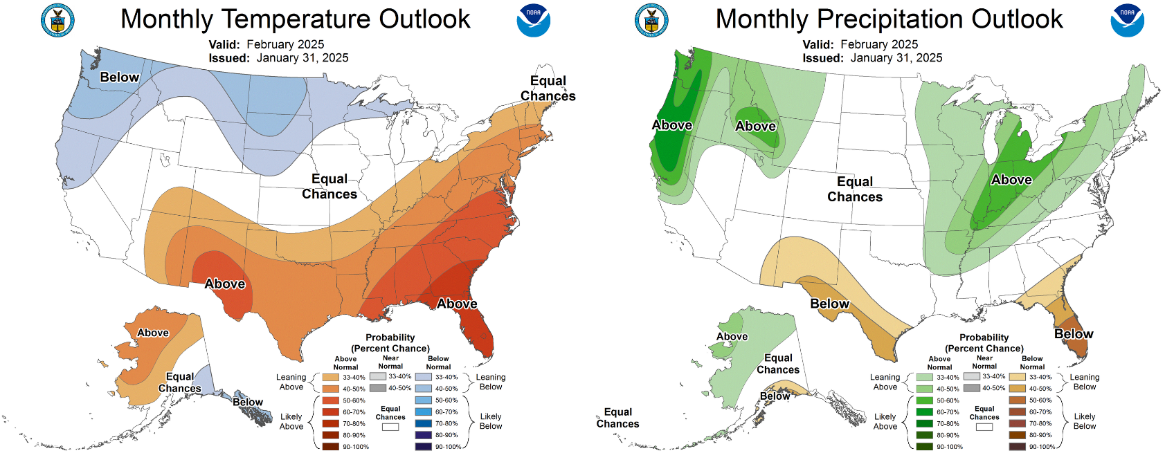
The February outlook from the Climate Prediction Center (CPC) favors warmer-
than-normal temperatures, with equal chances of above-, below-, or near-normal
precipitation. As a result, CPC’s February drought outlook predicts no major
drought relief or expansion across Oklahoma.
###
Gary McManus
State Climatologist
Oklahoma Mesonet
Oklahoma Climate Survey
gmcmanus@ou.edu
February 3 in Mesonet History
| Record | Value | Station | Year |
|---|---|---|---|
| Maximum Temperature | 89°F | SEIL | 2025 |
| Minimum Temperature | -18°F | NOWA | 2011 |
| Maximum Rainfall | 2.76 inches | SEIL | 2012 |
Mesonet records begin in 1994.
Search by Date
If you're a bit off, don't worry, because just like horseshoes, “almost” counts on the Ticker website!