Ticker for January 30, 2025
MESONET TICKER ... MESONET TICKER ... MESONET TICKER ... MESONET TICKER ...
January 30, 2025 January 30, 2025 January 30, 2025 January 30, 2025
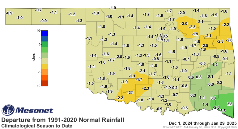
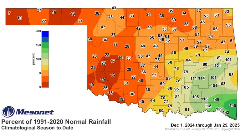
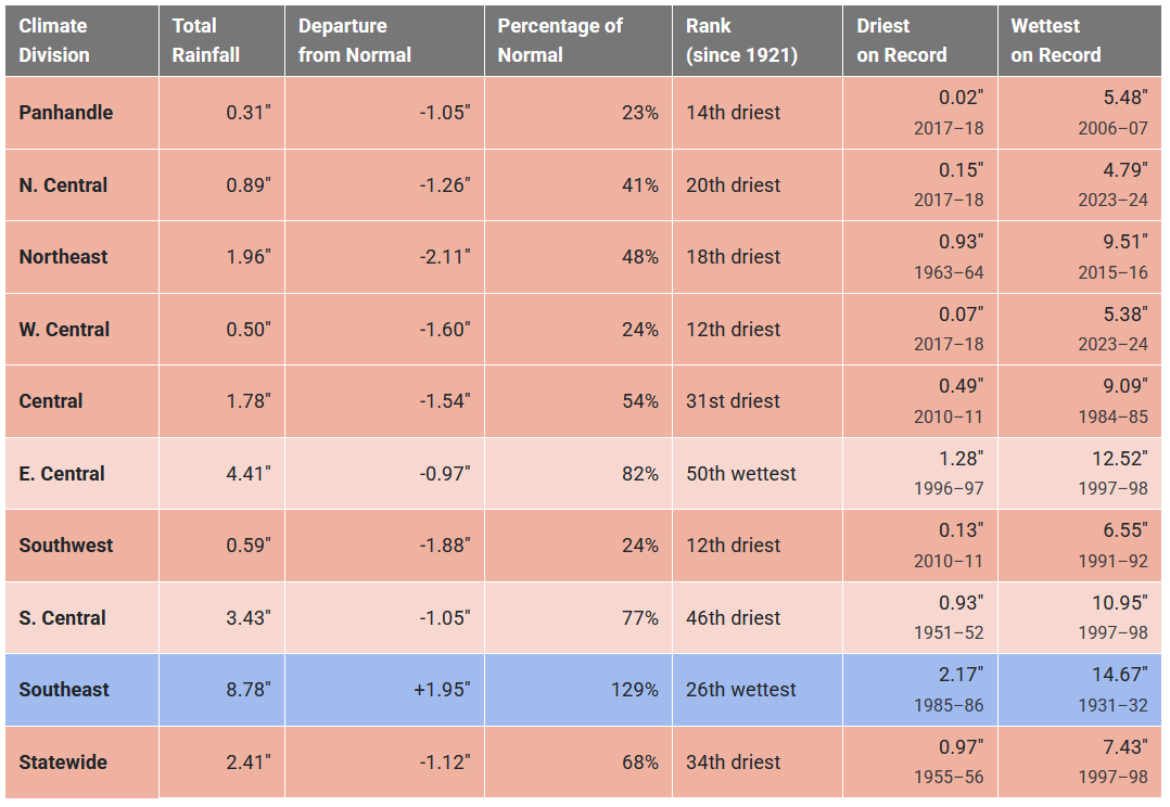
Where's the water?
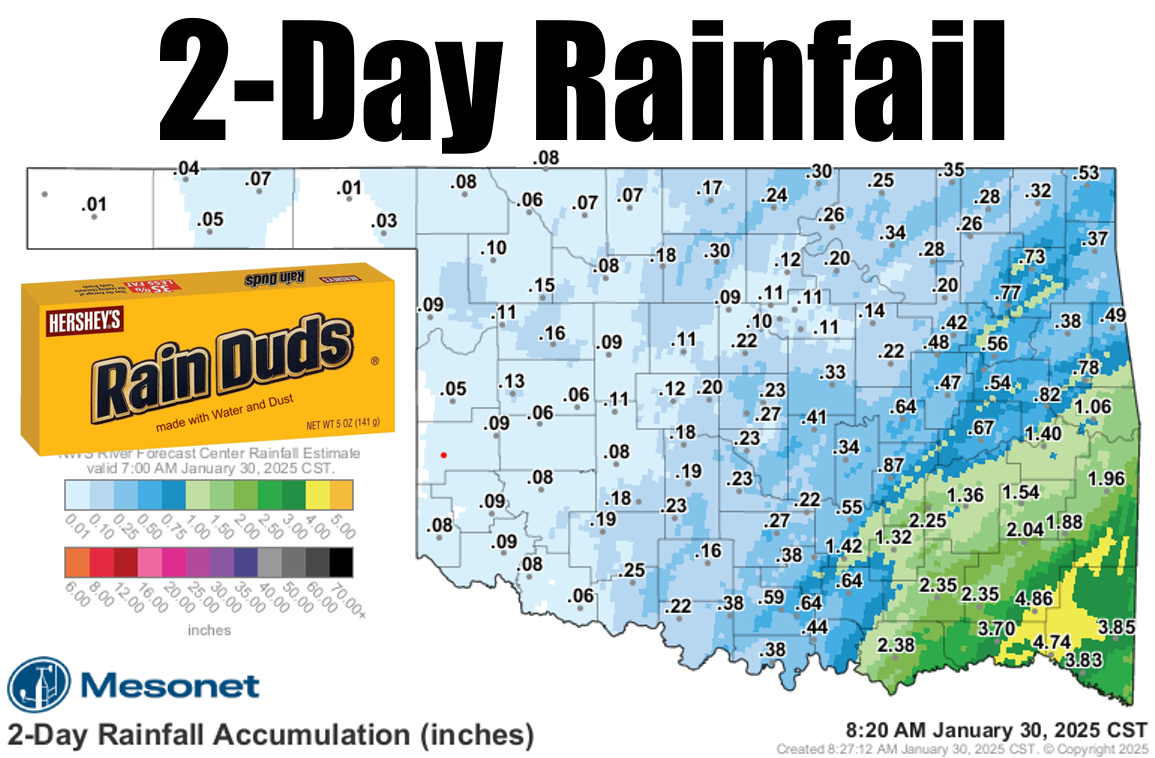
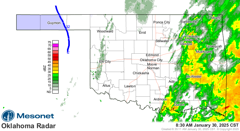
Rain? Heck, it's raining right now, for crying out loud! But not where it needs to
be.
Roughly (I tried to be gentle, didn't work) the northwestern two-thirds of the
state was left wanting by the passing storm system. A pretty sad showing and a
classic "Southeast Shift" of the forecast amounts over the last week. We couldn't
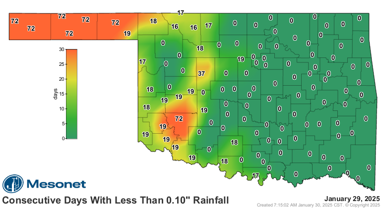
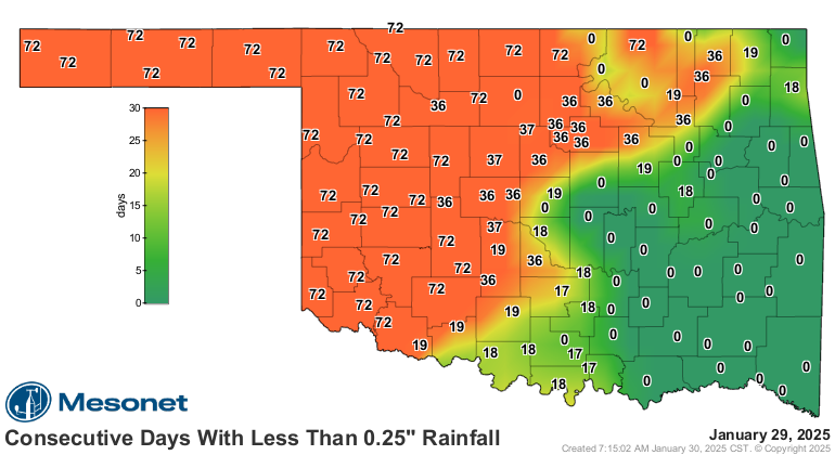
even reset these our "consecutive days without" maps.
Darn, even as I'm typing this I'm thinking some REAL Milk Duds sound pretty darned
good rn, ngl!
Anyway, back to our dud. That leaves us with a very precarious drought
situation going forward if another storm system doesn't come along soon. We held
steady again this week on the U.S. Drought Monitor, thanks to some steady
soil moisture supply remaining from our record November rains.

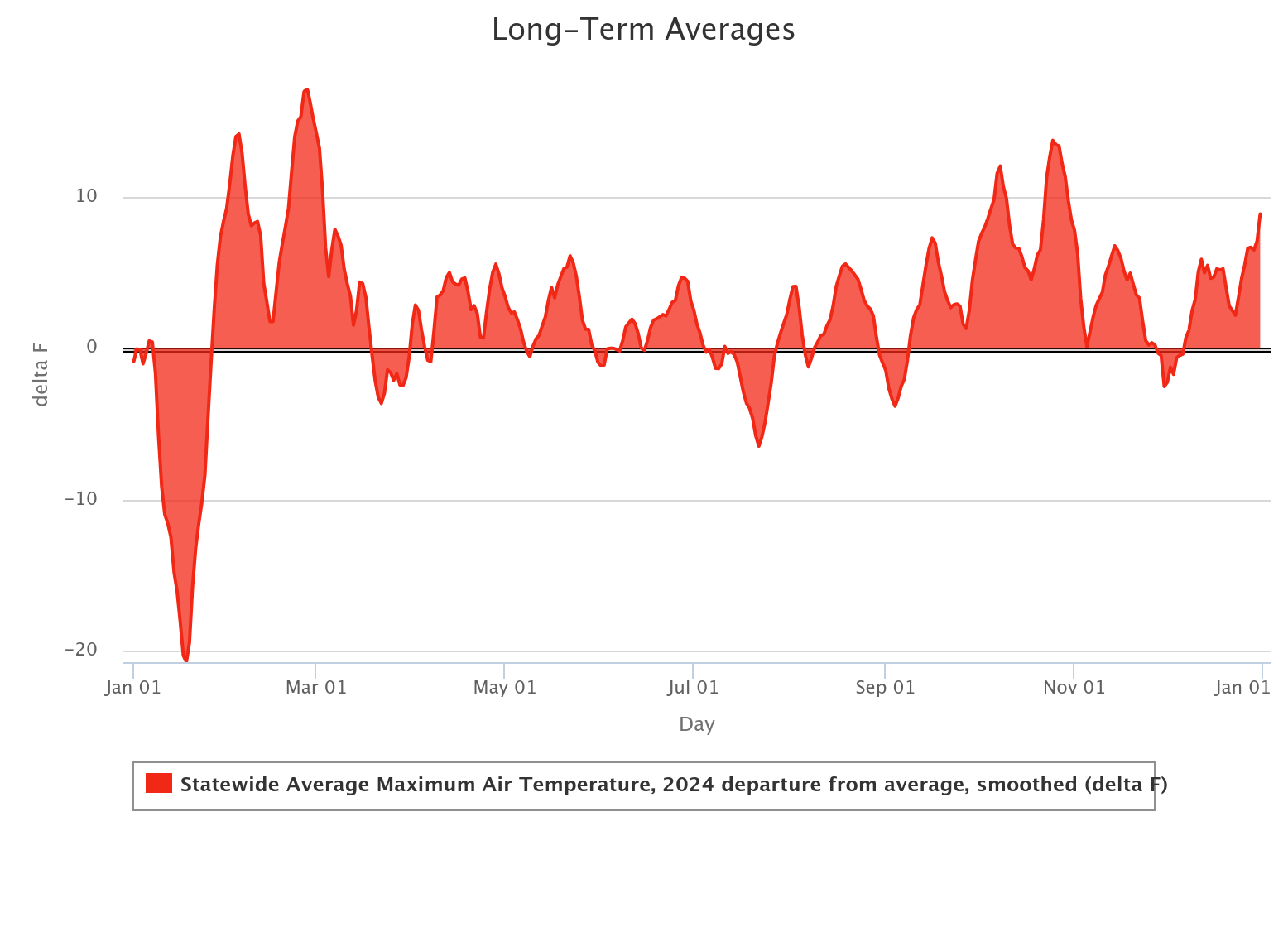
Winter has been dry. REALLY dry across the NW half of the state.
And don't look now, but here comes early spring, at least for a few days. Check
out those Sunday highs!
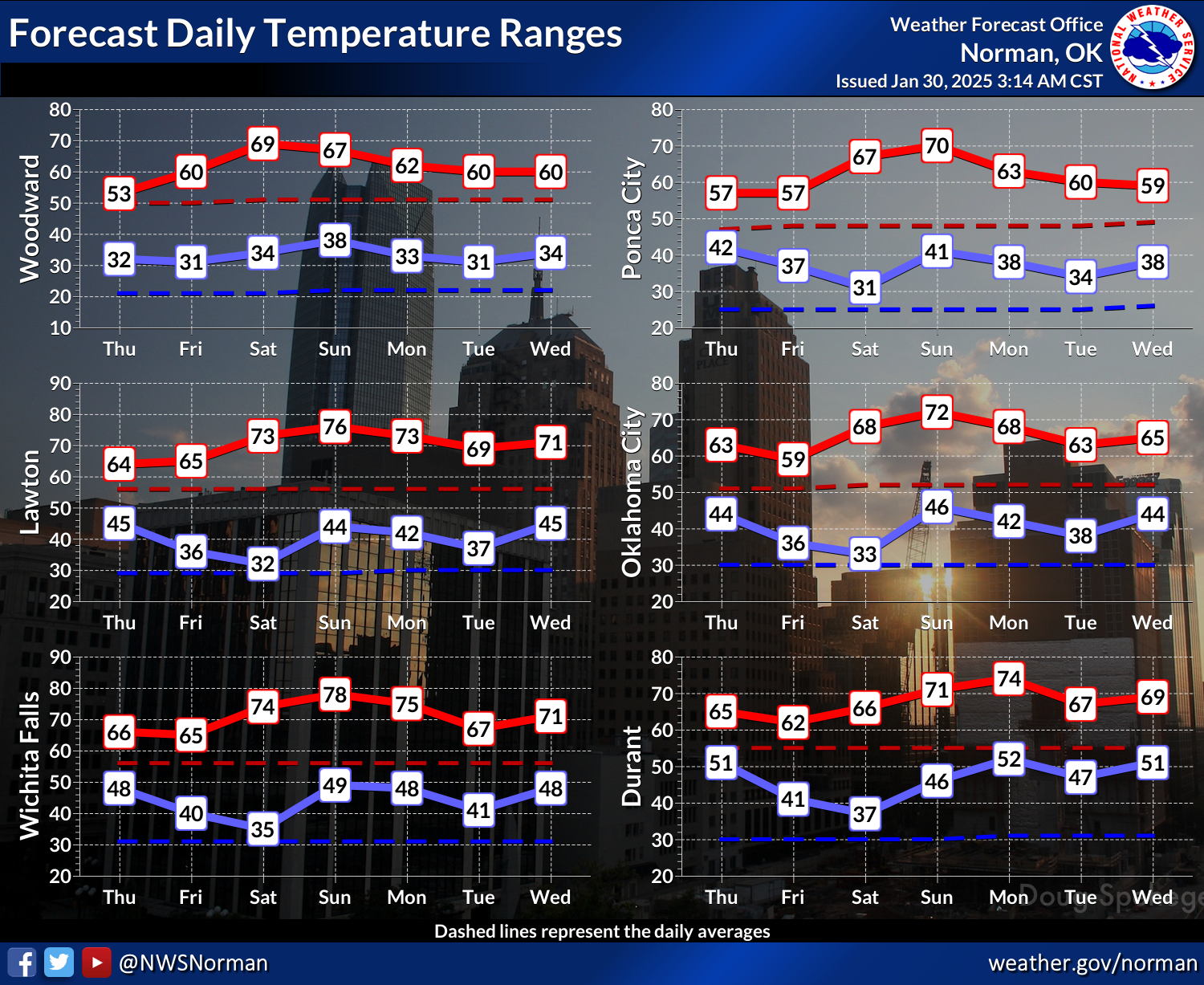

There are signs of some cold air after that, but remember what happened last
year after our January cold snap. We ended up tying our warmest year on record
(2012).
Yowsa! On second thought, just send more rain.
Gary McManus
State Climatologist
Oklahoma Mesonet
Oklahoma Climate Survey
gmcmanus@ou.edu
January 30 in Mesonet History
| Record | Value | Station | Year |
|---|---|---|---|
| Maximum Temperature | 85°F | HOLL | 2016 |
| Minimum Temperature | -3°F | HOOK | 2010 |
| Maximum Rainfall | 3.50 inches | VALL | 2025 |
Mesonet records begin in 1994.
Search by Date
If you're a bit off, don't worry, because just like horseshoes, “almost” counts on the Ticker website!