Ticker for January 2, 2025
MESONET TICKER ... MESONET TICKER ... MESONET TICKER ... MESONET TICKER ...
January 2, 2025 January 2, 2025 January 2, 2025 January 2, 2025
2024 we hardly knew ya
And we're back, stronger than ever! Cardboard futures are up to 19 cents/ton
(I bought 3 tons back in October at 13 cents/ton...you do the math) so I'm about
to move on from this weather gig, buy a yacht, and spend my days cruising Ft.
Supply Lake. But until then, we'll continue to track the weather AND climate for
you.
A lot has happened since we last Tocked, so go easy on is this first Ticker of
2025...we're still officially off for the rest of the week (and unofficially
"just a bit off" for the last few years). So two new all-time records to TOCK
about. HA! We eat all-time records for breakfast. Well, Cherry Pop-Tarts really,
but we wash those down with all-time records. As my librarian used to say: "Check
it out."
All-time State records I’ve experienced, lived through, or certified:
Snow depth (Buffalo, OK, 36 inches, 1971…I was there!!)
Lowest temperature (-31°, Feb. 10, 2011)
24-hour snowfall (27 inches, Feb. 9, 2011)
Highest wind gust (151 mph, May 24, 2011)
Largest hailstone (6 inches, May 23, 2011)*
Most 100° days (101, 2011)
Hottest summer in US History (86.9°, 2011)
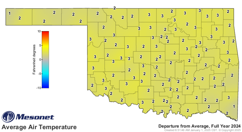
Warmest year (63.2°, 2012)
Wettest year (53.72”, 2015)
Wettest month (14.44”, May 2015)
Coldest day (-0.4°, Feb. 15, 2021)
Warmest December (2021, 10.3F above normal)
Most lost hair follicles (me, last two decades)
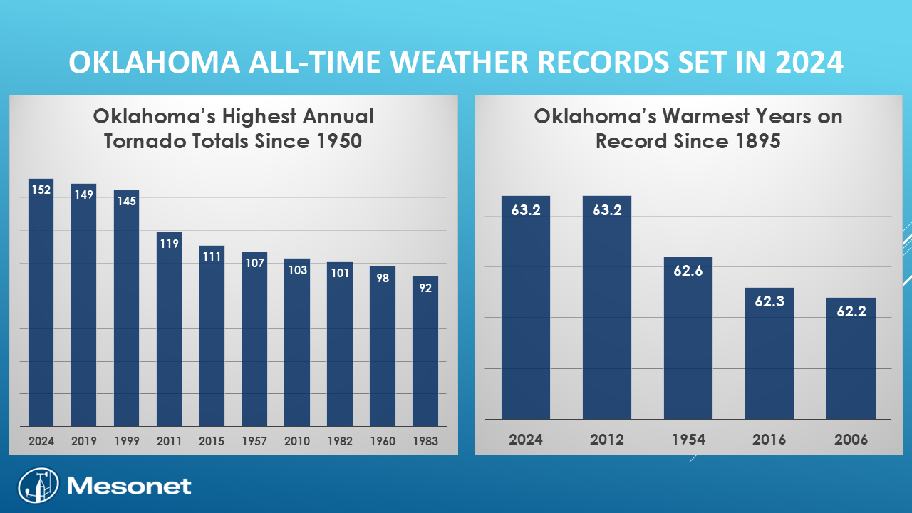
Now we add the tornado record (again), and glom onto the warmest year record.
Climatically speaking (usually gibberish), both of these records we set
(technically, one was a tie) are in the eye of the beholder. First off, we know
that all the radar advancements and proliferation of chasers and camera phones
and whatnot allow us to find many more tornadoes than in the past. And while
our new all-time tornado record might have been pushed to 152, can it really
compare to 1999's 145, which saw the Moore/SW OKC F5, along with 2 F4 and 9 F3
twisters? And how many smaller tornadoes did we miss besides the 107 actually
confirmed in Oklahoma in 1957?
Still, we can't NOT count tornadoes that actually occurred, so the record now
stands at LEAST at 152, and that number could technically still go up just a bit
but not come DOWN).
As for the all-time temperature record tied in 2024, that number could also face
more refinement as more preliminary data comes in and finally finalized (and we
all know just how painful that can be). I also think that number would go up
slightly vs. come back down, but the point remains...that tied record is also
preliminary.
Speaking of Pop-Tarts...I mean temperatures (Frosted Freudian slip...apologies),
it does appear that winter has a chance to hit the fan this weekend into next
week with a cold blast (I prefer Sonic Blasts...Butterfinger, thanks!) AND our
first foray into frozen precip in the main body of the state (remember, the
far western Panhandle had up to 26 inches of snow in November) this season.
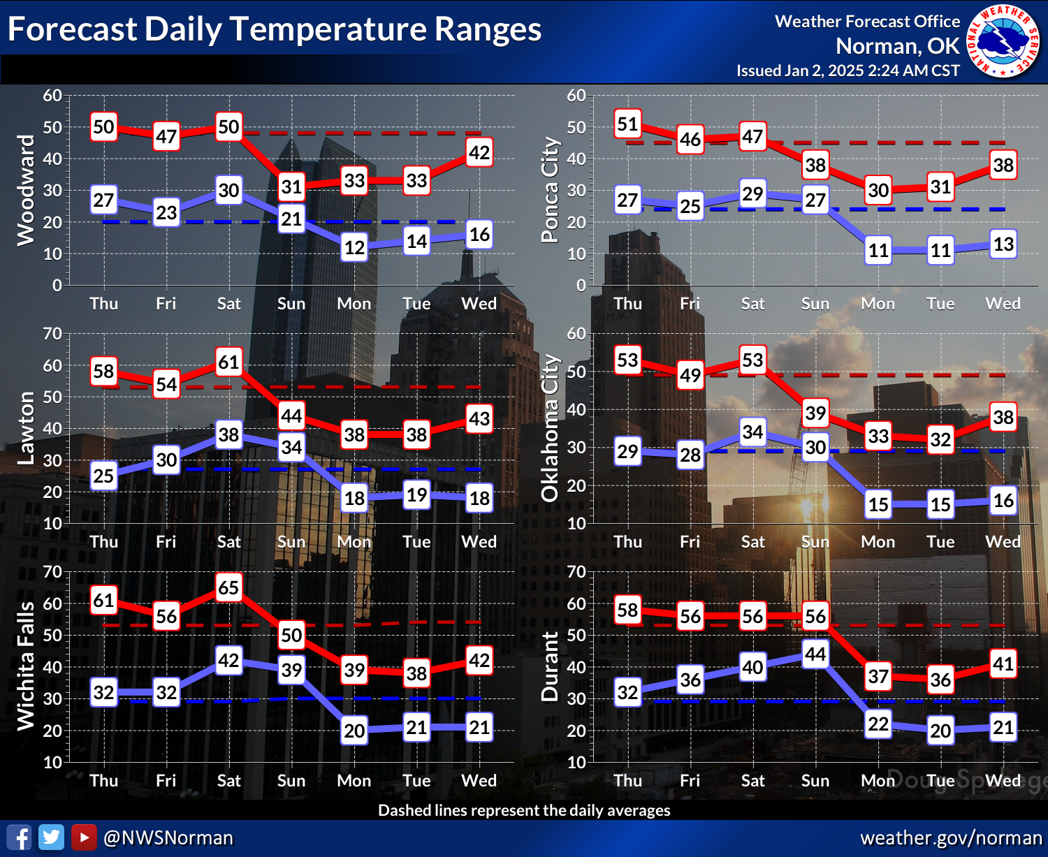
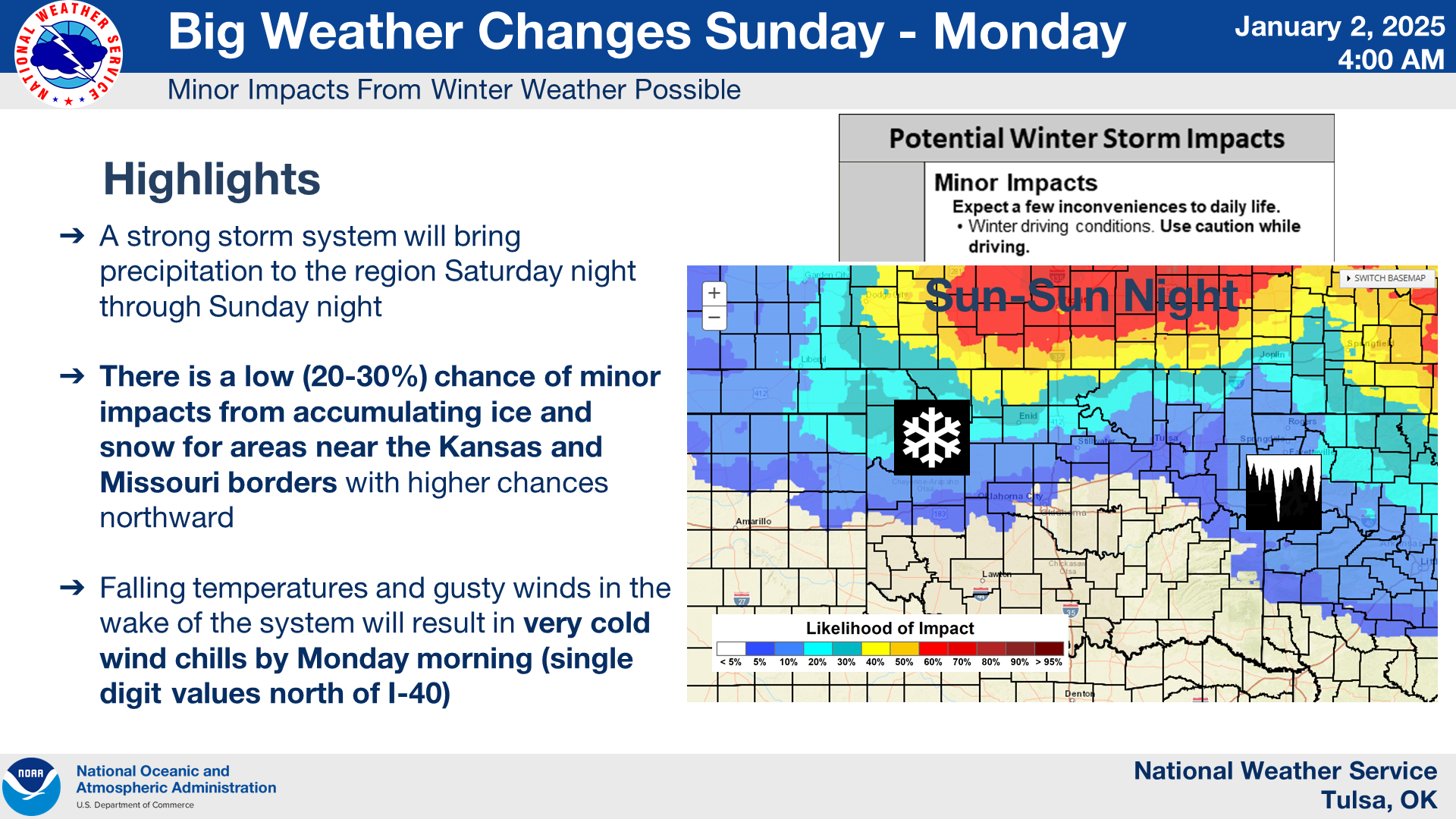
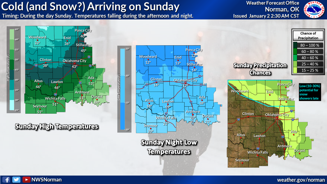
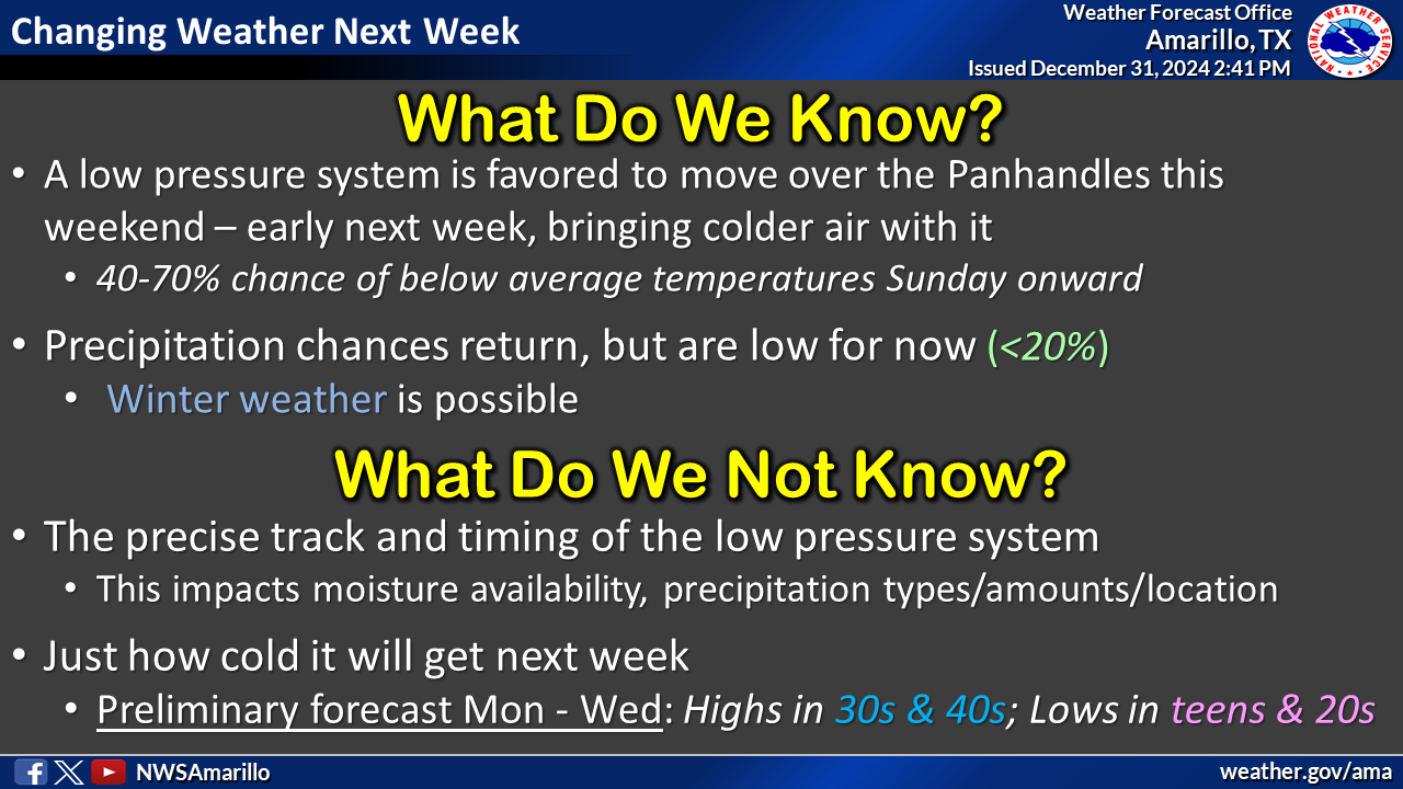
The most likely area for snow would but across northern Oklahoma. There's also
a threat of freezing rain across that part of the state, however that looks to
remain north of Oklahoma as of now, but we're also still several days out so
that bares (bears are dangerous, folks) watching. AND then maybe the threat of
more snow across SE OK the following weekend?
Okay, POTENTIALLY some excitement coming our way, which is both welcome and
unwelcome. A bit of snow would be nice, but not a bit of ice. And if you think
I rhymed on purpose, rats...nothing rhymes with purpose.
I should have thought that out better. Now, onto our December and 2024 recap
below. Watch this space for a future Braum's DEF-CON alert!
-------------------------------------------------------------------------------
Oklahoma Weather Records Fall in 2024
Jan. 2, 2025
It seems every year is a momentous one for weather in Oklahoma, and 2024 was no
exception, with two all-time records either tied or broken during the year. The
National Weather Service (NWS) confirmed at least 152 tornadoes touched down in
Oklahoma, surpassing the previous record of 149 set in 2019. This year’s total
was bolstered by record-breaking monthly totals of 56 in April and 33 in
November. Most of the tornadoes were of the weaker EF0 and EF1 variety,
accounting for 34 and 71 events, respectively. Among the stronger intensities,
there were eight EF2, seven EF3, and two EF4 tornadoes. At least eight
fatalities were reported due to these twisters. All tornado data is considered
preliminary until finalized by NWS personnel.
On a less violent but equally notable front, Oklahoma’s statewide average
temperature for 2024 was 63.2 degrees, tying 2012 as the warmest calendar year
on record—2.8 degrees above normal. These records date back to 1895. The year
began on a chilly note, with January finishing 4.3 degrees below normal.
However, the cold start was quickly erased by the fifth-warmest February on
record, which was 7.5 degrees above normal. July was the only other month to
finish below normal, and that was by just 0.5 degrees. The record-tying
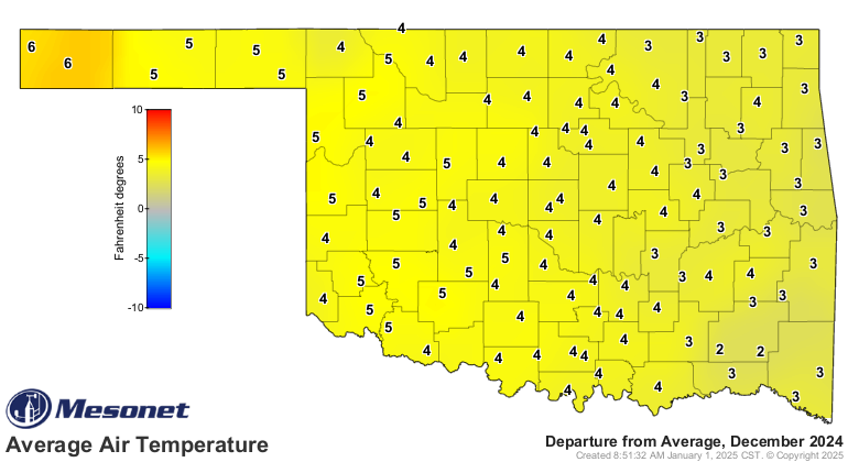
temperature was cemented by December, which ranked as the fifth-warmest on
record with a statewide average of 44.7 degrees, 4.6 degrees above normal.
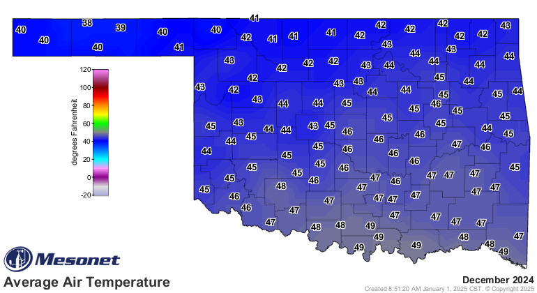
The Oklahoma Mesonet’s 120 sites recorded December temperatures of at least 70
degrees on 126 occasions, with the highest reading of 76 degrees observed at
several locations across multiple days. The month’s lowest reading was 14
degrees at Kenton on Dec. 13. For the year, the highest temperature was 113.3
degrees at Freedom on Aug. 24, while the lowest was minus 14.7 degrees at
Vinita on Jan. 16. On that same day, Vinita recorded a wind chill of minus 26.8
degrees. The year’s highest heat index was 123.4 degrees, recorded at Okmulgee
on Aug. 18.
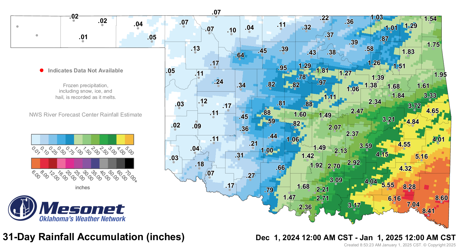
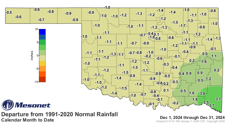
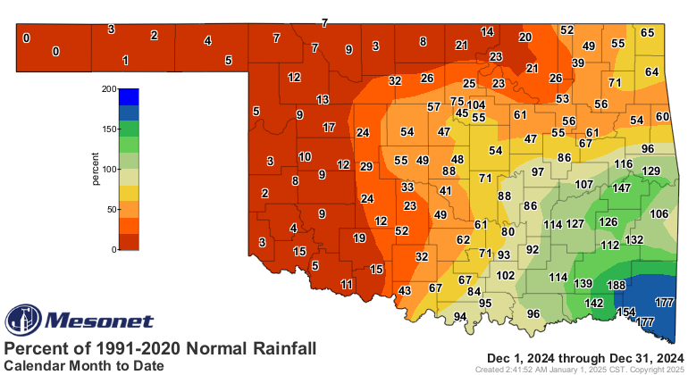
The statewide average precipitation total for December was 1.45 inches, 0.66
inches below normal, ranking as the 65th-driest December on record. The
Panhandle received an average of just 0.03 inches, 0.74 inches below normal,
ranking as the seventh-driest December on record for that region. Meanwhile,
southeast Oklahoma averaged 6.3 inches of rain, a surplus of 2.4 inches, making
it the 13th-wettest December for that area. Individual site totals ranged from
8.6 inches at Broken Bow to no measurable precipitation at Boise City and
Kenton. Sixty-three Mesonet sites recorded an inch or less of precipitation
during the month. Only a trace of snow was reported, confined to the area
around Kenton in the far western Panhandle.
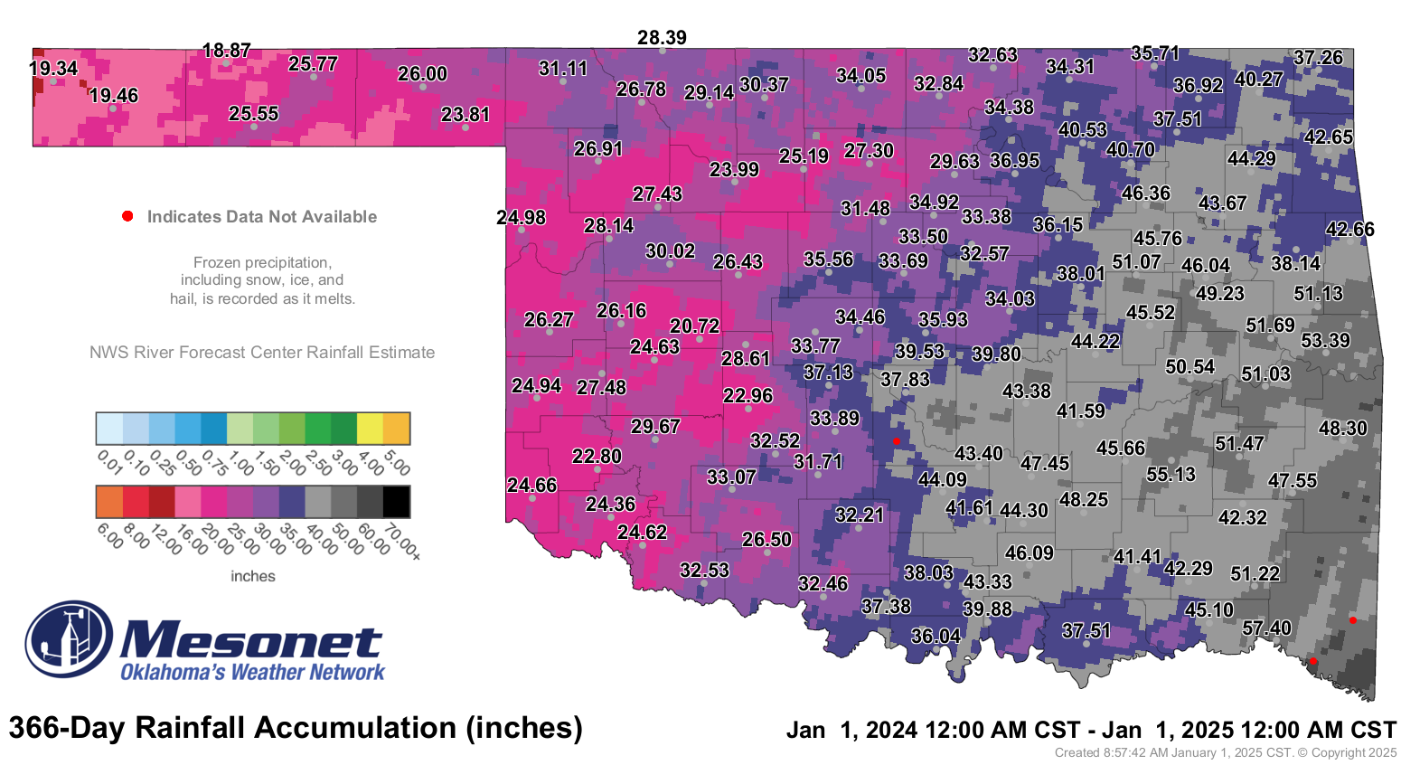
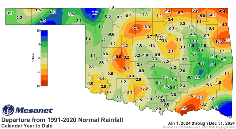
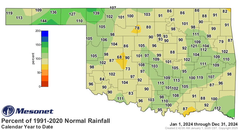
For the year, Oklahoma’s average rainfall total was 35.99 inches, 0.37 inches
below normal, ranking as the 50th-wettest on record. The highest rainfall total
for 2024 was 58.78 inches at Idabel, while the lowest was 18.87 inches at Eva.
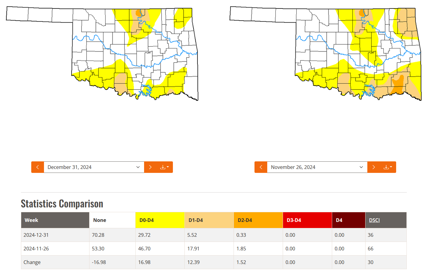
Drought conditions in Oklahoma were significantly reduced during December,
shrinking from 18% coverage at the start of the month to just 6% by its end.
Drought coverage had peaked earlier in the year, reaching 92% on Nov. 5.
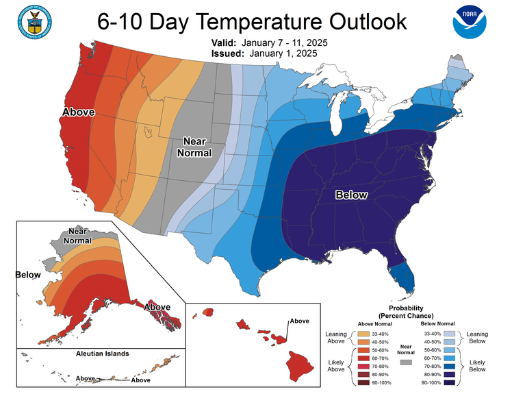
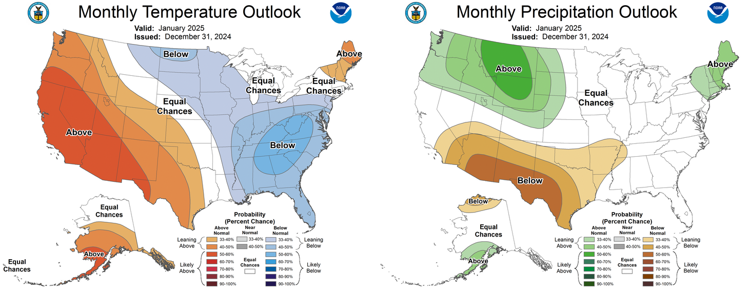
According to the January outlooks from the Climate Prediction Center, there are
increased odds of below-normal precipitation across all but far northern
Oklahoma and above-normal temperatures for the western half of the state.
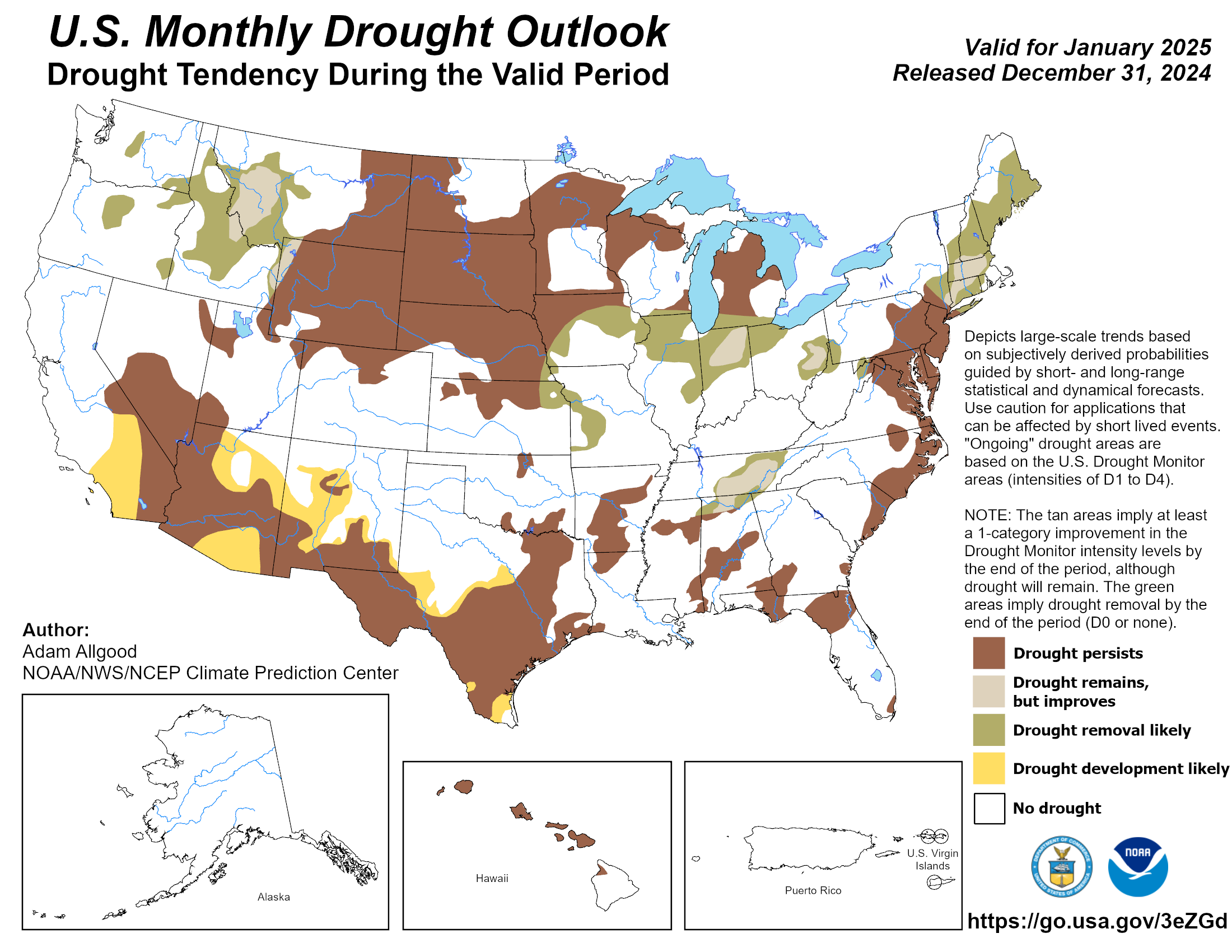
Drought conditions are expected to remain steady through January, with no
further development anticipated.
###
Gary McManus
State Climatologist
Oklahoma Mesonet
Oklahoma Climatological Survey
gmcmanus@ou.edu
January 2 in Mesonet History
| Record | Value | Station | Year |
|---|---|---|---|
| Maximum Temperature | 80°F | BURN | 2004 |
| Minimum Temperature | -10°F | KENT | 2013 |
| Maximum Rainfall | 2.55 inches | CLOU | 2005 |
Mesonet records begin in 1994.
Search by Date
If you're a bit off, don't worry, because just like horseshoes, “almost” counts on the Ticker website!