Ticker for December 20, 2024
MESONET TICKER ... MESONET TICKER ... MESONET TICKER ... MESONET TICKER ...
December 20, 2024 December 20, 2024 December 20, 2024 December 20, 2024
Discontent
I'm one of three people working (SNORT!) today, so if you're the other 2,
congrats.
I was told there would be no math.
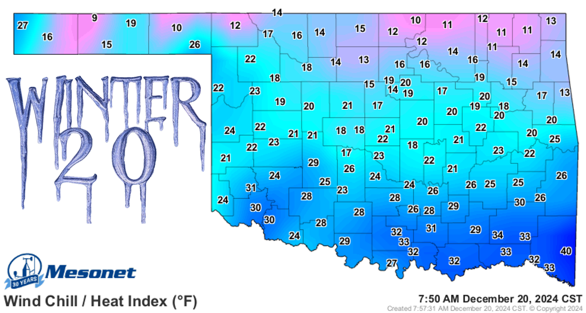
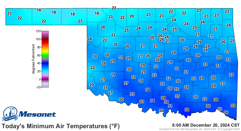
So we had a cold front barrel through the state last night like a big slobberin'
dog, dropping teens and 20s this way and that for wind chills. The actual air
temperatures indicate...winter.
Oviously (new improved "obviously"...now with less "b"!) it could be a lot worse!

Yeah, apparently it was an unpleasant day exactly 100 years ago. If you remember
that day, I want to know your secret to a long life.
Oh, mine you ask? Easy.
No. Strawberry. Pop-Tarts.
Ever.
But wait, we're not here to talk longevity, we're here to talk winter, and it's
gonna have a short life once again after a cold day today and tomorrow morning.
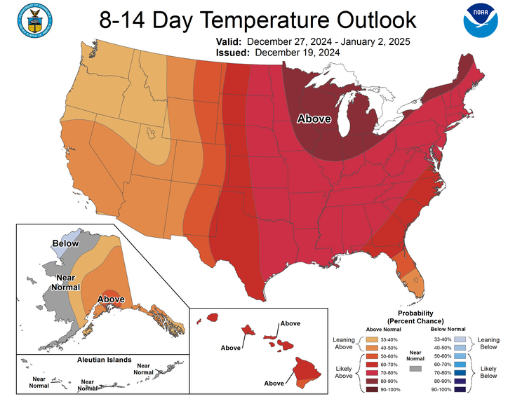
After that, it's right back to the warm side normal, which is better than the
abby side where I'm at.
And we're not talking a frozen New Year's Day either.
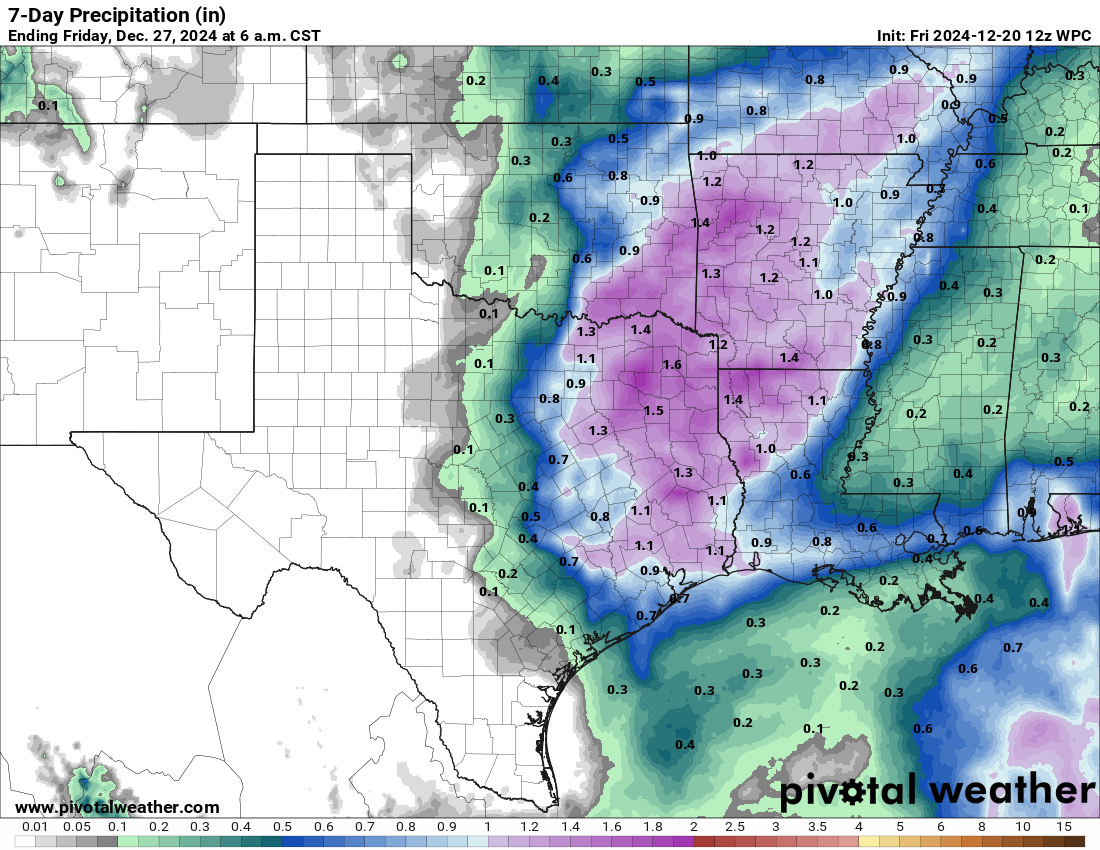
The good news is the rainfall over the next week has expanded westward a bit.
not far enough, obviously, but it's progress WHEN it happens. No ifs ands or
booties here.
So no snow. BOO!
No ice. YAY!
Some rain. YAY!
See ya next year. YAY?
Gary McManus
State Climatologist
Oklahoma Mesonet
Oklahoma Climate Survey
gmcmanus@ou.edu
December 20 in Mesonet History
| Record | Value | Station | Year |
|---|---|---|---|
| Maximum Temperature | 83°F | WAUR | 2010 |
| Minimum Temperature | 1°F | EVAX | 2022 |
| Maximum Rainfall | 3.31 inches | DURA | 1997 |
Mesonet records begin in 1994.
Search by Date
If you're a bit off, don't worry, because just like horseshoes, “almost” counts on the Ticker website!