Ticker for December 19, 2024
MESONET TICKER ... MESONET TICKER ... MESONET TICKER ... MESONET TICKER ...
December 19, 2024 December 19, 2024 December 19, 2024 December 19, 2024
30 Days Later

I don't understand why our new Insectoid Overlords won't send us rain in addition
to the bevy of drones being sent to New Jersey. I mean, they've already punished
us enough with this football season in the state...why rub it in with another
(or continuing) drought? I mean (part 2), we've already blasted the chances for
a White Christmas out of the picture, so that's another blatant insult (hey,
"Blatant Insult" was my band's name at East Popcorn State University!).
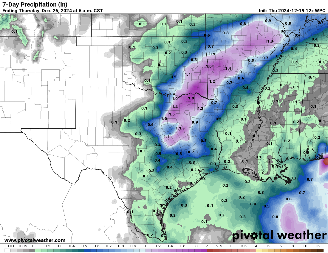
BUT, maybe something other than just eastern Oklahoma for us late on Christmas
or the day after?

We will need to watch out for the possibility of severe weather next week. Please
Insectoid Overlord Connectagazoink, don't send more tornadoes! We've already had
148 in 2024.
Wait, 148? Heck, that's just one off the all-time record (since accurate stats
began in 1950) for the state for crying out loud! We don't need to match or best
2019's 149. This comes off the higher preliminary total of 33 for November,
which itself blew 1958's previous November record of 12 out of the sky.
There is a possible pattern change coming after Christmas, so that is something
to look forward to.
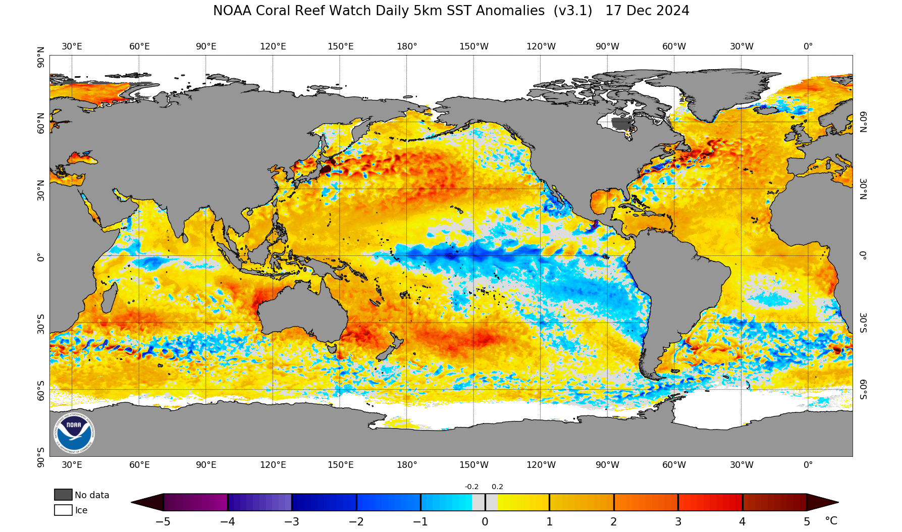
Well let's look forward even more. We're still waiting for La Nina to come into
play officially, but I've seen some talk about a quasi-La Nina (surely the work
of Connectagazoink again!) having an impact already. So we don't have the
SST anomalies in the official La Nina region to get an officially DECLARED La
Nina, but thanks to an unusually warm ocean as a whole, the temperature
differences between a sorta-cool Equatorial Pacific ocean and that unusually
warm water to the north are perhaps causing a La Nina-like coupling with the
atmosphere to produce La Nina impacts. Remember, you need that coupling between
the ocean and atmosphere to get weather impacts here over North America...in
other words, if a SST anomaly DOESN'T cause changes in the atmospheric circulation
over those anomalies, they can't cause changes in our connected atmosphere over
our heads. And whatnot.
However, it does look like those SST anomalies have dropped in the Equatorial
Pacific...an official La Nina might be at hand anyway.
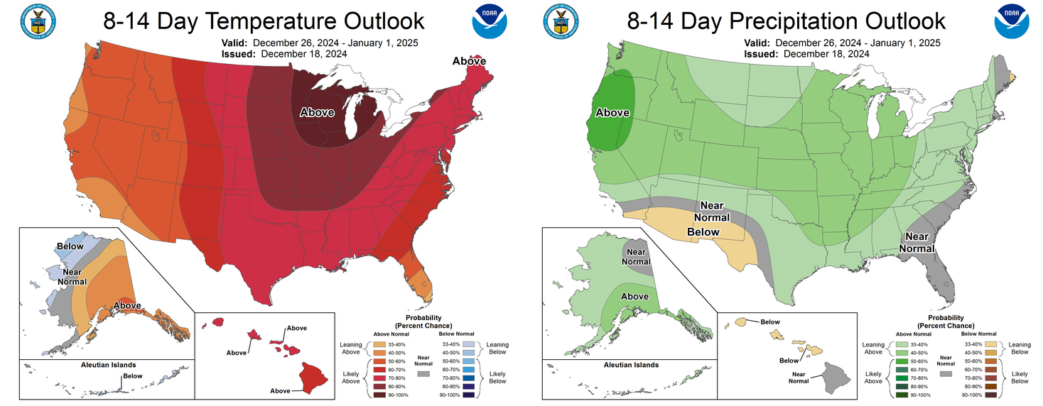
To look a bit further down the road, you'll need binoculars. However, with the
weather, you'll need the CPC outlooks for January and January-March, which show
a weakish La Nina pattern's impacts.

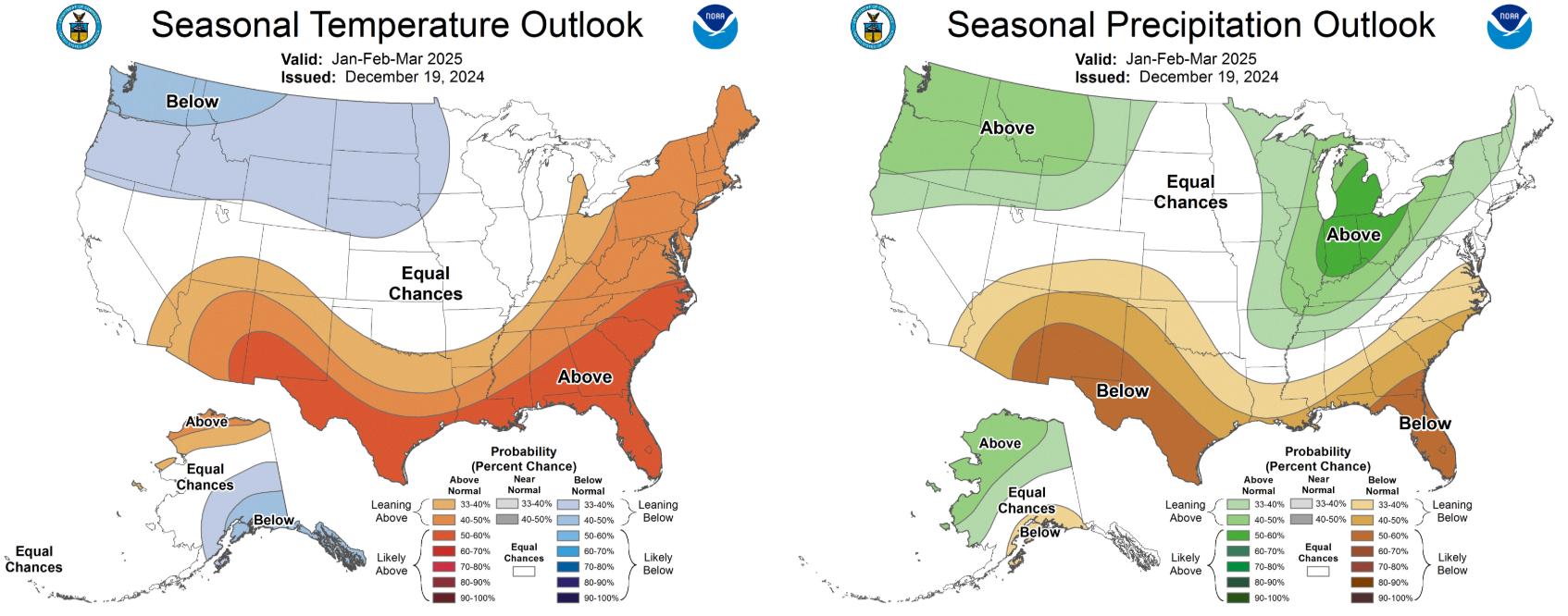
But overall, not too bad for us. And remember, even though we see the slightly
increased odds of below normal precip for the remainder of winter into early
spring, that can't account for a bigtime extreme coming in and throwing things
askew, much like genetics did to my plans for movie stardom with both my looks
and my hair.
It happens.
So, "hey, it looks kind of dry for the next 3 months on average, but we didn't
account for that 4-inch rainfall event on March 3, or that 22-inch snowfall on
January 28!"
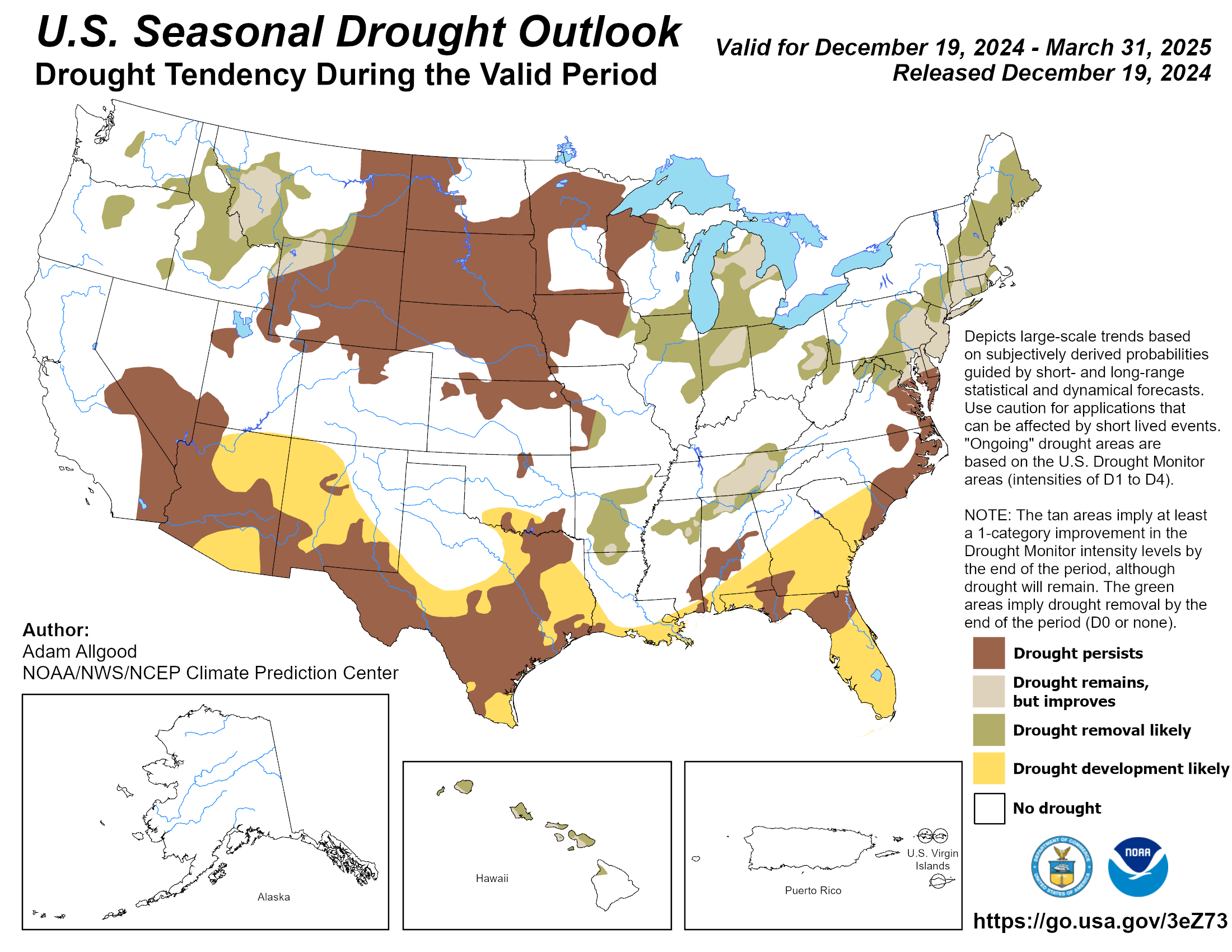
That sort of deal. We will need to watch the drought possibilities, however,
because it now has another 31-day head start, counting today.
Well there ya have it. If we don't Tock again for awhile, Merry Christmas to you
and yours, and an even happier New Year!
Gary McManus
State Climatologist
Oklahoma Mesonet
Oklahoma Climate Survey
gmcmanus@ou.edu
December 19 in Mesonet History
| Record | Value | Station | Year |
|---|---|---|---|
| Maximum Temperature | 75°F | IDAB | 2012 |
| Minimum Temperature | -10°F | EVAX | 2016 |
| Maximum Rainfall | 2.94 inches | BUTL | 2006 |
Mesonet records begin in 1994.
Search by Date
If you're a bit off, don't worry, because just like horseshoes, “almost” counts on the Ticker website!