Ticker for December 18, 2024
MESONET TICKER ... MESONET TICKER ... MESONET TICKER ... MESONET TICKER ...
December 18, 2024 December 18, 2024 December 18, 2024 December 18, 2024
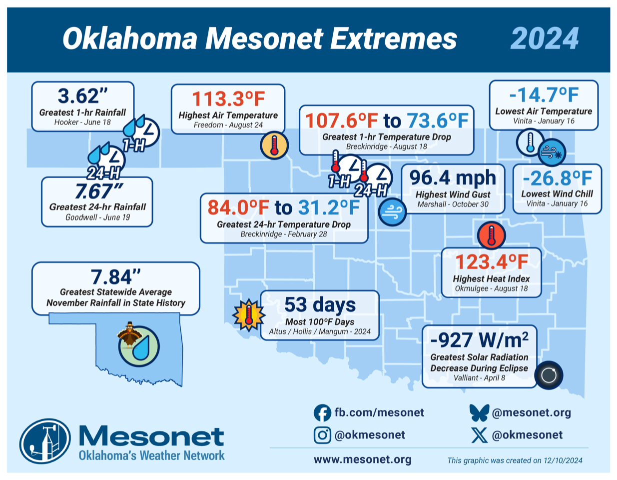
Extremely Extreme Extremes of 2024
Extreme? We don't need to look back to see extreme, we just have to look outside!
Yeah, THAT'S extreme, considering what weather we've been having up until this
morning. Heck, we had 60s and 70s yesterday for crying out loud!
So maybe not extreme for December, but extreme for THIS December. But no (but
yes?), we're not gonna match and of those 2024 Oklahoma Mesonet Extremes for,
uhhhhhhhhhhh, 2024. I hate when that happens.
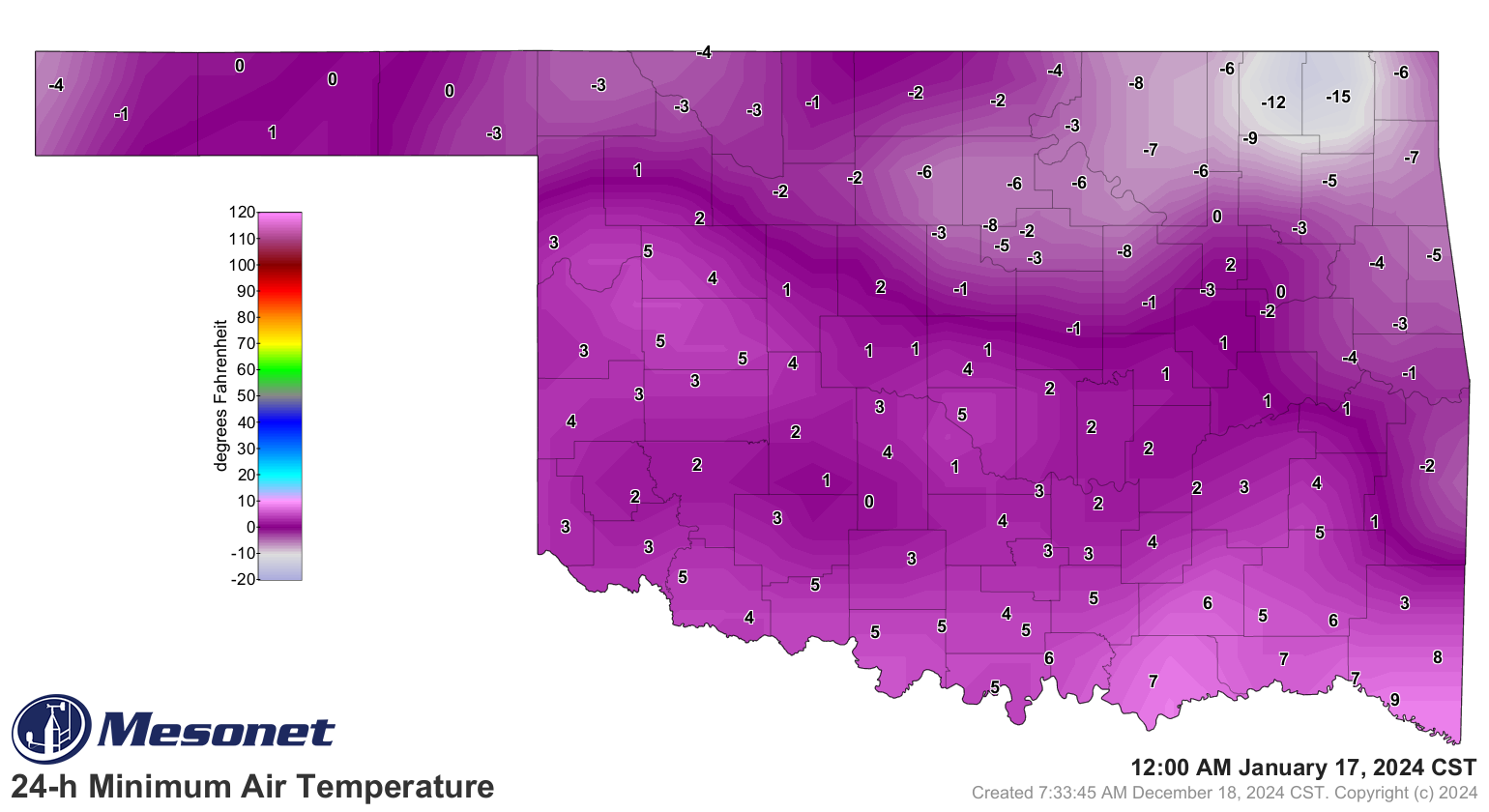
Do you see a -26.8F (that's -27 to you and me, kids) wind chill this morning,
like we saw on January 6 in Vinita? Didn't think so.
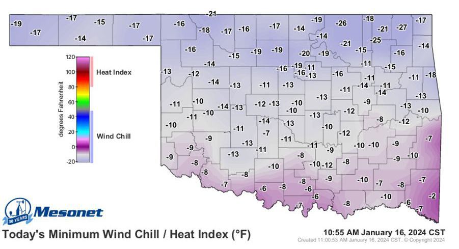
Or the -14.7F actual air temperature that morning in Vinita? Nope.
I yearn (and we all know just how painful that can be) for the other side of
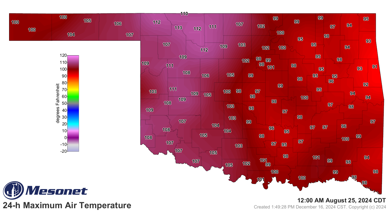
those extremes, like the 113.3F high in Freedom back on August 24.
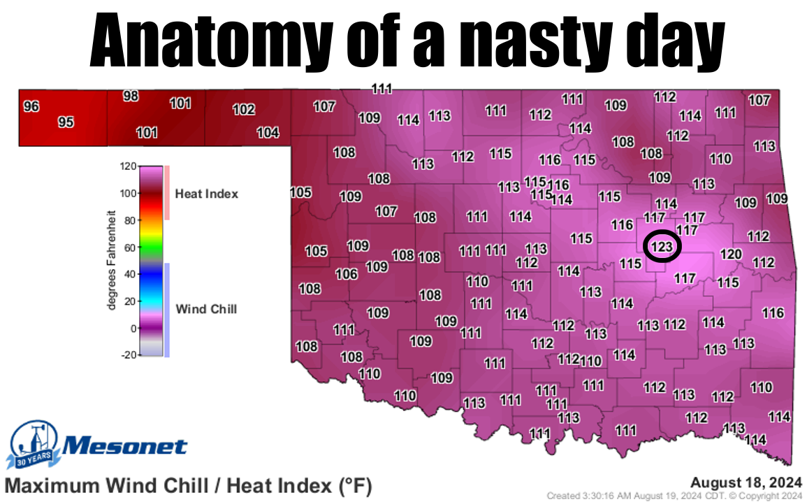
Maybe not so much the heat index of 123.4F at Okmulgee the week before, however.
Give me a dry heat any day. Please?
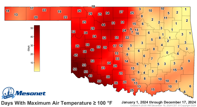
Speaking of heat, we had our own little circle of Hades centered in far SW OK
this year, where Altus, Hollis, and Mangum all saw 53 days at or above 100
degrees.
I think it was Will Rogers, or perhaps Will Jorgenson, that guy that hangs
around the 7-Eleven calling everybody "brother," that said "if you don't like
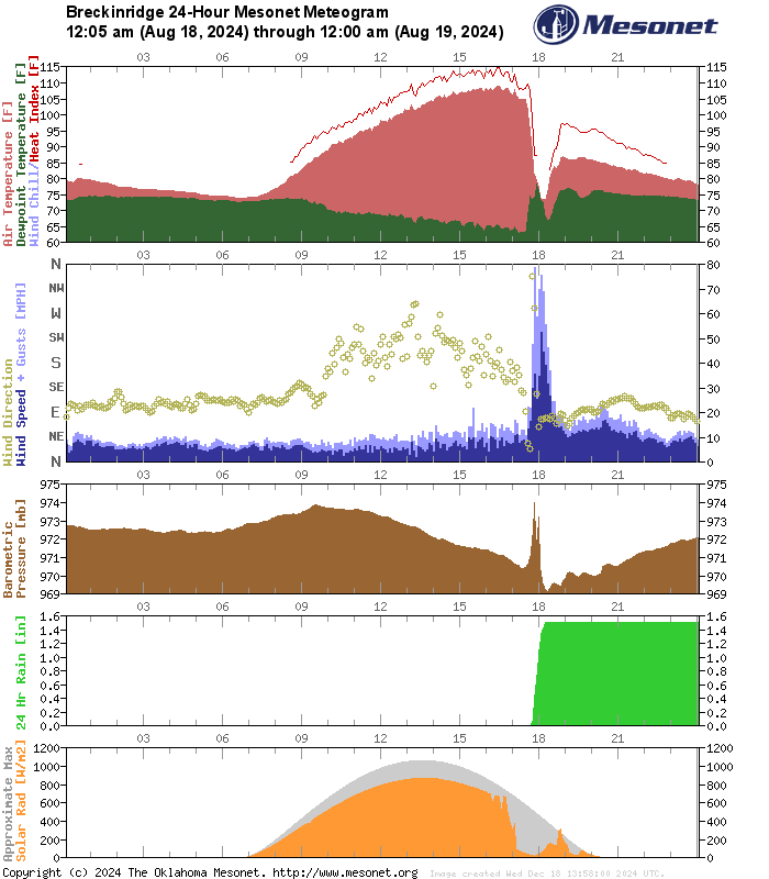
the weather in Oklahoma, give it an hour...just like what happened in
Breckinridge on August 18 when the temperature dropped from 107.6F to 73.6F in
an hour!
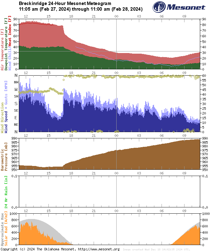
If an hour goes by too quickly, you can also just give it 24 hours for good
measure, like we did AGAIN in Breckinridge on February 28 when the temp dropped
from 84F to 31.2F!
Remember the rainfall extremes in the Panhandle? Usually it's the LACK of rainfall
that's the extreme out that way, but on June 18-19, we tried to fill up Lake
Optima with a 1000-year rainfall event that left the flatlands of the Oklahoma
Panhandle an inland sea.
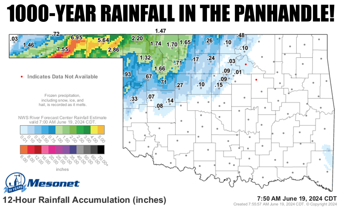
Read all about it righ'chere.
https://ticker.mesonet.org/ticker?date=2024-06-19
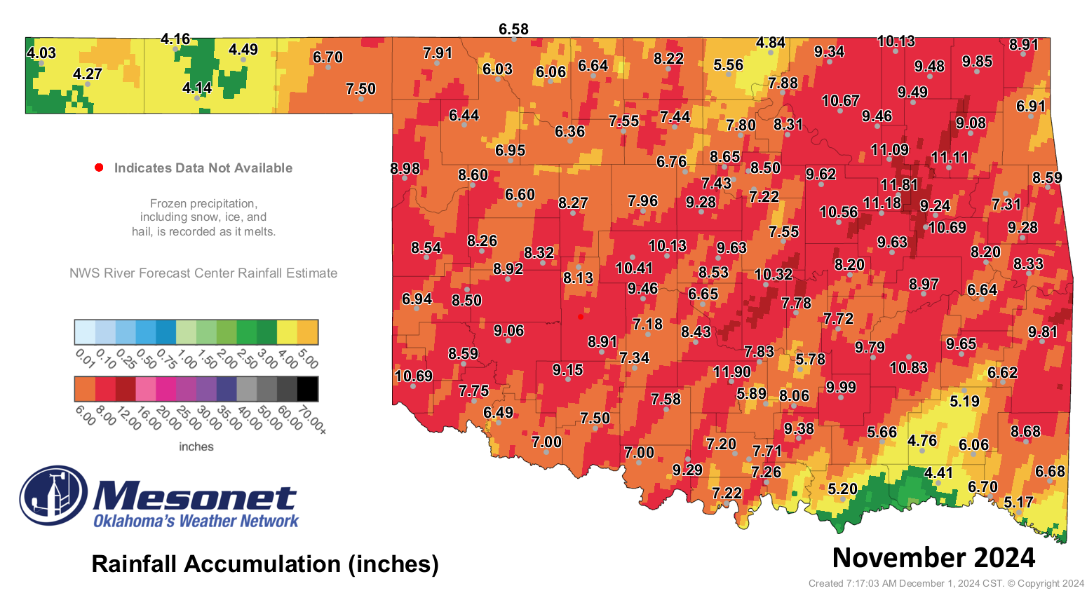
And who can forget November. Who?
NOVEMBER, and it's obliteration of the previous record statewide rainfall total
of 6.05" from 2015 with a whopping 7.84" in 2024.
Why? Because Oklahoma, that's why (and also don't forget the 33, 33!, tornadoes
that touched down last month as well).
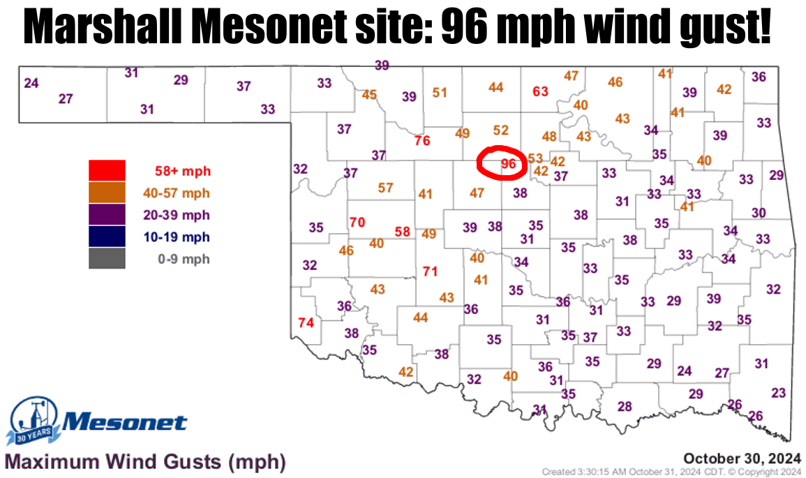
Oh, the Mesonet doesn't measure tornadoes? Sure it does, when tornadoes measure
the Mesonet, like at Marshall on October 30 when that site was wayyyy too close
to an EF1 twister and recorded a wind gust of 96.4 mph.
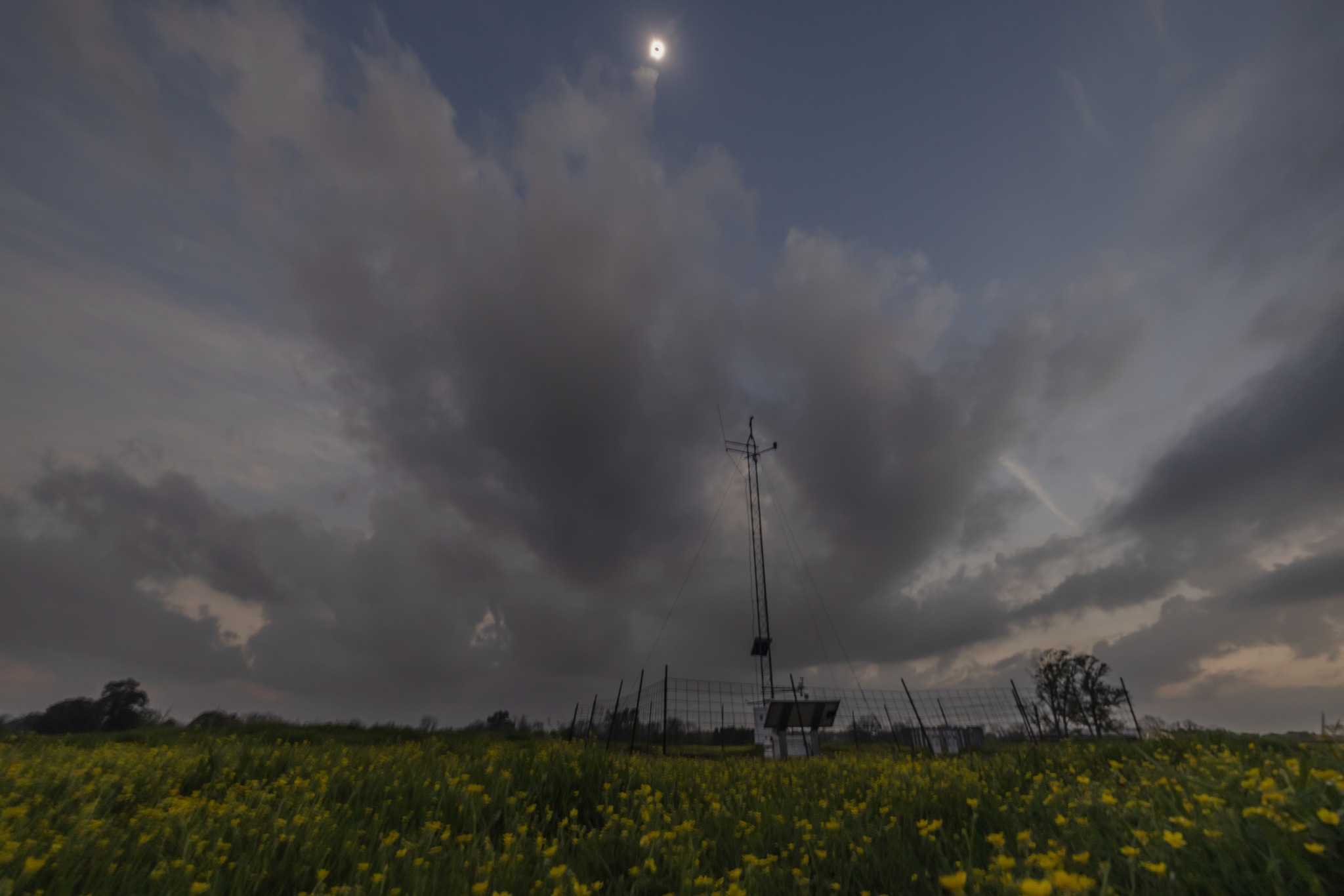
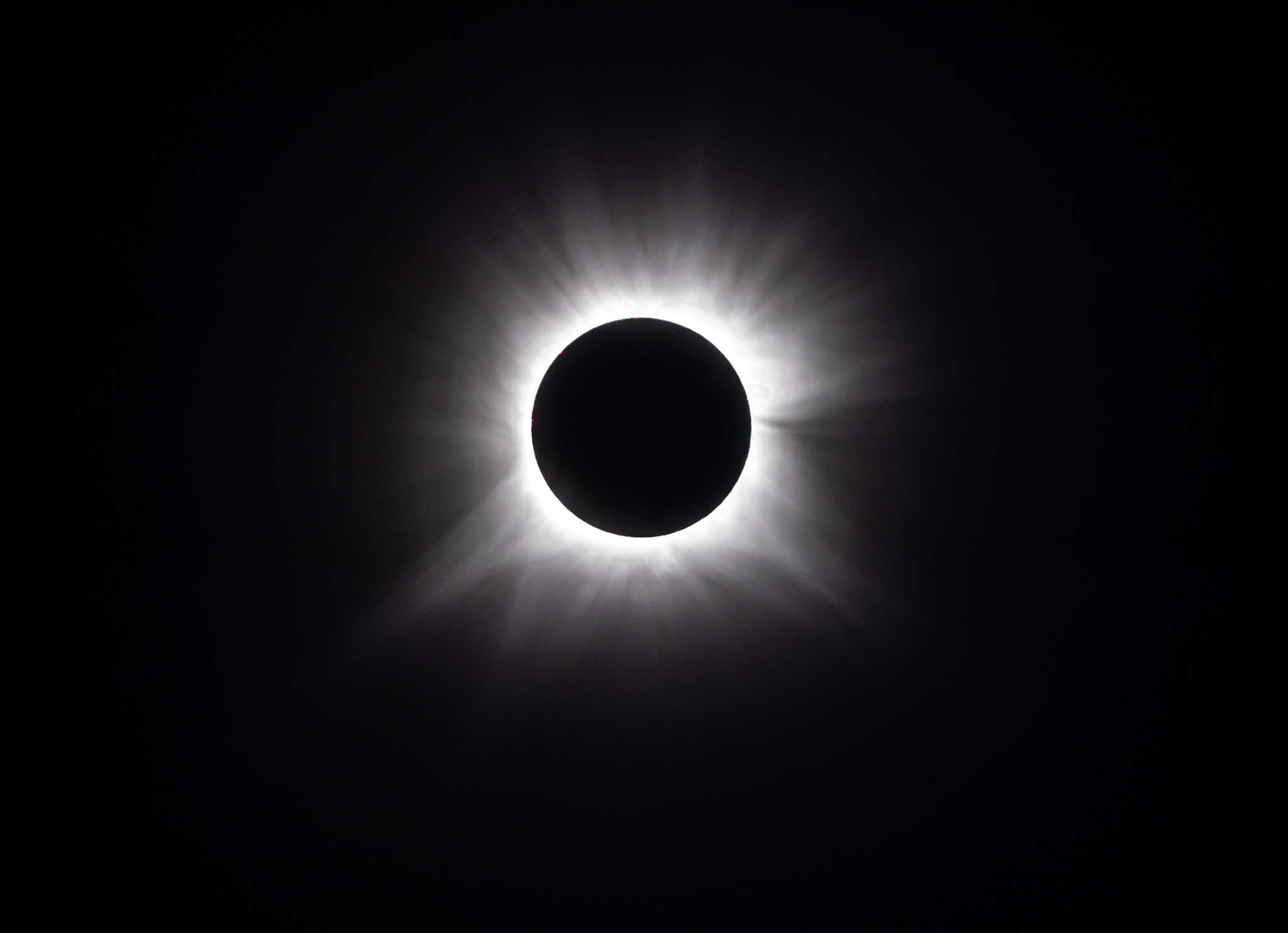
And finally, the day it got dark as night in SE OK, we saw that total eclipse
down in McCurtain County and the surrounding area, and our Valliant Mesonet
site was VALLIANTLY (valiantly, now with an extra L!) keeping track of the
solar radiation drop throughout the event. We have the pics from the site to
prove it!
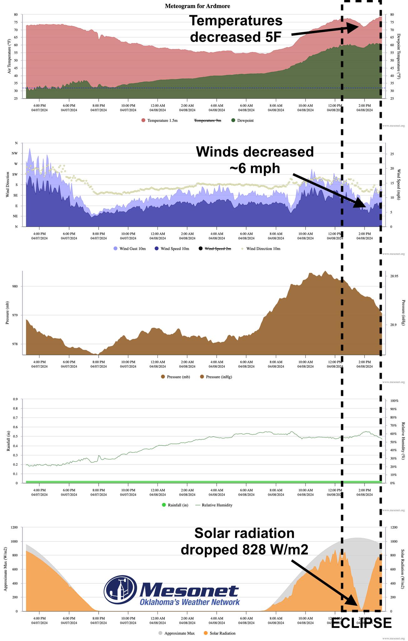
Shoot, even in places farther west like Ardmore saw a significant impact to the
Mesonet data, outside of the totality.
We took a chance releasing this on December 18, of course, with two weeks still
to go in 2024. But come on, what's the worst that could happen in two weeks?

Gary McManus
State Climatologist
Oklahoma Mesonet
Oklahoma Climate Survey
gmcmanus@ou.edu
December 18 in Mesonet History
| Record | Value | Station | Year |
|---|---|---|---|
| Maximum Temperature | 76°F | HUGO | 2006 |
| Minimum Temperature | -18°F | EVAX | 2016 |
| Maximum Rainfall | 1.43 inches | WEST | 1995 |
Mesonet records begin in 1994.
Search by Date
If you're a bit off, don't worry, because just like horseshoes, “almost” counts on the Ticker website!