Ticker for November 21, 2024
MESONET TICKER ... MESONET TICKER ... MESONET TICKER ... MESONET TICKER ...
November 21, 2024 November 21, 2024 November 21, 2024 November 21, 2024
Faber
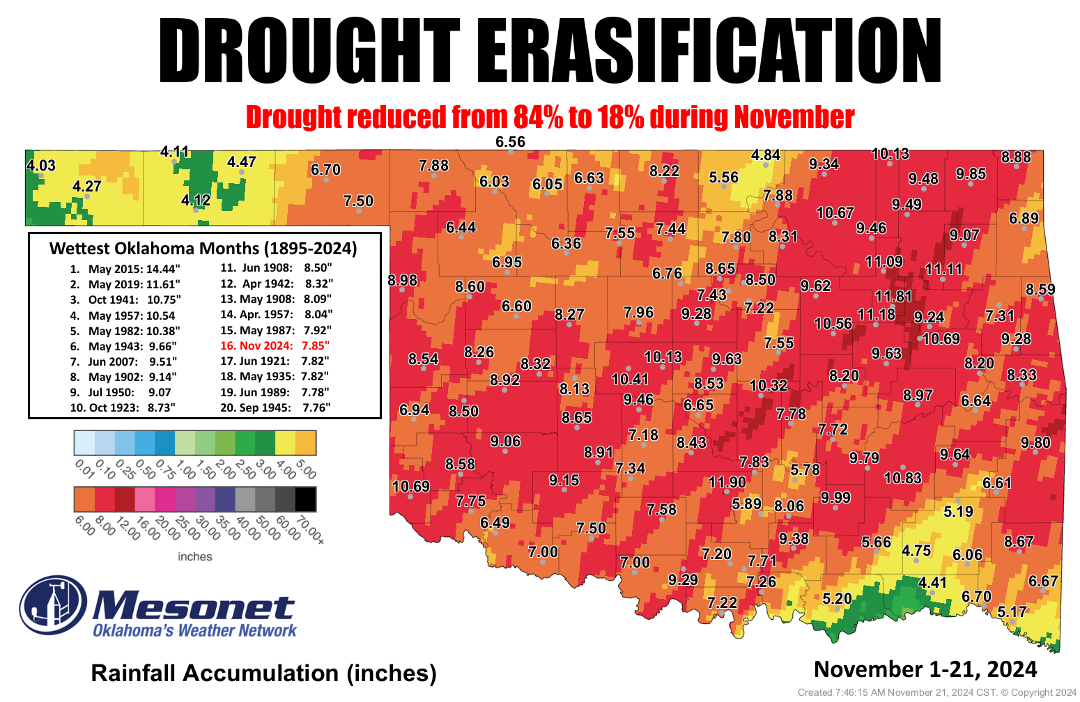
Drought? Who cares about drought (well, I do, but that's beside the point)!?! It's
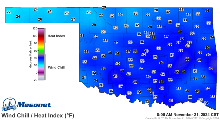
frigging freezing (hey, "Frigging Freezing" was my band's name in Alcatraz!)
outside!
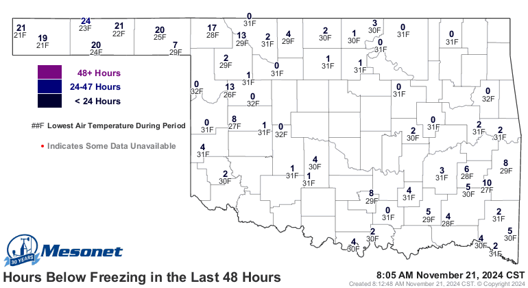
Some folks even had a freeze this morning.

Darn, that's danged-near North Pole-like! Notice how I was careful to separate my
darn and dang (and we all know just how painful that can be!)? Well, desperate
times call for desperate measures, and the freezes we have measured over the last
couple of days are some of the coldest weather we've seen so far this season.
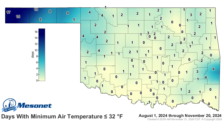
Heck, some areas are STILL waiting for their first freeze, for crying out loud!
Okay, enough out winter trying to peek out from behind the curtains...how about
that record rainfall? It has caused some problems with flooding, obviously, but
it's also done wonders for our drought. As the graphic sez, we've seen a
reduction of drought in the state from 84% to 18% during November, with just a
few areas still holding onto those deficits.
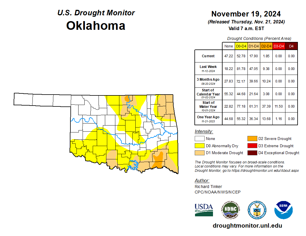
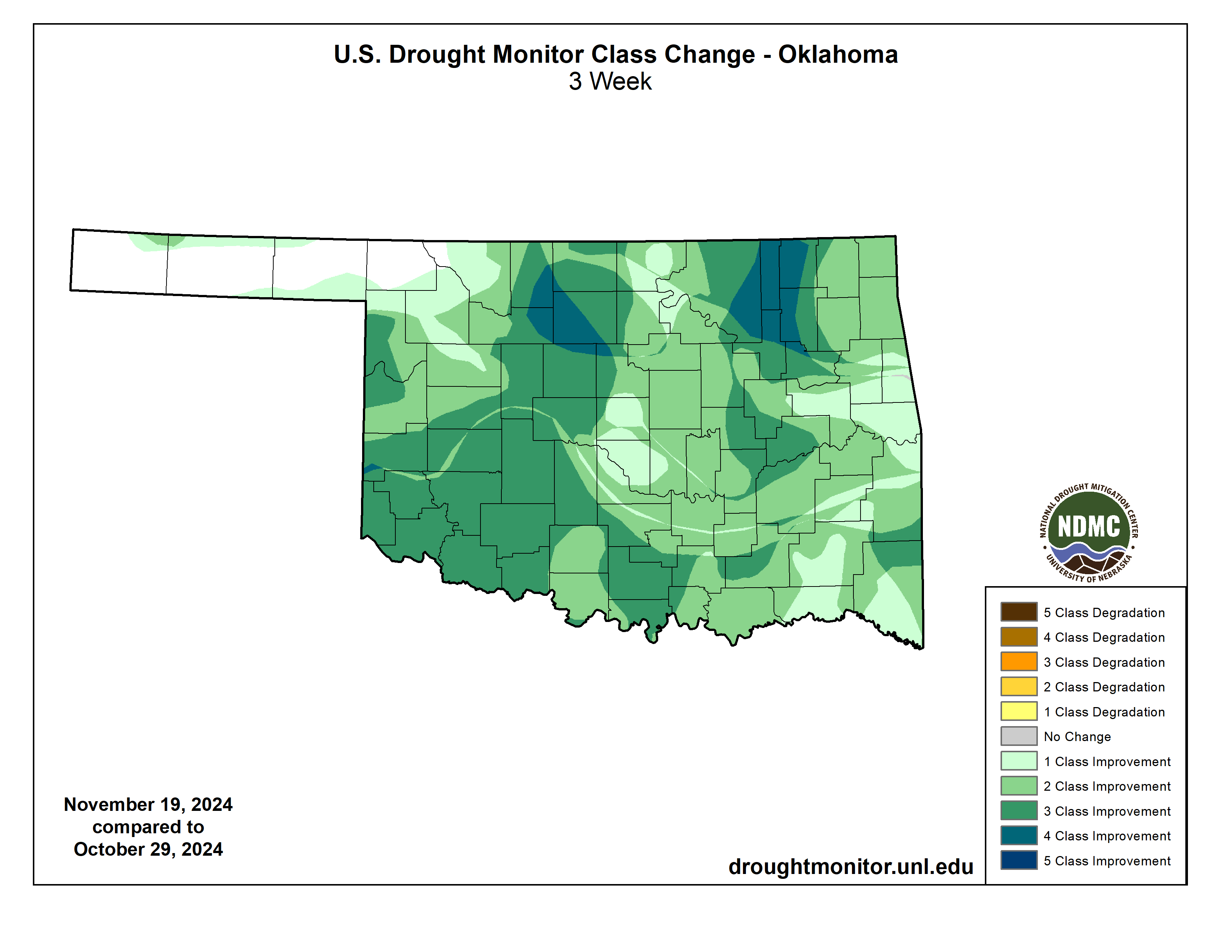
Even better, the amount of Severe (D2) and Extreme (D3) drought dropped from
68% of the state to just 2% during that same time frame. Just under 35% of
Oklahoma is under those Abnormally Dry (D0) conditions. D0 isn't a drought
designation, but it signals areas either going into or coming out of drought...
the latter which applies here.
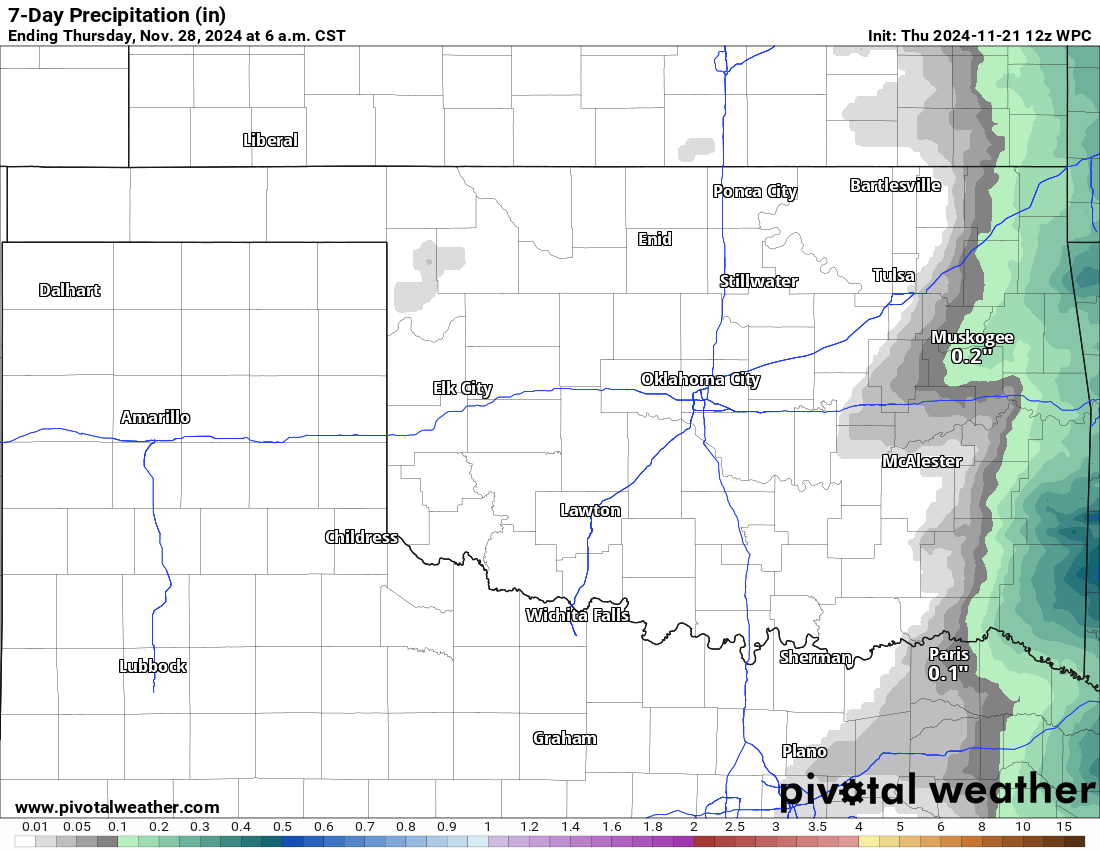
Not much rain is showing up for the next week or so, but that's okay. We could
use a bit of sun as the state continues to clean up after our record 23 (and
counting) November tornadoes.
Are ya like me (seek help if so...I understand there is medication available)
and you'd like a bit of winter in between all this warmth? Maybe a flake or
two (flakes, you know who you are)? Nothing really showing up just yet, although
there are some computer models trying to spit out some snow later next week.
December looks to remain warm, at least relative to normal December weather,
but that doesn't preclude a drastic deep freeze or two...and we're not seeing
the dreaded "below normal precip" signal according to the Climate Prediction
Center.
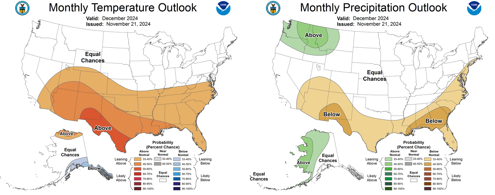
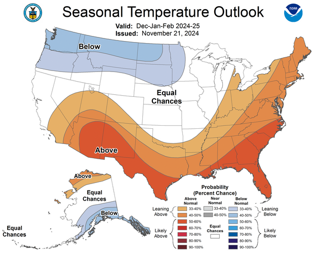
*ABOUT* the same look from CPC for the winter, with the Dec-Feb outlooks showing
increased odds of above normal temps for far southern OK, as well as below normal
prcip for all but the NE corner. Just a smidge elevated on both, however.

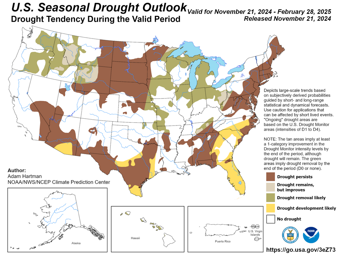
More good news according to CPC, no new drought expected in the state during
that time frame...in fact, a bit more easing up north. Unfortunately, the
drought in SE OK is expected to hold fast.
Now the Ticker is going to be off for the next 10 days or so, but we'll be back
to Tock about anything big showing up if need be.
It's Oklahoma...I'm betting need WILL be!
Gary McManus
State Climatologist
Oklahoma Mesonet
Oklahoma Climate Survey
gmcmanus@mesonet.org
November 21 in Mesonet History
| Record | Value | Station | Year |
|---|---|---|---|
| Maximum Temperature | 82°F | WAUR | 2010 |
| Minimum Temperature | 11°F | KENT | 2022 |
| Maximum Rainfall | 4.52″ | TALI | 2011 |
Mesonet records begin in 1994.
Search by Date
If you're a bit off, don't worry, because just like horseshoes, “almost” counts on the Ticker website!