Ticker for December 2, 2024
MESONET TICKER ... MESONET TICKER ... MESONET TICKER ... MESONET TICKER ...
December 2, 2024 December 2, 2024 December 2, 2024 December 2, 2024
Here we go again
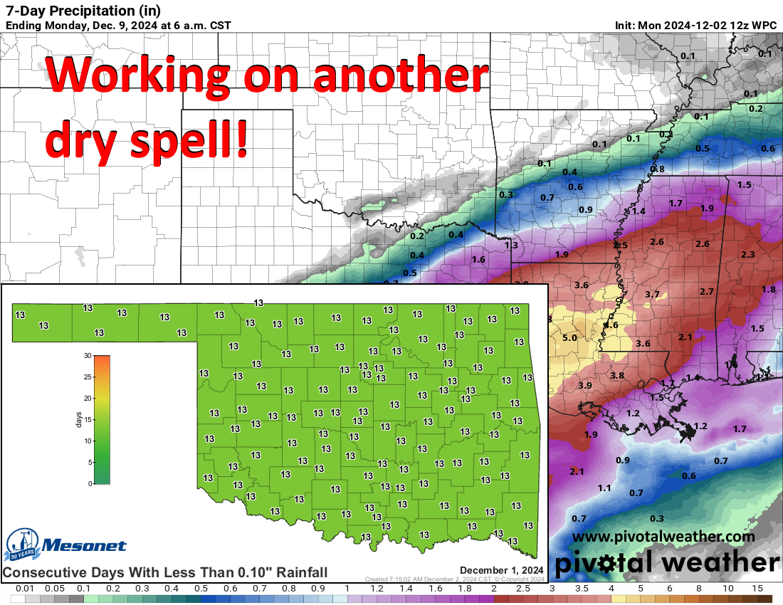
We're back! You're front! Together we're...ahh, I don't know where that's going.
So did you do the eating and the shopping and the napping and the football
watching and the Christmas lights putting up and the whatnot? Nice. One thing
you didn't do is put up with any rain, since it has now been two weeks--as of
today--since we've seen significant rainfall anywhere in the state. But that's
okay for a bit longer thanks to what we saw in November's first 18 days (more
on...no not "moron"...I heard that...more on that down below in the November
summary!). However, it does need to end soon, but soon ain't coming soon, it
would appear.
So what we're faced with is lots and lots of boring weather, and after 31
tornadoes in November...yes 31 TORNADOES IN NOVEMBER, boring is also good. We'll
see fluctuating temperatures (and we all know just how painful that can be),
some cloudiness here and there, some cold weather, some mild weather, and
very little in the way of rainfall.

I won't bore ya anymore. Well, until tomorrow. Plenty of excitement below
recounting November's crazy weather. Enjoy (that it's over).
----------------------------------------------------------------------------------
A November for the Record Books
Dec. 2, 2024
November 2024 will enter Oklahoma’s vast and storied weather lore as one of the
most extreme months in state history, shattering records for both the highest
statewide average rainfall and the most tornadoes ever recorded in November.
This unprecedented combination of rain and storms has left an indelible mark on
the state’s already dynamic weather narrative. The month also saw another
extreme, drought—which had been rapidly intensifying since mid-summer—nearly
eradicated by the historic rainfall.
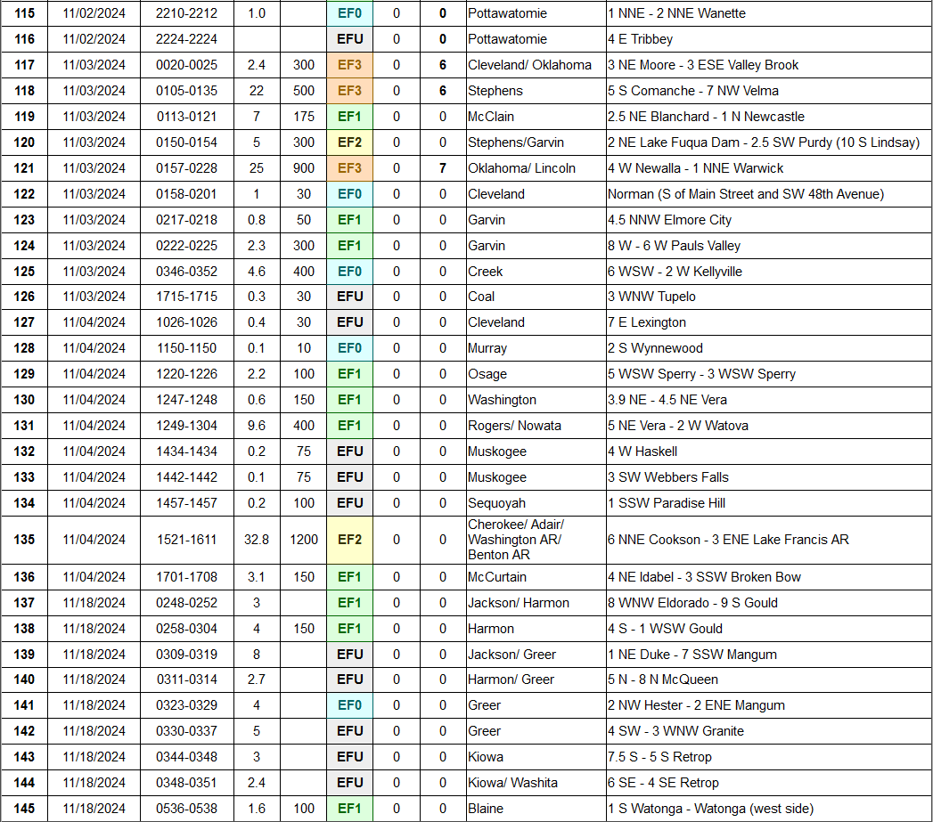
At least 31 tornadoes were confirmed during the month, according to preliminary
data from the National Weather Service, nearly tripling the previous November
record of 12 set in 1958. That brought the 2024 tornado count to 145 through
November, just four shy of the record 149 set through all of 2019. The tornadic
activity came in two waves, the first striking from Nov. 2-4 and causing the
most damage. Three tornadoes were rated EF3 on the Enhanced Fujita Scale, while
another was rated EF2. Preliminary reports from emergency management officials
indicated at least 384 structures were damaged or destroyed, and the Oklahoma
State Department of Health reported nearly 50 injuries. Substantial damage
occurred in southeast Oklahoma City, Moore, Choctaw, Comanche, Harrah,
Fairland, and near Tenkiller. An EF1 tornado struck near the Oklahoma Mesonet
site at Talala, which measured a wind gust of 94 mph as the twister passed
nearby. The month’s second wave of tornadoes hit southwestern Oklahoma early on
Nov. 18. Though far less violent and damaging, the overnight twisters added at
least nine more to the month’s total.
While the November rains were as extreme as the month’s tornadoes—adding
flooding to the month’s woes—they helped significantly alleviate Oklahoma’s
ongoing drought. The statewide average rainfall totaled 7.84 inches, according
to preliminary data from the Oklahoma Mesonet—5.52 inches above normal—
obliterating the previous record of 6.05 inches set in November 2015. It also
became the 16th-wettest calendar month on record, dating back to 1895. May 2015
still holds the top spot with 14.44 inches. Numerous individual locations
across the state also saw their all-time November rainfall records fall. These
accomplishments were made even more remarkable by the fact that the rainfall
occurred almost exclusively during the first 18 days of the month.
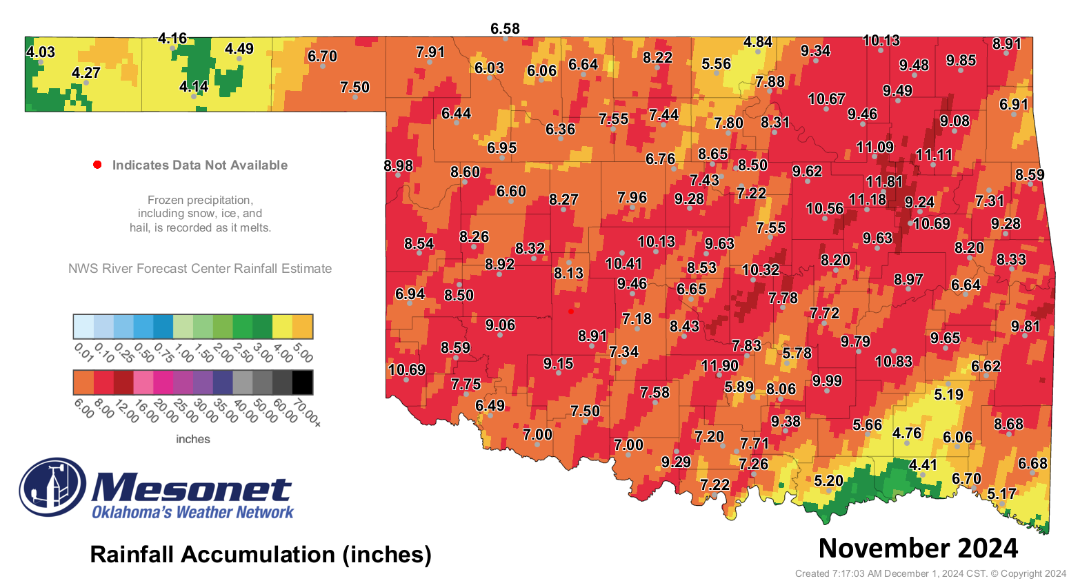
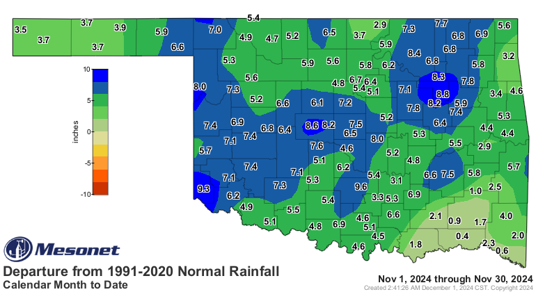
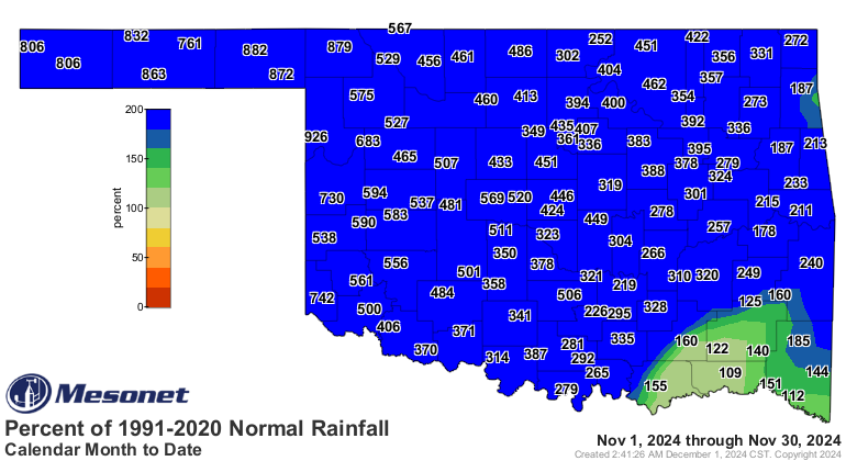
The heaviest rains fell from southwestern to northeastern Oklahoma, with totals
ranging from 8 to 11 inches and surpluses of 7 to 10 inches. All areas of the
state saw a surplus, though parts of southeastern Oklahoma barely exceeded
normal with totals closer to 4 inches. Pauls Valley recorded the highest
Mesonet total at 11.9 inches, while even Kenton’s low of 4.03 inches was 3.5
inches above normal. Some volunteer observing sites in northeastern Oklahoma
reported more than 13 inches, including 13.8 inches near Broken Arrow.
The precipitation wasn’t all rain. The far western Panhandle received more than
20 inches of snow over a five-day span from Nov. 5-9, including 26 inches
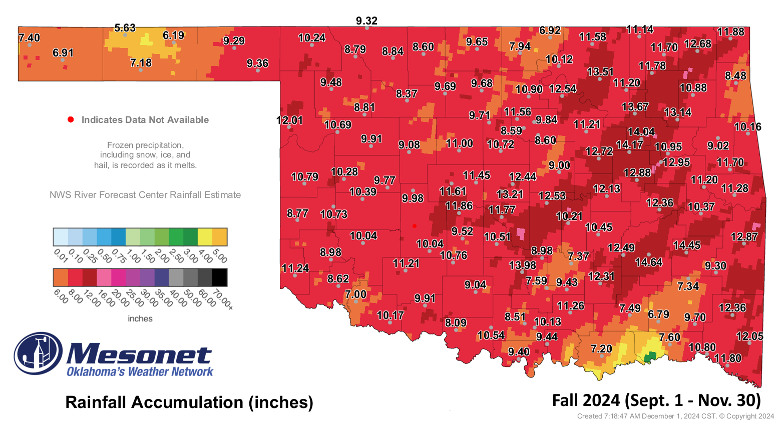
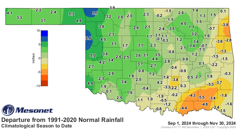
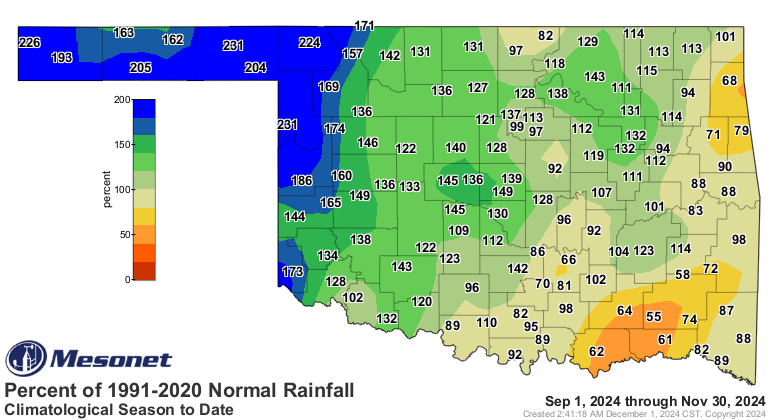
reported by a volunteer observer south of Kenton. Climatological fall—September
through November—ended as the 37th-wettest on record, with a statewide average
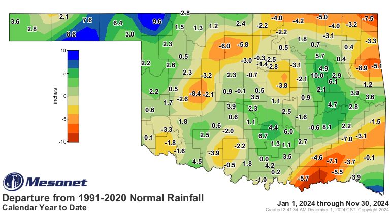
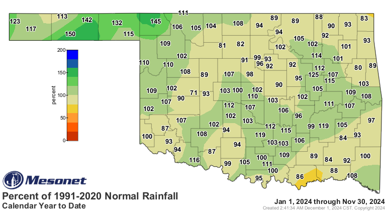
of 10.2 inches, 1.2 inches above normal. The first 11 months of the year were
also wetter than average, with a surplus of 0.52 inches, making it the
44th-wettest January-through-November period on record, with 34.77 inches.

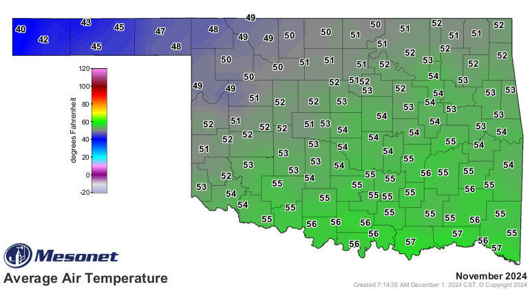
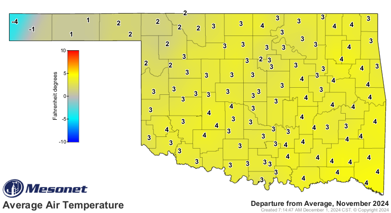
November was also unusually warm, finishing with a statewide average
temperature of 52.9 degrees, 3.5 degrees above normal, ranking as the 11th-
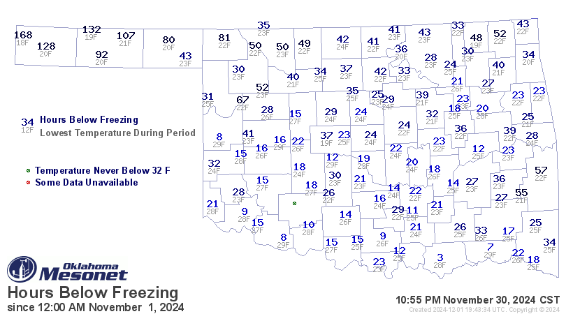
warmest since records began in 1895. Cold weather was scarce, with some areas
not experiencing their first freeze until the day after Thanksgiving. Durant
recorded only three hours below freezing, according to Mesonet readings.
Temperatures ranged from 86 degrees at Talihina on Nov. 4 to 18 degrees at
Kenton on the month’s final day.
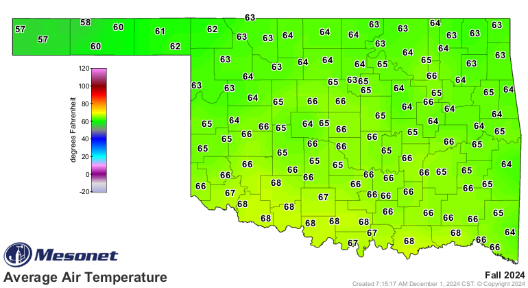
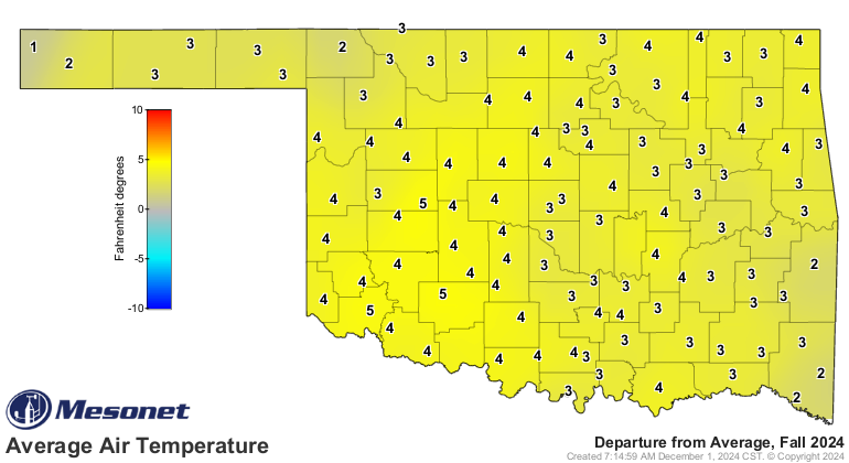
Autumn was exceptionally warm, with a statewide average temperature of 65.3
degrees—4.1 degrees above normal—ranking as the third-warmest fall (September
through November) on record. The first 11 months of the year ranked as the
second-warmest on record, with a statewide average of 64.8 degrees, 2.6 degrees
above normal.
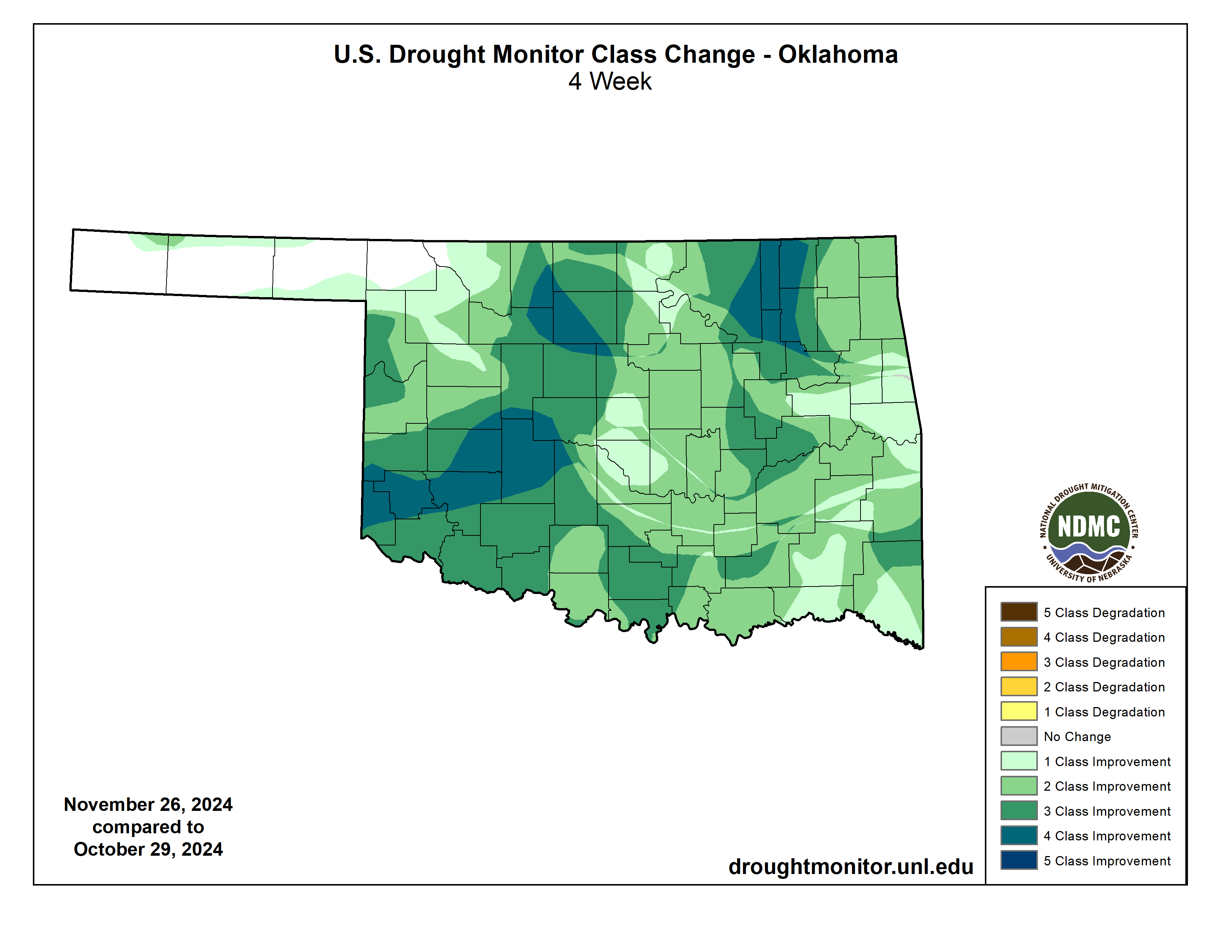
Drought’s coverage dropped from 84% of the state in late October to just 18% by
the end of November, according to the U.S. Drought Monitor—the lowest levels
seen in Oklahoma since early June. More severe drought levels fell from 42% to
2% during the month.

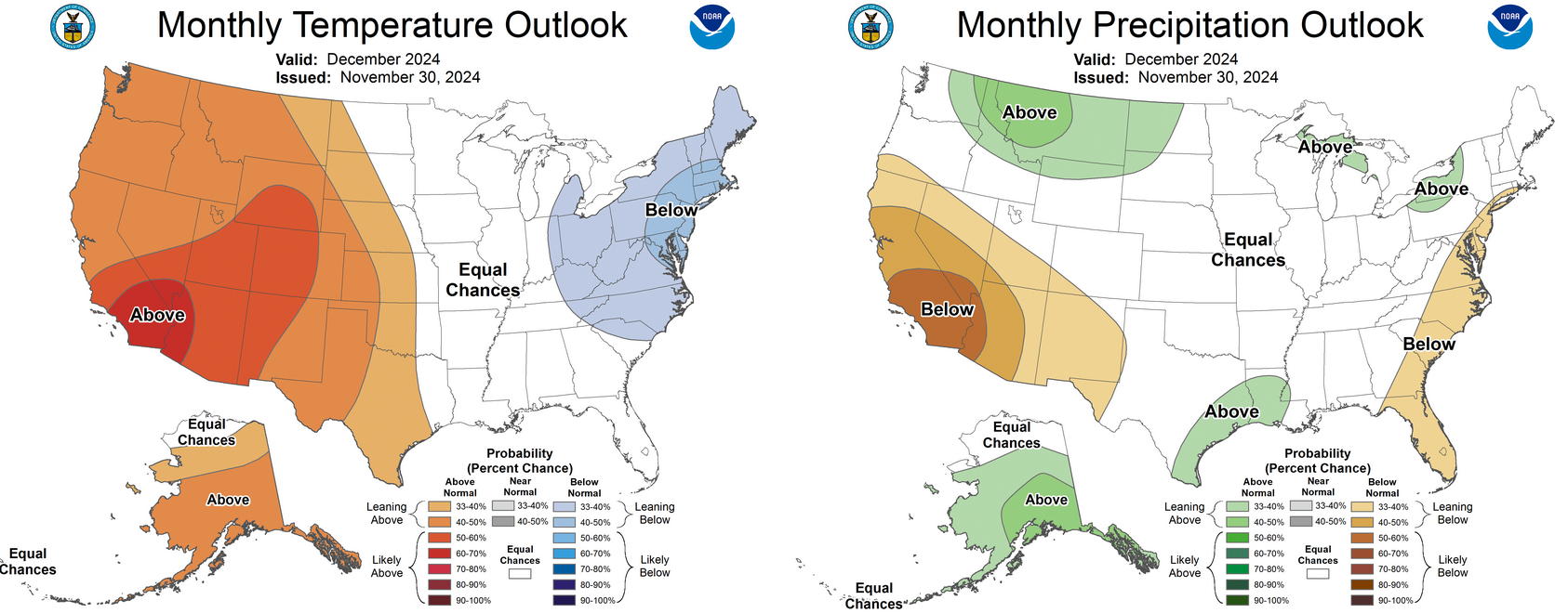
The December outlook from the Climate Prediction Center (CPC) indicates
increased odds of above-normal temperatures across the western three-fourths of
the state, particularly in far western Oklahoma and the Panhandle. The
precipitation outlook shows equal chances of above-, below-, or near-normal
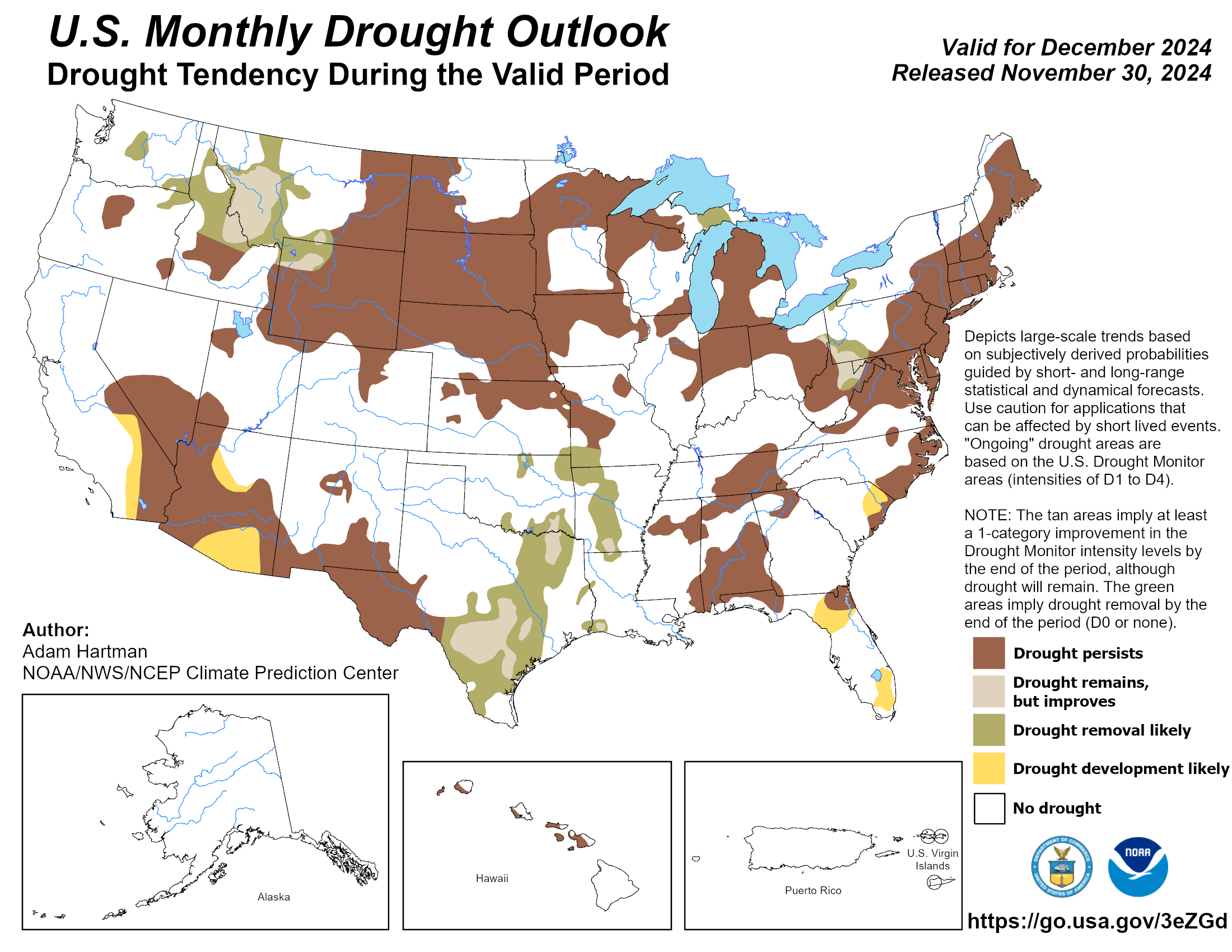
totals. CPC’s December drought outlook calls for further improvement in drought
conditions where it still exists.
###
Gary McManus
State Climatologist
Oklahoma Mesonet
Oklahoma Climate Survey
gmcmanus@ou.edu
December 2 in Mesonet History
| Record | Value | Station | Year |
|---|---|---|---|
| Maximum Temperature | 83°F | BURN | 2021 |
| Minimum Temperature | -1°F | MIAM | 2006 |
| Maximum Rainfall | 2.15 inches | BROK | 2020 |
Mesonet records begin in 1994.
Search by Date
If you're a bit off, don't worry, because just like horseshoes, “almost” counts on the Ticker website!