Ticker for October 15, 2024
MESONET TICKER ... MESONET TICKER ... MESONET TICKER ... MESONET TICKER ...
October 15, 2024 October 15, 2024 October 15, 2024 October 15, 2024
Neighbor?
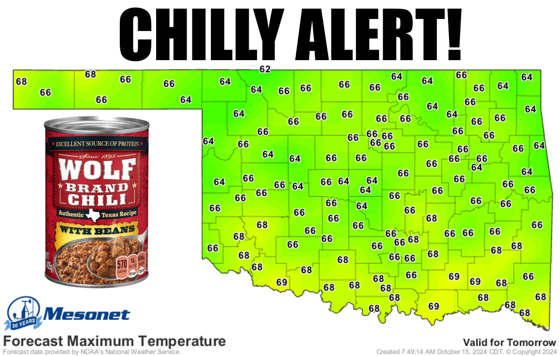
I like to have beans in my chili, because I think a guy that eats beans in his
chili is hard to stop. Now some would say 60s for highs and 30s for lows still
isn't chili weather, but it's chilly enough when faced with the coolest day in
the state since late April (maybe earlier)! I mean, it WILL be our first
freeze in the state since April 22, for crying out loud.
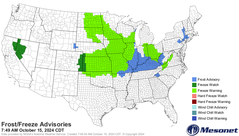
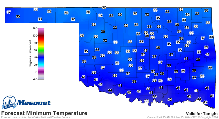
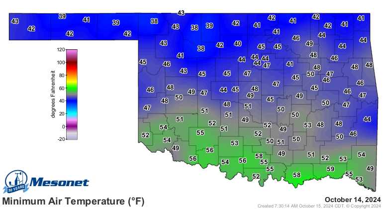
We've already had our first 30s in OK since May 25 the last couple of days (I
started to say "our first 30s the last couple of days since May 25," but that
frightened and confused me).
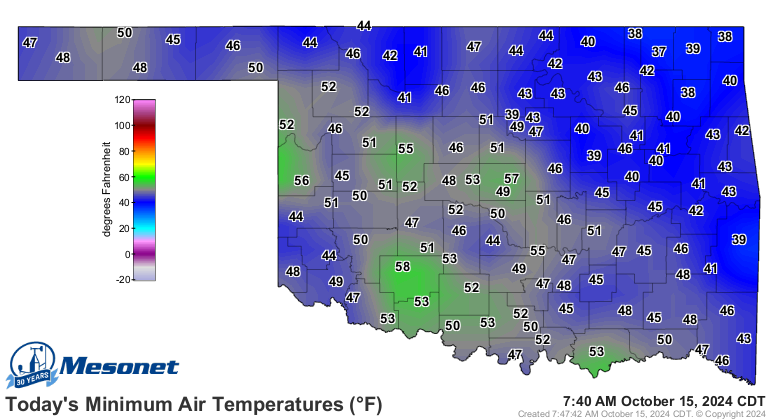
The fun gets started today as this strong cold front moves through, and by "fun"
I mean
"NOOOOOOOOOOOOOOOOOOOOOOOOOOOOOOOOOOOOOOOOOOOOOOOOOOOOOOOOOOOOOOOOO!!!!"
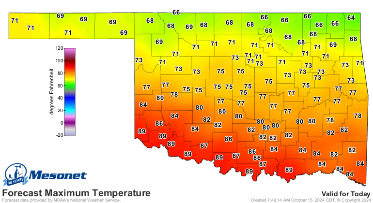
Your experience will vary depending on where you are. Somebody broke out the
powerpoint gradient fill feature (and we all know just how painful that can be)
on the high temperature map for today.
The biggest problem we have is Johnny Depp, but the SECOND biggest problem we
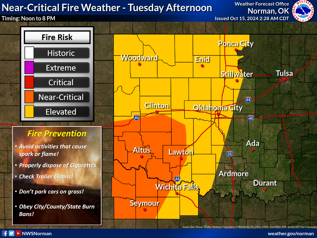
have is fire danger. With the drought firmly entrenched across most of the
state, and those gusty winds kicked up by the front, combined with low humidity,
am I still writing a sentence? Okay, back on track...that all sets up for a
critical fire danger today.
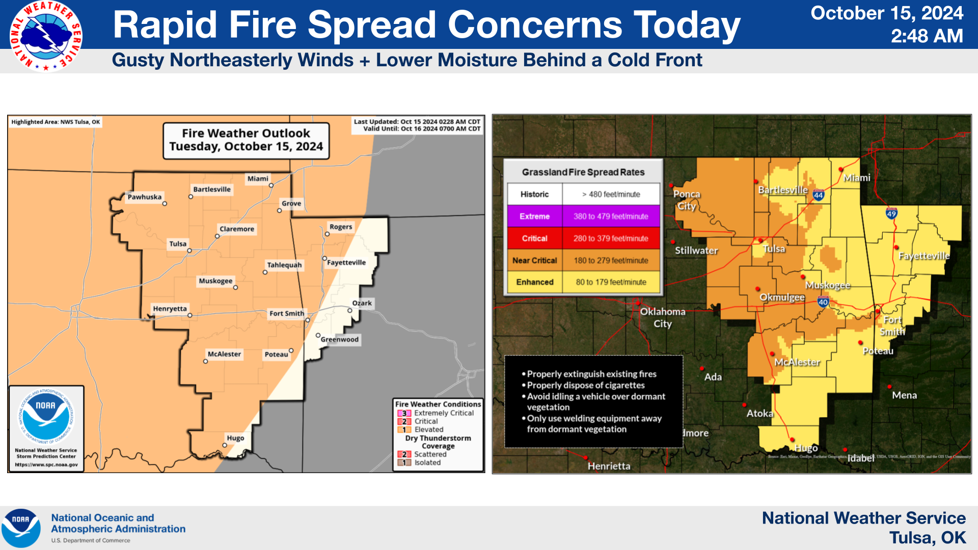
The latest Fire Situation Report indicates that large fires are becoming
increasingly more likely:
"Elevated to near-critical fire weather will occur across Oklahoma today
as another dry cold-front passes through the day today. Initial attack
activity has become increasingly more challenging as composite fuel
moisture deteriorates. The majority of fires will continue to be captured
during initial attack although large fire occurrence is increasingly
more likely. Dry conditions persist through the week in the dry, post-
frontal environment holding fire danger in the forefront."
https://ag.ok.gov/wp-content/uploads/2023/04/Most-Recent-Fire-Situation-Report.pdf
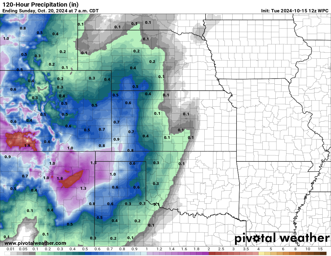
Not good. Some rain would help, but that's down the road and seems to continue
shifting west. Great for those folks, but the entire state could use a good
dose of moisture.
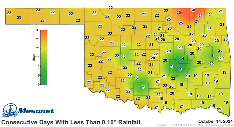
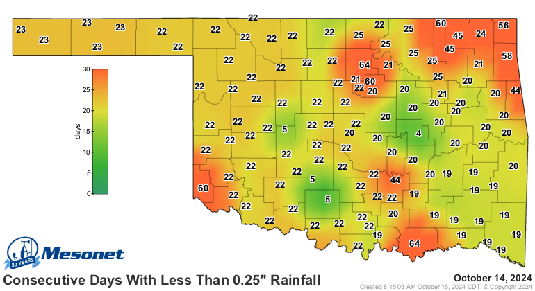
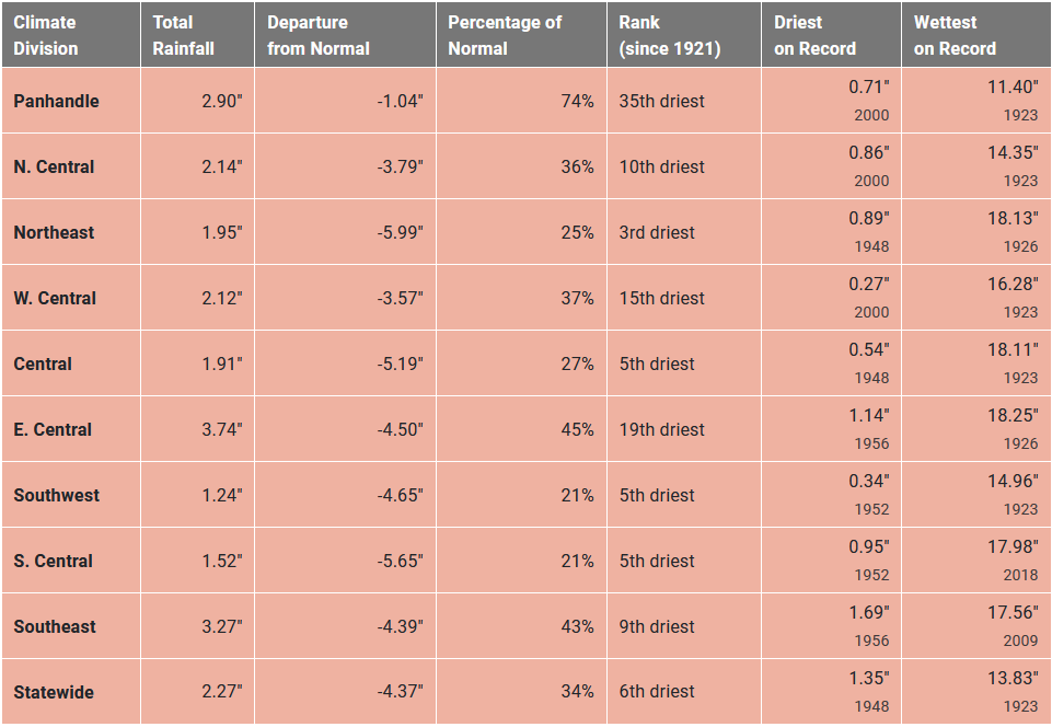
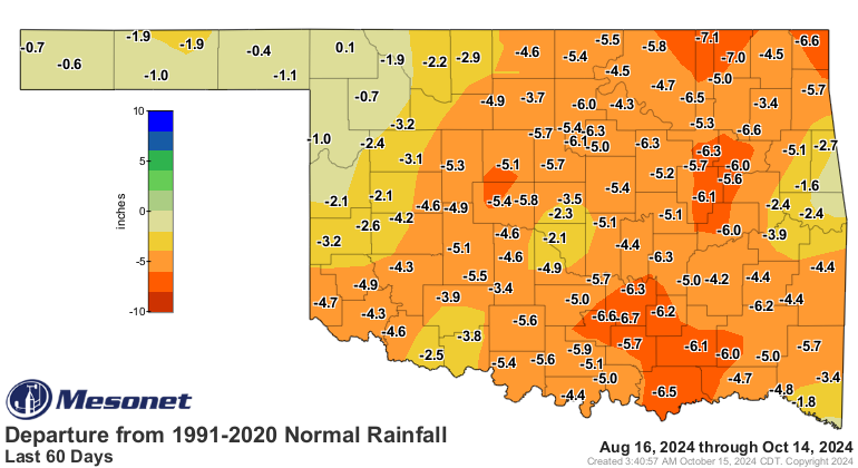
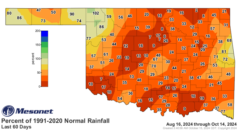
We're in a 3-week dry spell across the state, but others have gone more than 2
months with significant moisture. The drought over the last 60 days has grown
seriouser and seriouser.
Seriouserly.
So chili with no beans...you just eat it and that's the end of it.
Where's the fun in that?
Gary McManus
State Climatologist
Oklahoma Mesonet
Oklahoma Climate Survey
gmcmanus@ou.edu
October 15 in Mesonet History
| Record | Value | Station | Year |
|---|---|---|---|
| Maximum Temperature | 97°F | TIPT | 2015 |
| Minimum Temperature | 26°F | EVAX | 2018 |
| Maximum Rainfall | 5.41″ | WALT | 2006 |
Mesonet records begin in 1994.
Search by Date
If you're a bit off, don't worry, because just like horseshoes, “almost” counts on the Ticker website!