Ticker for October 10, 2024
MESONET TICKER ... MESONET TICKER ... MESONET TICKER ... MESONET TICKER ...
October 10, 2024 October 10, 2024 October 10, 2024 October 10, 2024
Pass
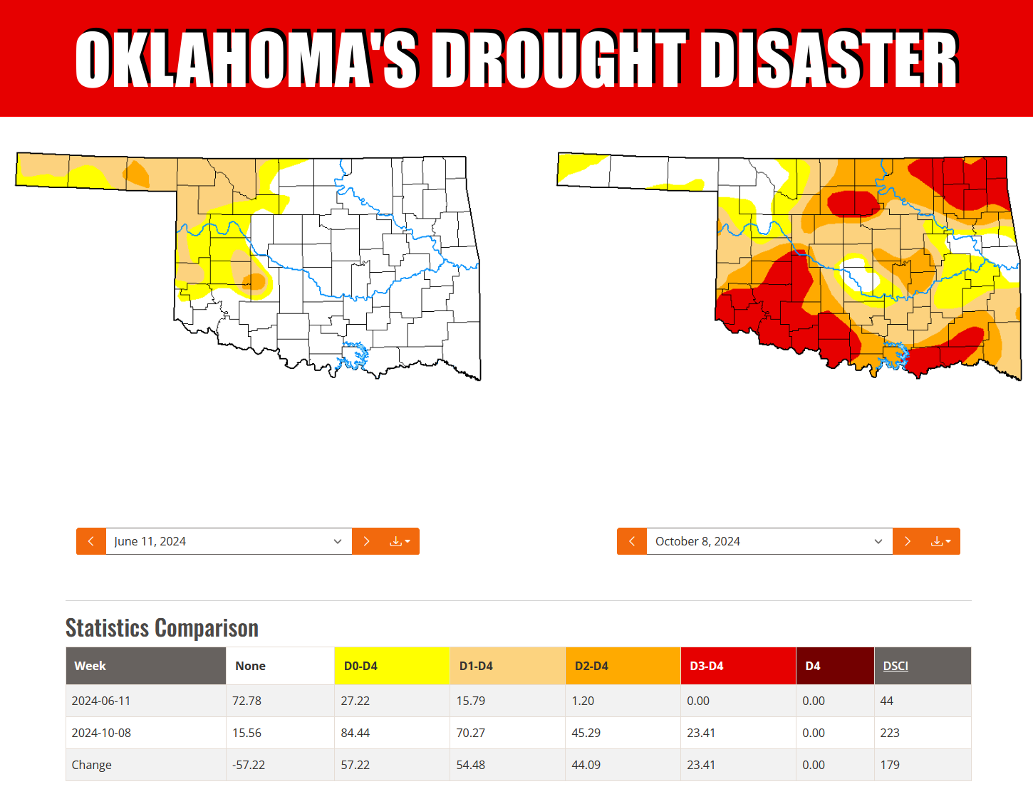
Drought has nearly quintupled (and we all know just how painful that can be) since
the beginning of summer, from 15% back in early June to 70% in this second week
of October. Even worse (literally), the amount of at least Severe (D2) drought
has increased from 1% to 45% (which we will call quadruplifyftied) and the amount
of at least Extreme (D3) drought has gone from 0% to 23% (twenthrusted).
Yeah, we made up those words...like "quintupled" is actually a thing.
Things are increasingly bad...I'm not making that up. It's not a hurricane, and
our hearts go out to those suffering in the Southeast, but we are facing our own
billion-dollar disaster right here in Oklahoma, and those damages will continue to
increase if we don't see rain soon for this crucial planting period for Oklahoma's
hard winter wheat crop.
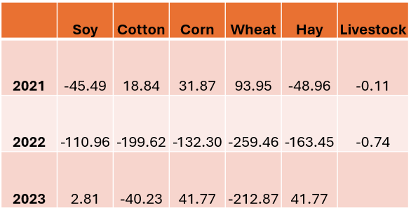
Did you know that the wheat crops have suffered nearly $500 million in losses over
the last 2 years? And the cotton crop has been hit by $240 million in losses
over that same time. Again, that's not counting this year, which again saw
incredibly poor conditions for the cotton crop. In addition to that, in just
2021 and 2022, we saw a $155 million loss to soy, $100 million loss for corn, and
a $212 million loss in hay. That's a billion and then some. And remember, this
is only the damages directly related to agriculture. When these types of
disasters occur, they reverberate up and down the economy of Oklahoma. They are
at least mitigated by crop insurance and disaster relief, but the impacts are
still profound.
This data was provided to me by Katie Welch, a PhD student in OSU's Ag Economics
Dept., and are in millions of dollars.
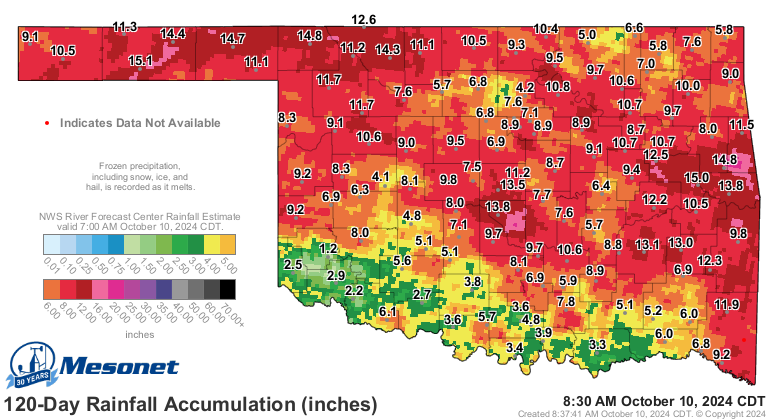
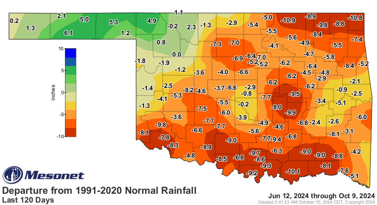
The 120-day rainfall tells the story of the disaster in no uncertain terms.
I'm certain of that.
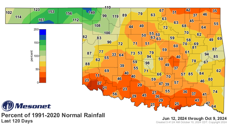
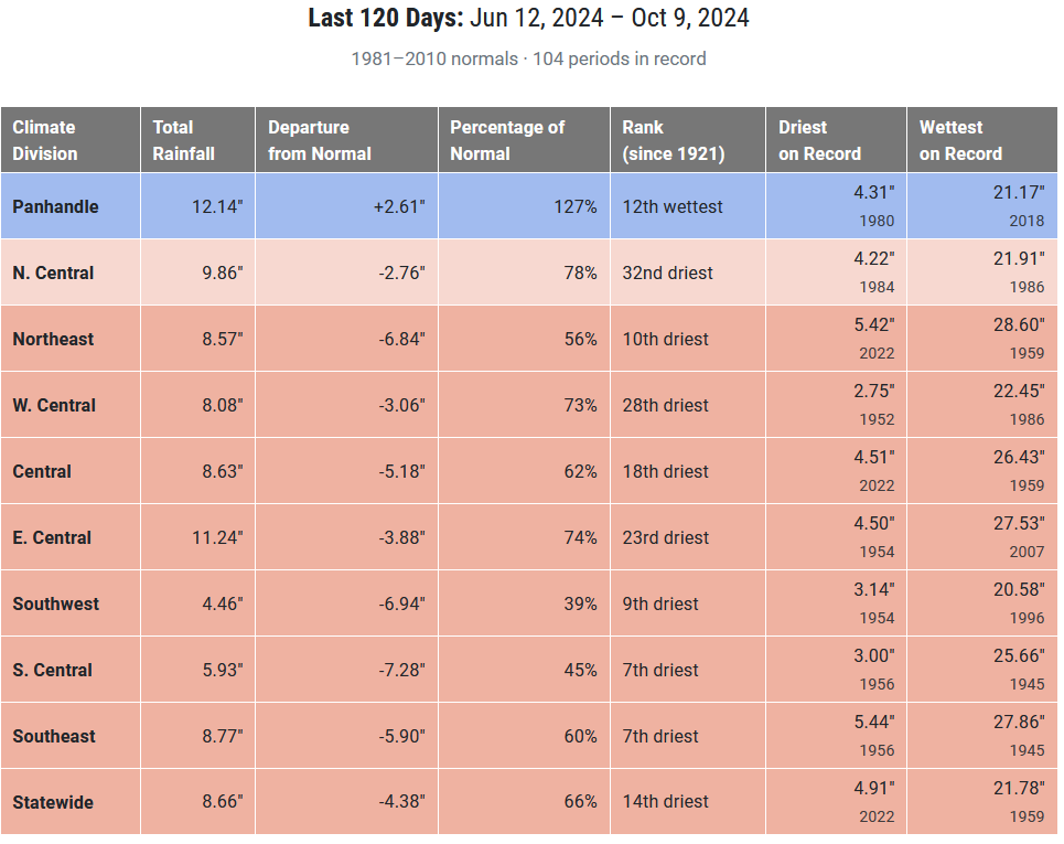
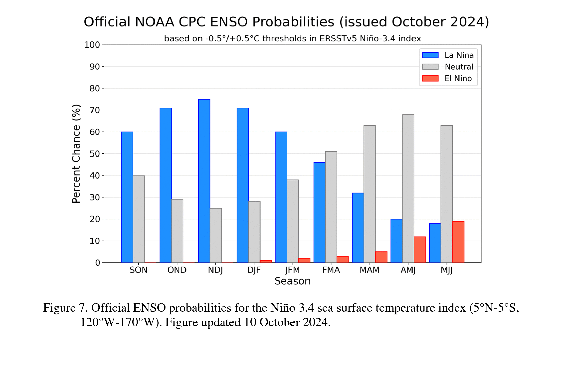
No, this isn't due to La Nina. ENSO (La Nina, El Nino) don't really impact us
in the summer months, and the kicker is our mucho-promised La Nina still hasn't
formed completely in the Equatorial Pacific. We are still waiting for the
sea surface temps and atmospheric circulation to couple, and in fact the
chances for it to actually form have dropped to 60% in the next 2 months, but
up to 75% for the winter months.
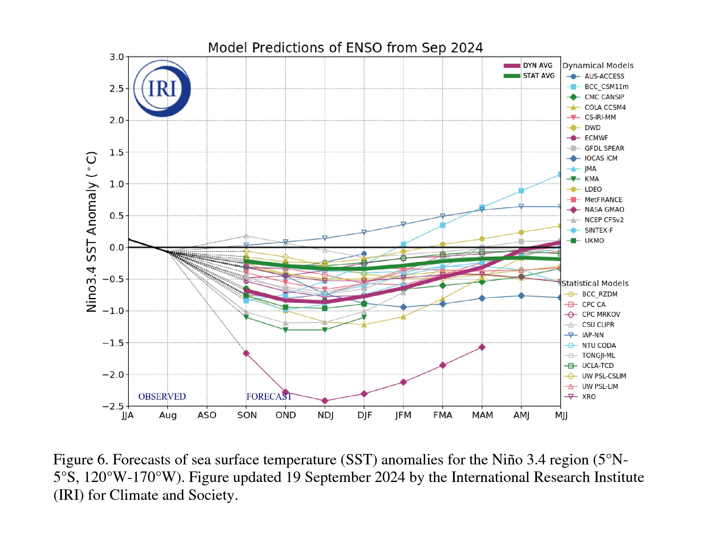
So we keep kicking the ENSO can down the road. The La Nina, if it eventually
forms, is also expected to be weak, with a SST anomaly between -0.5C and -1.0C.
That doesn't change the strength of the impacts expected from La Nina (tilted
odds towards a drier and warmer than normal cool season--November through March),
but it does less the CHANCES of seeing those impacts.
However, we are still seeing a mostly dry forecast, unfortunately. The next
7 days look like more of the same.
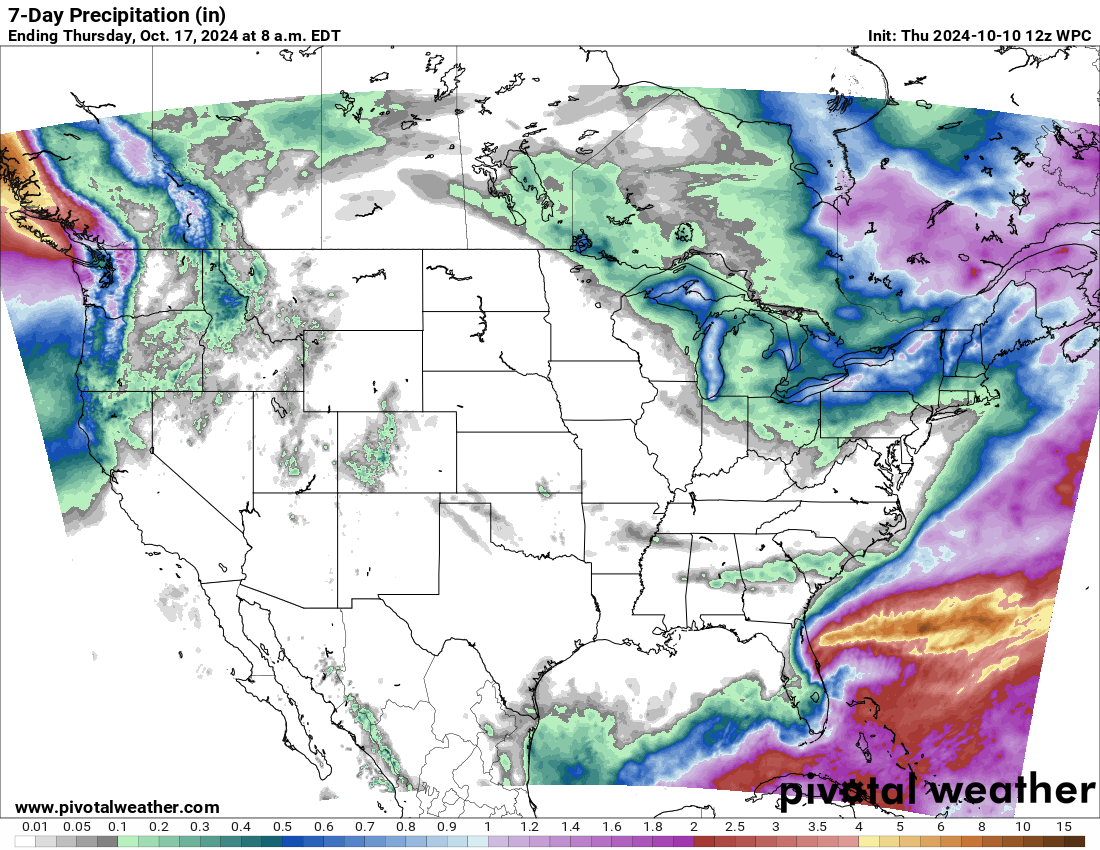
There is some rain in fantasy-cast territory, for NEXT weekend, but you know
our mantra...believe it when you see it!
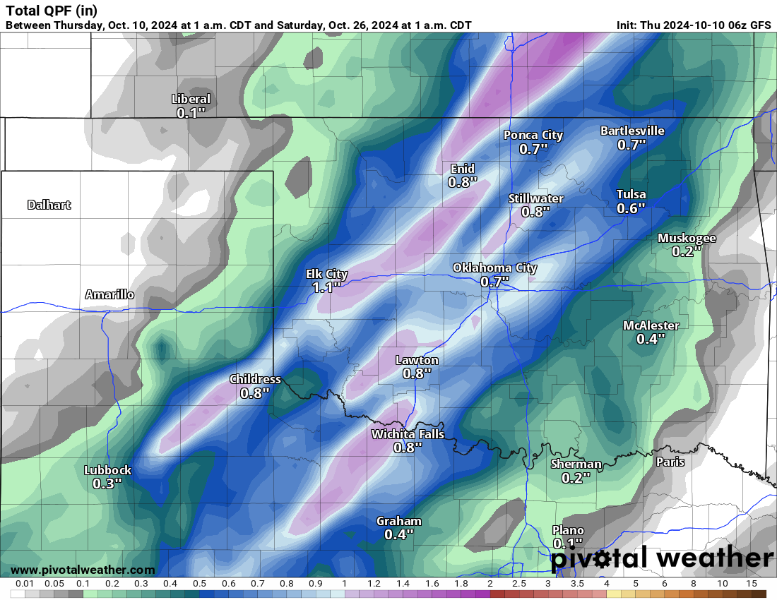
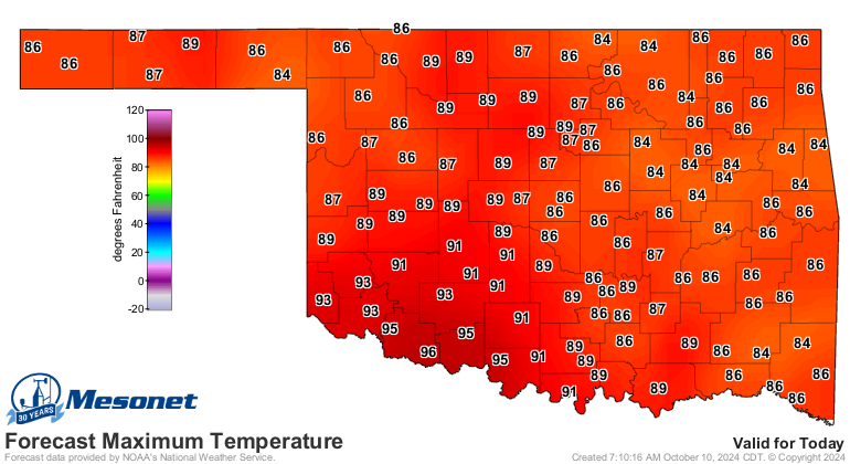
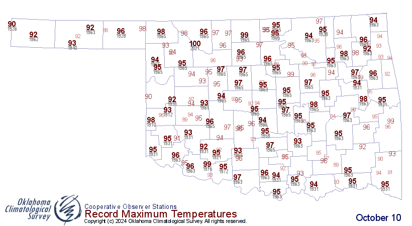
That's ONE model run, and a long way out to boot. What we do know is that we will
continue with near-record warmth for the next few days before seeing a
significant cooldown early next week. Saturday's gonna be SUMMER, but even today
could see records fall in SW OK.
Keep hope alive, though! Our next big rain is right around the corner...or two
corners. Or three.
Gary McManus
State Climatologist
Oklahoma Mesonet
Oklahoma Climate Survey
gmcmanus@ou.edu
October 10 in Mesonet History
| Record | Value | Station | Year |
|---|---|---|---|
| Maximum Temperature | 97°F | GRA2 | 2024 |
| Minimum Temperature | 21°F | BRIS | 2000 |
| Maximum Rainfall | 4.52 inches | ANTL | 2004 |
Mesonet records begin in 1994.
Search by Date
If you're a bit off, don't worry, because just like horseshoes, “almost” counts on the Ticker website!