Ticker for October 8, 2024
MESONET TICKER ... MESONET TICKER ... MESONET TICKER ... MESONET TICKER ...
October 8, 2024 October 8, 2024 October 8, 2024 October 8, 2024
Vote
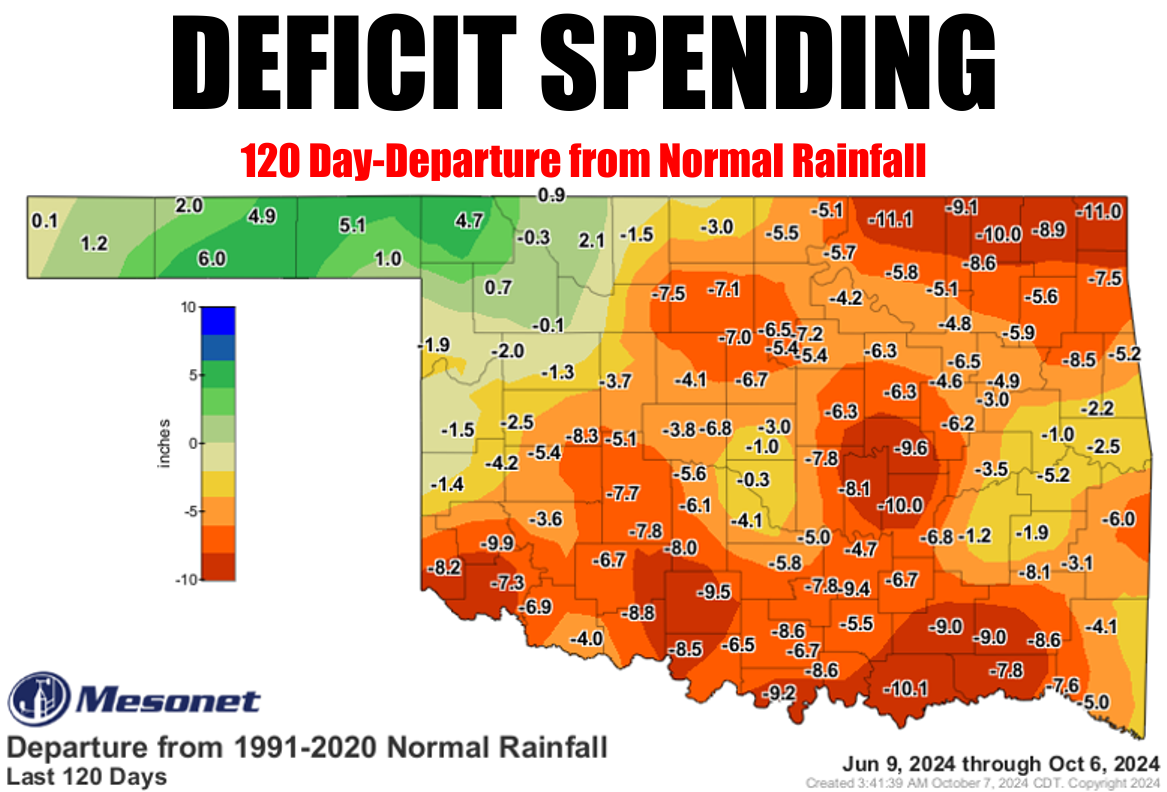
Mother Nature's writing checks on our moisture account that we can't cash! We're
down almost a foot in some places. Hey, here's an oddity!
No no no...that's weird. I'm talking "odd" (I'm also talking gibberish, so what's
it matter?). Our departure from normal map numbers are going to start going down,
as in the deficits will start to shrink, because we're headed into a drier part
of the year. So for the 120-day map, those numbers will continue to shrink. But
the year-to-date numbers will continue to grow, since its starting point is on
a fixed date (Jan. 1...duh!), while the 120-day map is a moving window.
Make sense?
No? Well, what does!
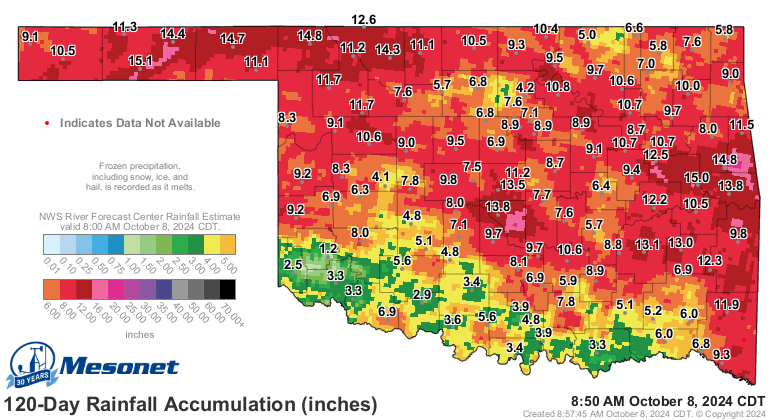
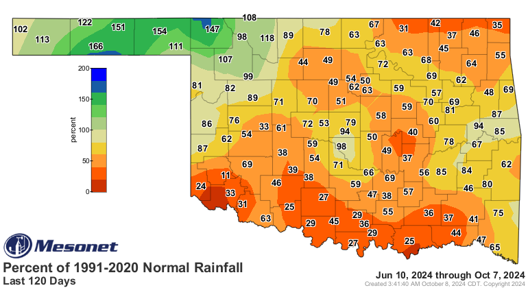
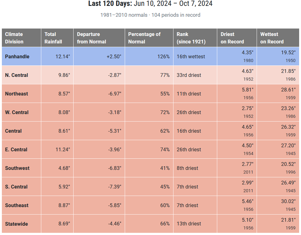
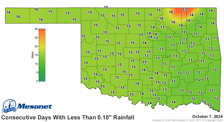
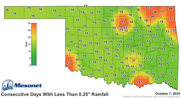
That's the part of this drought on the medium scale. Then there's the near
scale.
Then there's the long-term scale.
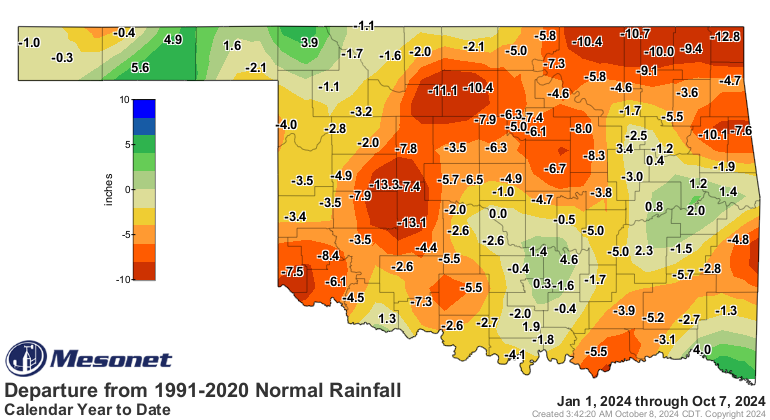

The longer-term drought is more background to the summer drought over the last
120 days because you add summer temperatures in there, which causes a lot of
evaporation from our surface water and soil moisture. Also add in growing,
thirsty vegetation sapping that soil moisture as well.
And there's STILL no rain in sight, at least within the confines of sane,
non-fantasy forecasts.
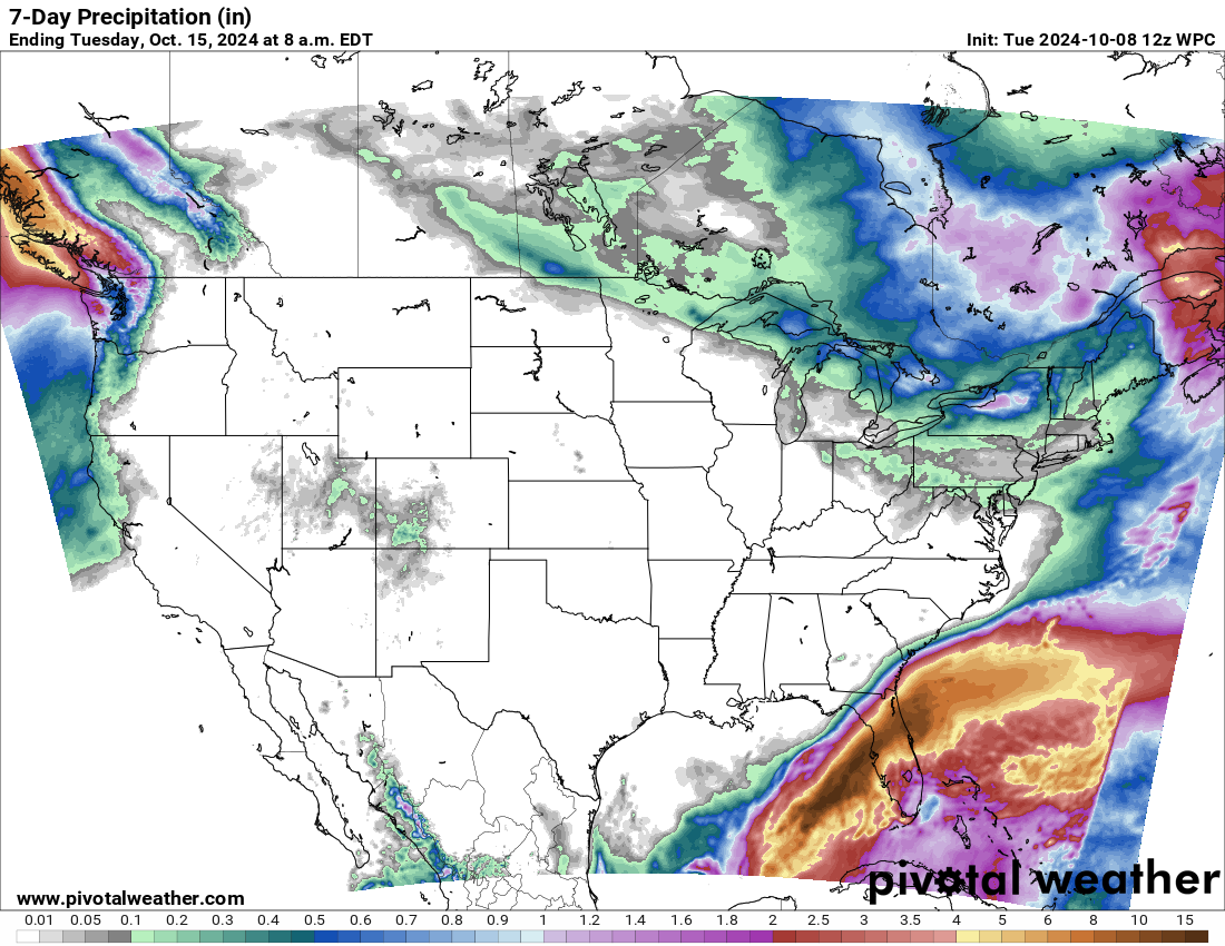
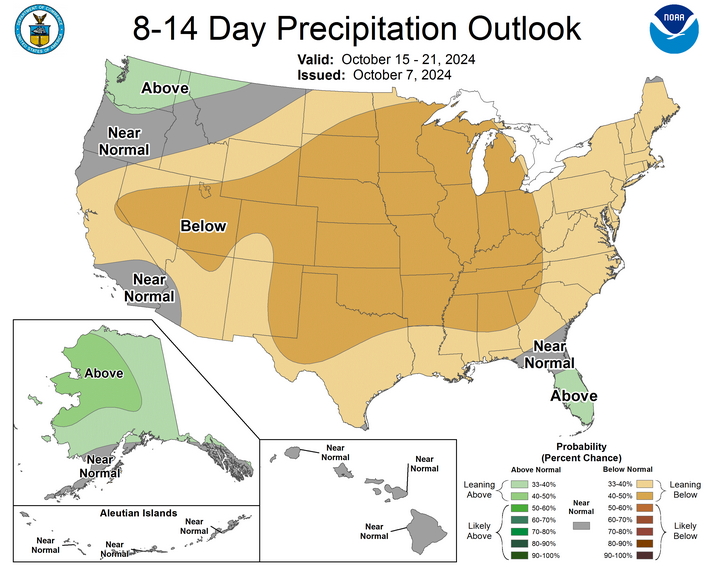
Fantasy-cast...still looking!
Gary McManus
State Climatologist
Oklahoma Mesonet
Oklahoma Climate Survey
gmcmanus@ou.edu
October 8 in Mesonet History
| Record | Value | Station | Year |
|---|---|---|---|
| Maximum Temperature | 100°F | GRA2 | 2021 |
| Minimum Temperature | 22°F | ELRE | 2000 |
| Maximum Rainfall | 5.94 inches | VINI | 2009 |
Mesonet records begin in 1994.
Search by Date
If you're a bit off, don't worry, because just like horseshoes, “almost” counts on the Ticker website!