Ticker for October 7, 2024
MESONET TICKER ... MESONET TICKER ... MESONET TICKER ... MESONET TICKER ...
October 7, 2024 October 7, 2024 October 7, 2024 October 7, 2024
Oof
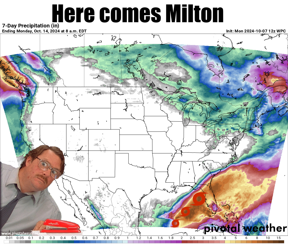
It's a crazy world we live in (hey, you outta be in MY head for a bit!). I have no
clue why Florida was scheduled a second visit from a major hurricane within a
couple of weeks by Mother Nature.
Heck, I can't even understand why people stop right outside a door to talk whilst
other people are still exiting!
(Don't mention slow left-laners, don't mention slow left-laners...)
This one looks nasty, with Milton forecast to hit the western coast of Florida
broadsides late on Wednesday or early Thursday, possibly still a major hurricane
after intensifying over the next couple of days.
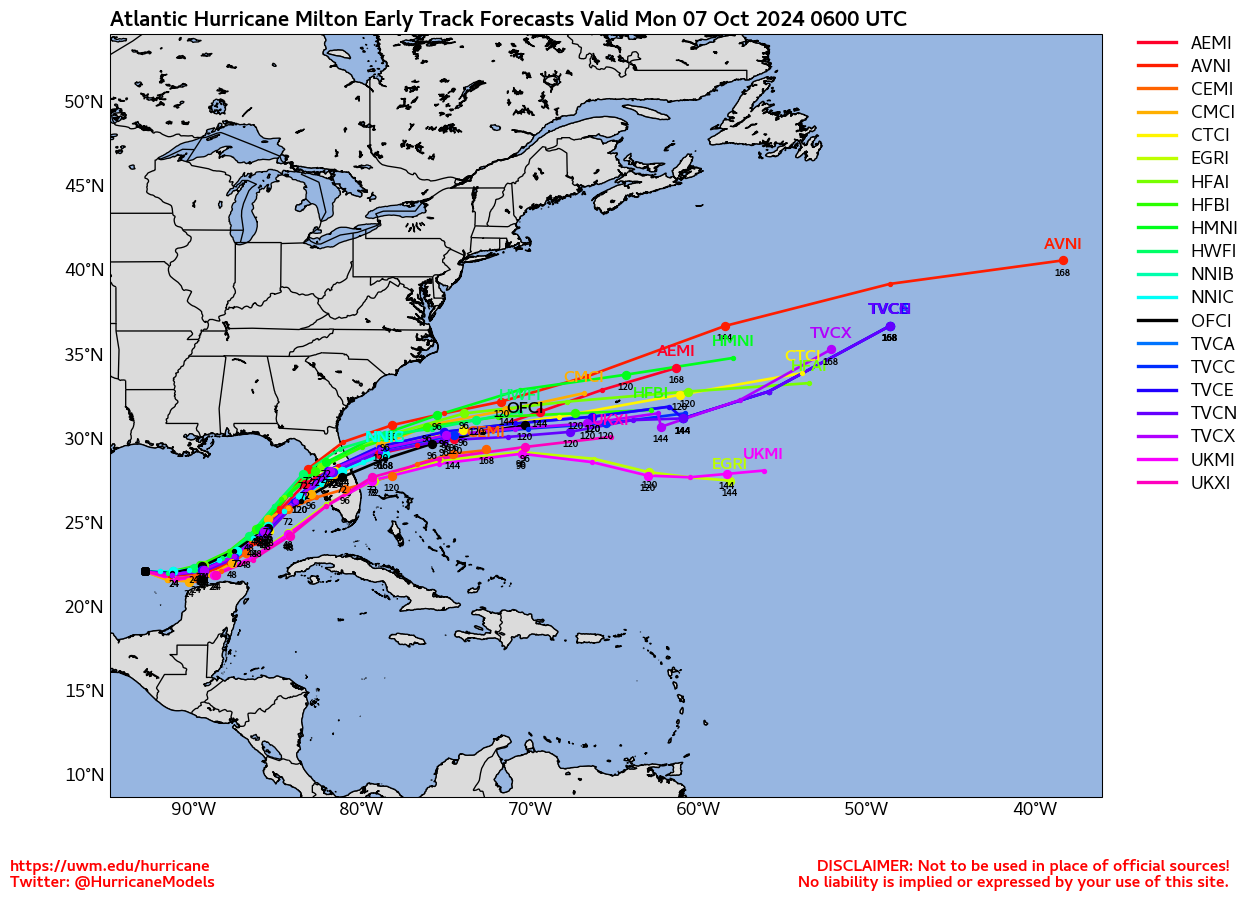
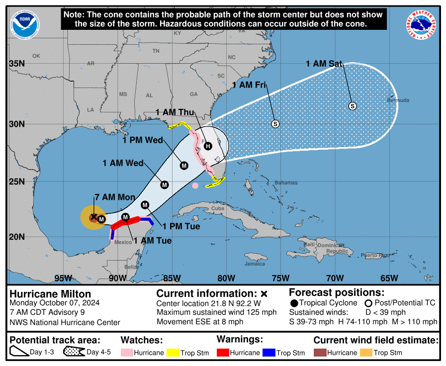
What's it mean for Oklahoma? Not a whole heckuva lot as we are still dominated
by this mid-fall Dome of Death over the western half of the U.S.; the same
Dome of Death that is helping keep Milton headed east. And apparently this
dome still ain't budging anytime soon.
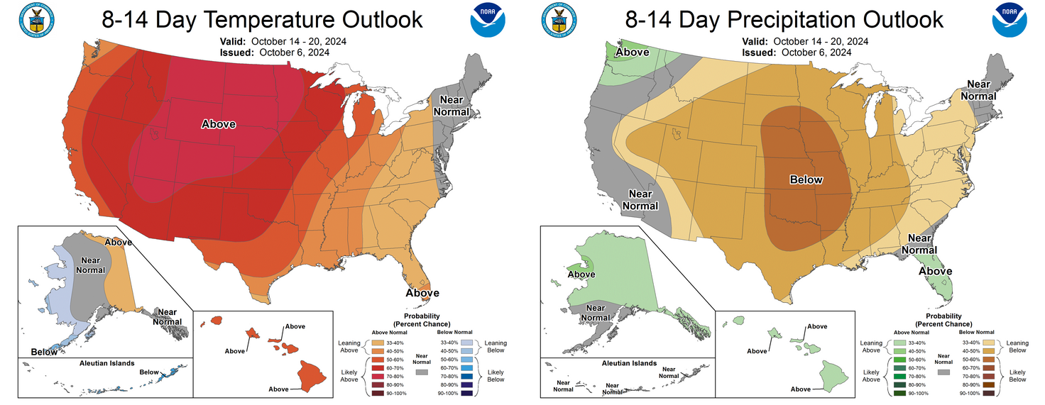
Pretty simple--simple and demented, but still sad--forecast for Oklahoma...above
normal temperatures and below normal precip for the next 2 weeks or so. The
"or so" comes from the hope something will break through as we get into fantasy-
cast territory 10+ days out, but that is probably not happening over the next
7 days, at least.
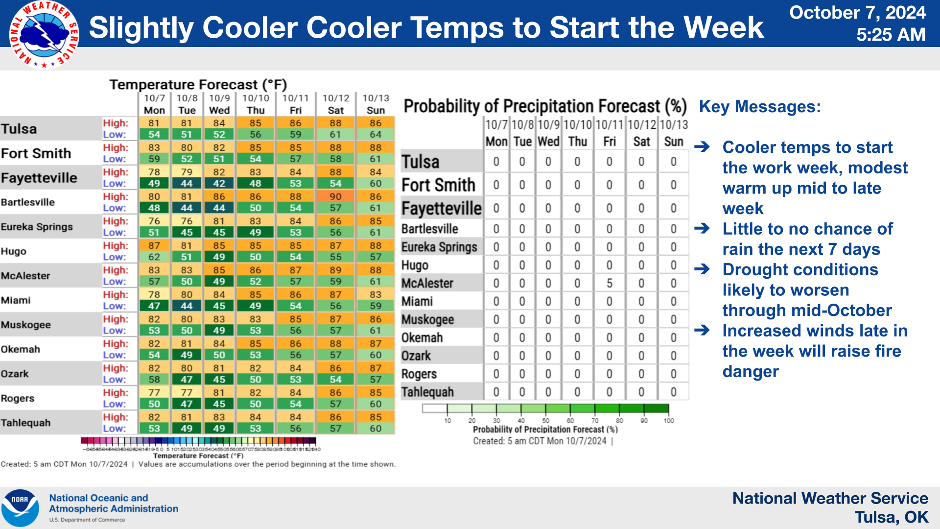
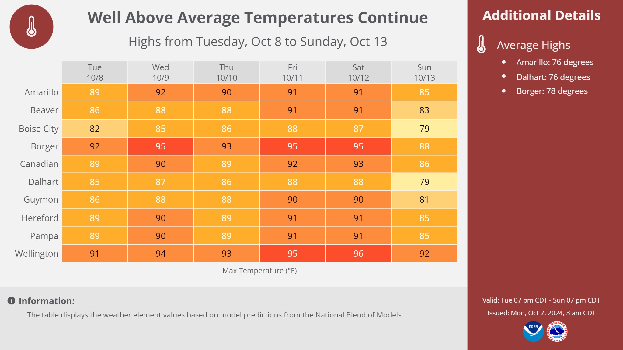
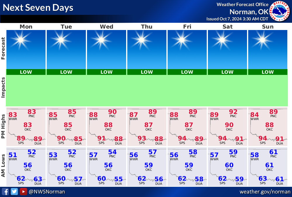
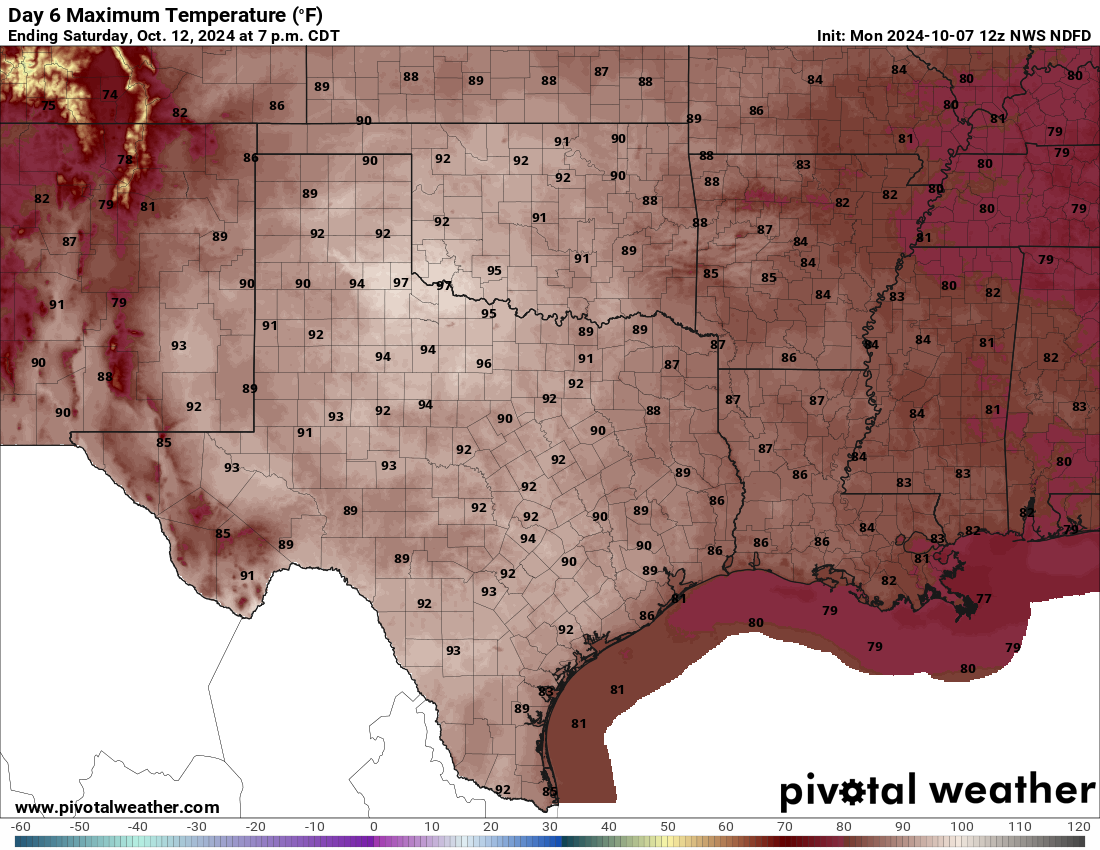
Heck (TWO hecks in one Ticker?!?), just look at this coming Saturday for crying
out loud!
More on the drought tomorrow (emphasis on "moron").
Gary McManus
State Climatologist
Oklahoma Mesonet
Oklahoma Climate Survey
gmcmanus@ou.edu
October 7 in Mesonet History
| Record | Value | Station | Year |
|---|---|---|---|
| Maximum Temperature | 99°F | WAUR | 2014 |
| Minimum Temperature | 26°F | SEIL | 2012 |
| Maximum Rainfall | 5.79″ | HOBA | 2018 |
Mesonet records begin in 1994.
Search by Date
If you're a bit off, don't worry, because just like horseshoes, “almost” counts on the Ticker website!