Ticker for October 3, 2024
MESONET TICKER ... MESONET TICKER ... MESONET TICKER ... MESONET TICKER ...
October 3, 2024 October 3, 2024 October 3, 2024 October 3, 2024
Zero
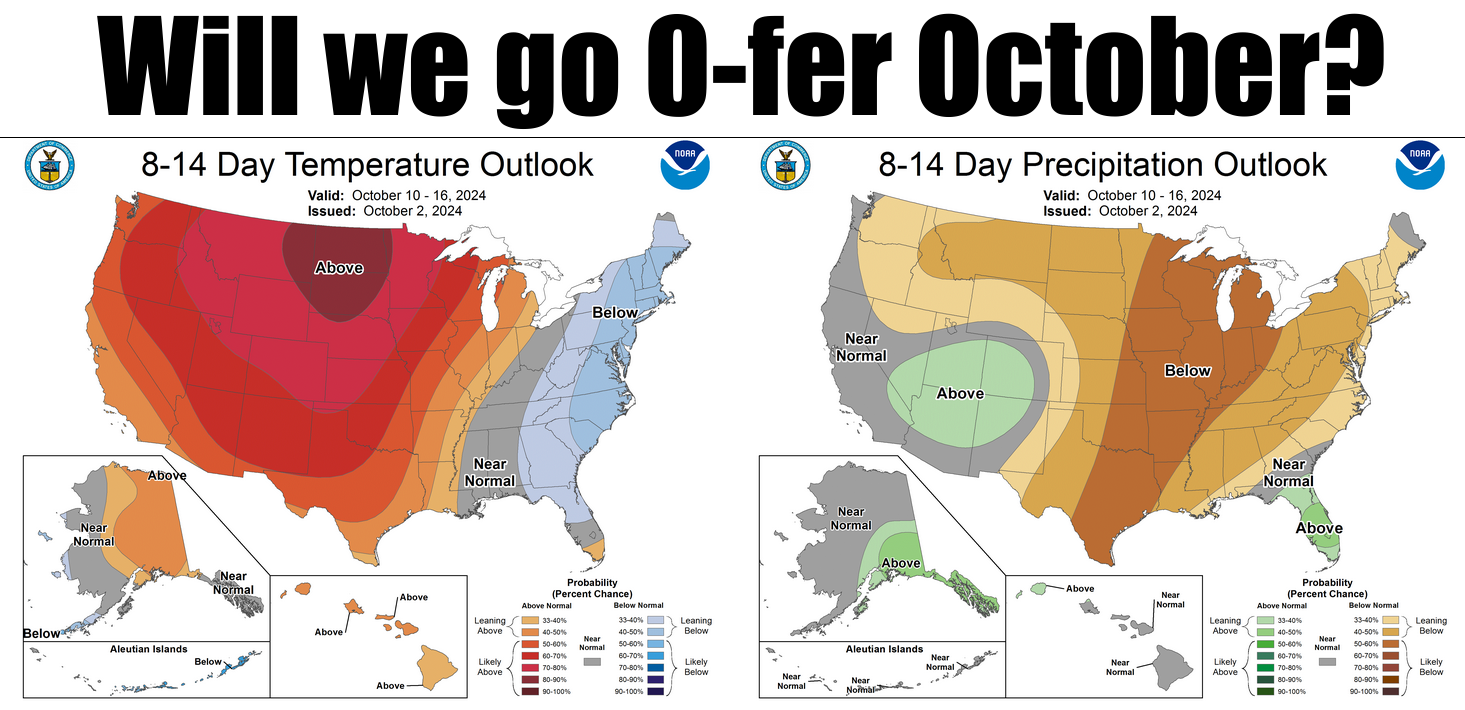
Don't worry...0-fer a month's not that big of a deal. I do it all the time.
Use of a hair drier: 0-fer
Strawberry Pop-Tarts eaten: 0-fer
Days without slow left-laners road rage: 0-fer
Tickers that make sense: 0-fer
But here's the deal...if we go 0-fer October in rainfall (or snow or ice...beware
Halloween!), that would be big. And bad. Flash drought is on the loose in Oklahoma
once again, and it's getting nasty.
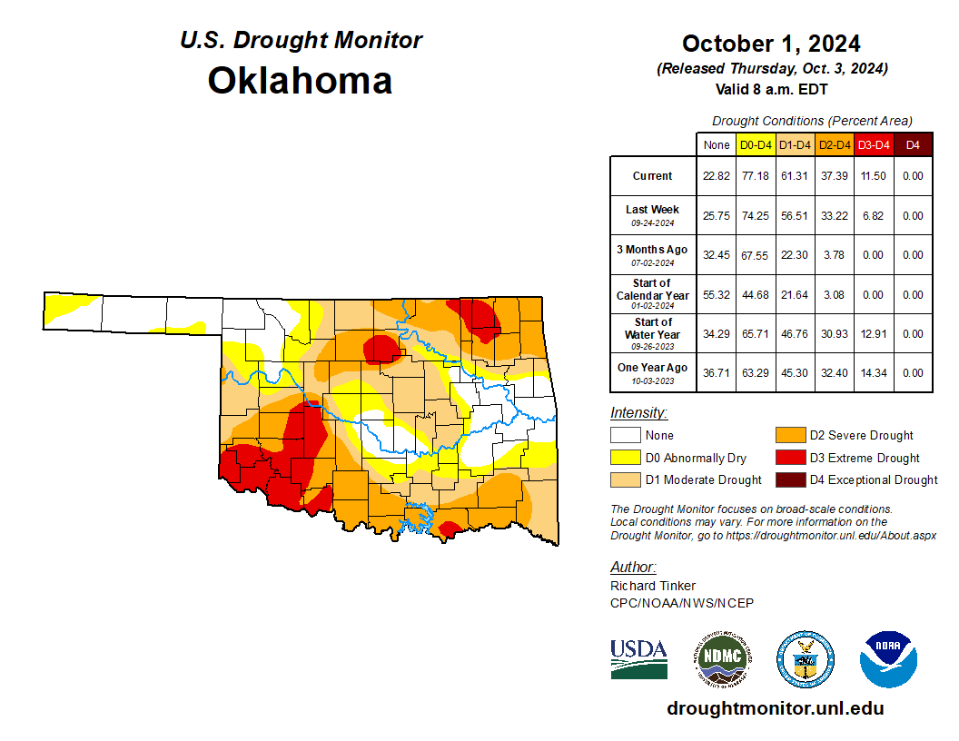
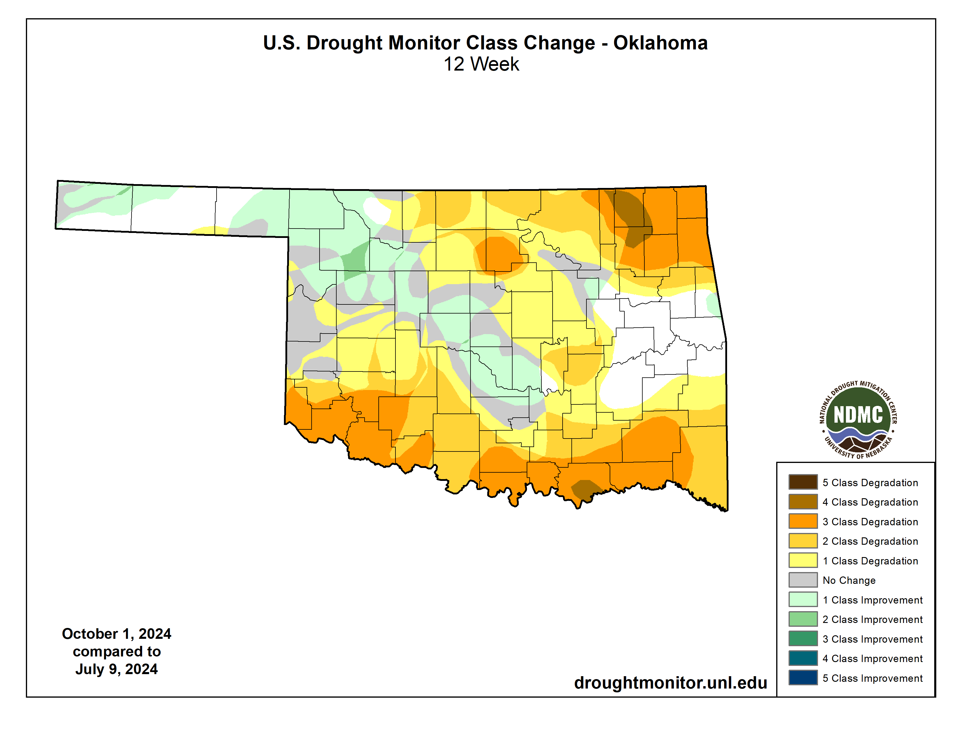
The bulk of our current flash drought situation has occurred with drying over the
last 120 days, and you can see the changes in the Drought Monitor over that time,
AND the dryness associated with it.
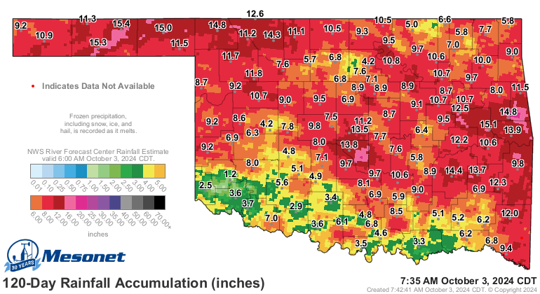
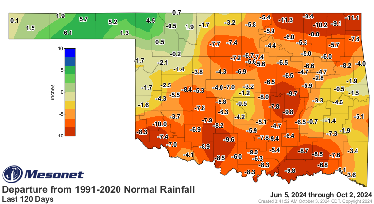
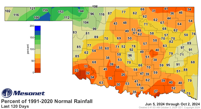
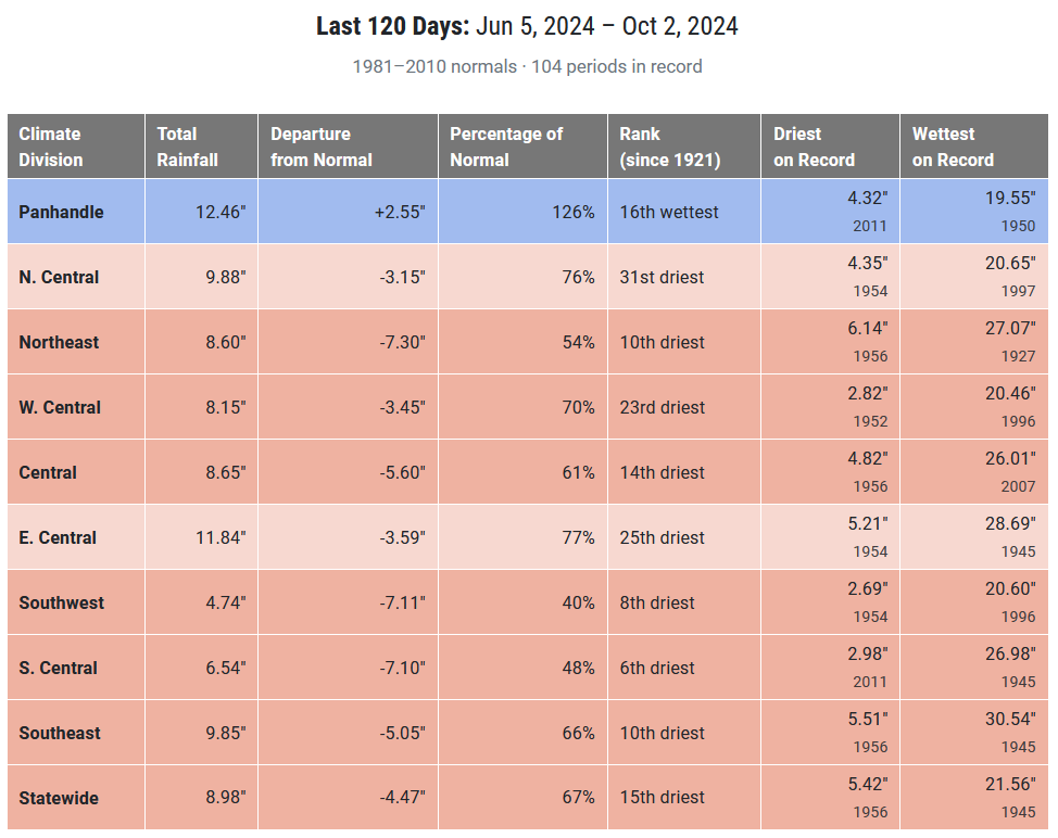
You can even see it on the statewide average departure graph for accumulating
rainfall on the Mesonet graph of long-term average, ummmmm...graph. Or whatever
this is.
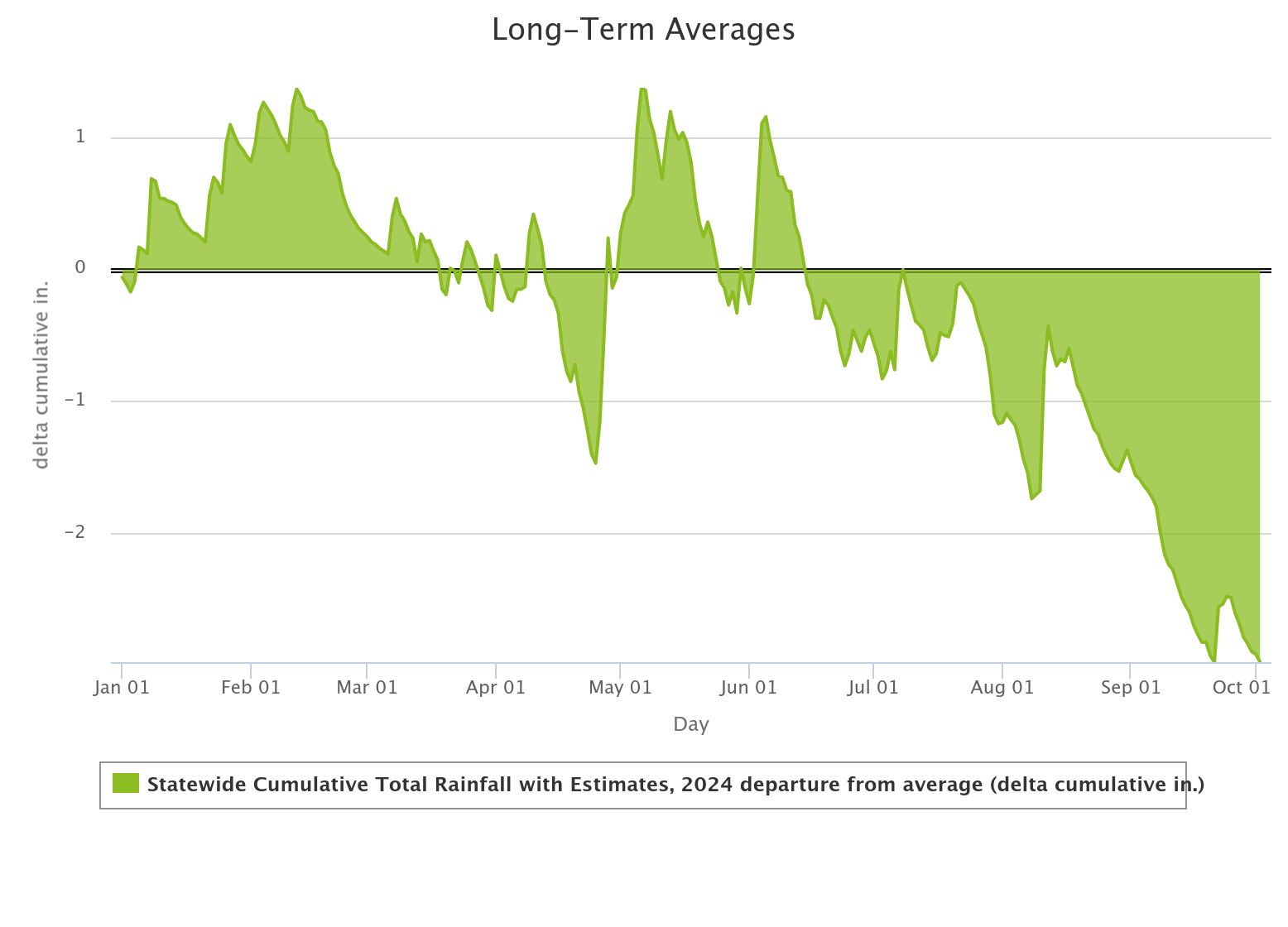
Check out the lovely influence of El Nino there in the first few months of
2024, then a dry April worried us, then we got our primary rainy season going
again in May and early June. Then...blah. I mean, we can't all be as lucky as
Goodwell (except for that flooding rainfall, which is obvious, they've done
pretty well).
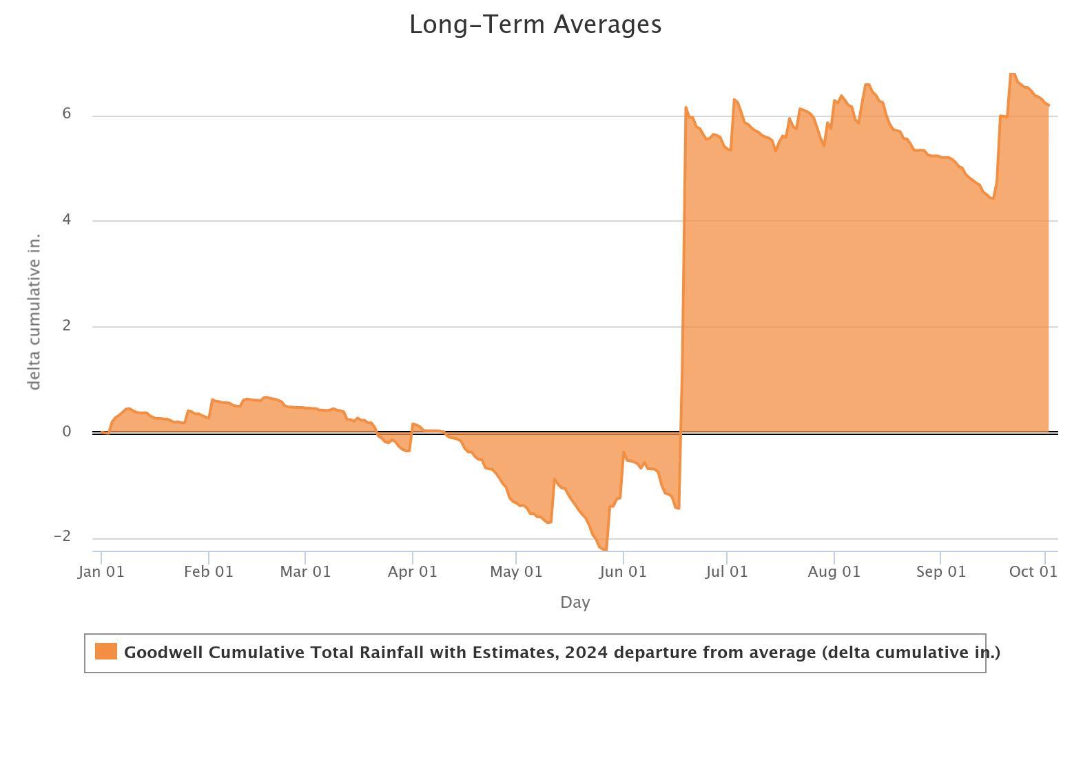
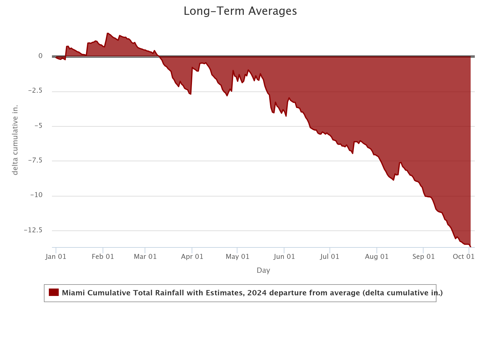
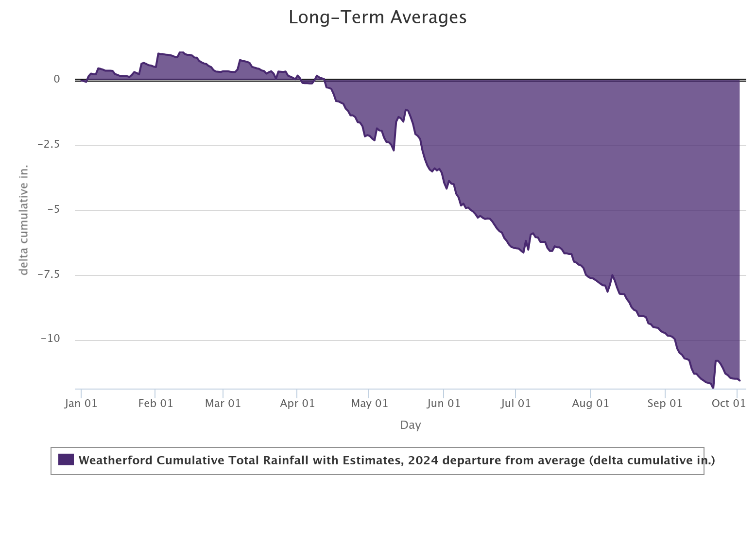
Certainly better than Miami, or Weatherford.
Will we go 0-fer October? Unlikely.
Will we go 0-fer the next couple of weeks? More likely than not.
Gary McManus
State Climatologist
Oklahoma Mesonet
Oklahoma Climate Survey
gmcmanus@ou.edu
October 3 in Mesonet History
| Record | Value | Station | Year |
|---|---|---|---|
| Maximum Temperature | 106°F | HOLL | 2000 |
| Minimum Temperature | 31°F | OILT | 2010 |
| Maximum Rainfall | 4.11 inches | WOOD | 2019 |
Mesonet records begin in 1994.
Search by Date
If you're a bit off, don't worry, because just like horseshoes, “almost” counts on the Ticker website!