Ticker for May 1, 2024
MESONET TICKER ... MESONET TICKER ... MESONET TICKER ... MESONET TICKER ...
May 1, 2024 May 1, 2024 May 1, 2024 May 1, 2024
TornadoGames
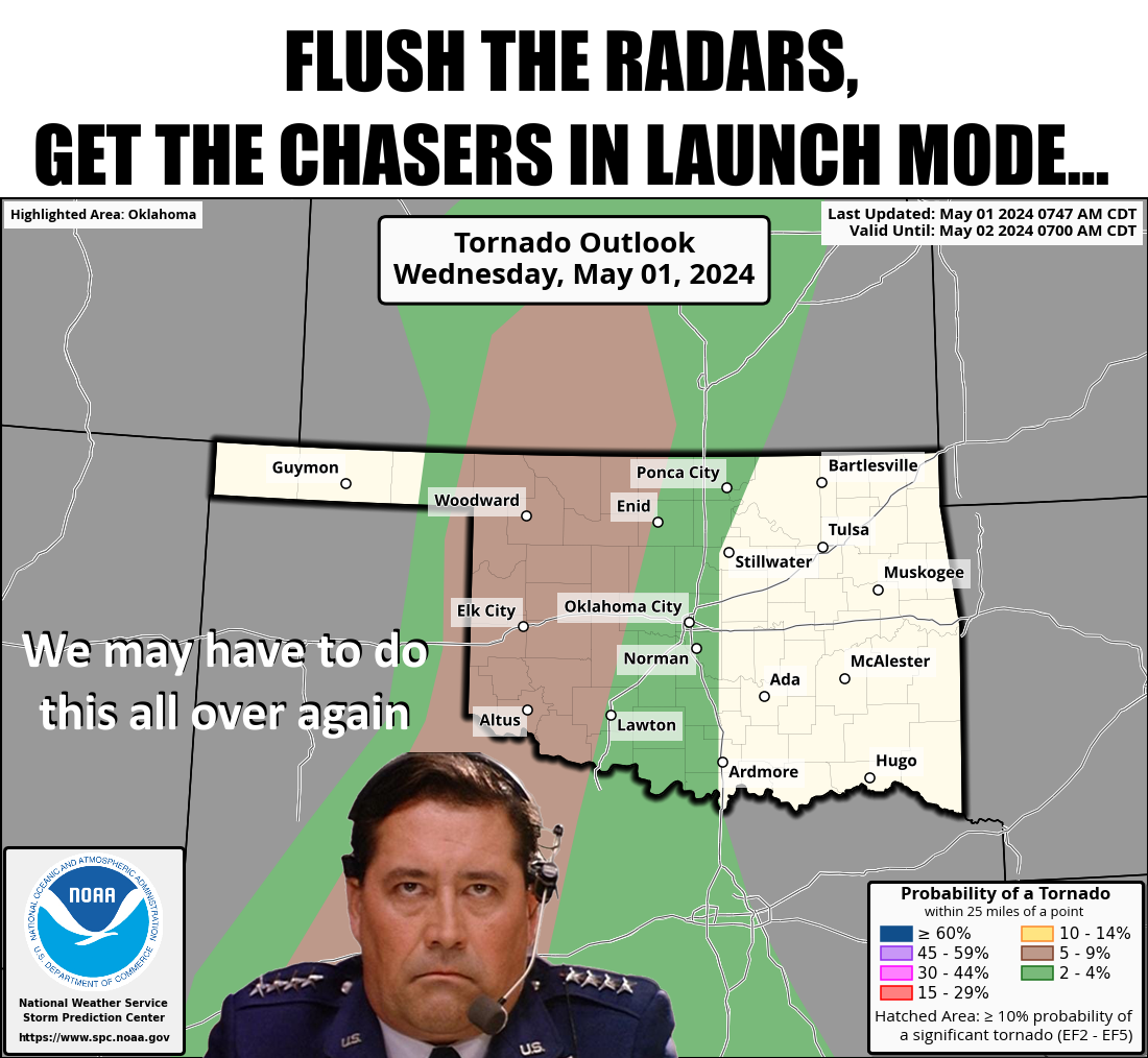
Normally this would be just a mention of the old "low, but not zero" tornado
chances according to that map. But much like life in Jurassic Park, severe
weather "finds a way." Remember that yesterday's risk was "very low" and we
ended up with 3 or 5 tornadoes, and a couple of big'ns even! So the atmosphere
is very much in late-April/early-May, with an apparent hair trigger (why you
gotta hurt me??) itching to go off.
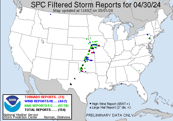
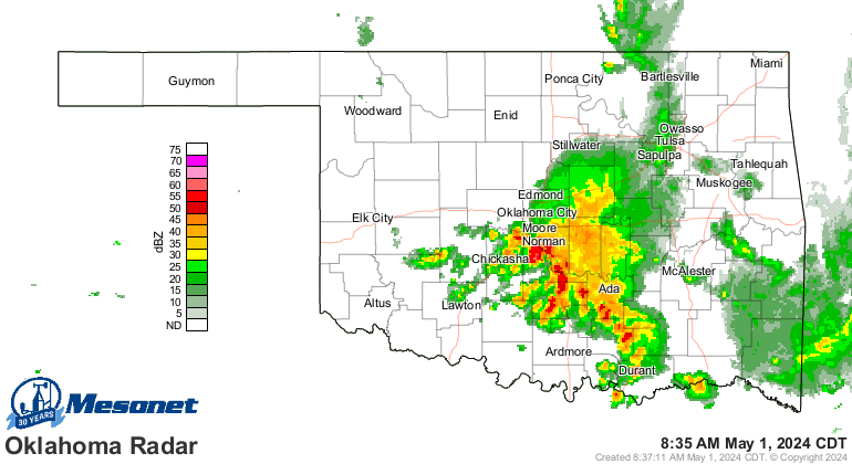
Heck, it's storming right now for crying out loud!
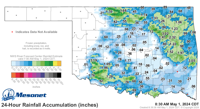
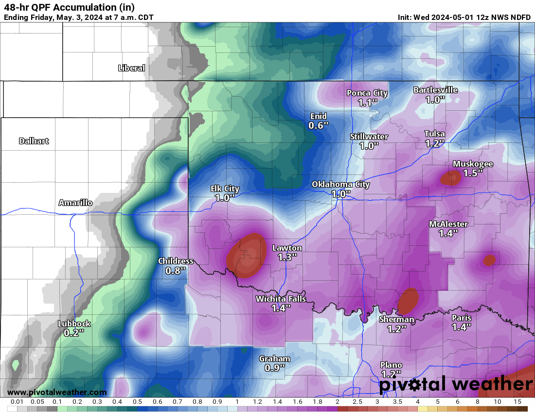
And we've had a crapload (Okie to English translation: "a considerable amount")
of rain over the last day with these storms.
Heck, it's raining right...oh wait, I've already done that. Well, later on
today it's liable to severe storm, for crying out loud!
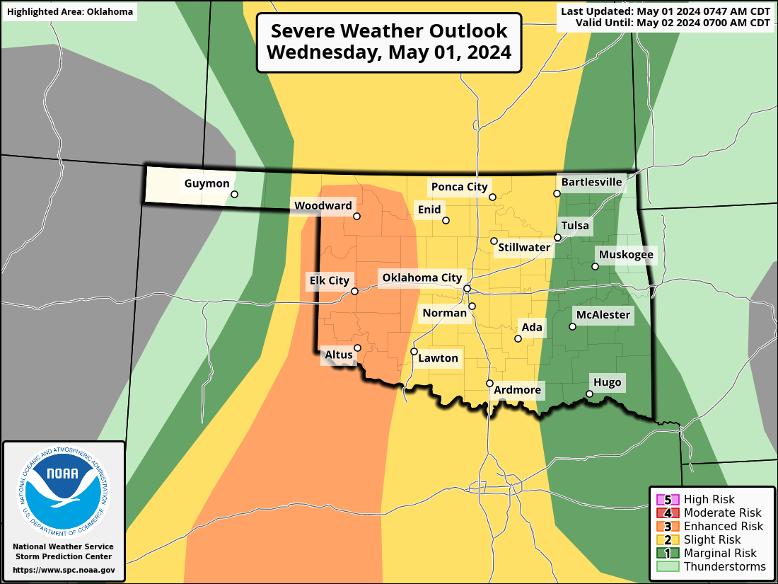
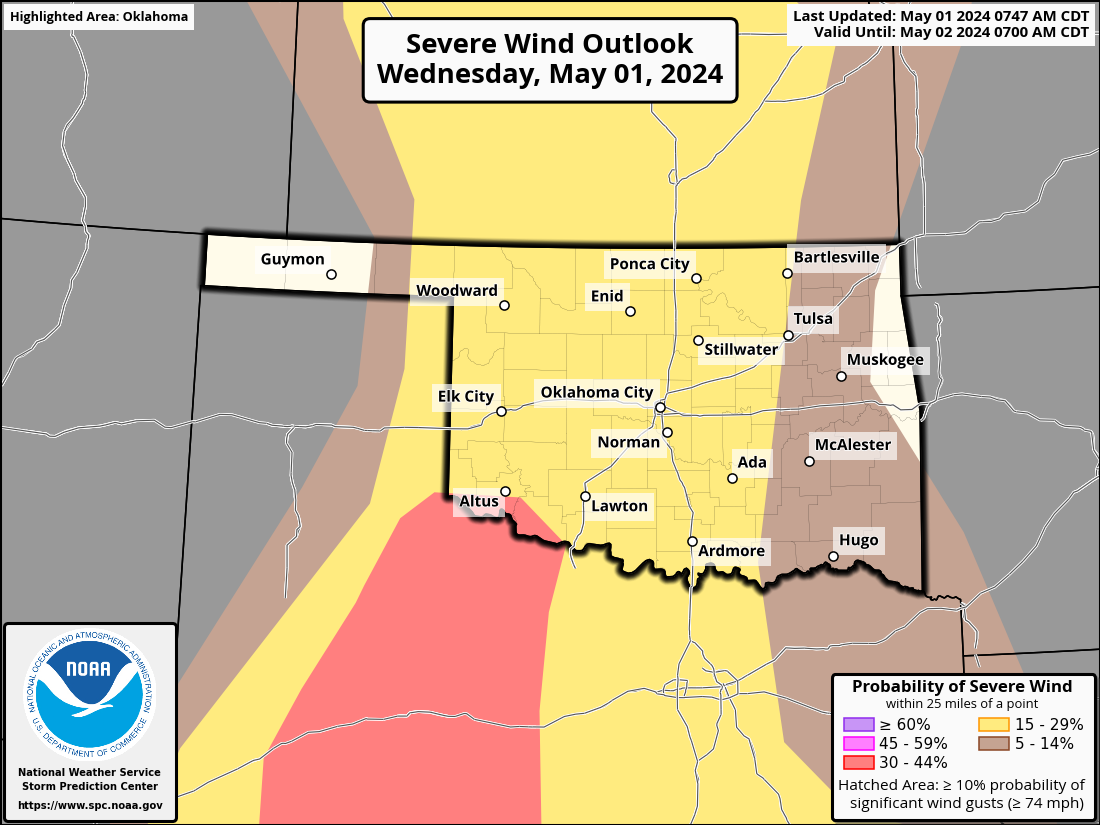

This is once again a very complicated and conditional forecast based upon what's
already happened this morning, what sort of recovery the atmosphere sees
through the day, and where things set up just perfectly. However, as we saw
yesterday...don't sleep on this one. Have a plan. Be ready.
Flash flooding will also be a concern in that some areas are quite moist already,
so runoff will be abundant with further storms today and into tomorrow.
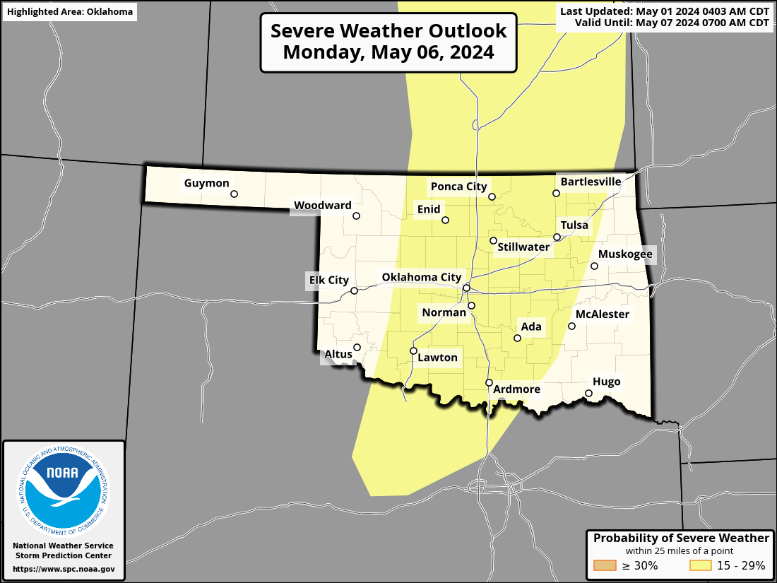
Storms this weekend will have a marginal risk of severe weather, as will those
tomorrow. At least that's how it looks now. Then we get to do another possibly
significant severe weather day on Monday, with supercell sand tornadoes already
being mentioned...yes, by folks much smarter than me! I can hear ya you know!
Okay, enough talk. If you're interested in the latest on tornado counts and
whatnot, and finding out we probably had the 3rd highest total of April
tornadoes on record for the state, continue reading below.
----------------------------------------------------------------------------------
April Tornado Outbreak Scars Oklahoma
May 1, 2024
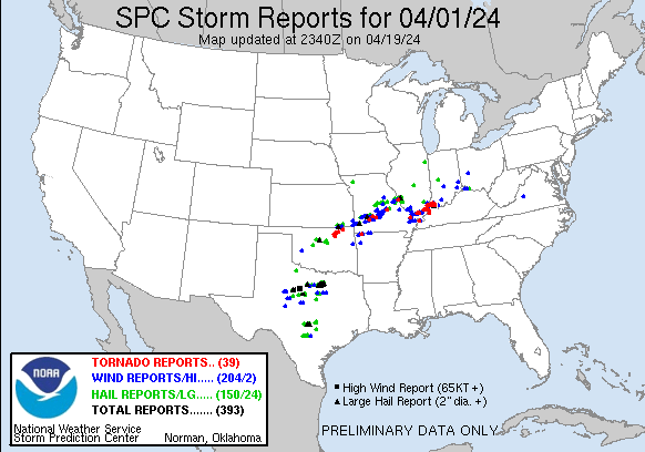
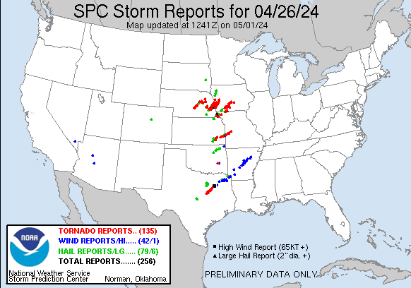
Severe weather roared back into Oklahoma during April with giant hail, severe
winds up to 80 mph, flash flooding, and over 40 tornadoes—a number that is
destined to grow with further investigation by National Weather Service damage
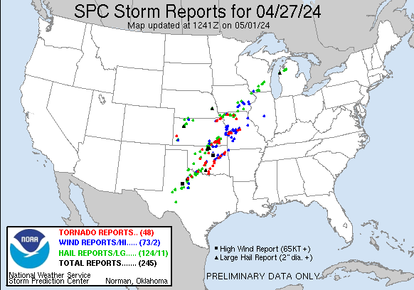
survey teams. That total included a historic outbreak on April 27, a day where
at least 22 tornadoes were confirmed to have struck the state—the second-most
prolific outbreak for a single day during April on record, behind the 33
twisters back on April 14, 2011. Another four tornadoes touched down just after
midnight in eastern Oklahoma to bring the event total to at least 26. Other
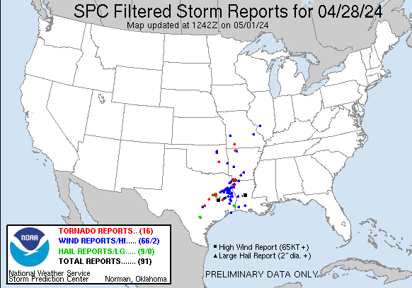
tornadoes struck on April 1 and 26, and the month ended with a slew of twisters
in southwest Oklahoma on its final day. The still-nebulous preliminary total of
more than 40 tornadoes marks the month with at least the third-highest April
total in Oklahoma since accurate records began in 1950, behind 2011’s 50 and
2012’s record mark of 54. The count also far outpaces April’s average of 11.8,
and more than doubles the January-April average of 17. The 1950-2023 annual
average number of tornadoes in Oklahoma is 57.5. Add another two events from
March 14 and Oklahoma seems well on its way to exceeding its annual average
tornado count for the twelfth time in the last 15 years. May sees an average of
24 tornadoes and June’s average stands at 7.3.

The tornadoes on April 27 killed at least four people and injured nearly 300
more, according to the Oklahoma Department of Emergency Management. The day
also saw the state’s first violent-rated tornado—EF4 or EF5 on the
Enhanced Fujita scale—since May 9, 2016. The lead-up to the outbreak stretched
back nearly a week, with Storm Prediction Center outlooks alerting Oklahomans
to the possibility of strong, long-tracked tornadoes. Severe weather started
early on the 27th with a line of supercells stretched from southwest through
north-central Oklahoma, and the first tornado warning was issued for portions
of Roger Mills and Dewey counties at 10:10 a.m. Those cells eventually moved
into Kansas but not before dumping more than 5-7 inches of rain across Kay
County. A lull in activity gave way to two lines of supercells later that
evening moving north out of Texas into southern, central, and eastern Oklahoma,
dropping tornadoes along the way. The violent EF4 twister struck Marietta with
winds estimated at 165-170 mph, causing considerable damage along Interstate 35
and in the city itself. One person was killed along I-35 as the tornado crossed
the highway along its 27-mile path. Sulphur suffered the worst hit when an EF3
plowed through the town and flattened many of the buildings in its downtown
area with winds estimated at 160-165 mph. One person died in the wreckage of
one of those collapsed buildings in downtown Sulphur. Another EF3 killed two
people near Holdenville, including a 4-month-old infant. Two more significant
tornadoes, rated EF2, struck near Goldsby and Ardmore. The final alert went out
at 1:51 a.m. early on the next day, two of the 81 tornado warnings issued by
the Norman and Tulsa National Weather Service offices during the event on the
27th that stretched out to early on the following day. Norman issued 62 of those
warnings, the most the office has ever issued in a single day.

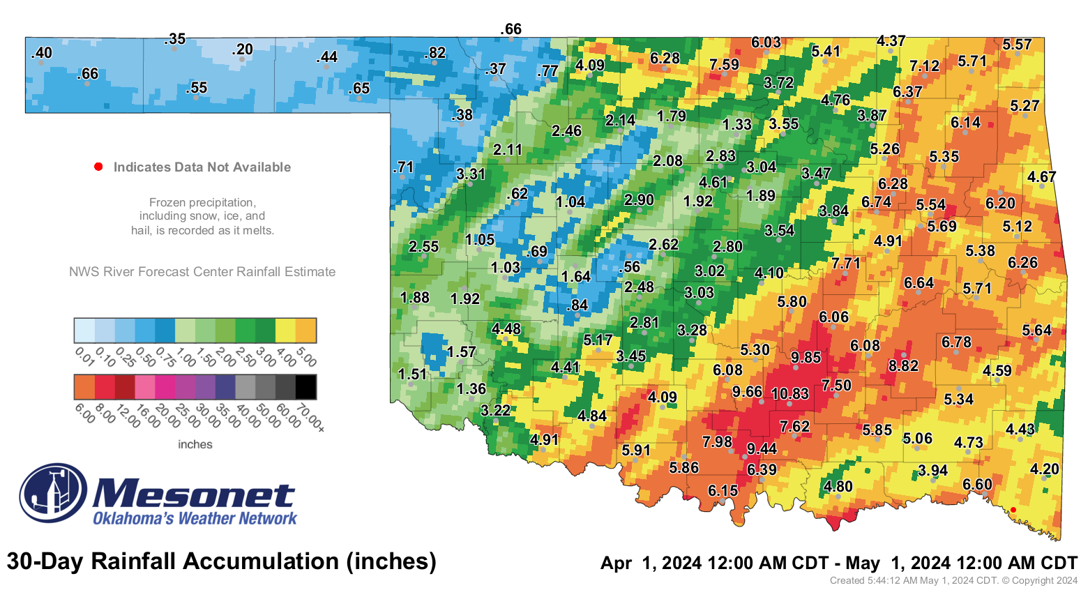
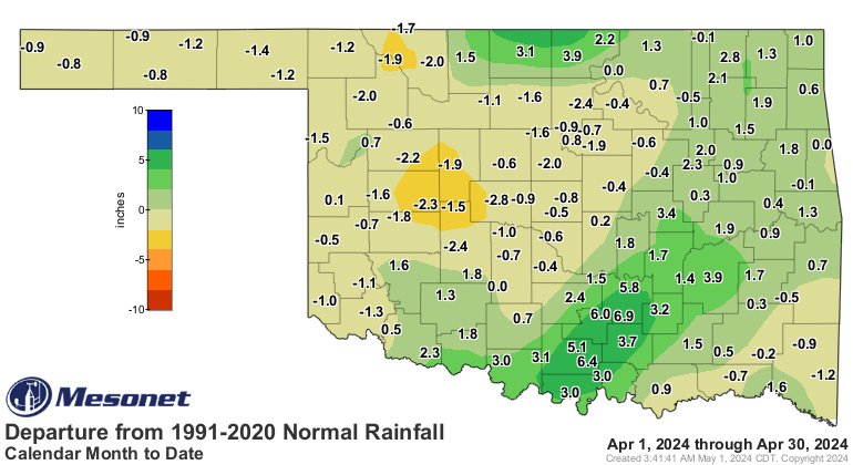
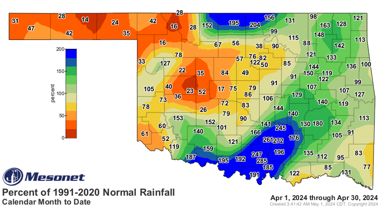
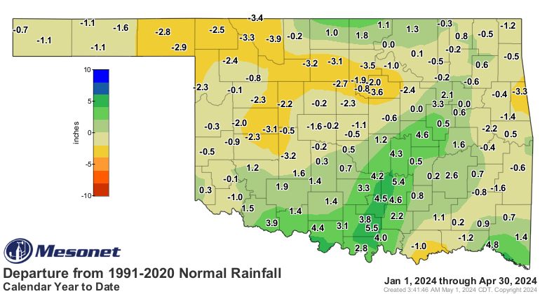
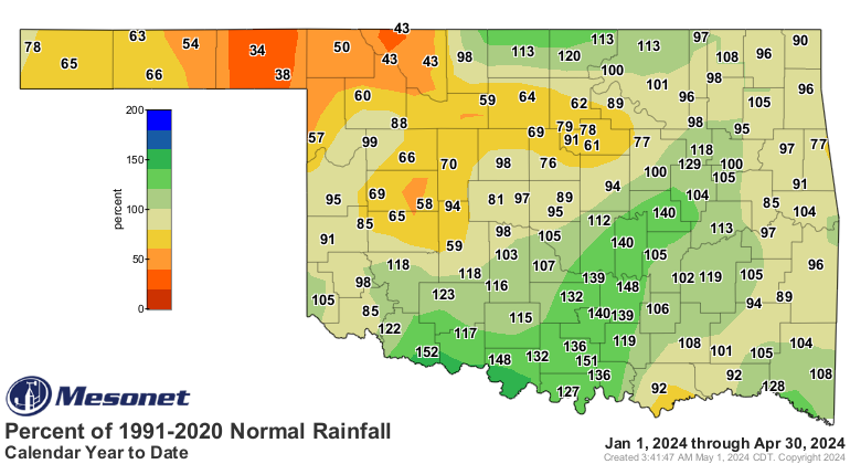
The statewide average rainfall total for the month was 3.94 inches, 0.35 inches
above normal, and ranked as the 41st-wettest April since records began in 1895.
The heaviest rains coincided with the worst severe weather, which is often the
case during Oklahoma’s spring rainy season. Surpluses of 4-7 inches were common
across parts of south central Oklahoma, which saw its April average surge to
7.21 inches, 3.45 inches above normal, ranking as the 10th wettest April for
that section of the state. Meanwhile, the Panhandle saw a deficit of over an
inch, suffering its 12th-driest April on record. Fittstown led the state with
10.82 inches, 7 inches above normal, while Hooker managed a meager 0.2 inches.
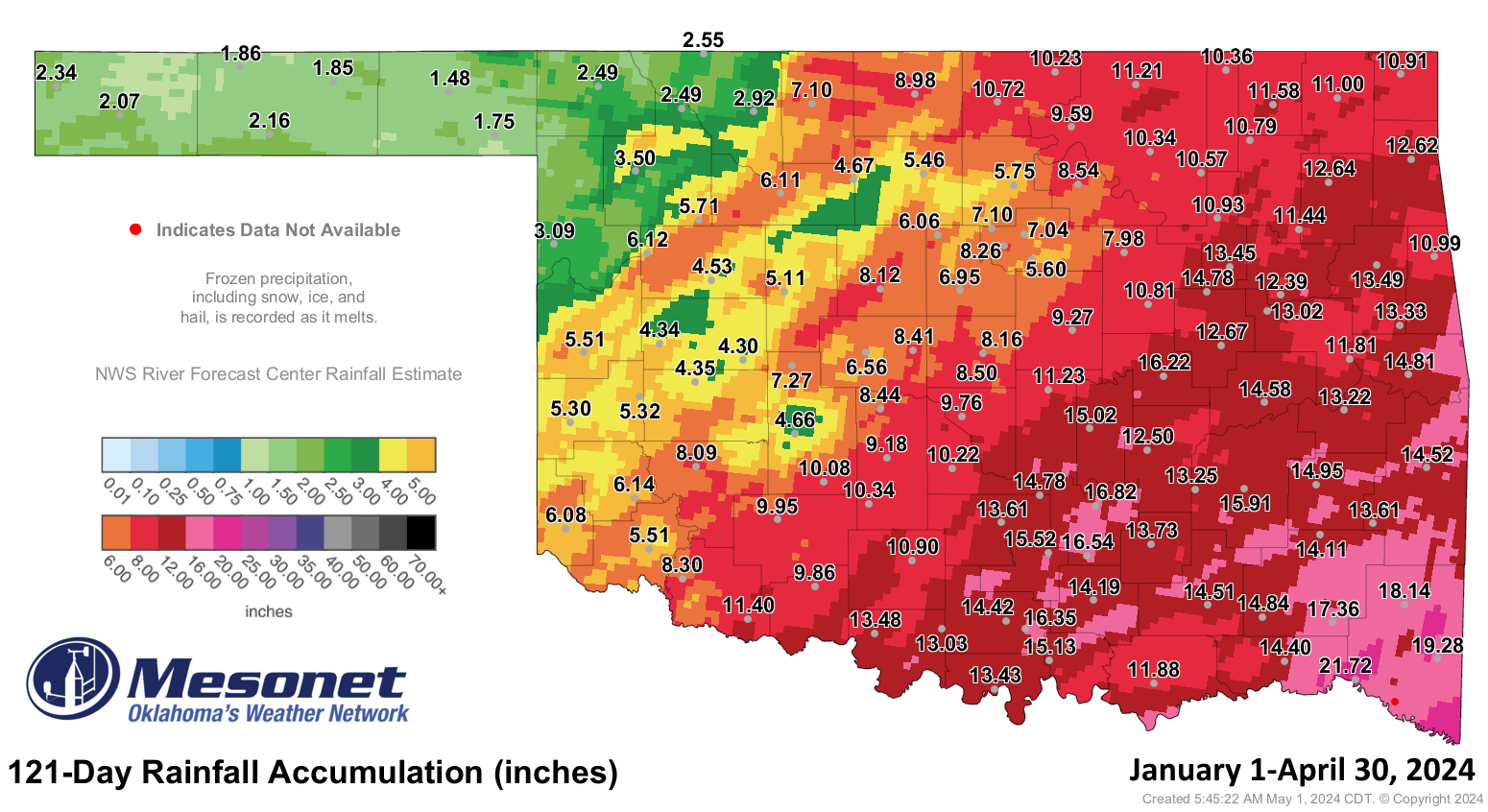
Deficits of 1-2 inches dominated much of western and central Oklahoma. The
first four months of 2024 had a statewide average rainfall total of 9.62 inches,
just 0.01 inches below normal, ranking as the 46th-wettest January-April on
record.
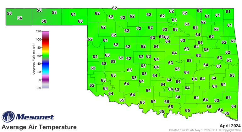
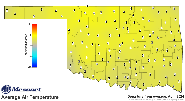
Temperatures during April ranged from 96 degrees recorded at several locations
on the 14th and 30th to 27 degrees at Kenton on the 10th. The final freeze of
April—and presumably spring—occurred on April 22 across the northern half of
the state. The statewide average temperature for the month was 62.2 degrees,
2.7 degrees above normal, ranking as the 22nd-warmest April since records began
in 1895. The first four months of the year saw a statewide average of 50
degrees, 2.1 degrees above normal, ranking as the 15th-warmest January-April on
record.
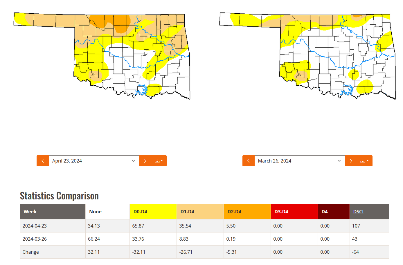
Flash drought continued to advance throughout the northern half of the state,
although rains late in the month undoubtedly eased impacts in many areas.
Coverage of drought increased from 9% at the end of March to 36% at the end of
April, according to the U.S. Drought Monitor, with severe drought increasing
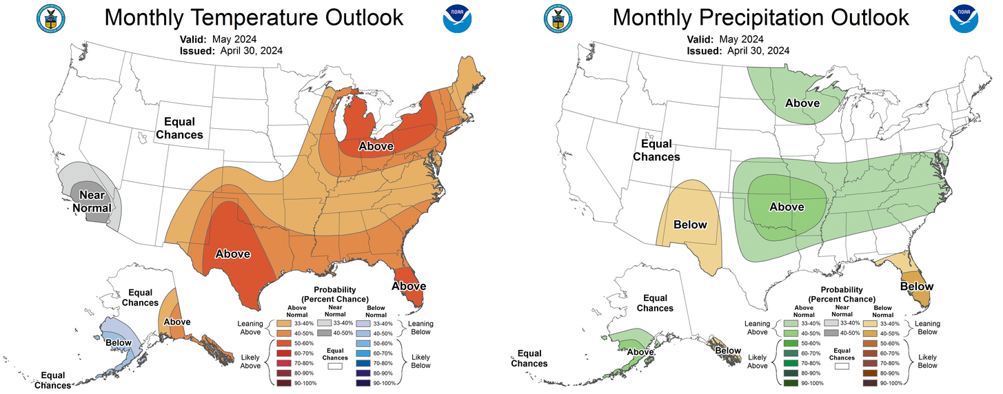
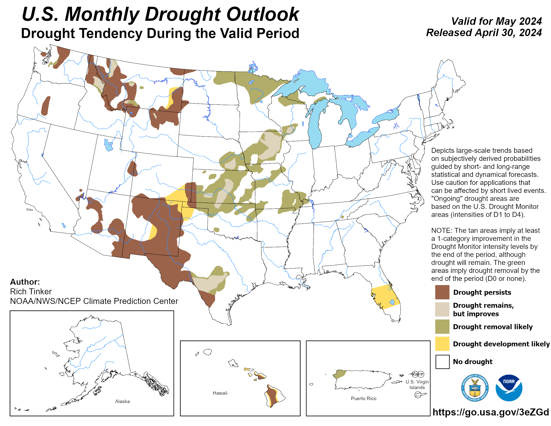
from 0% to 6% over that same period. Major relief is in store for the state,
according to the Climate Prediction Center outlooks for May. The precipitation
outlook calls for increased odds of above-normal rainfall across all but the
far western Panhandle. That, in addition to the rains of late April, fuels CPC’s
May drought outlook to call for drought improvement or removal across all but
that far western Panhandle region by the end of the month, with drought
development likely in Cimarron County. Temperatures are also expected to be
above normal during May, especially across the southwestern half of the state.
###
Gary McManus
State Climatologist
Oklahoma Mesonet
Oklahoma Climatological Survey
gmcmanus@mesonet.org
May 1 in Mesonet History
| Record | Value | Station | Year |
|---|---|---|---|
| Maximum Temperature | 101°F | ALTU | 2002 |
| Minimum Temperature | 28°F | BOIS | 2011 |
| Maximum Rainfall | 7.70″ | PRYO | 2009 |
Mesonet records begin in 1994.
Search by Date
If you're a bit off, don't worry, because just like horseshoes, “almost” counts on the Ticker website!