Ticker for May 2, 2024
MESONET TICKER ... MESONET TICKER ... MESONET TICKER ... MESONET TICKER ...
May 2, 2024 May 2, 2024 May 2, 2024 May 2, 2024
Uh huhuhuhuhuhuhuhuhuh
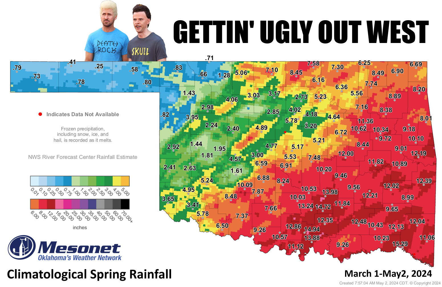
I don't have to tell you what a failure spring has been for some folks,
particularly from the far western Panhandle down into central Oklahoma. I also
don't have to tell you how aggrieved (English to Okie translation: riled up) I am
that even in a Butthead costume, Ryan Gosling looks much better than me. Yes,
ESPECIALLY the hair!
Enough about me, though...no wait, there can never be enough about me. But enough
about Ryan Gosling, but..."Gosling," what a dumb name! You know that's the name
of a baby duck, right?
Oh. Well, darn it Jim, I'm a climatologist, not an Ornath...Ornethol...Ornitoll...
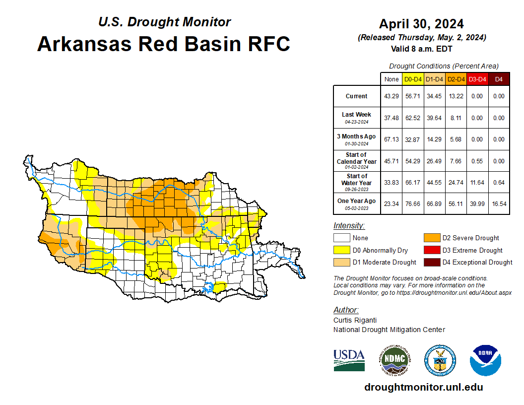
a bird expert! However, I do know a bit about drought, and I'll also be darned if
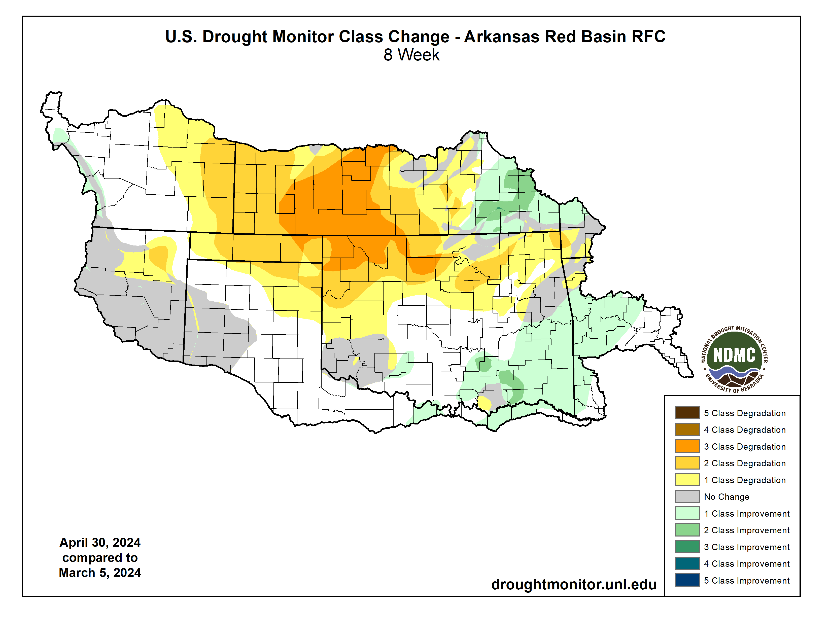
the flash drought across NW OK doesn't continue to get worse at the same time it's
being relieved across the rest of the state. I know, let's blame this on Kansas!
That's right...Kansas, the Beavis to Texas' Butthead. WE KID...WE KID!! Anyway,
this is all spreading from up their direction.
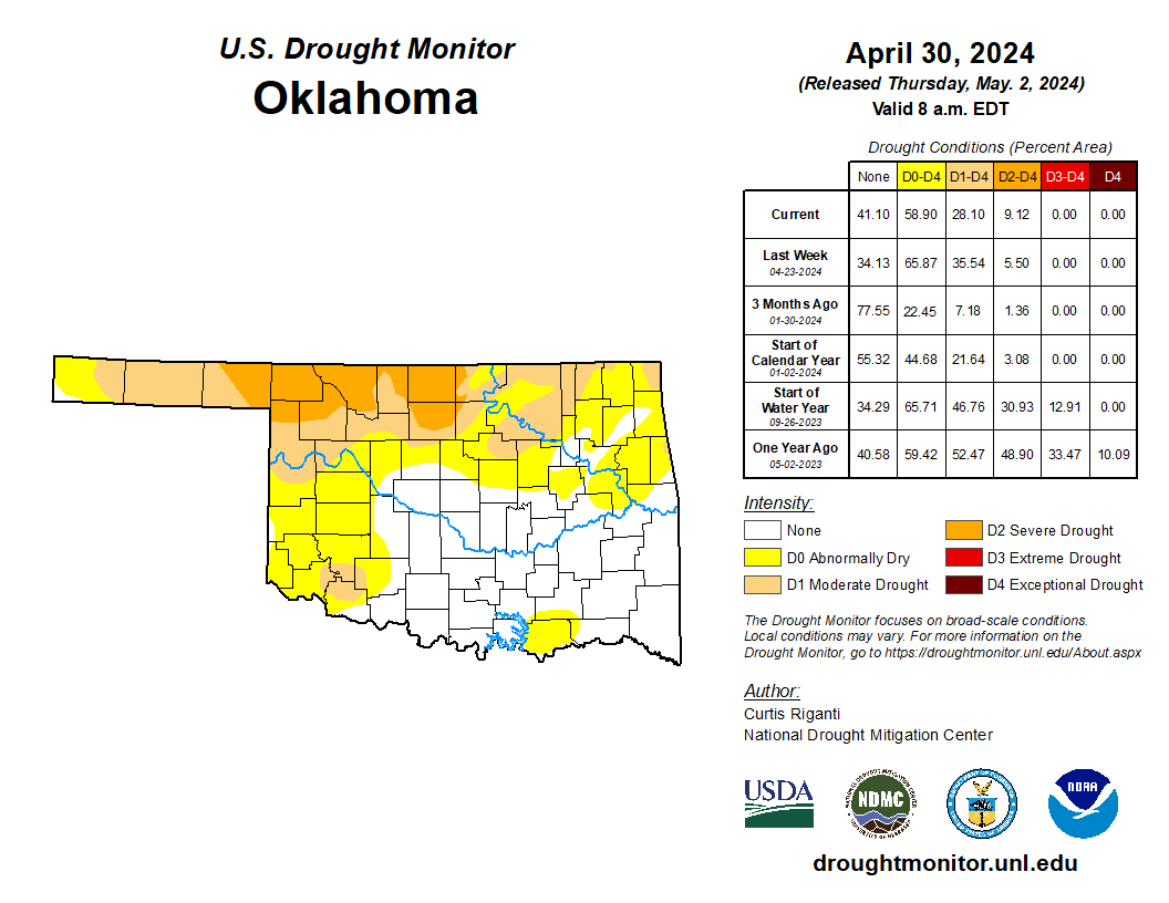
And looking at the Oklahoma-only map, we can see that we shrank our all-drought
from 36% to 28% this week, but the amount of severe drought increased from 5%
(if it's an odd number in front of the .5, you're supposed to round down...it's
statistics, I could tell you but then I'd have to count you) to 9%..
When we look at the departure and pct of normal maps for spring thus far, AND
the statistics again, you can easily see why.
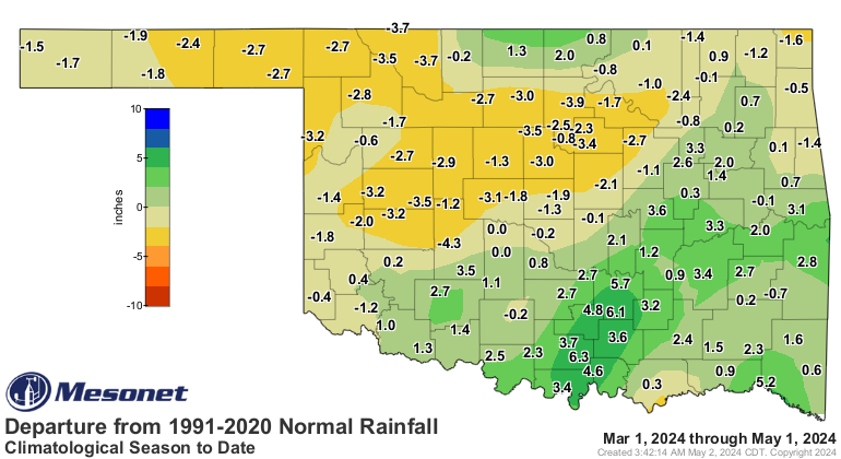
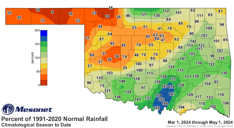
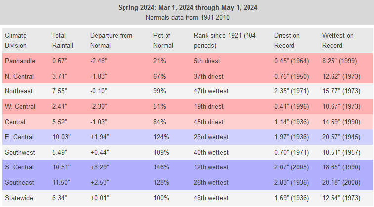
Yikes! Fifth-driest in the last 100+ years? What are you doing to me, Panhandle?
West Central OK isn't much better at the 19th driest. And all this time south
central is down there bragging about it's 12th wettest spring thus far.
Not good. What about chances for rain coming up? Darn it, Jim! I'm a bird person,
not a weather pers...oh wait, I am a weather person. Well, let's take a look.
Heck, it's raining right now for crying out loud!

Yeah, it's raining, but not in the right place. Need to spread that to the
west even more. Same for the forecast over the next 5 days, through the weekend.
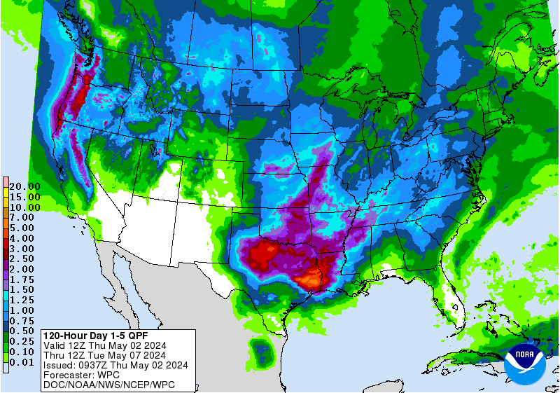
That's not *TOO* bad, but it could certainly be more. And it actually has to
come to fruition (translate it yourself...I'm too busy), of course.
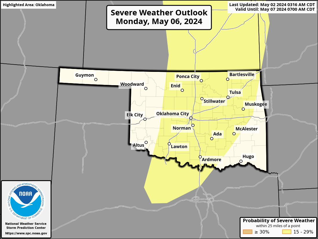
Let's not forget about severe weather, as if we could if we tried. With the
storms over the next 4 days, there will be marginal chances for a severe storm
here or there, at least how it looks now, But then we need to watch Monday for
another one of *THOSE* days in Oklahoma.
We'd rather have *THESE* days, I think.
Gary McManus
State Climatologist
Oklahoma Mesonet
Oklahoma Climatological Survey
gmcmanus@Mesonet.org
May 2 in Mesonet History
| Record | Value | Station | Year |
|---|---|---|---|
| Maximum Temperature | 105°F | ALTU | 2020 |
| Minimum Temperature | 24°F | BOIS | 2013 |
| Maximum Rainfall | 4.04″ | HASK | 2022 |
Mesonet records begin in 1994.
Search by Date
If you're a bit off, don't worry, because just like horseshoes, “almost” counts on the Ticker website!