Ticker for April 10, 2024
MESONET TICKER ... MESONET TICKER ... MESONET TICKER ... MESONET TICKER ...
April 10, 2024 April 10, 2024 April 10, 2024 April 10, 2024
Who needs glasses?
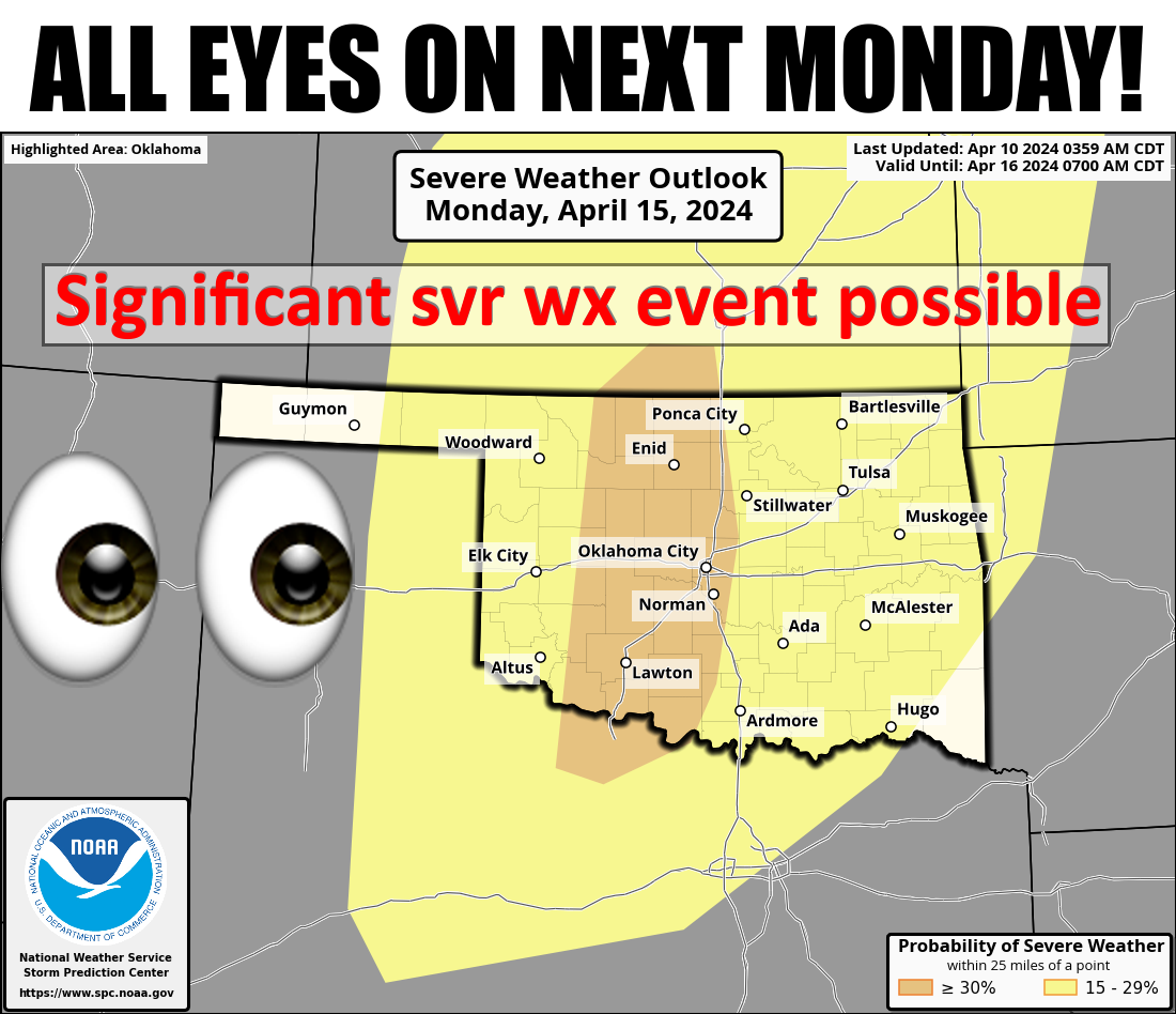
Well I don't set the Ticker agenda...Mother Nature does! Wait, much like my
forecasts, that's not necessarily true. Everybody knows my Strawberry Pop-Tart
agenda. I mean, WHO set the Strawberry flavor over the much more popular (and
tasty) Cherry flavor? If you see those individual packages of Pop-Tarts in
convenience stores...Strawberry. Vending machines...Strawberry. Now if you're
talking Fanta flavors, OBVIOUSLY you're going with Strawberry, right? Trick
question...they don't make a Cherry flavor.
If you said Orange, please exit to the left immediately. Do not pass Go, do not
collect $318 (used to be $200, but inflation...).
Oh wait, we were talking about next Monday until you started talking about Pop-
Tarts! Might have been me...now is not the time to play the blame game. When I see
the 30% probability contour on a 6-day severe weather outlook from SPC, I sit up
and take notice. Sometimes I notice up and sit, but it varies. Here is the
reasoning for an unusual amount of severe contouring almost a week out:
The actual severe weather setup appears substantial. Air mass
modification will ensue northward from the western Gulf on D3, with
multiple days to improve the low-level moisture profile amid well
above-normal surface temperatures and a pronounced elevated mixed
layer. With the likely flow field amplification through the
troposphere, all ingredients appear present for a significant severe
weather day on D6/Monday."
Hey, "Significant Severe Weather Day" was my band's name in Meteorology school!
Here is NWS Norman's take on it from this far out.
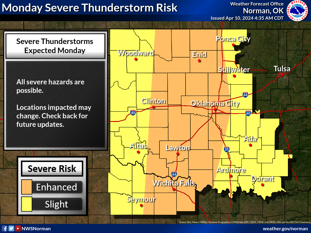
At any rate, something to think about as we go about the rest of the week (next
Monday's severe risk, not my band name).
Something to think about today?
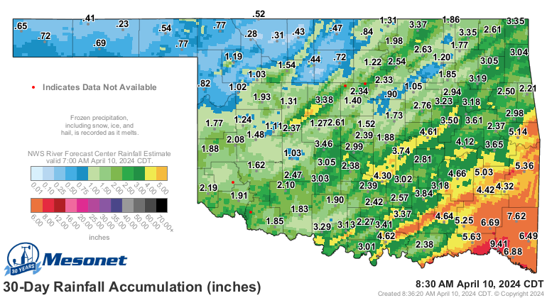
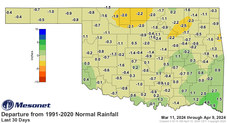
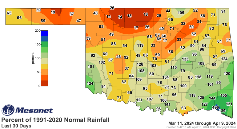
Rain. We've gotten some good amounts, gotten some not-good amounts (as in ZERO),
and can expect a bit more to the east.
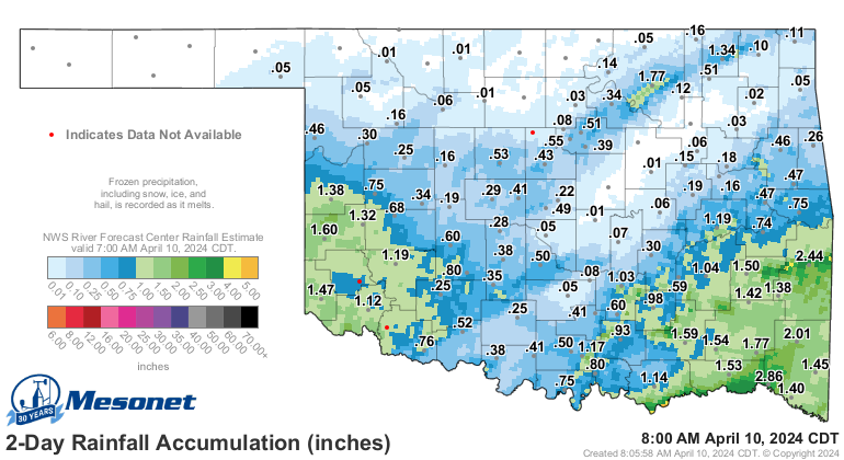
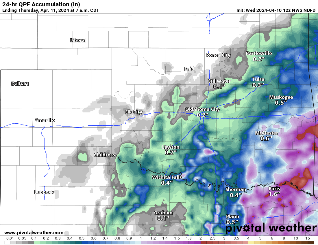
That's all well and good, but the folks in far NW OK are still hurting. And
Frankly (could have said Georgely, but that makes no sense), much of the
state is still dealing with increasing dry conditions, if not outright drought.
We will see a drastic warm up over the next 5-6 days, with highs eventually
settling into the 80s. Lots of gusty winds will go with that warm up, much like
we'll see in the next 24 hours. Watch for those winds to gust to 25-35+ mph
over this period.
Gary McManus
State Climatologist
Oklahoma Mesonet
Oklahoma Climatological Survey
gmcmanus@mesonet.org
April 10 in Mesonet History
| Record | Value | Station | Year |
|---|---|---|---|
| Maximum Temperature | 94°F | HOLL | 2019 |
| Minimum Temperature | 14°F | BOIS | 2013 |
| Maximum Rainfall | 3.83″ | COPA | 1994 |
Mesonet records begin in 1994.
Search by Date
If you're a bit off, don't worry, because just like horseshoes, “almost” counts on the Ticker website!