Ticker for April 11, 2024
MESONET TICKER ... MESONET TICKER ... MESONET TICKER ... MESONET TICKER ...
April 11, 2024 April 11, 2024 April 11, 2024 April 11, 2024
Fun?
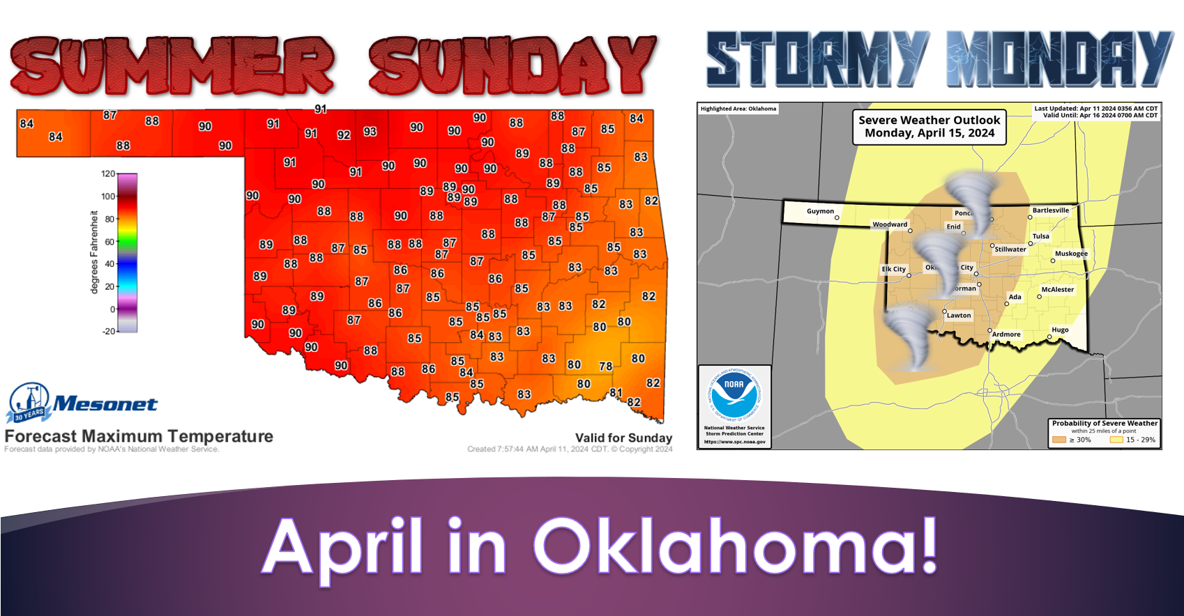
Now don't you know somebody's waking up from a coma today and thinking "Thank
God I'm still here, now I can watch the eclipse!"
That's sort of what I feel like when I first wake up in the morning and think
to myself (it'd be odd if I thought to somebody else, after all) "I can't wait
to comb my hair!" Well, it's all in the imagination, right? What's not in the
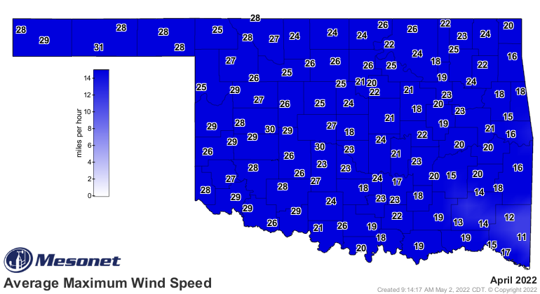
imagination is wind during April in Oklahoma. Remember when April 2022 became the
windiest month in Mesonet history?
Quoting the Ticker from May 2, 2022 (Nevermore...SUDDEN POE REFERENCE, ACTIVATE!):
"Already Oklahoma’s windiest calendar month climatologically, the seemingly
unceasing gales howling day and night became a common point of exasperation.
Data from the Oklahoma Mesonet lends credence to that frustration. Both the
statewide average wind speed and maximum wind speed for this April were tops
since Mesonet data began in 1994 at 12.2 mph and 22.9 mph, respectively.
Previous top marks were held by 1996’s 12 mph and 2011’s 22.5 mph, again
respectively. Those and other metrics point towards the month as the windiest
April statewide in the Mesonet era. Fourteen of April’s 30 days saw
non-thunderstorm wind gusts of at least 50 mph somewhere in the state, and nine
days with at least 60 mph."
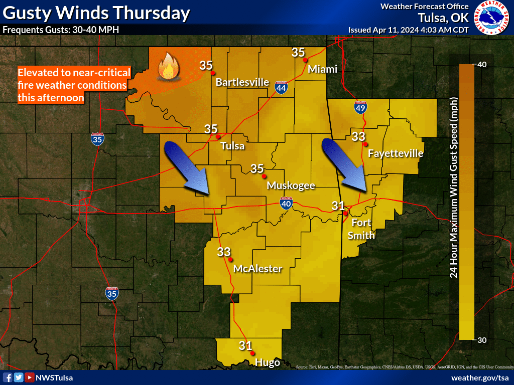
Nothing like that today, of course, but we will be back to our windy April ways
for the next few days, with gusts commonly 25-35 mph and sometimes greater.

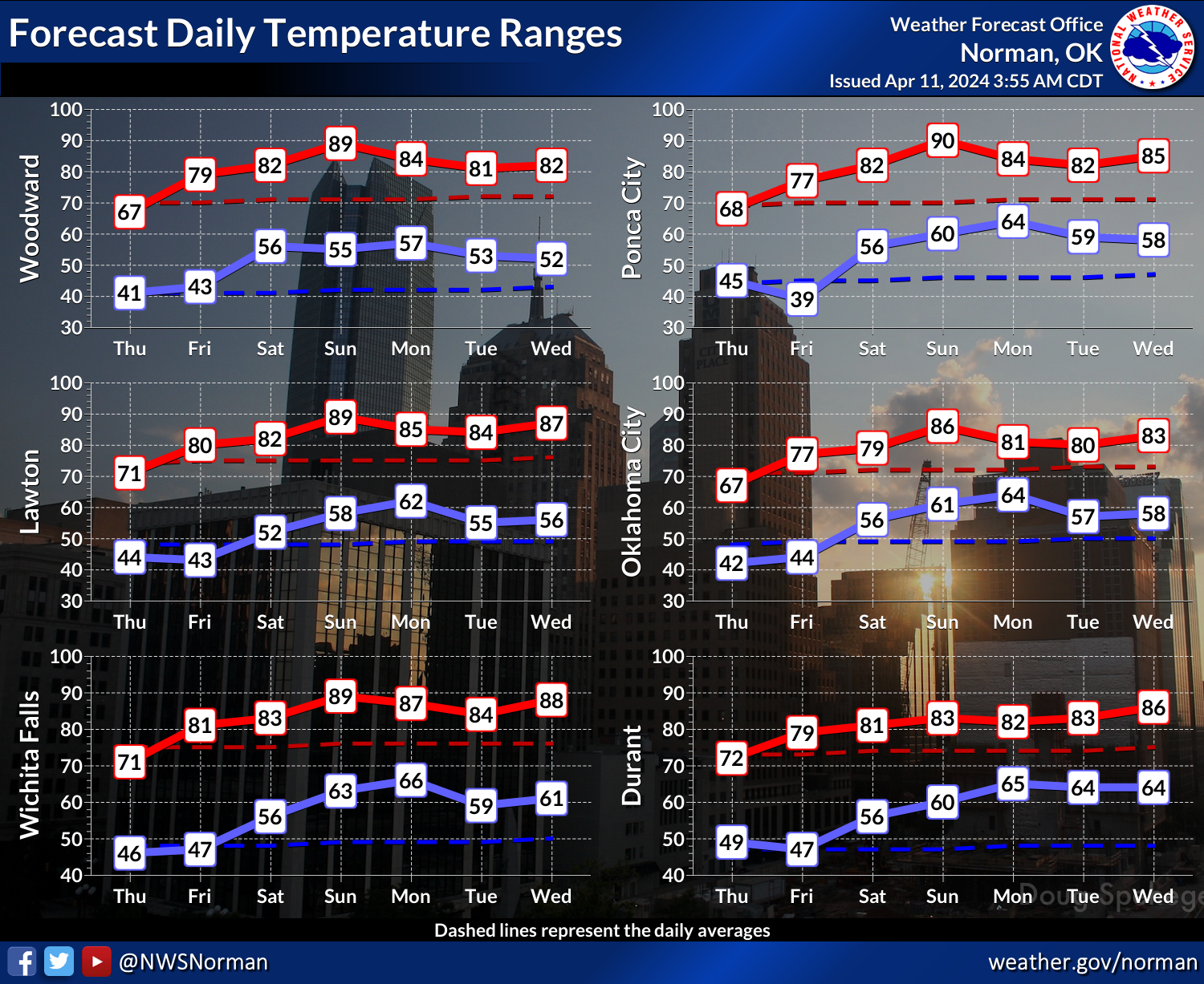
Now that, along with increasing temperatures and lower humidity, will lead to
lots of fire danger in the next week, especially across NW OK and centered over
Osage County. Those areas have not seen much green up yet due to dry conditions.
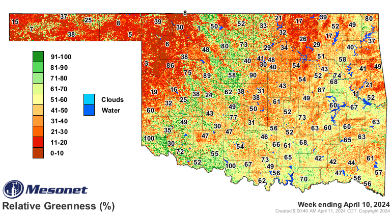
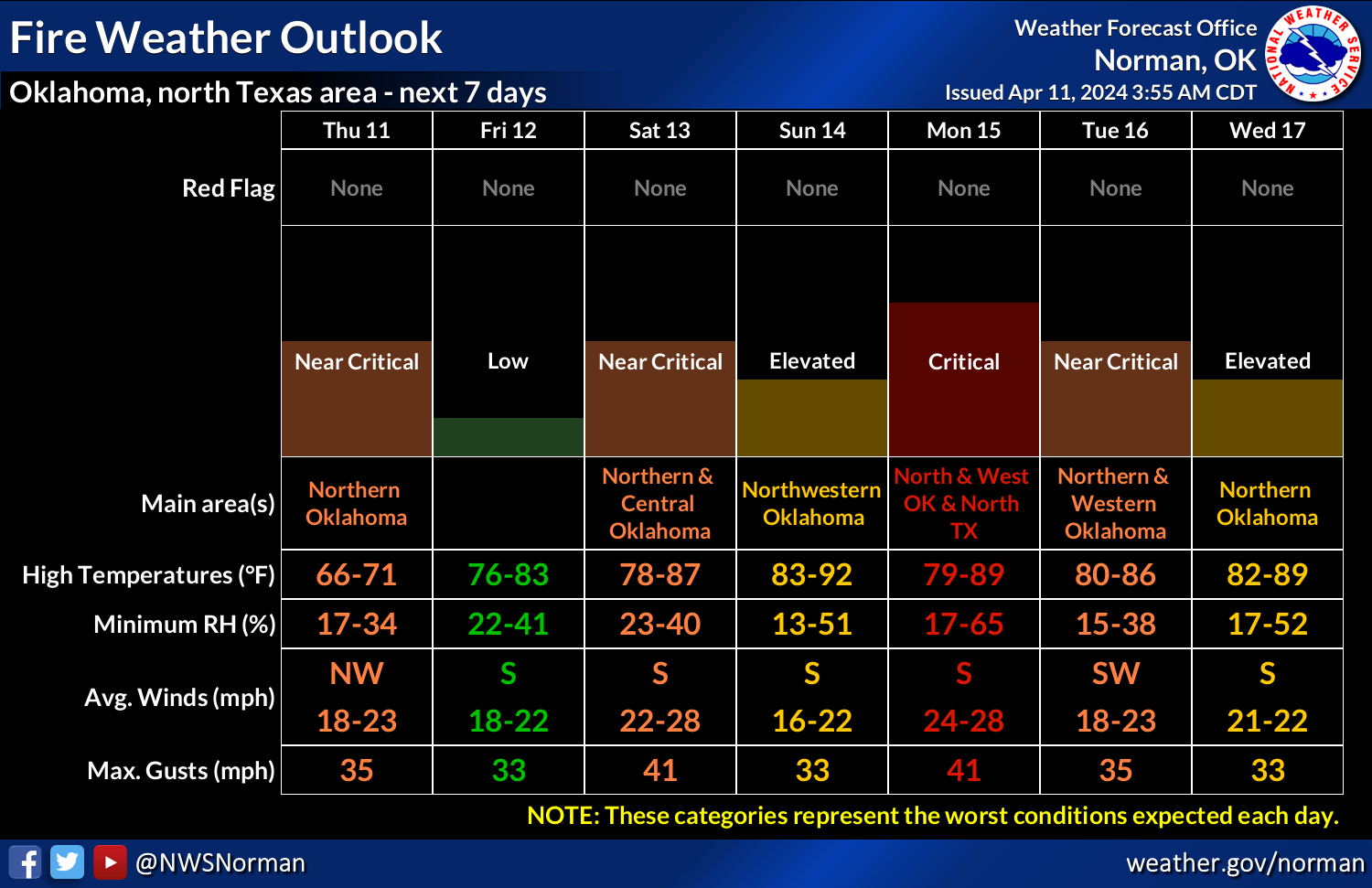
That lack of moisture ain't helping at all, and we now see drought building
ONCE AGAIN (Arghhhh! SUDDEN PIRATE REFERENCE...ACTIVATE!) across parts of NW
and east central Oklahoma. In fact, we've seen drought conditions increase from
just over 3% of the state about a month ago to more than 15% this week.

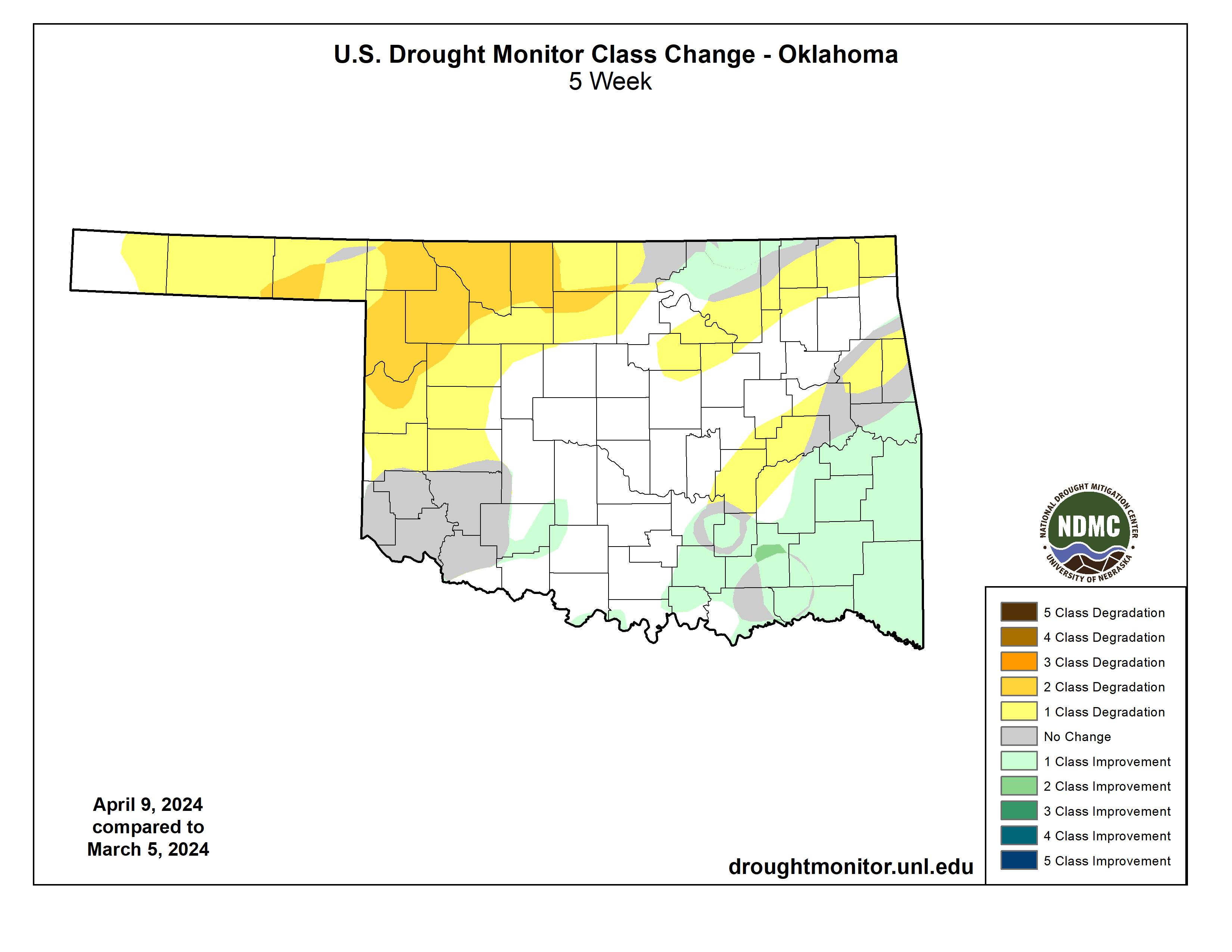
The dryness since the beginning of the growing season has mean for those parts
of the state, it's more of a NON-growing season.
Get it? NON-growing season. As opposed to growing season.
BWAHAHAHAHAHA!
BWAHAHA!
HAHA!
haha
ha
Oh.
Hey, who said climate comedy was pretty? You want pretty, go as those weather
folks!
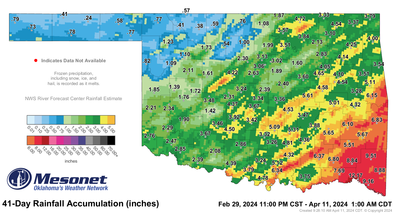
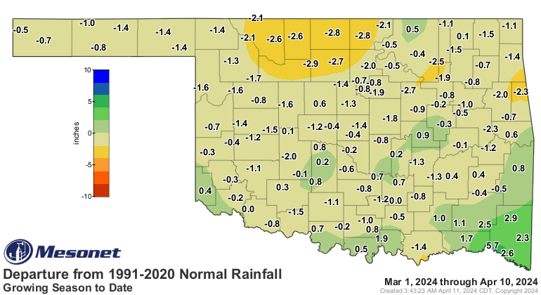

So we have almost all hazards covered for the next week. Wait, don't tell me...
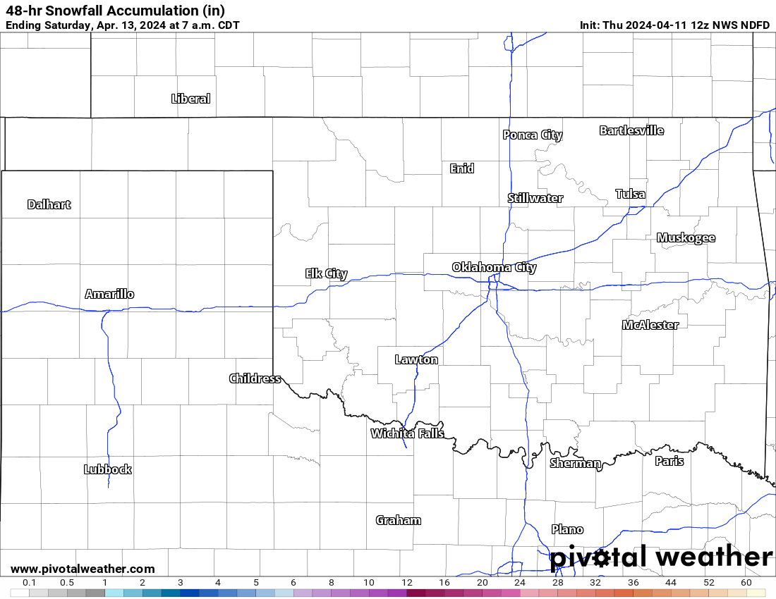
Okay, whew.
As for the storminess next Monday, everything still looks like it's in place to
have a classic severe weather outbreak setup across the Southern Plains, with
a dryline across western Oklahoma kicking off storms, and then all hazards
being possible throughout the rest of the evening.
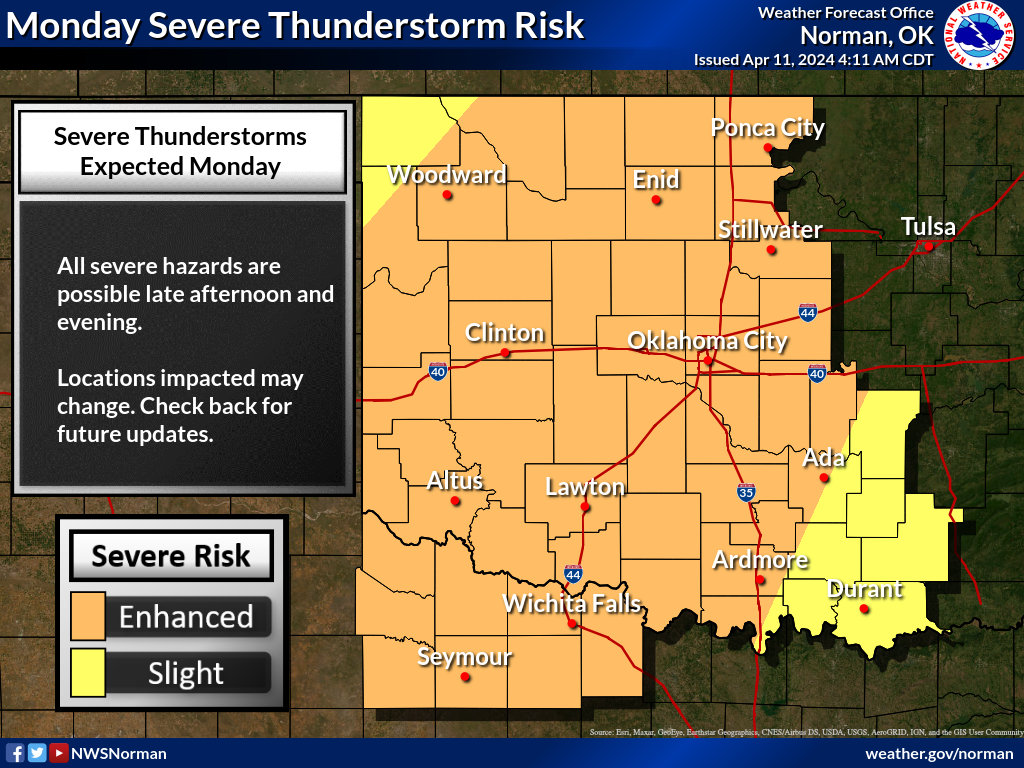
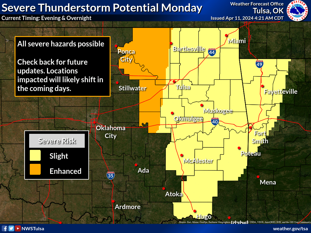
April in Oklahoma...we should expect nothing less.
Gary McManus
State Climatologist
Oklahoma Mesonet
Oklahoma Climatological Survey
gmcmanus@mesonet.org
April 11 in Mesonet History
| Record | Value | Station | Year |
|---|---|---|---|
| Maximum Temperature | 96°F | ARNE | 2018 |
| Minimum Temperature | 15°F | BOIS | 2013 |
| Maximum Rainfall | 4.55″ | VINI | 1994 |
Mesonet records begin in 1994.
Search by Date
If you're a bit off, don't worry, because just like horseshoes, “almost” counts on the Ticker website!