Ticker for March 13, 2024
MESONET TICKER ... MESONET TICKER ... MESONET TICKER ... MESONET TICKER ...
March 13, 2024 March 13, 2024 March 13, 2024 March 13, 2024
Roar
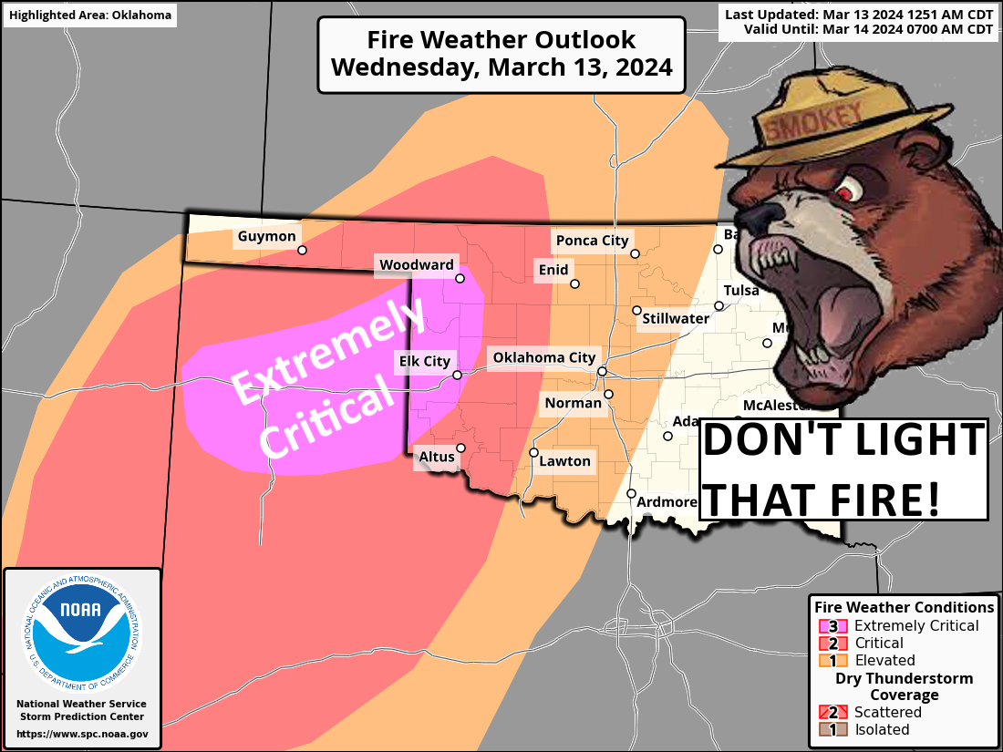
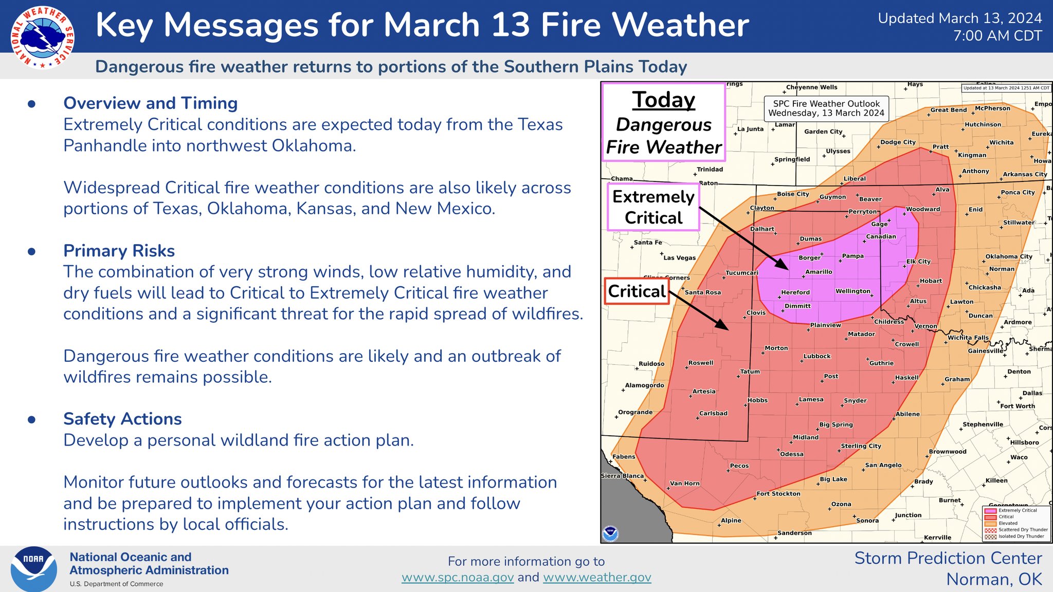
Yes, we have your Mother-in-law's intensity of fire danger today out west...
"extremely critical." All the ingredients are in place for some damaging and
deadly fires today out across western Oklahoma (hey, "Damaging and Deadly" was
my band's name at Seton Hall Prep!). Here's the deal...don't light any fires,
don't cause any sparks, and definitely keep your butts in your car (anatomical
AND cigarettical). Because not only are you endangering the lives of you and your
neighbors, but also the mostly volunteer firefighters tasked with battling those
blazes.
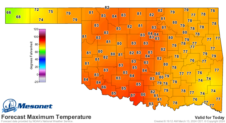
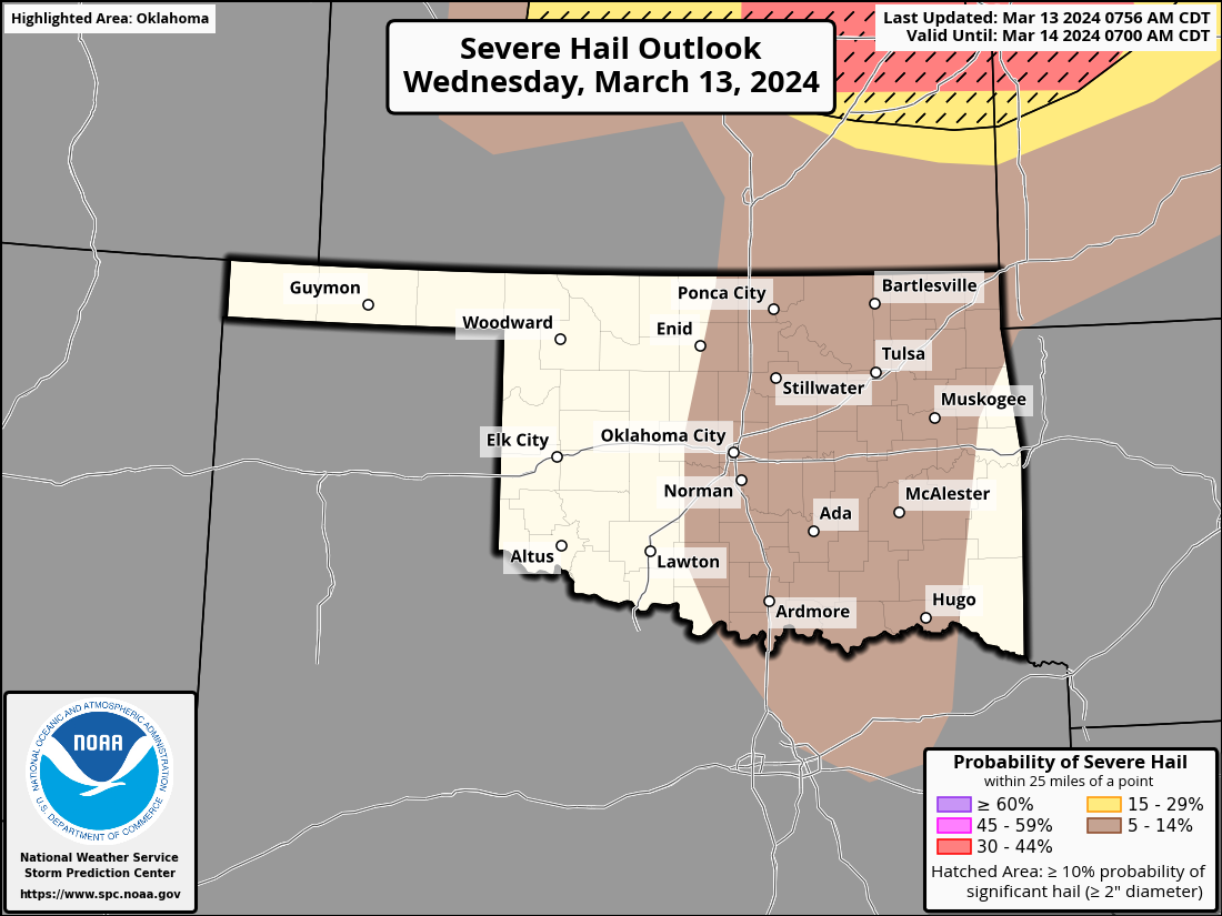
This is a classic setup for that fire danger today with a storm system moving
in. Strong southwesterly winds gusting to over 40 mph will combine with relative
humidity in the teens to single digits along and behind a dryline, in addition to
temperatures in the mid-to-upper 80s.
Here's a bit more.
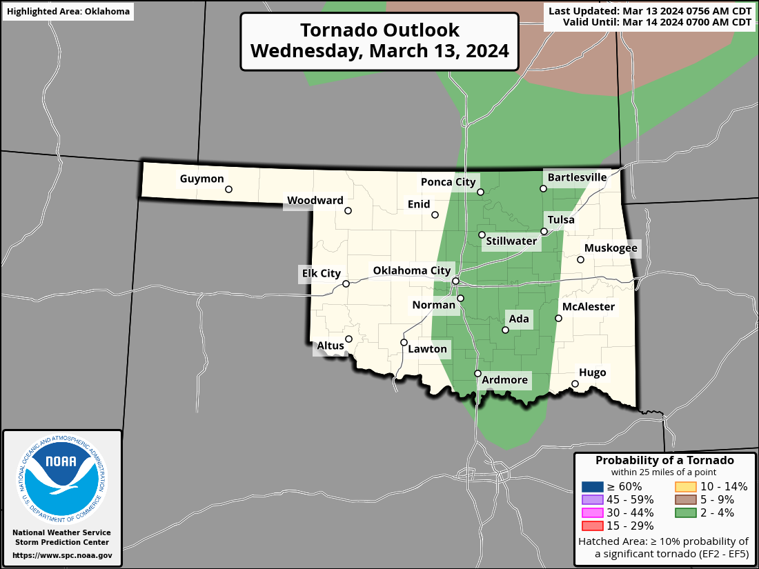
There's also a very very conditional severe threat today across eastern OK,
contingent upon storms being able to beat the cap and initiate. If they do,
which is still unlikely but bares watching (cheeky monkey, aren't ya...the
rest of us will be "bears watching") because all hazards will be possible.
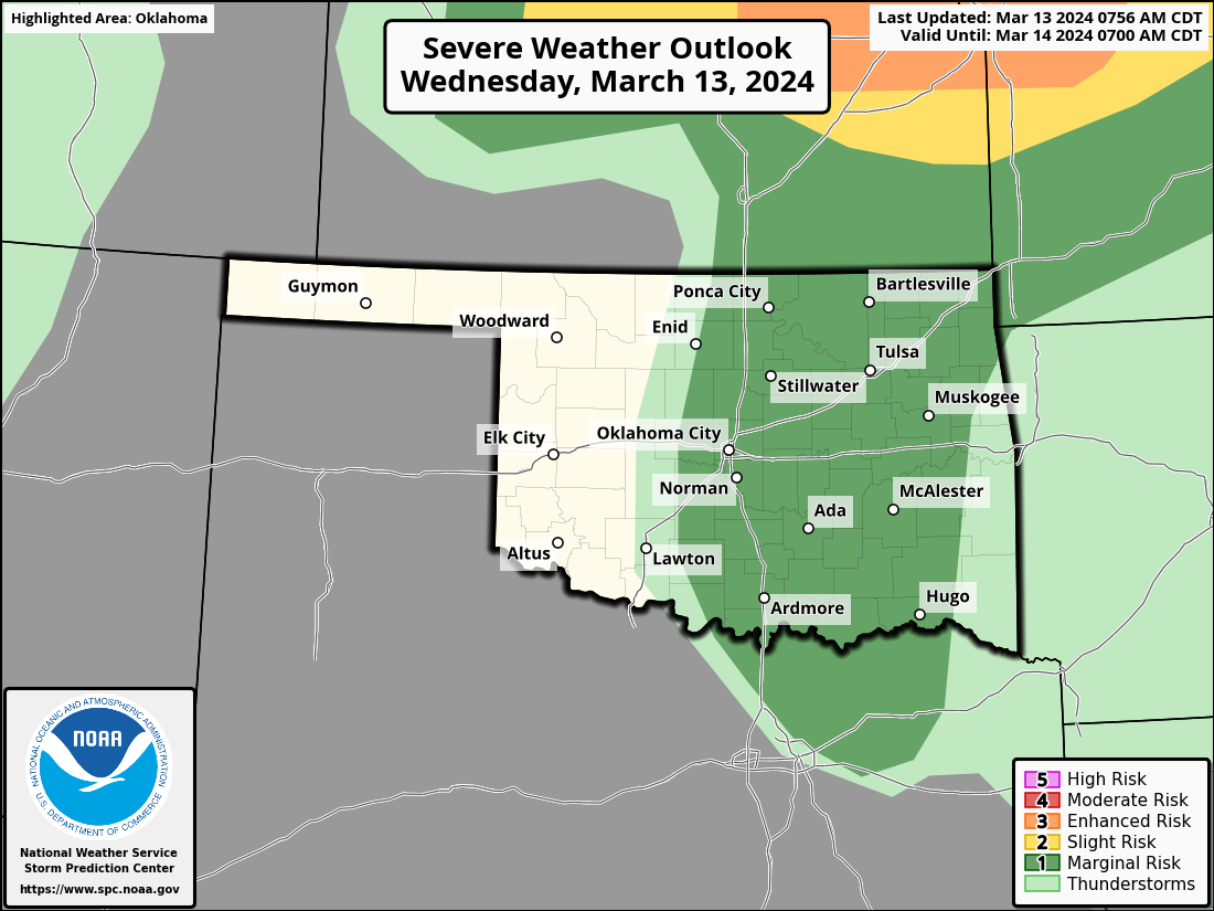

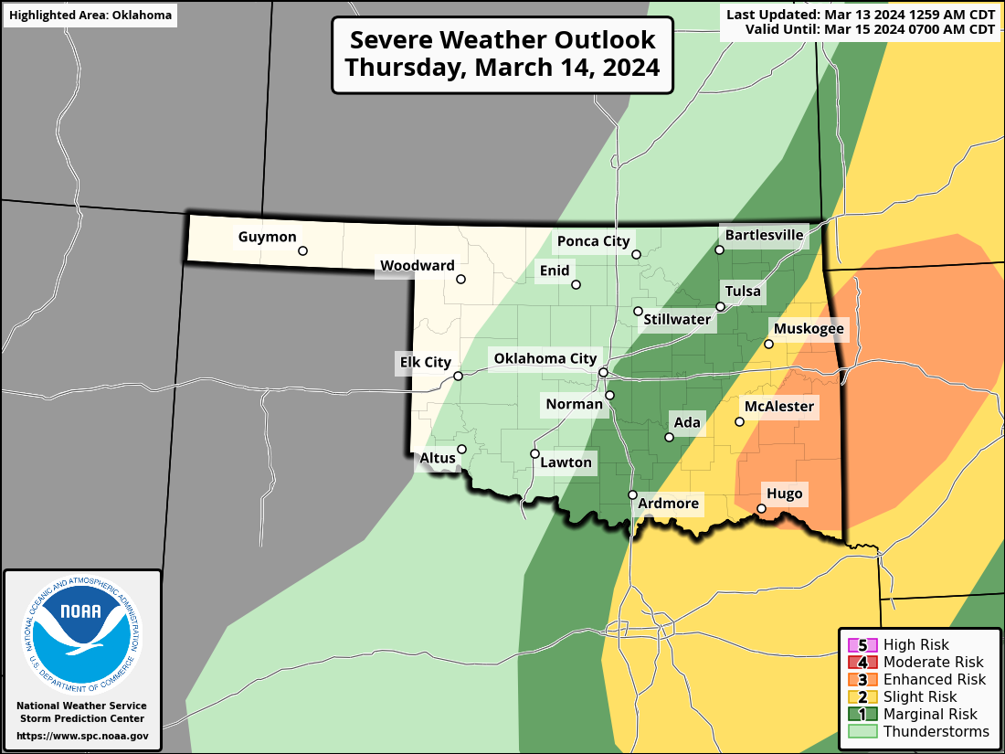
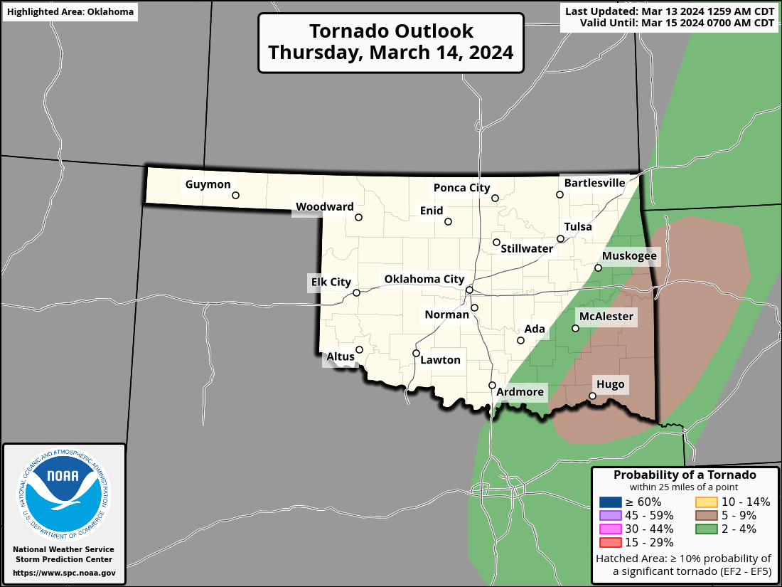
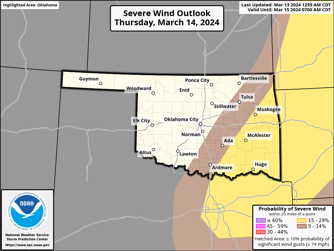
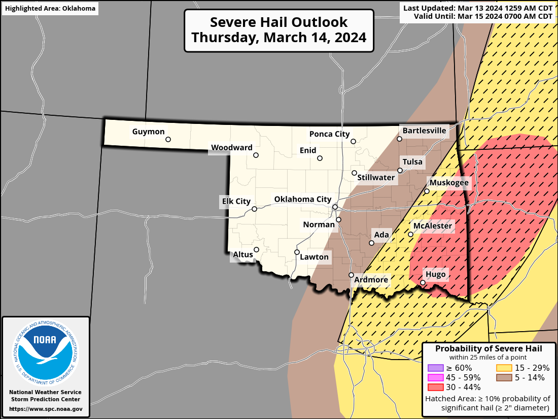
Then we get another more substantial threat tomorrow across SE OK with the
actual cold front, with big hail being a primary threat.
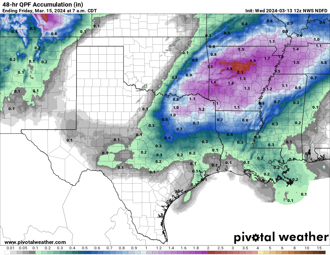
Rain totals, outside of SE OK, you ask? Snort!
Lots of hazards possible the next couple of days...stay weather aware!
Gary McManus
State Climatologist
Oklahoma Mesonet
Oklahoma Climatological Survey
gmcmanus@mesonet.org
March 13 in Mesonet History
| Record | Value | Station | Year |
|---|---|---|---|
| Maximum Temperature | 92°F | ALTU | 2002 |
| Minimum Temperature | 14°F | KENT | 2006 |
| Maximum Rainfall | 3.50 inches | LANE | 1995 |
Mesonet records begin in 1994.
Search by Date
If you're a bit off, don't worry, because just like horseshoes, “almost” counts on the Ticker website!