Ticker for March 14, 2024
MESONET TICKER ... MESONET TICKER ... MESONET TICKER ... MESONET TICKER ...
March 14, 2024 March 14, 2024 March 14, 2024 March 14, 2024
One of THOSE days
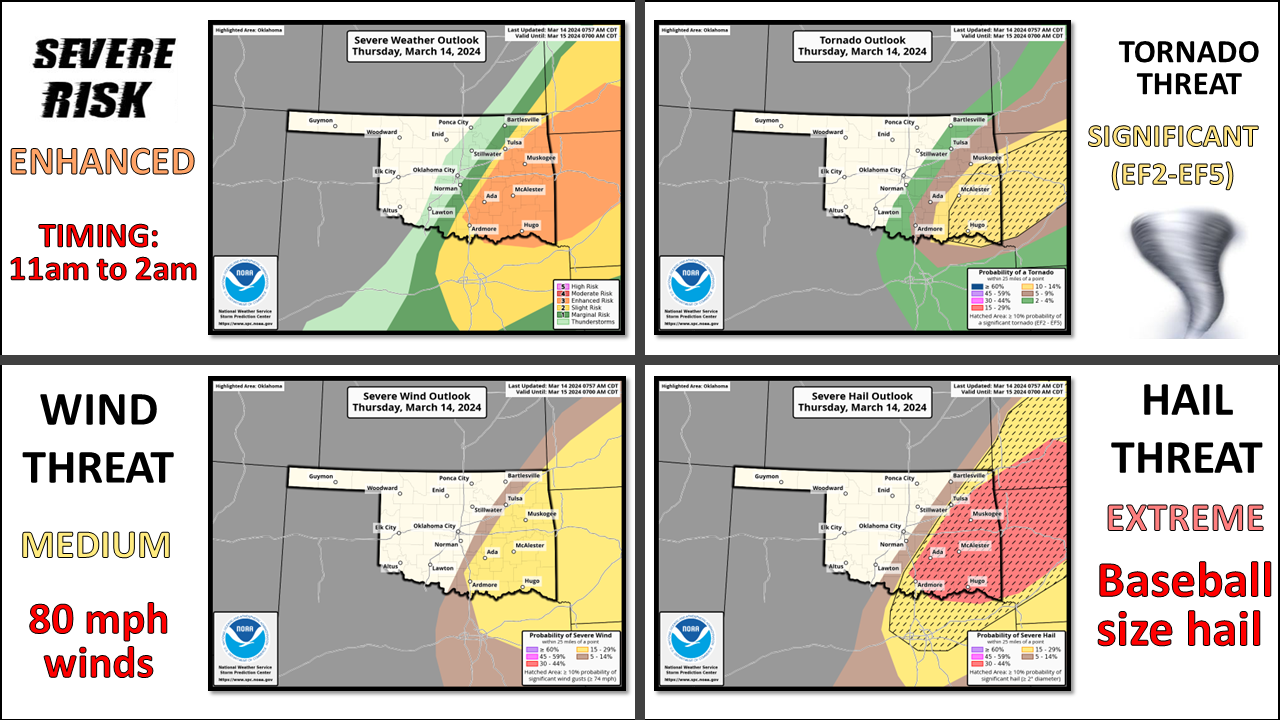
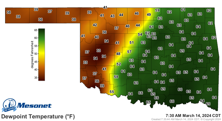
Uh oh, it's one of THOSE days in Oklahoma. You know, when you go outside and see
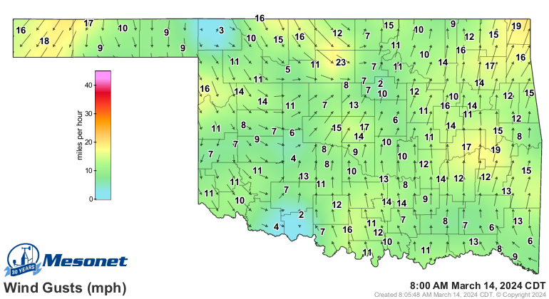
condensation on your concrete, and that stiff south breeze hitting you in the
face. That recognition of moisture return in advance of a cold front and dryline
makes your hair stand up on your head (or in my case, it makes my hair stand up
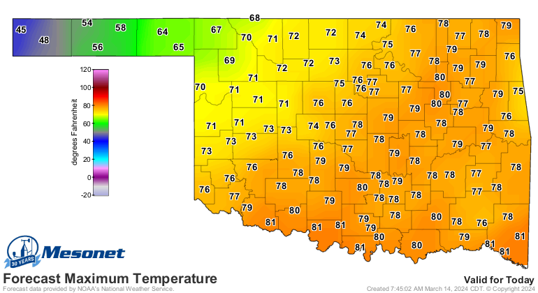
on my eyebrows...don't laugh, you'll be there soon!). Add highs in the upper-70s
and probably a few low-80s and you have trouble brewing in severe weather city.
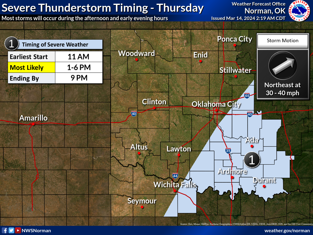
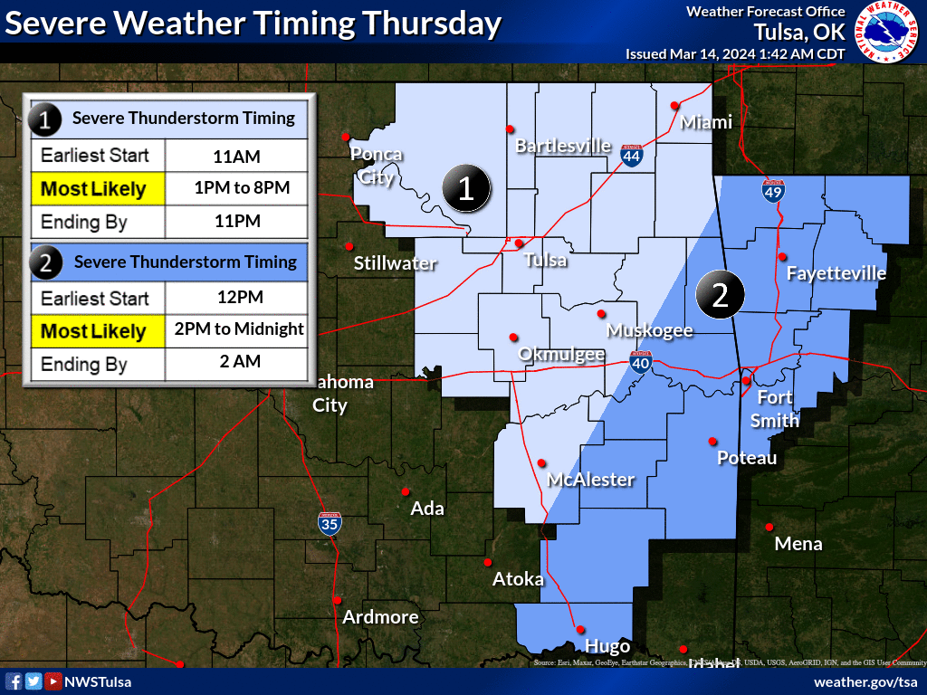
Storms could form as early as 11am and head east, with discrete supercells possible
as they tread eastward before lining out and forming an MCS. It's in the discrete
mode that they are most dangerous. I'm most dangerous when I'm indiscrete. Alas,
I digress.
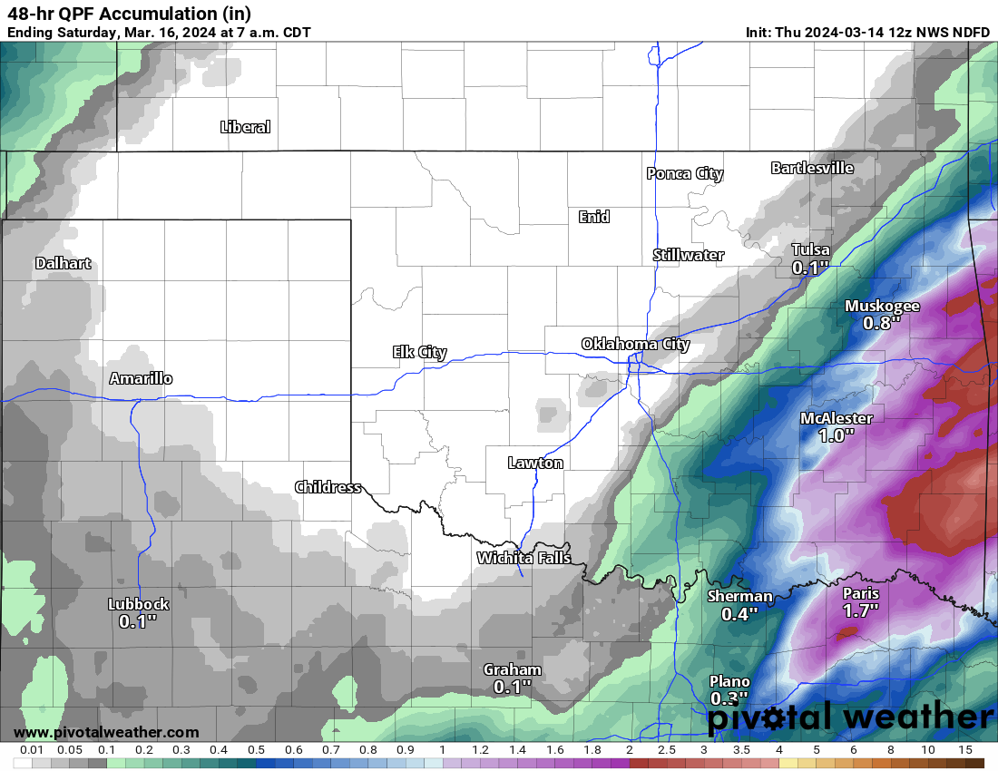
The good news? The rain. Sorry western OK...you're still in possible flash
drought mode.
After that, back to boring spring-ish type seasonable temps and little chance
for rain.
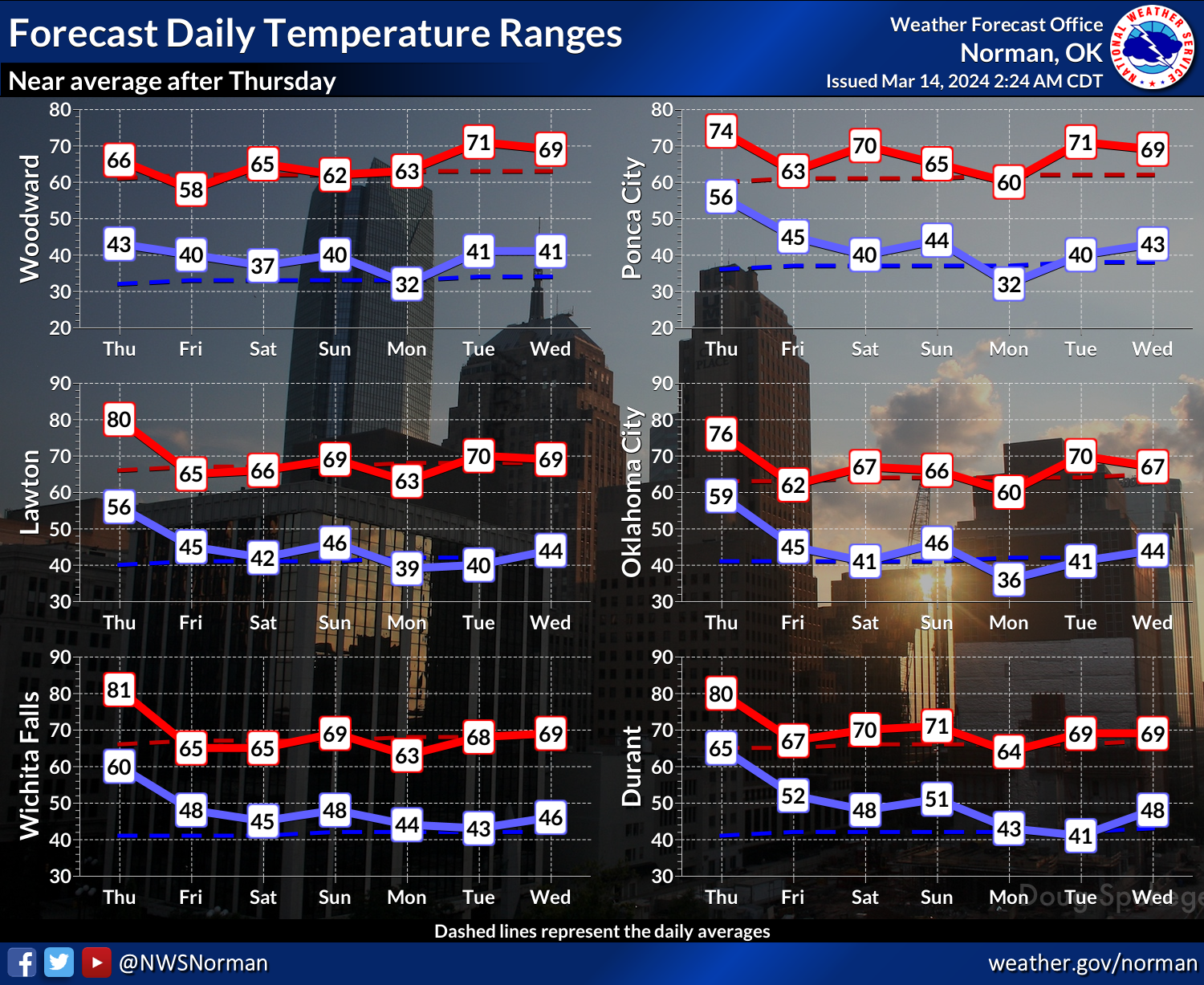
Boring for SE OK will be good. Boring for NW OK will be bad.
Stay weather aware today, especially SE of the I-44 corridor.
Gary McManus
State Climatologist
Oklahoma Mesonet
Oklahoma Climatological Survey
gmcmanus@mesonet.org
March 14 in Mesonet History
| Record | Value | Station | Year |
|---|---|---|---|
| Maximum Temperature | 90°F | WAUR | 2002 |
| Minimum Temperature | 10°F | HOOK | 1999 |
| Maximum Rainfall | 2.45 inches | BYAR | 2020 |
Mesonet records begin in 1994.
Search by Date
If you're a bit off, don't worry, because just like horseshoes, “almost” counts on the Ticker website!