Ticker for March 11, 2024
MESONET TICKER ... MESONET TICKER ... MESONET TICKER ... MESONET TICKER ...
March 11, 2024 March 11, 2024 March 11, 2024 March 11, 2024
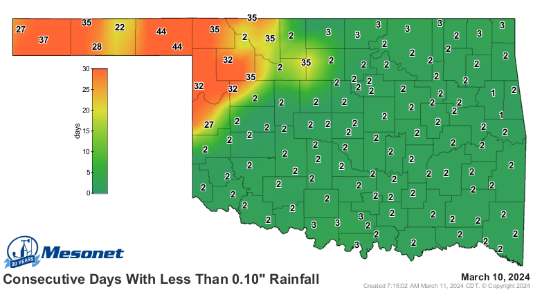
Two steps sideways

Oh yeah, we're watching alright. Watching our ability to finally be free of
drought take two steps back a day after Springing forward! Rain, you say (we're
listening, too...wait, you're wearing THAT today!!)? Okay, well, not sure those
brown shoes go with that black belt, but at least you won't be getting them wet.
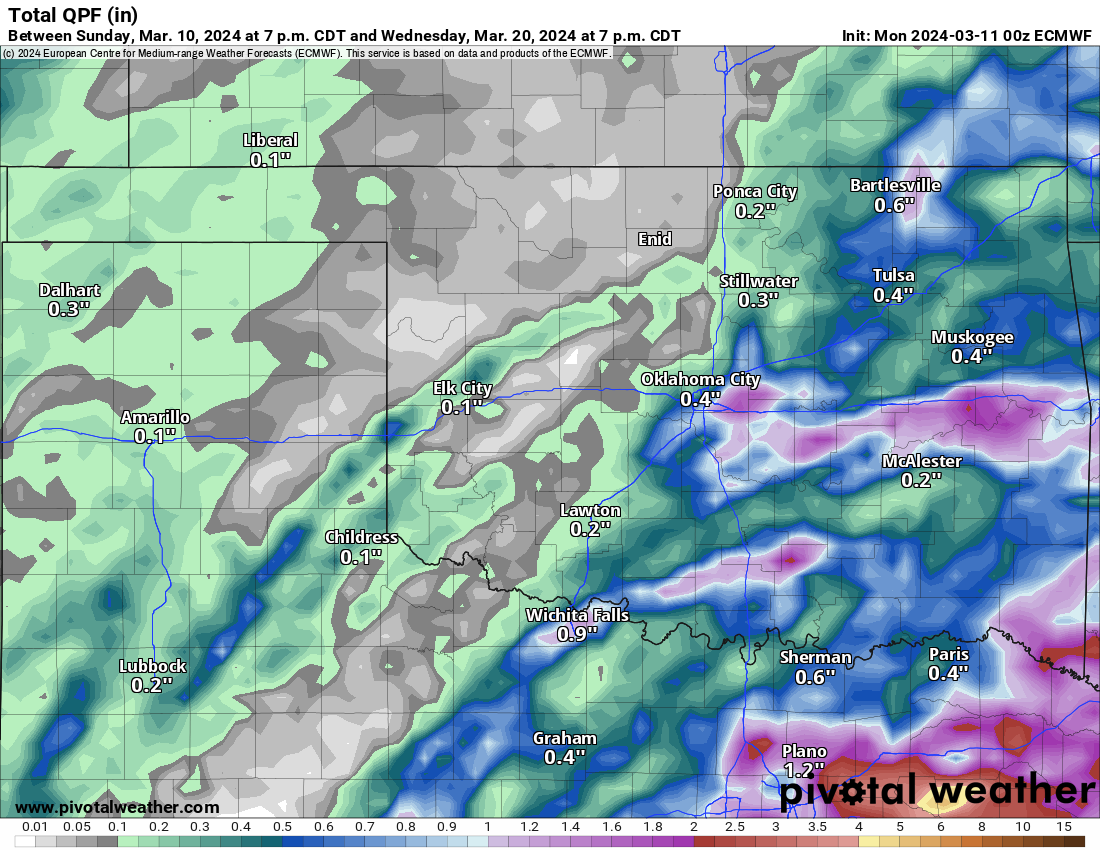
Check out the enlarged rain forecast (the map...not the amounts, saddenly) map
for the bleak outlook for an already parched NW OK.
Sure, this is an area that received record-ish rainfall back in the summer, and
again in the fall. But like Janet Jackson said..."what have you done for me
lately?" Kids...google.
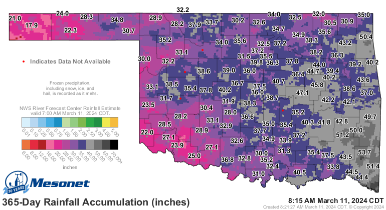
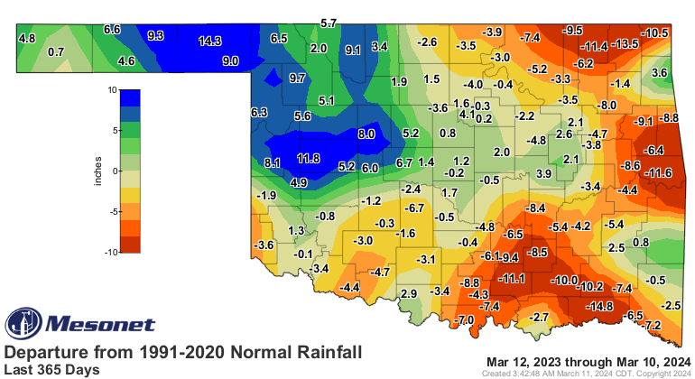
Wait, Janet Jackson is an oldie now? YIKES! At any rate, the long-term rainfall
maps look much better than the short-term maps, but as any High Plains Drifter
can tell ya, moisture doesn't last long up in those parts.
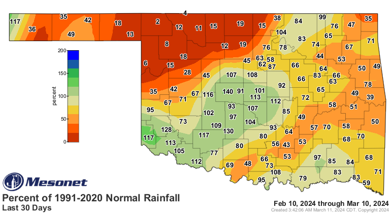
That moisture is starting to evaporate into out memories in the face of much-
above average temperatures and a growing dry streak (and we all know just how
painful a growing dry streak can be).

Even the fantasy-casts out to 10 days are fairly bleak for that part of the
state.
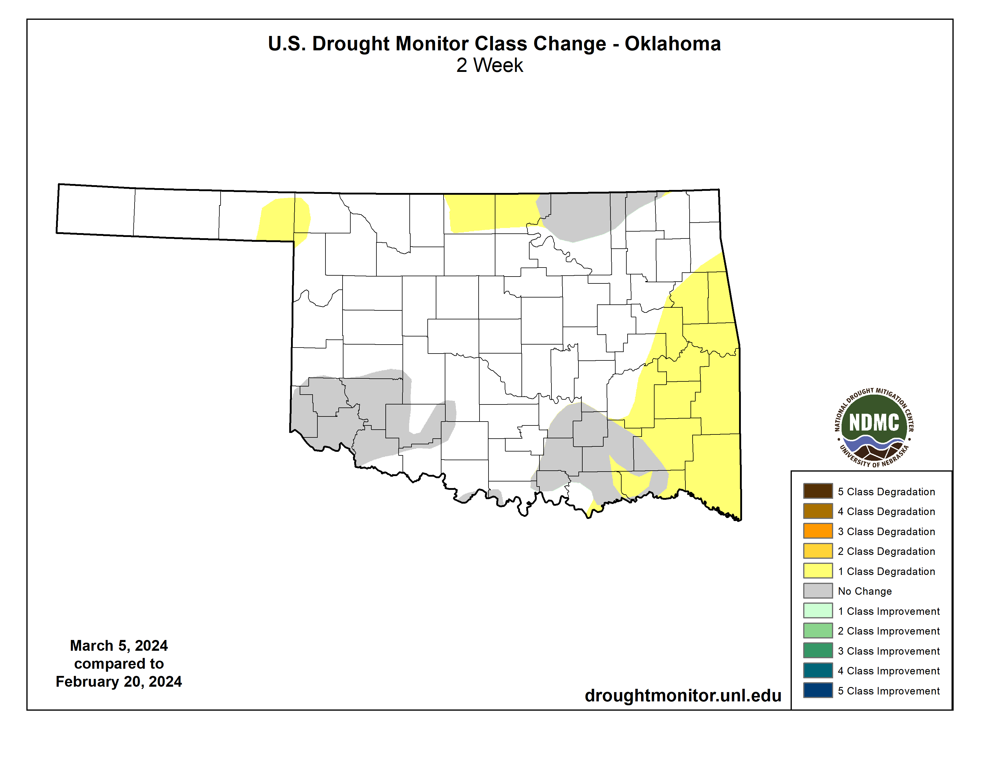
And the damage is being done (and has been done). Check out the change in the
Drought Monitor map over the last 2 weeks.
El Nino is fading, as its influence on our weather. We'll transition to Neutral
Conditions soon, and then to La Nina for the summer (possibly).
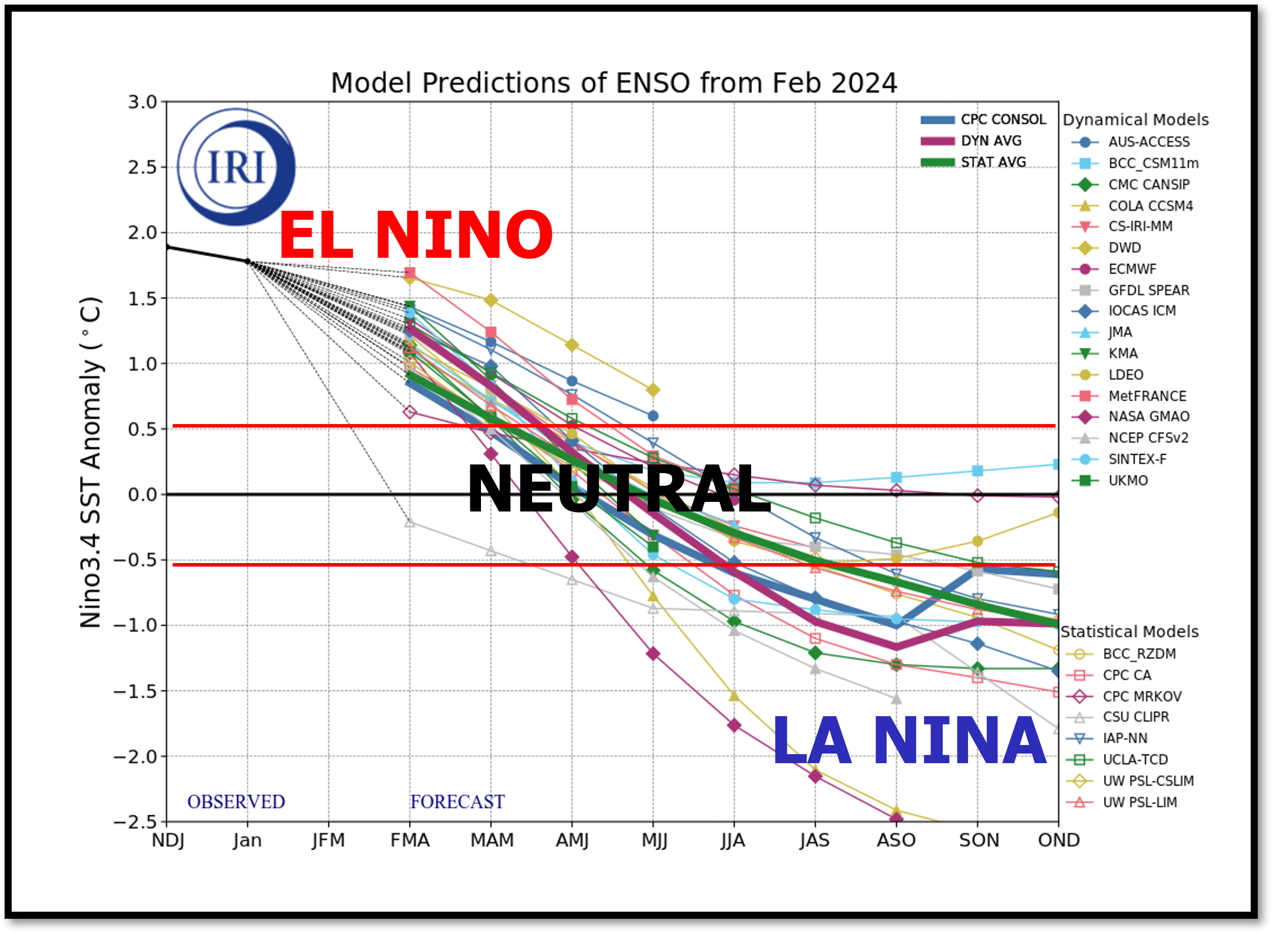
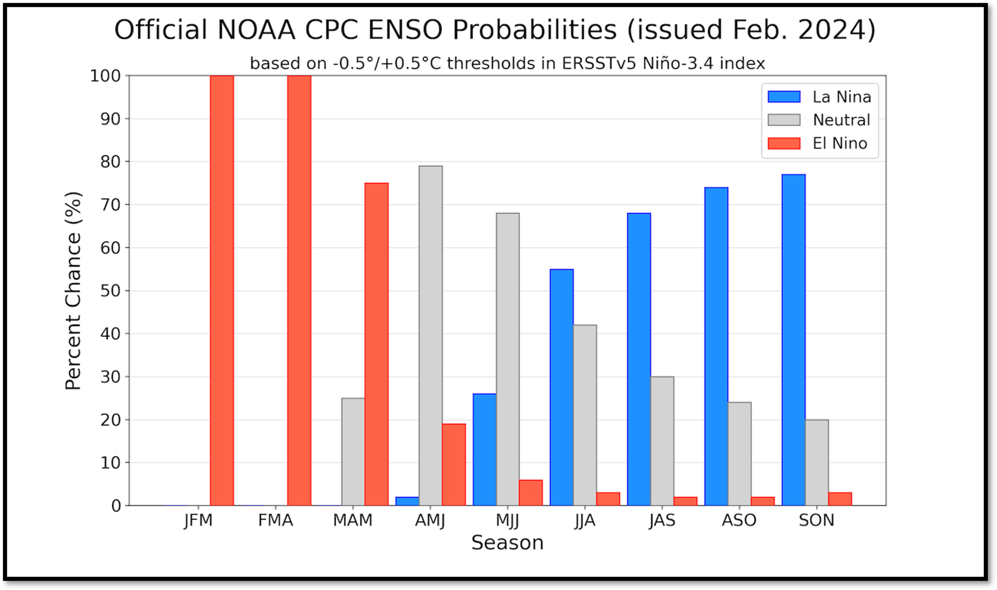
Now don't worry about La Nina during the summer. ENSO (La Nina/El Nino) doesn't
have much of an impact on our summer weather here in North America, mostly
because the jet streams they influence jump far to the North during the hot
months as the temperature difference between the pole and mid-latitudes also
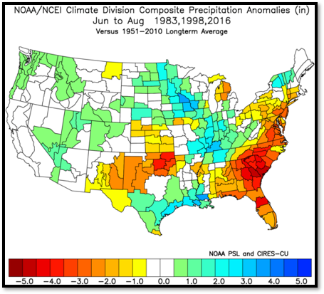
jumps north. But we have seen some pretty hot and dry summers following those
super-strong El Ninos. The thing is, this mostly got to a borderline super-strong
El Nino, but the correlation is something to keep an eye on (with a limited
sample size of 3).
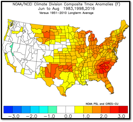
Ooh, that's hot. No, not THAT way...just hot.
Gary McManus
State Climatologist
Oklahoma Mesonet
Oklahoma Climatological Survey
gmcmanus@mesonet.org
March 11 in Mesonet History
| Record | Value | Station | Year |
|---|---|---|---|
| Maximum Temperature | 90°F | MANG | 2023 |
| Minimum Temperature | 9°F | SLAP | 1998 |
| Maximum Rainfall | 2.62 inches | IDAB | 2012 |
Mesonet records begin in 1994.
Search by Date
If you're a bit off, don't worry, because just like horseshoes, “almost” counts on the Ticker website!