Ticker for March 4, 2024
MESONET TICKER ... MESONET TICKER ... MESONET TICKER ... MESONET TICKER ...
March 4, 2024 March 4, 2024 March 4, 2024 March 4, 2024
El Nino?
“Miles to water, miles to wood, and only six inches to hell” – early Panhandle
ranchers describing the local landscape.
First off, watch your language there, early Panhandle ranchers!
We've given El Nino lots of credit for our bountiful rainfall amounts (avert
your eyes, SE OK!), at least over much of the state, since Dec. 1, when El Nino's
impacts here in the Northern Hemisphere peak.
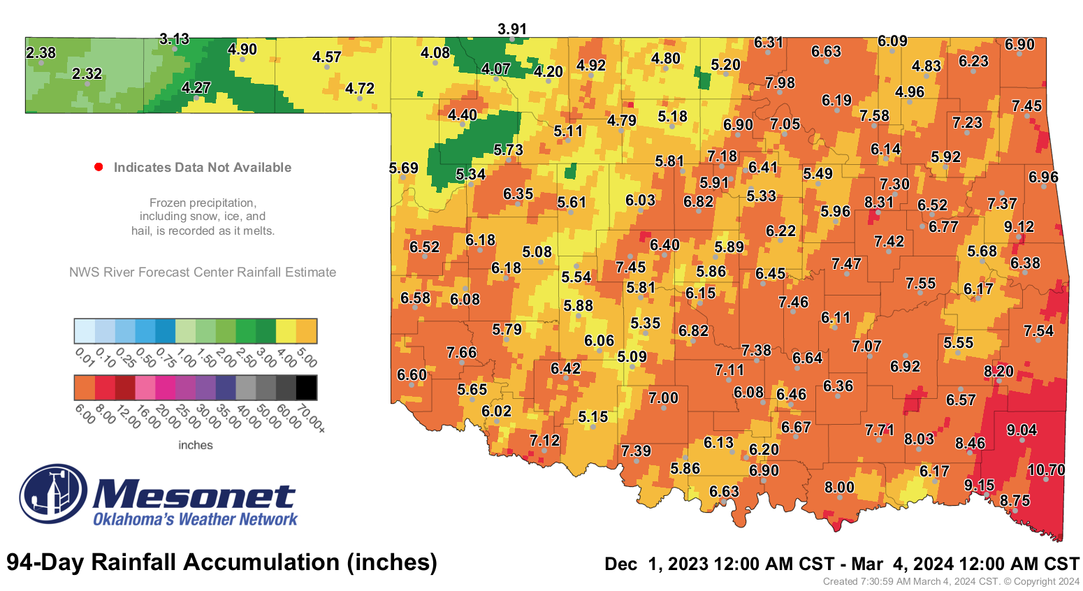
Sure, amounts are higher across that 94-day span in SE OK than in western OK, but
it's all relative to what's expected and what each area is accustomed to, right?
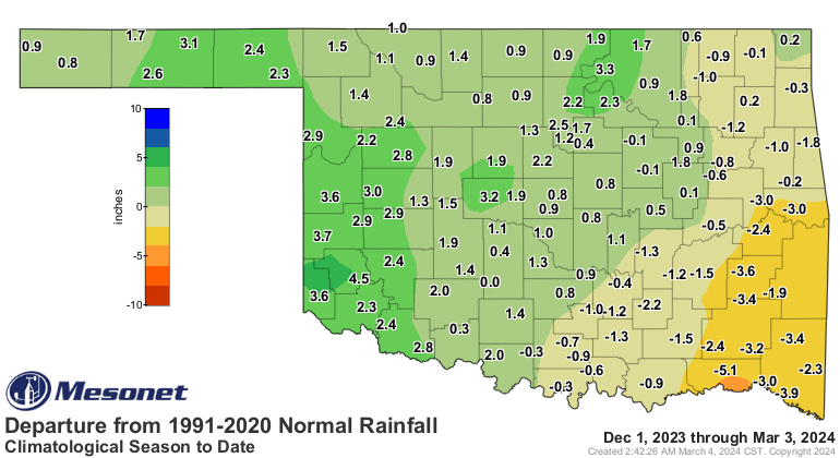
But ENSO (El Nino, La Nina, and Les Neutral Conditions...who let the French in?)
can only describe about a third of our widely varying weather. At some point,
you just have to go with natural variability. And right now, our naturally
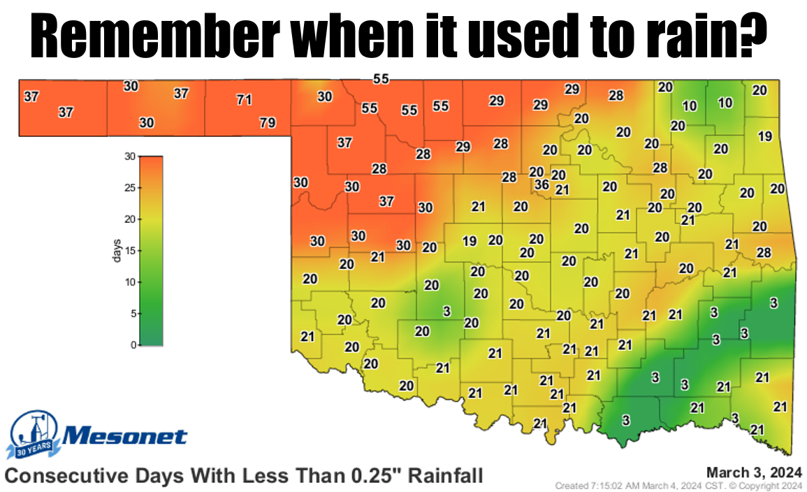
varying weather is less than kind to us. It doesn't take long for that top
map's conditions to start to have an impact on our ecosystem. And then you
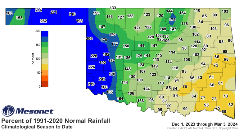
have to contrast the last 3 maps with the next 3, relating what's occurring
in the last 30 days.
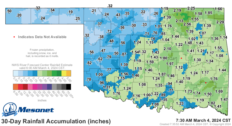
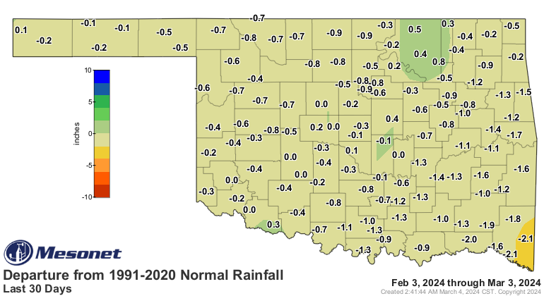
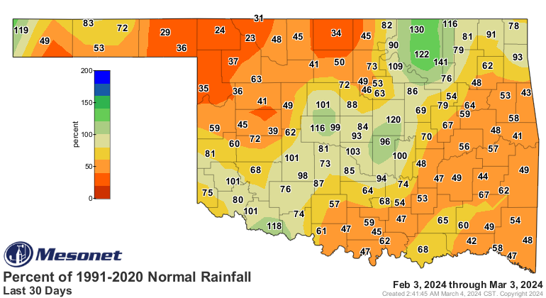
Sure, it's just 30 days (but up to 71 in the Panhandle), but this is important
because it's getting warmer out. What? NO, I have proof!
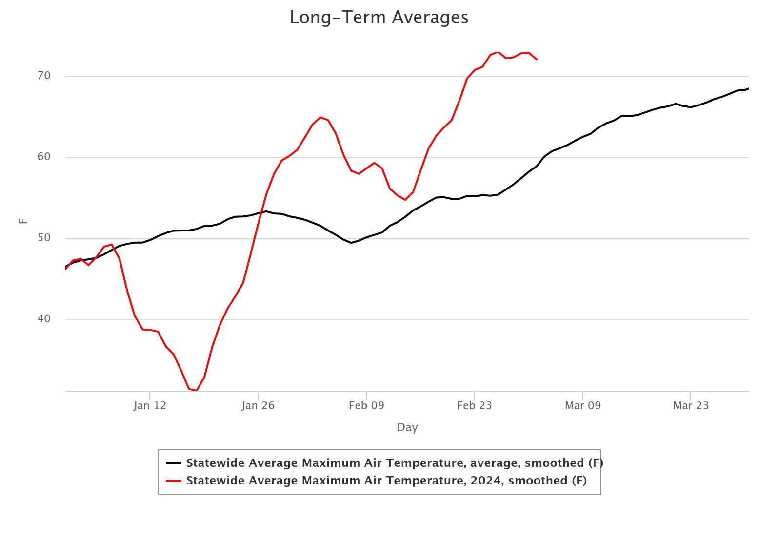
And, at least for parts of the state, we're headed into spring about 2 weeks
early if you listen to the local vegetation (seek help if so...I had a cedar
tree tell me "LOL!", can't imagine why).
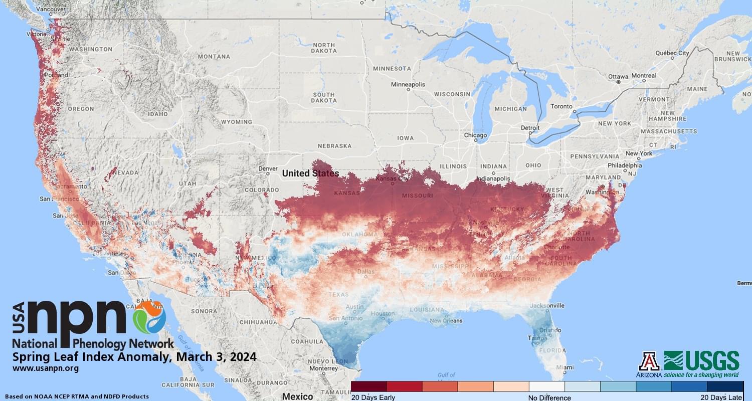
Why does this matter? Well, it's warmer than normal out for late-February (well,
nearly all of February!) and early March, so more evaporation. Early spring
according to the plants, more usage of the soil moisture available to them in
waking up early. They don't run on coffee like y'all do, ya know! No, not me,
I'm a Pop-Tart Smoothie kind of a guy.
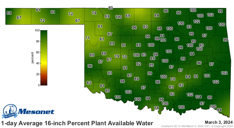
Nothing to fear just yet...soil moisture still looks "okay" for most of the
state, but it doesn't take long in these conditions to start to whittle away
at that supply.
Okay, enough fear mongering (Why doesn't anybody ever chocolate milk monger??),
what about prospects for rain coming up? Well, that comes later this week
around Thursday, at least for the most significant amounts. And that includes
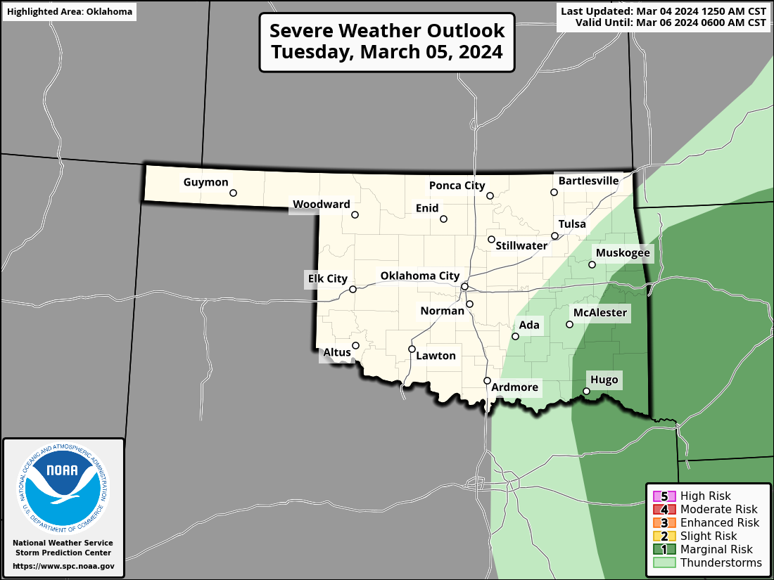
some marginal severe thunderstorm risk starting today as well.
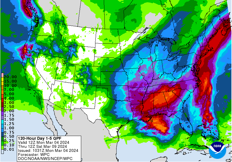


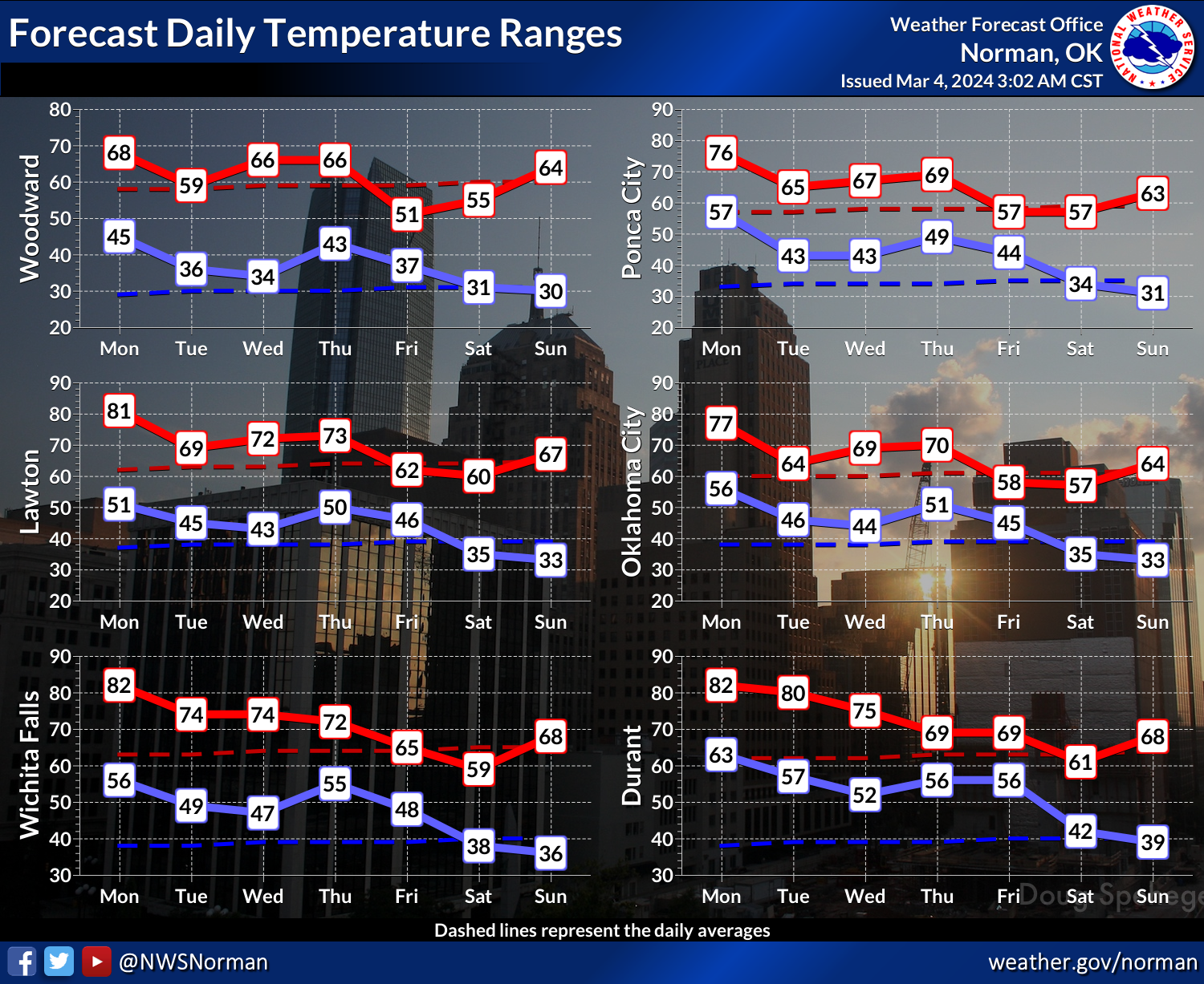
And temperatures will fluctuate along with those chances.
Hey, it's early-early spring! What did you expect?
If you said "summer," you get extra points.
Gary McManus
State Climatologist
Oklahoma Mesonet
Oklahoma Climatological Survey
gmcmanus@mesonet.org
March 4 in Mesonet History
| Record | Value | Station | Year |
|---|---|---|---|
| Maximum Temperature | 91°F | HOLL | 2009 |
| Minimum Temperature | -5°F | VINI | 2002 |
| Maximum Rainfall | 5.31 inches | KING | 2004 |
Mesonet records begin in 1994.
Search by Date
If you're a bit off, don't worry, because just like horseshoes, “almost” counts on the Ticker website!