Ticker for March 1, 2024
MESONET TICKER ... MESONET TICKER ... MESONET TICKER ... MESONET TICKER ...
March 1, 2024 March 1, 2024 March 1, 2024 March 1, 2024
Fire away...far far away please
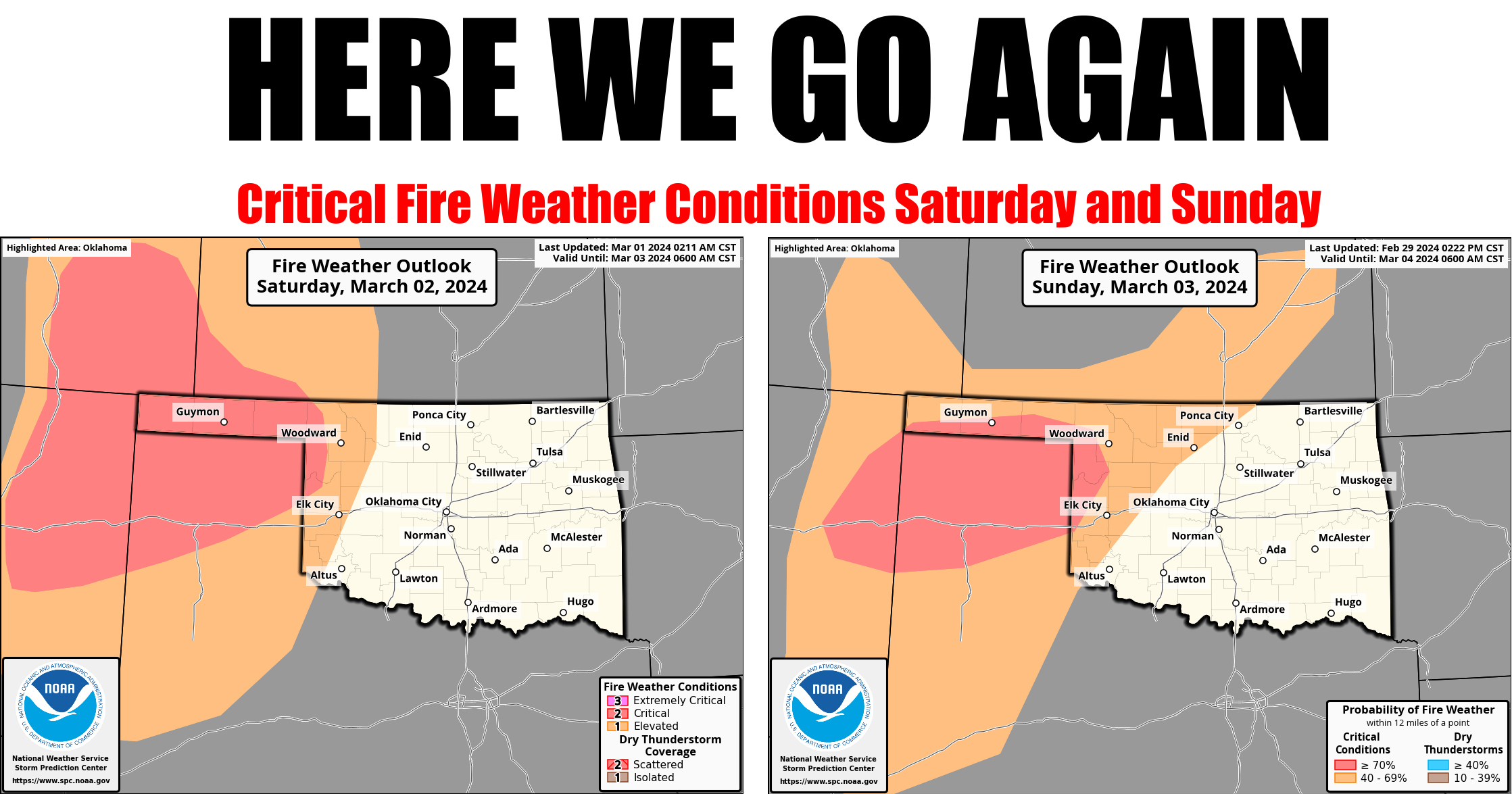
As if (and I mean AS IF very much in the sarcastic "Clueless" sense) Mother
Nature wasn't satisfied with the million-plus acres burned in Oklahoma and
Texas over the last few days, she gives us another dry cold front over the
weekend. That of course means gusty SW winds, temperatures soaring another 20-30
degrees above normal, and RH values down into the teens. In other words...nothing
but trouble.
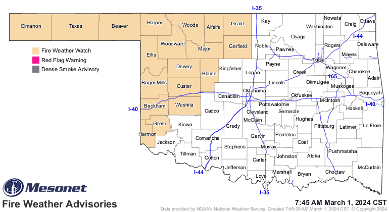
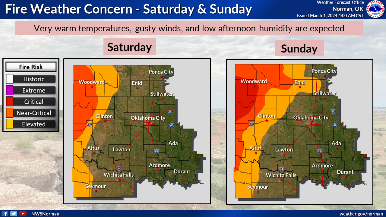

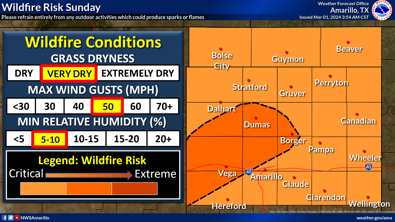
This obviously poses a problem not only for new fires to erupt, but exacerbating
any remaining fires burning from February.
Hey, speaking of February...
----------------------------------------------------------------------------------
Wildfires Erupt During Warm February
March 1, 2024
Wildfires tore through northwestern Oklahoma in late February, propelled by
severe winds gusting to over 60 mph, relative humidity values in the teens, and
temperatures soaring more than 30 degrees above normal. Over 140,000 acres were
scorched in Oklahoma, with Oklahoma Emergency Management officials reporting the
loss of at least 13 homes, as damage assessments continued through the month's
end. Additionally, reports of lost livestock and other structures emerged. The
most significant wildfires erupted on the 27th, prompting evacuations in several
small towns and leading to numerous road closures. The Smokehouse Road fire
alone consumed over a million acres in the Texas Panhandle before spreading
into Ellis and Roger Mills counties in far western Oklahoma. The fires belched
ash and smoke eastward and then southward across Oklahoma, triggering health
alerts for individuals with respiratory issues downwind from the blazes. A cold
front surged through the state later on the 27th, altering the fires' paths
from eastward to southward, with the abrupt change endangering more lives and
property. Although a bit of snow and rain on the 29th aided wildfire
suppression efforts, the larger fires in far western Oklahoma persisted as
February drew to a close.
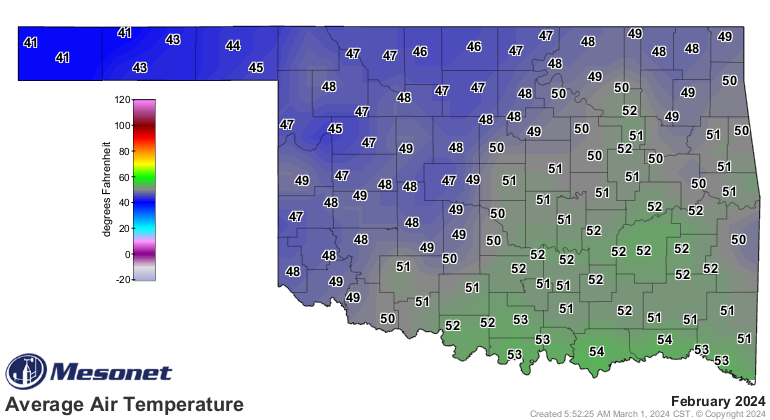
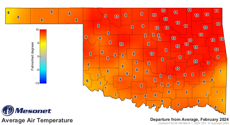
Oklahoma experienced a significant temperature surge throughout February,
bidding a not-so-fond farewell to the wintry weather that plagued the state in
January. Twenty-three of the 29 days in February featured above-normal
temperatures statewide, with many days recording temperatures 10-20 degrees
higher than the average. According to preliminary data from the Oklahoma
Mesonet, the statewide average temperature was 49.2 degrees, marking it as the
sixth-warmest February since records began in 1895, with a deviation of 6.8
degrees above normal. Northeast Oklahoma matched its warmest February on record
with an average of 49.4 degrees, tying with 1976 and boasting an impressive 8.4
degrees above normal. The highest temperature recorded during the month was 93
degrees at the Mangum Mesonet site on Feb. 26, while the lowest reading of 10
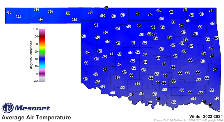
degrees was reported at Eva on Feb. 28. Climatological winter concluded as the
eighth warmest December-February on record, with a statewide average of 42.6
degrees, surpassing the normal by 2.4 degrees.

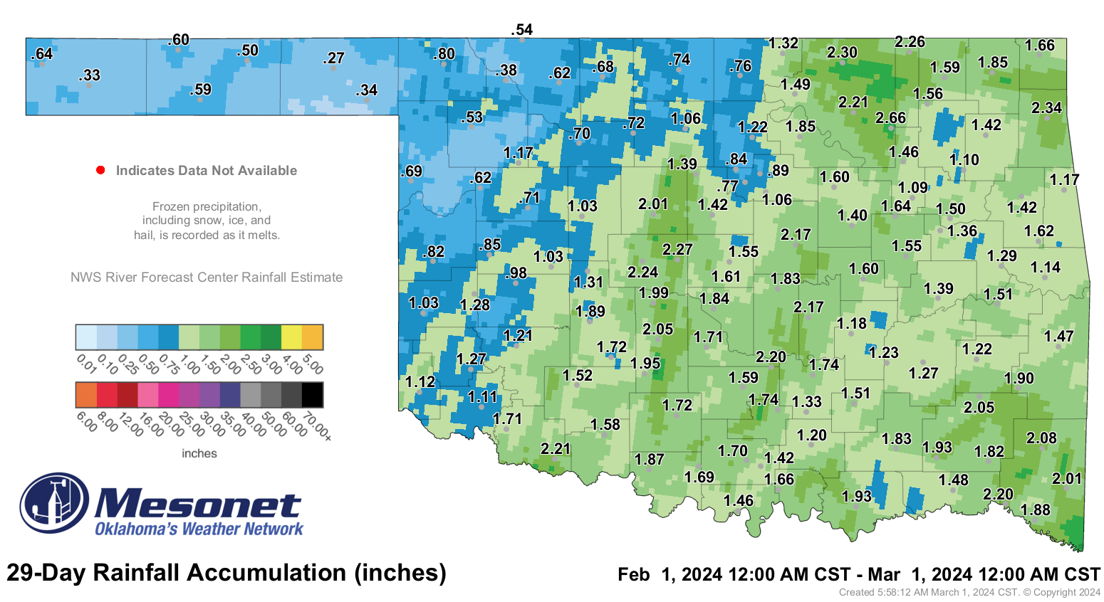
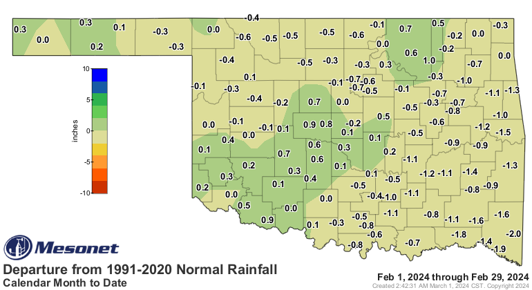
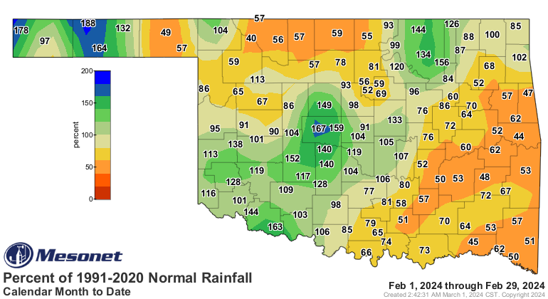
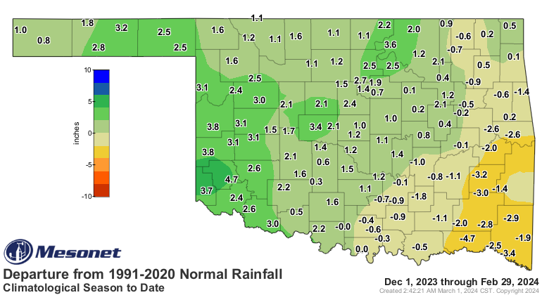
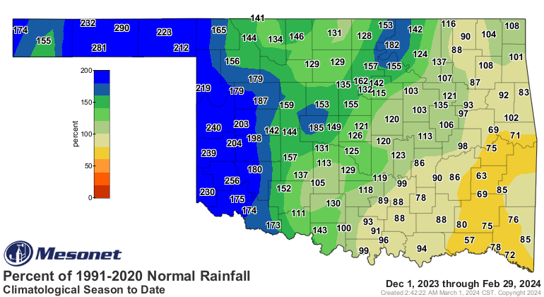
The statewide average precipitation total settled at 1.35 inches, marking a
deficit of 0.34 inches and ranking as the 59th driest February since records
began in 1895. While most of the state experienced below-average precipitation
for the month, surplus amounts were observed from southwest up through north-
central Oklahoma, as well as in the western Panhandle. Conversely, far
southeast Oklahoma encountered the most significant deficits, ranging from 1-2
inches, positioning it as the 36th driest February on record for that region.
Precipitation totals ranged from 2.66 inches at Skiatook to 0.27 inches at
Beaver. Climatological winter fared slightly better with a statewide average of
6.45 inches, surpassing the norm by 1.08 inches and ranking as the 25th wettest
December-February period since 1895.
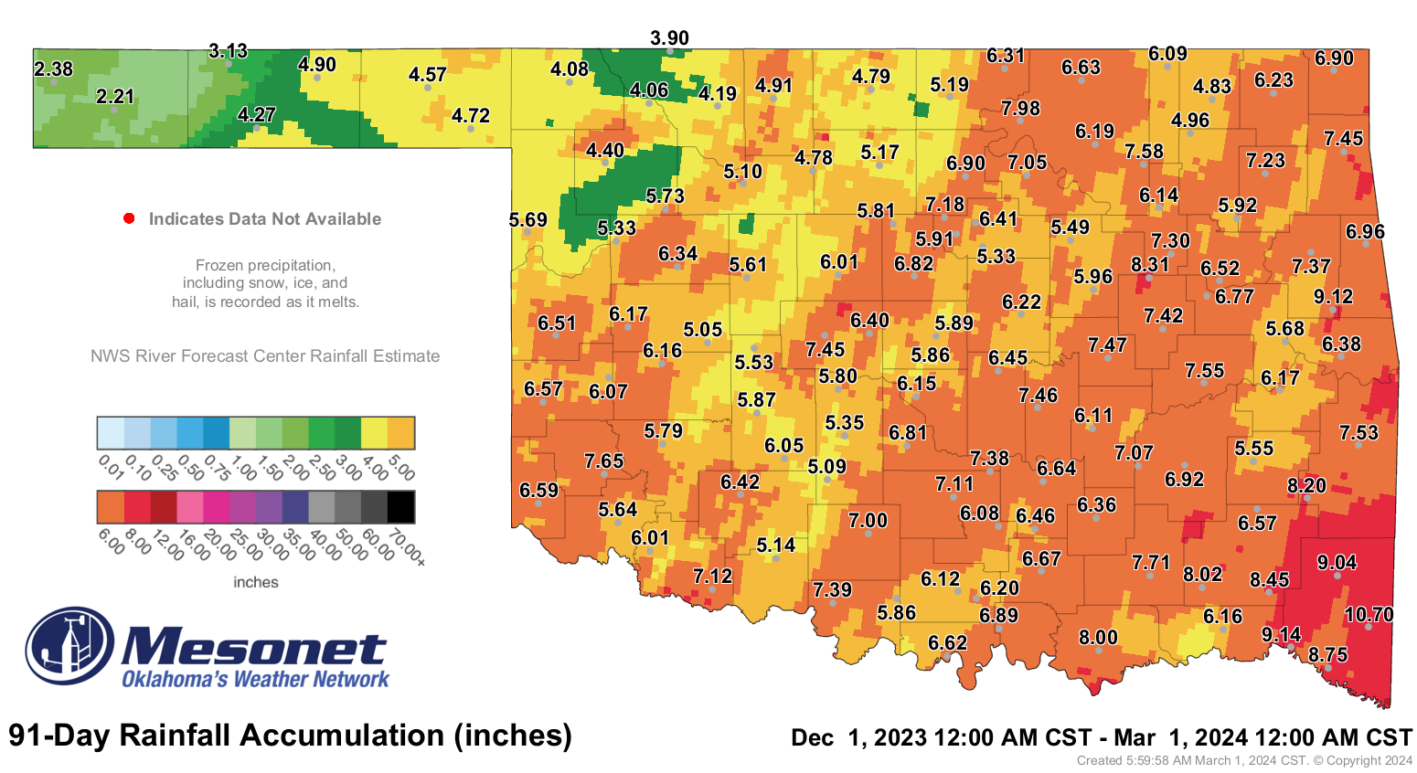
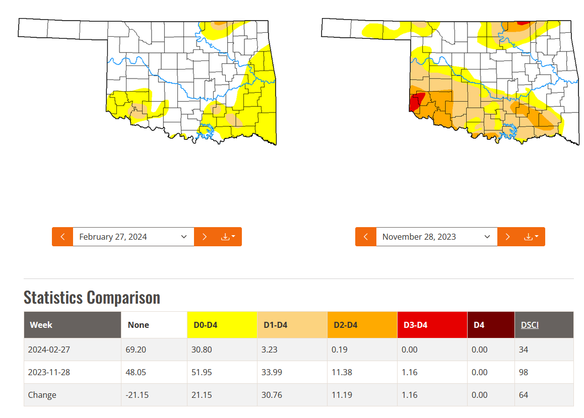
The winter brought more profound relief from drought, aided by a strong El Niño
event. Drought coverage in the state plummeted from 34% at the beginning of
December 2023 to the current level of 3%, with only 0.2% categorized as
“severe.” The remaining drought retreated to several small strongholds fueled
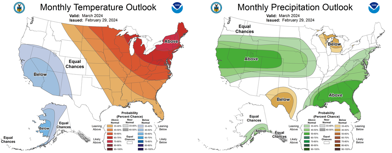
by long-term deficits in northeastern and southern Oklahoma. The March outlooks
from the Climate Prediction Center indicate increased odds of above-normal
precipitation across far northern Oklahoma and above-normal temperatures across
the northeastern two-thirds of the state. Other areas are forecast to have equal
odds of above-, below-, and near-normal conditions for both parameters during
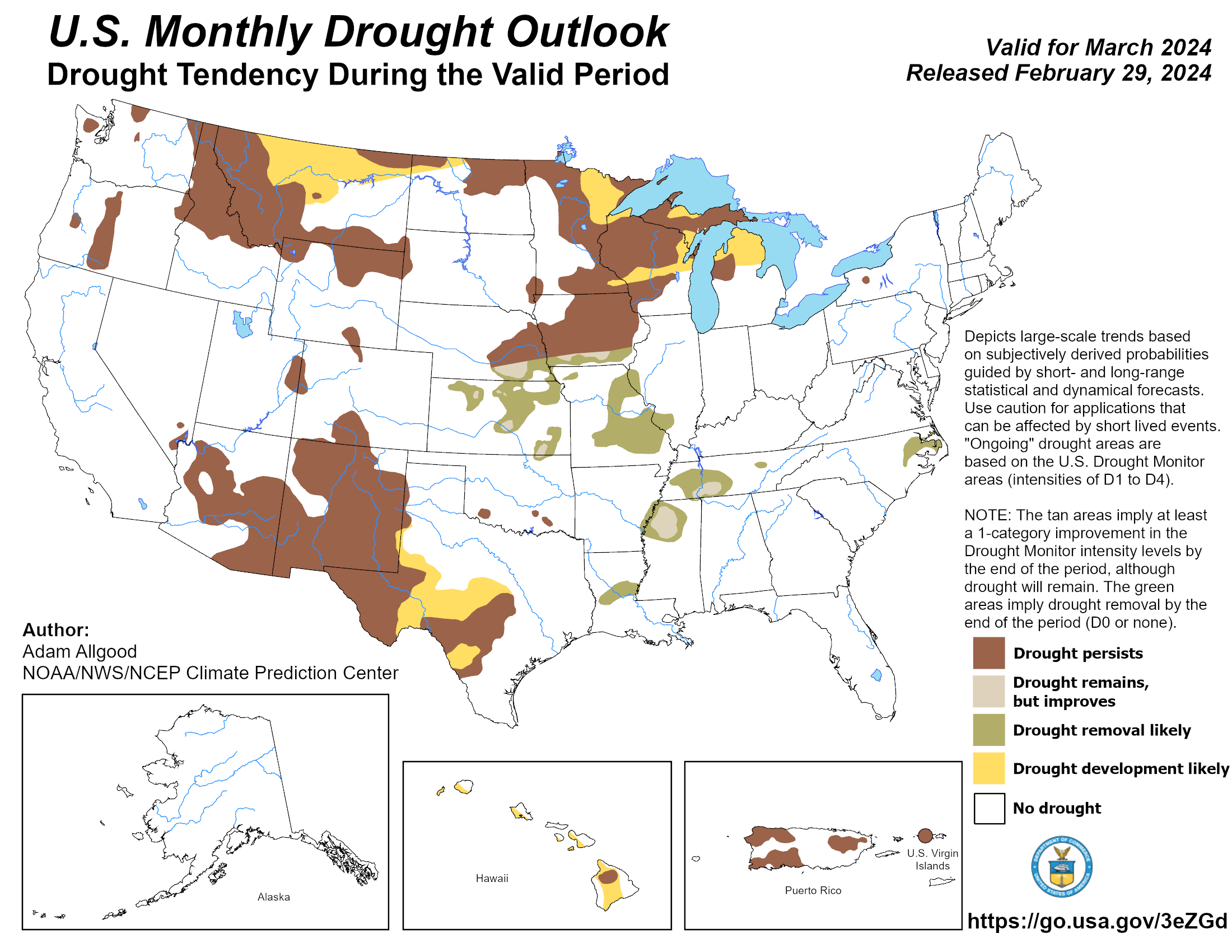
March. The CPC’s March drought outlook suggests improvement in drought
conditions across far northeastern Oklahoma, while conditions are expected to
remain steady in the southern region. No new drought areas are anticipated to
develop during the month.
###
Gary McManus
State Climatologist
Oklahoma Mesonet
Oklahoma Climatological Survey
gmcmanus@mesonet.org
March 1 in Mesonet History
| Record | Value | Station | Year |
|---|---|---|---|
| Maximum Temperature | 95°F | NEWP | 2006 |
| Minimum Temperature | 7°F | GOOD | 2001 |
| Maximum Rainfall | 1.86 inches | HUGO | 1997 |
Mesonet records begin in 1994.
Search by Date
If you're a bit off, don't worry, because just like horseshoes, “almost” counts on the Ticker website!