Ticker for February 12, 2024
MESONET TICKER ... MESONET TICKER ... MESONET TICKER ... MESONET TICKER ...
February 12, 2024 February 12, 2024 February 12, 2024 February 12, 2024
Scream
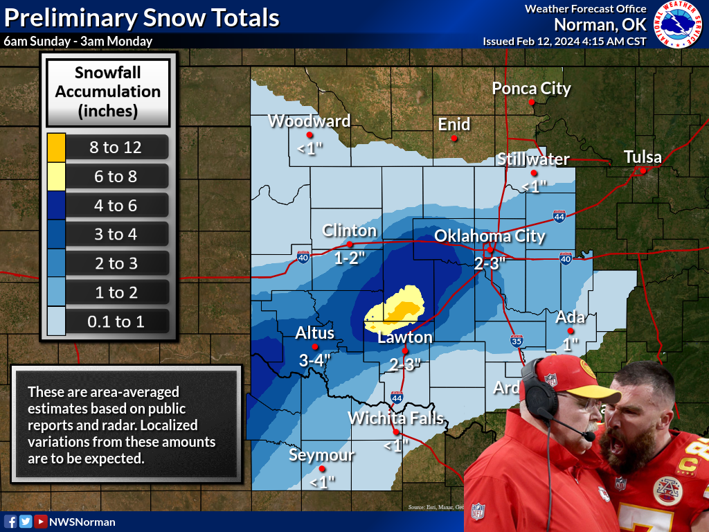
"WE TOLD YOU THE HEAVIEST SNOWS WERE SHIFTING SOUTHWEST, AND THAT TEMPERATURES
WERE GONNA BE MARGINAL FOR IMPACTS!"
Well, we did, and that's exactly what occurred. Even here at Ticker Command
Headquarters in NW Norman, we saw the snow fall, stick to the grass pretty good,
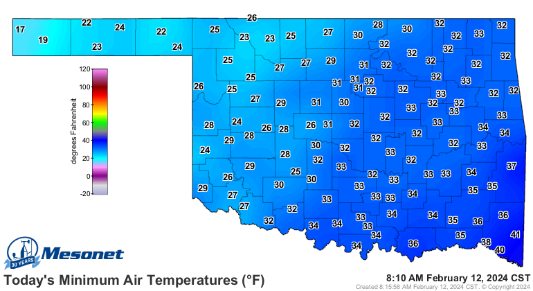
but readily melt off of the concrete due to those marginal temps. It has gotten
below freezing across the western half of the state now, of course, but those
temperatures are gonna rise well above freezing today, creating a melt-pocalypse
for all that snow that did stick.
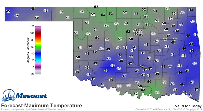
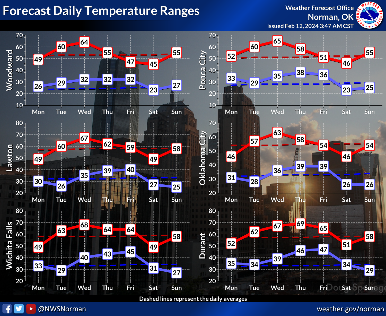
And they'll continue to go back up to spring preview mode for a few days before
our next marginal cold front.
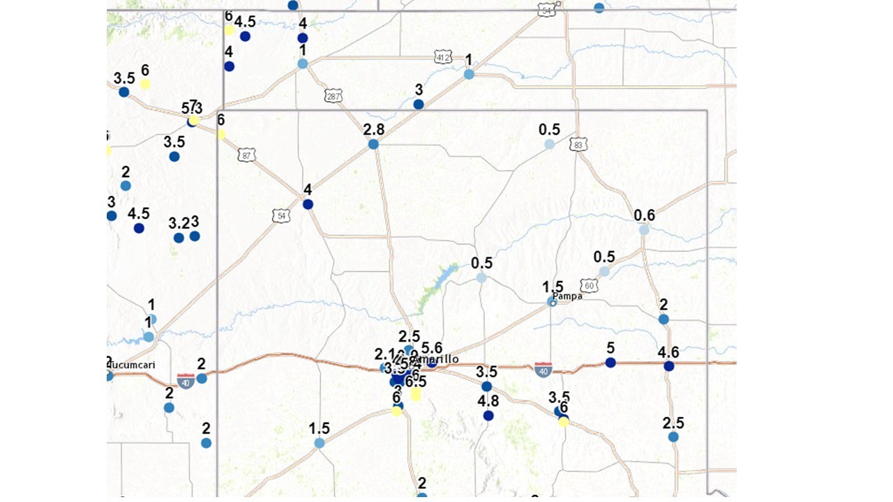
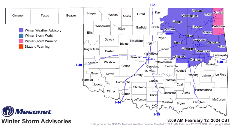
Now notice I didn't show any snowfall amounts for eastern OK, and the reason is
heck, it's snowing over there right now for crying out loud! And we still have
traveler's advisories and a winter storm warning for those far NE counties. We
do have forecast amounts, however. And we also have the actual estimated totals
for the Panhandle as well.
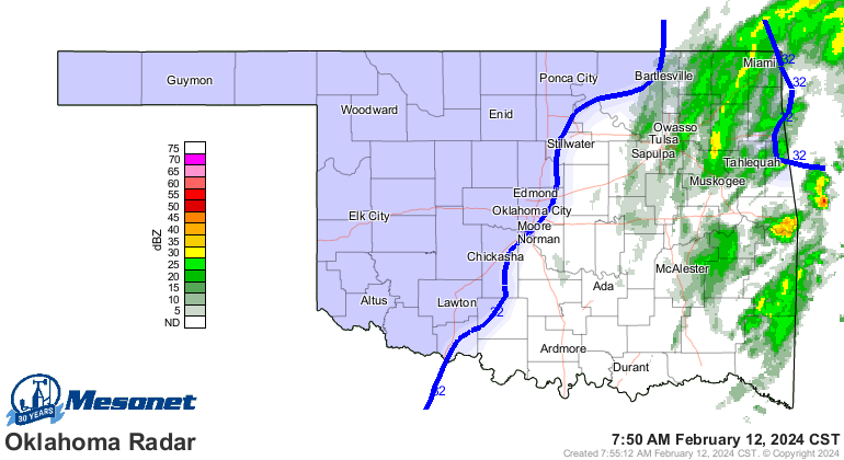
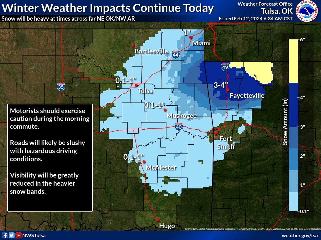
Same story though...temps remain marginal for impacts, even in those areas
where snow is falling.
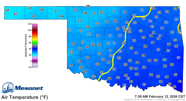
What this storm DID bring, regardless of form, is lots of moisture. Some very
nice rainfall totals for much of the state.
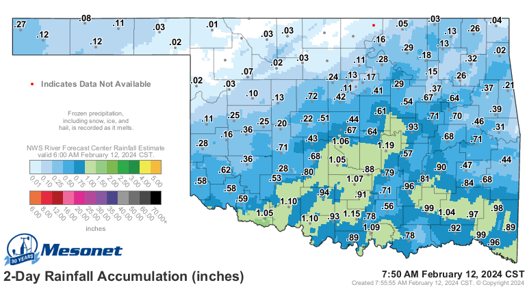
Totals will continue to update in those areas with snow when it melts in the
Mesonet's tipping-bucket rain gauges.
Gary McManus
State Climatologist
Oklahoma Mesonet
Oklahoma Climatological Survey
gmcmanus@mesonet.org
February 12 in Mesonet History
| Record | Value | Station | Year |
|---|---|---|---|
| Maximum Temperature | 76°F | CAMA | 2023 |
| Minimum Temperature | -3°F | EVAX | 2025 |
| Maximum Rainfall | 1.81 inches | BROK | 2020 |
Mesonet records begin in 1994.
Search by Date
If you're a bit off, don't worry, because just like horseshoes, “almost” counts on the Ticker website!