Ticker for February 9, 2024
MESONET TICKER ... MESONET TICKER ... MESONET TICKER ... MESONET TICKER ...
February 9, 2024 February 9, 2024 February 9, 2024 February 9, 2024
Nachos and Wings

"Nachos and Wings," probably the worst cop-buddy movie since "Tango and Cash."
Basically the same plot, just with worse hair. Hey, we don't talk about hair, okay!
Of course, nothing will top the ultimate cop-buddy movie "Lethal Weapon!" Now
"Lethal Weapon 2" was fine as heck too, what with Joss Ackland's ultimate baddie
Arjen Rudd wreaking havoc in L.A. He had diplomatic immunity though. Didn't help
him in the end (or the middle of his forehead), of course, but I'm gonna declare
METEOROLOGICAL IMMUNITY on Sunday's storm system, if you don't mind. Well, and
if you do mind, too. The models are in the middle of several different lunatic
moves:
1) Shifting it south, or maybe not, but maybe so.
2) Setting up narrow bands of very heavy snow, with little demarcation between
getting 4-8", vs. nothing a few miles away.
3) Smuggling Krugerrands into the U.S. NO! We're off of "Lethal Weapon 2."
So today's Braum's map (hey, they DO sell tortilla chips, and if you buy some
buffalo sauce, you can put it on their chicken fingers..."thin," as Roger Murtaugh
would say) tries to reflect those movements to the south. The next model output
that comes out could completely change things, and maybe west central OK gets
left out and SW OK becomes snow central. Or no snow at all.
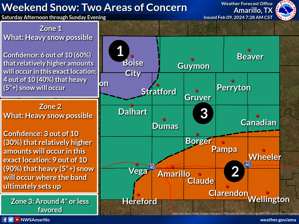
The NWS Amarillo office tells us why, or sorta tells us, with this infographic.
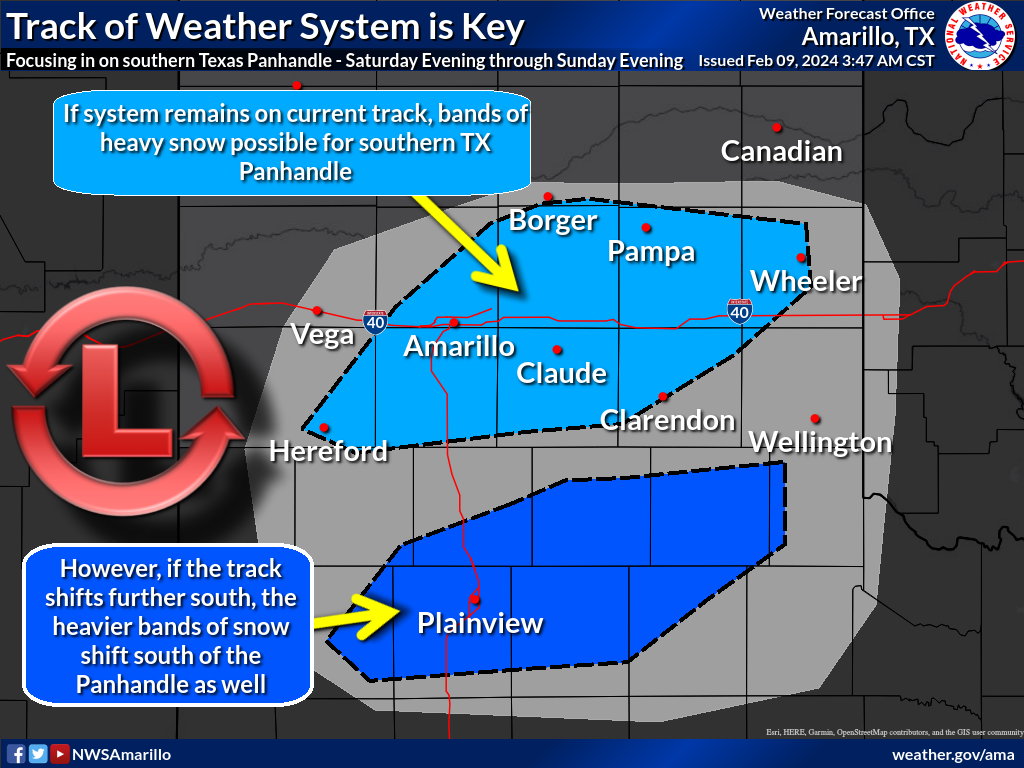
There's lots of complicated meteorology here, what with talk of baroclinic
zones and deformation zones and whatnot, and in some cases the models are saying
there are equal chances for west central OK to receive 6+ inches of snow and
nothing at all. As NWS Norman explains it:
"...we want to stress the lower than normal forecast confidence as slight
changes to the track of this system and a degree or two change in temperatures
could make all the difference between a heavy, wet snow or a cold rain."
Ugh, so the Braum's map coincides with the current guidance, but I'm pretty
uneasy about it, much like I am when I step in front of a mirror.
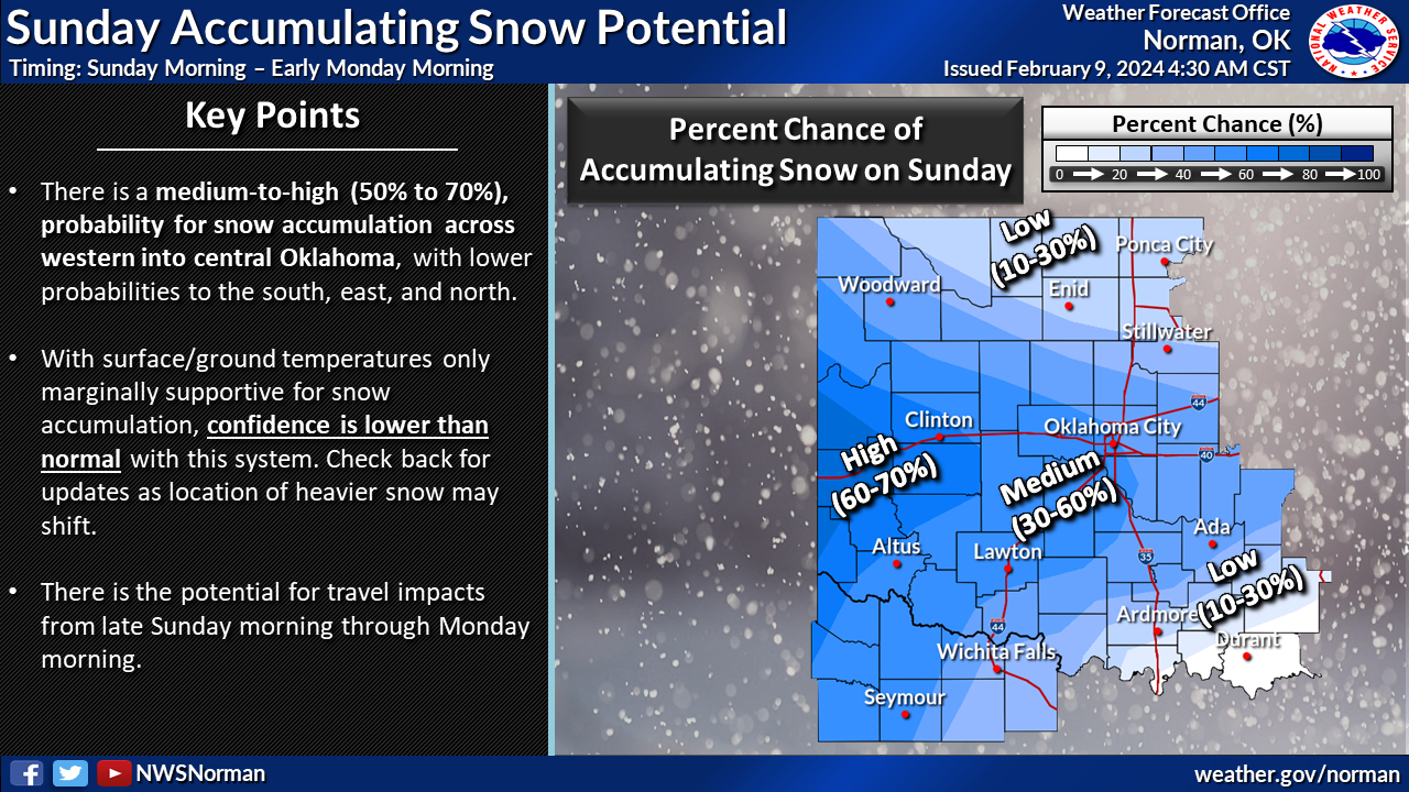
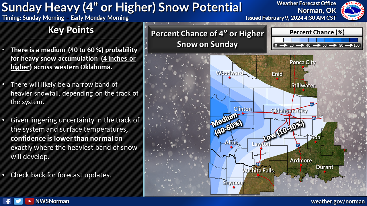
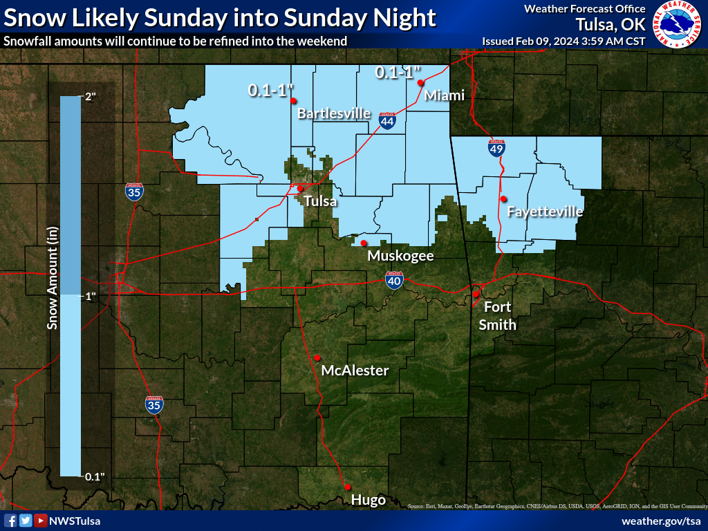
DON'T BE SHOCKED IF ALTUS BECOMES SNOW CENTRAL ON UPCOMING FORECASTS, but also
don't be shocked if things trend downwards dramatically for everybody. But, as
I've explained many times, the Braum's map is meant to reach out and grab ya,
and alert you to incoming weather so you can stay tuned to your local NWS
and media sources to stay up to date. So do that.
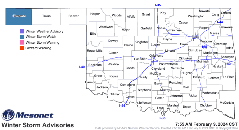
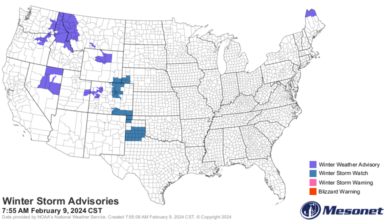
So far, we have some limited Winter Storm Watches from NWS Amarillo, so we'll
have to keep watching for additional advisories. In Oklahoma, Cimarron County
is the only one with a watch thus far, and it's sort of marginal out that
way.
Oof! Bust potential is high on this one. Again, a bust EITHER WAY. Could be a
lot worse, or could be a lot better. Perspectives on that are key.
Gary McManus
State Climatologist
Oklahoma Mesonet
Oklahoma Climatological Survey
gmcmanus@mesonet.org
February 9 in Mesonet History
| Record | Value | Station | Year |
|---|---|---|---|
| Maximum Temperature | 82°F | GRA2 | 2000 |
| Minimum Temperature | -18°F | MEDF | 2011 |
| Maximum Rainfall | 1.02 inches | VINI | 2001 |
Mesonet records begin in 1994.
Search by Date
If you're a bit off, don't worry, because just like horseshoes, “almost” counts on the Ticker website!