Ticker for February 8, 2024
MESONET TICKER ... MESONET TICKER ... MESONET TICKER ... MESONET TICKER ...
February 8, 2024 February 8, 2024 February 8, 2024 February 8, 2024
Chips and snowlsa
I warned you over and over and over (and over).
And over.
But nobody listens to me, do they? Yeah, I told you to stay away from the
Strawberry Pop-Tarts. Now you know.
And also, yes, snow forecasts CAN change and CAN break your heart (the heart
breakage is from your perspective, of course). But they can also change and
gladden your heart! So with the increased chances of snow, and increased chances
of impactful snow, some folks are getting breakage, but probably most folks are
getting gladdened (and we all know just how painful that can be).
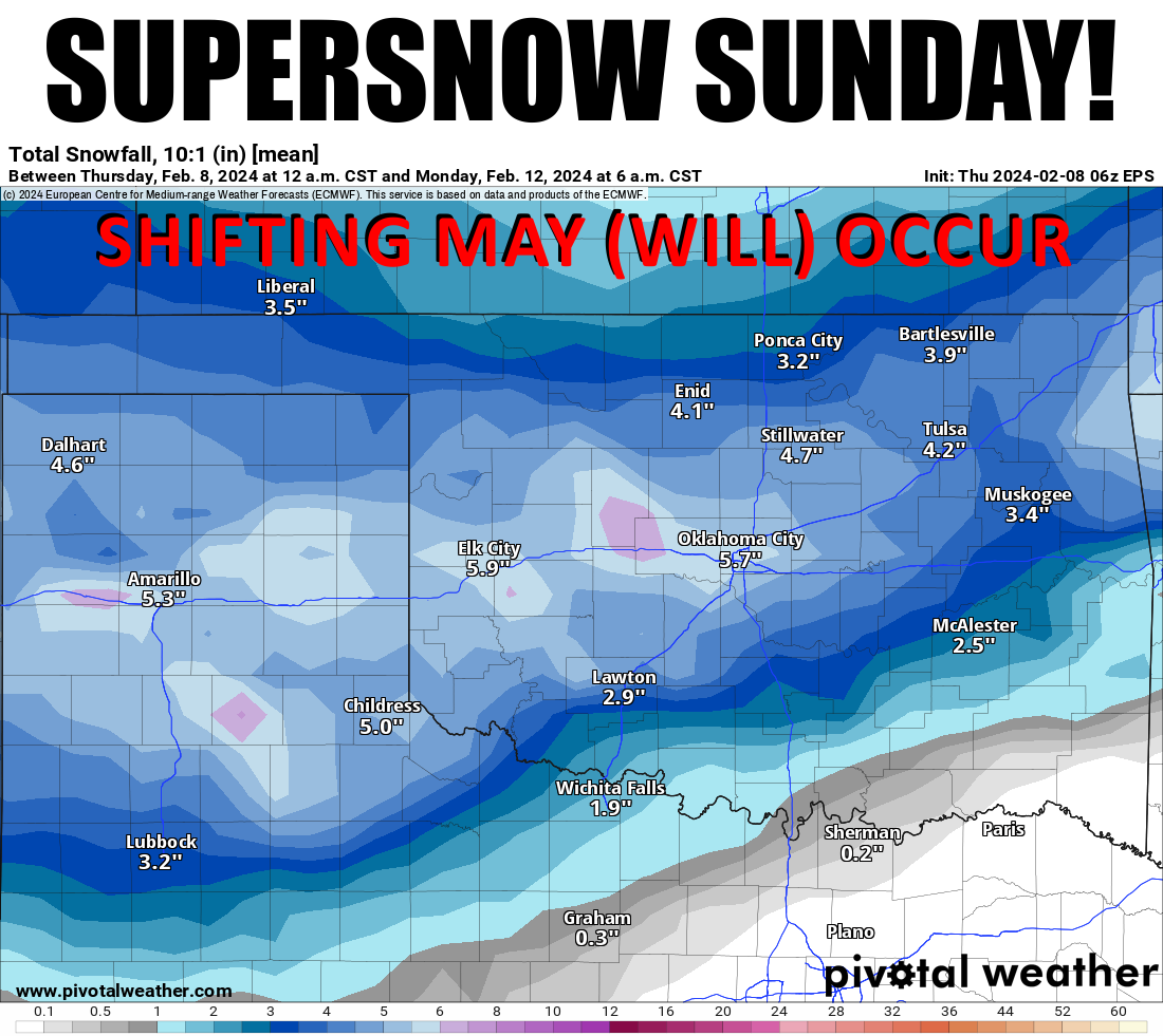
Now I could show you all the various model output maps of glorious-but-unrealistic
snowfall totals (hey, Glorious But Unrealistic was my band's name in the Kiwanis!),
but I just went with the Eurpean model ensemble's mean snow totals. Well, here is
their single deterministic model (I said I could, and now I would...errr, will).
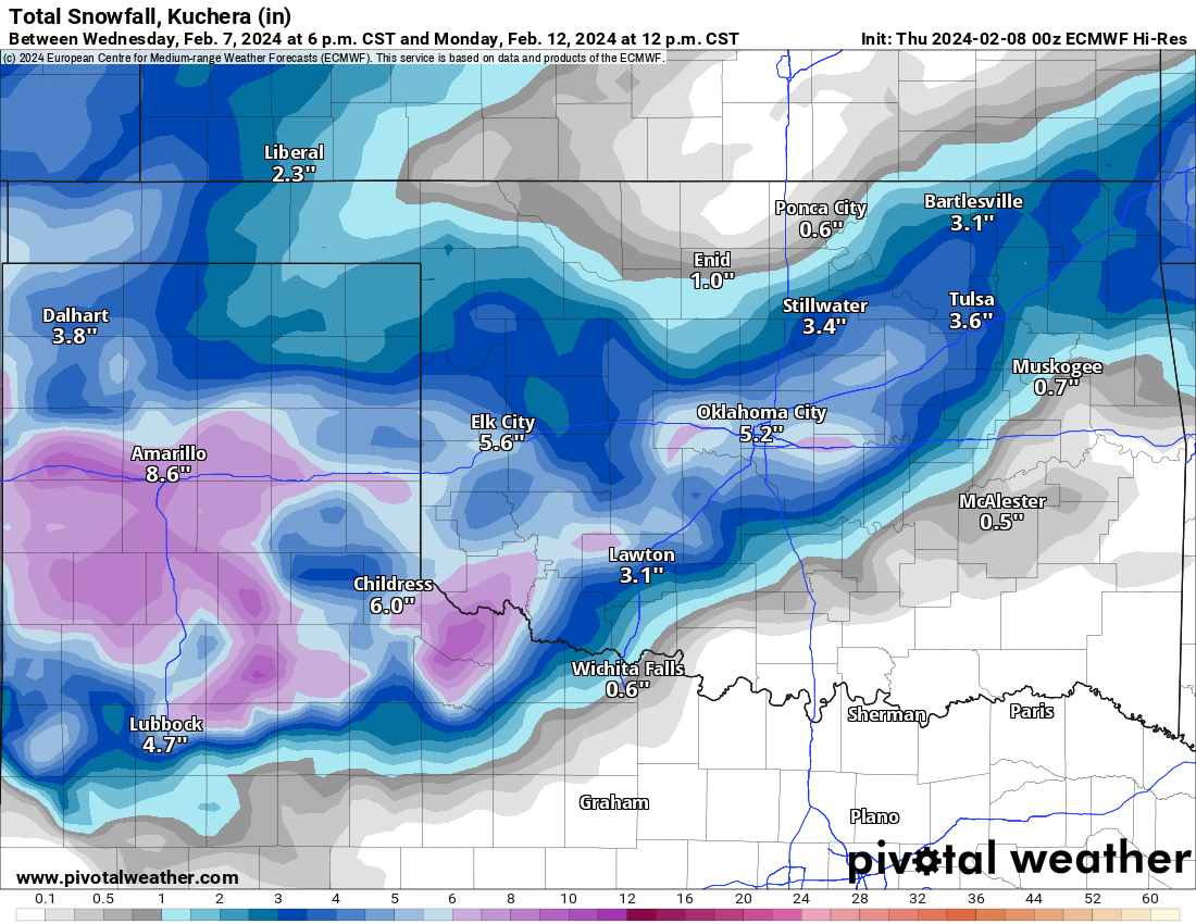
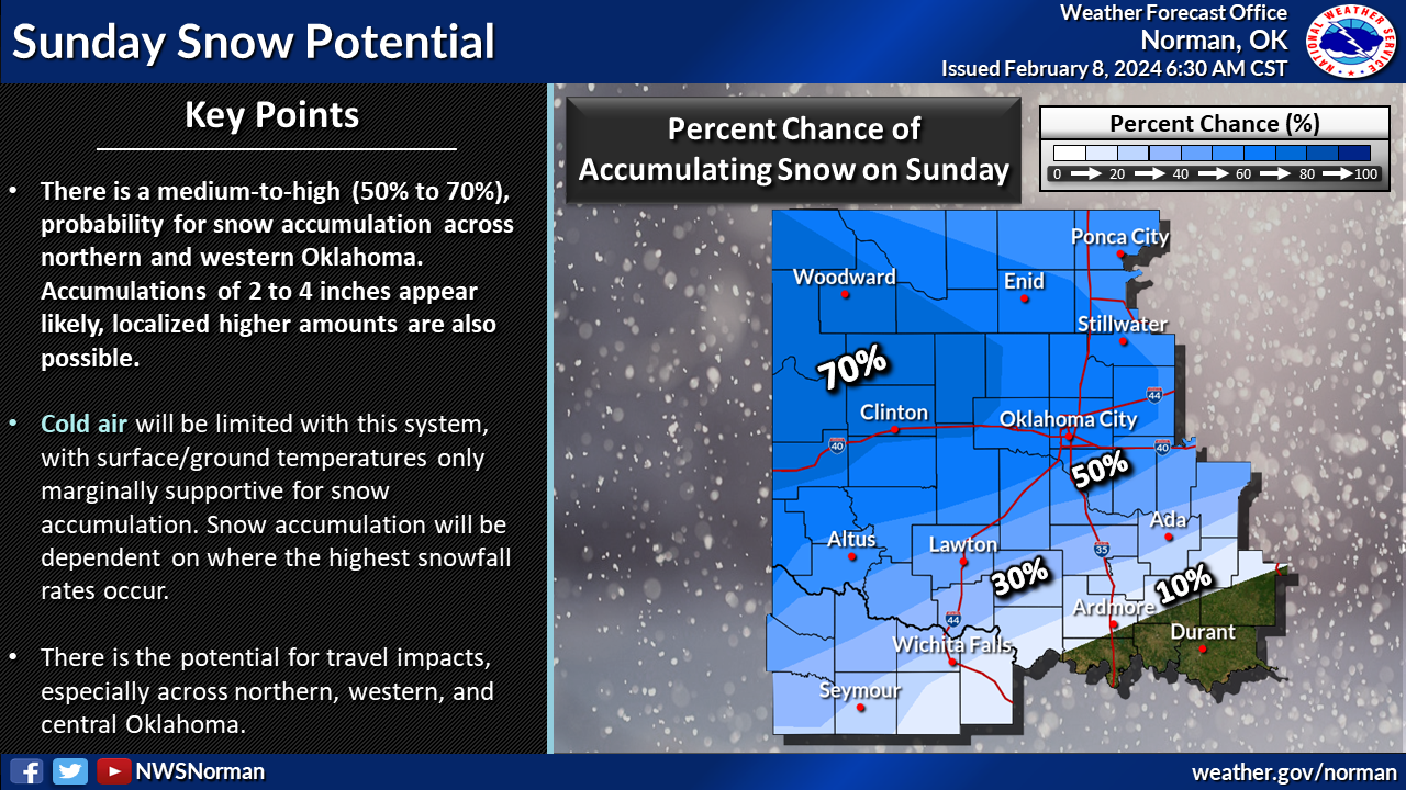
Things will continue to shift and amounts will change over the next few days,
but it does look good for snow. Here are our local NWS offices' takes on the
subject.
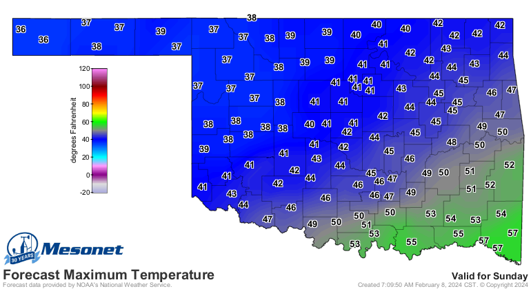
And here's the deal...temperatures look sorta marginal early on Sunday, but
they appear to come in line later that afternoon and evening. So we'll start
out with rain, then probably see a changeover to snow a bit earlier than
previously thought. So don't take Sunday's forecast highs as what we'll see
during the event, but more so the Monday morning lows.
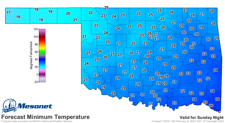
Now those lows are obviously going to lead to problems if heavy snow does indeed
occur. They're not January-like lows that we saw last month, but cold enough.
Listen, I've watched time and time again when all sorts of people will be saying
"the ground's too warm, it'll all melt," only to see the snow rates cool down
road surfaces faster than expected, and mass chaos results. So we'll see.
Look, it may seem like I'm not sufficiently excited by my Tocking today, but
I'm just frustrated waiting for each new model run and being able to see what
the changes are gonna end up being. I understand "a watched pot never boils,"
for crying out loud, but I guess the same goes for forecast model runs.
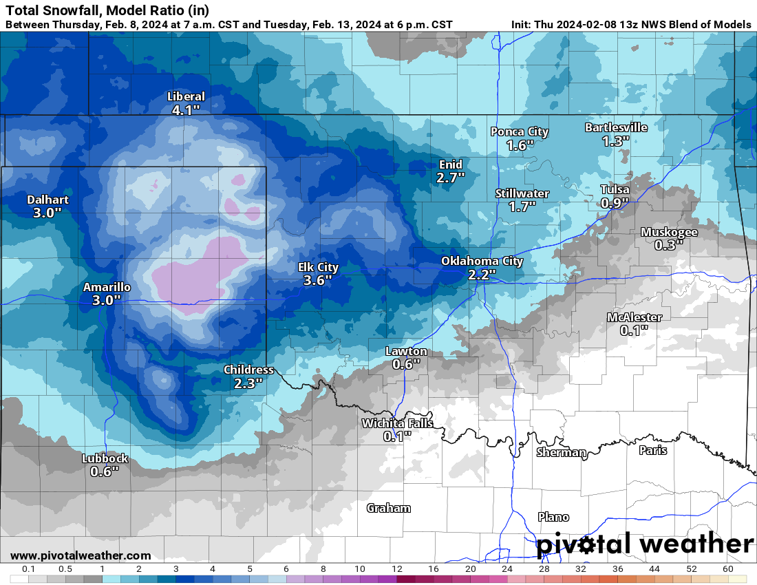
Wait, one just finished...the NWS blend! Even it, which is normally an old
fuddy-duddy because it's more realistic, is starting to pump out some significant
amounts AND spread them a bit east.
Hey, speaking of highs (don't go there), today looks magnificent. Tomorrow too.
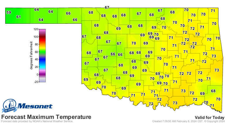

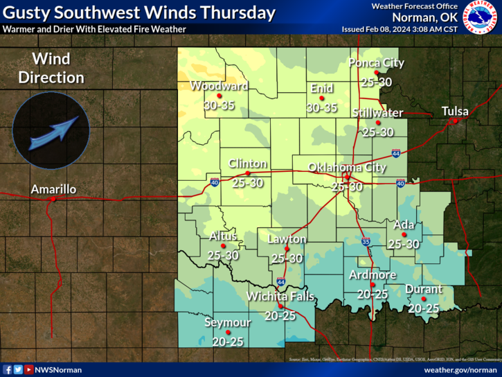
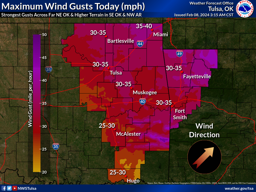
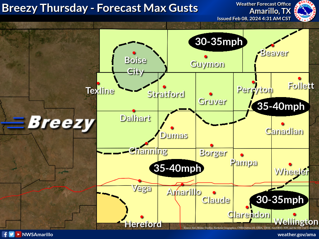
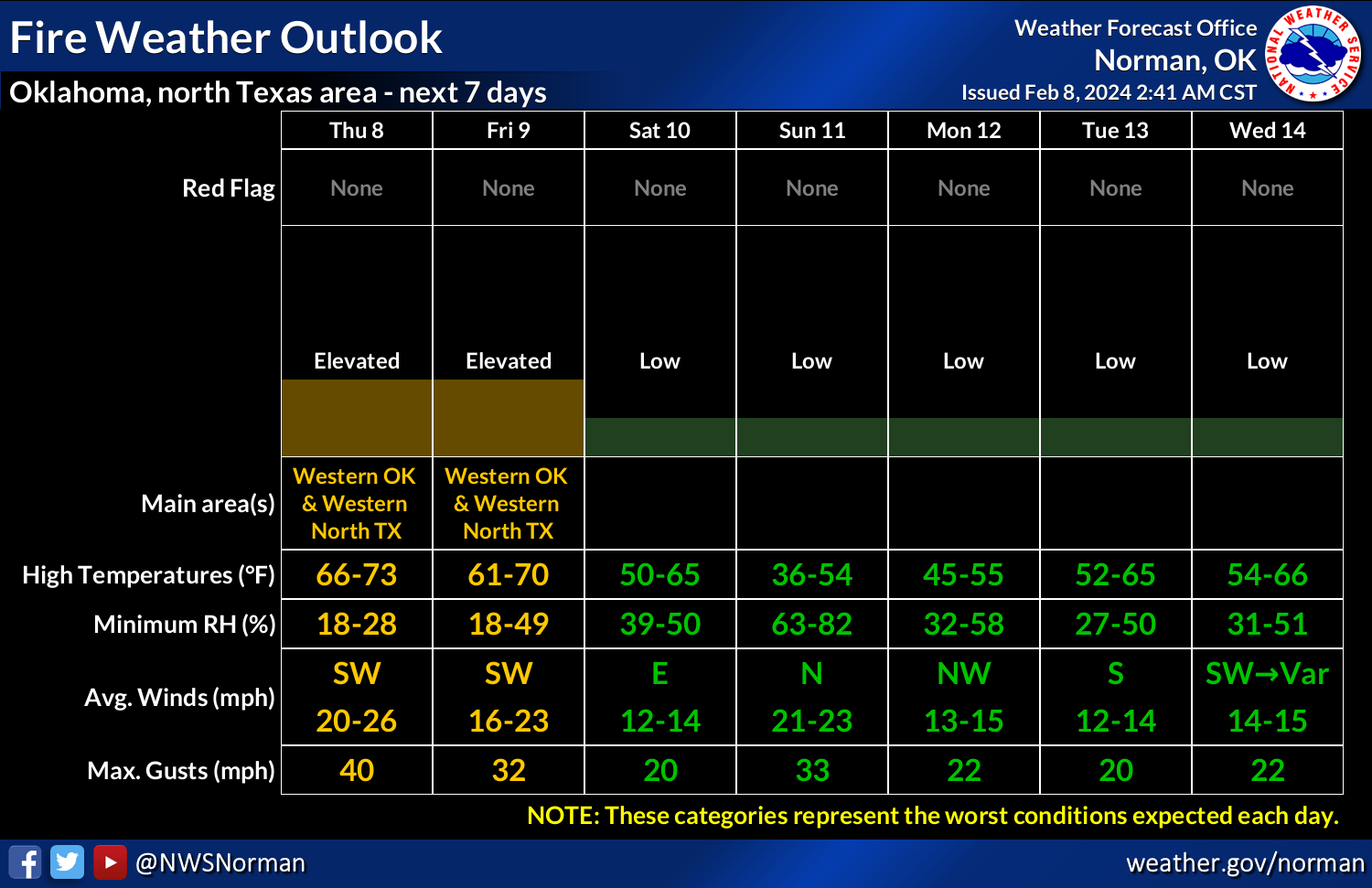
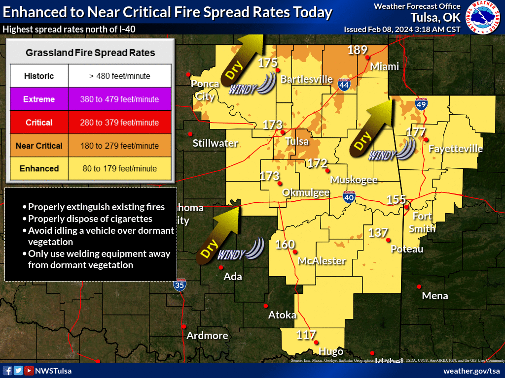
Not bad, eh? What is bad is the wind. And the fire danger.
Hey, another model run is done! Wait, I'm not even gonna show you this one.
Gary McManus
State Climatologist
Oklahoma Mesonet
Oklahoma Climatological Survey
gmcmanus@mesonet.org
February 8 in Mesonet History
| Record | Value | Station | Year |
|---|---|---|---|
| Maximum Temperature | 83°F | BROK | 2025 |
| Minimum Temperature | -5°F | BOIS | 2011 |
| Maximum Rainfall | 4.35″ | BROK | 2023 |
Mesonet records begin in 1994.
Search by Date
If you're a bit off, don't worry, because just like horseshoes, “almost” counts on the Ticker website!